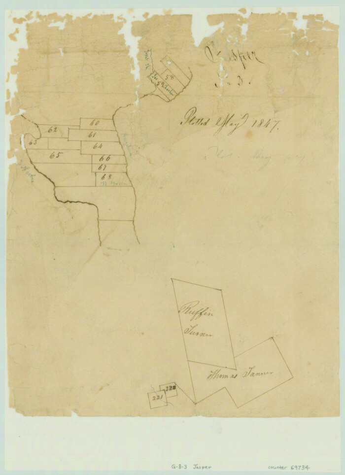
[Surveys in the Jasper District]
Print $2.00
- Digital $50.00
[Surveys in the Jasper District]
1847
Size: 9.4 x 6.9 inches
69734
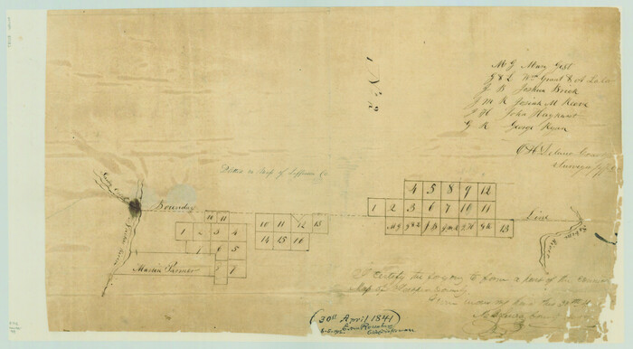
[Surveys along the boundary between Jasper and Jefferson Counties]
Print $3.00
- Digital $50.00
[Surveys along the boundary between Jasper and Jefferson Counties]
1841
Size: 9.3 x 16.9 inches
99
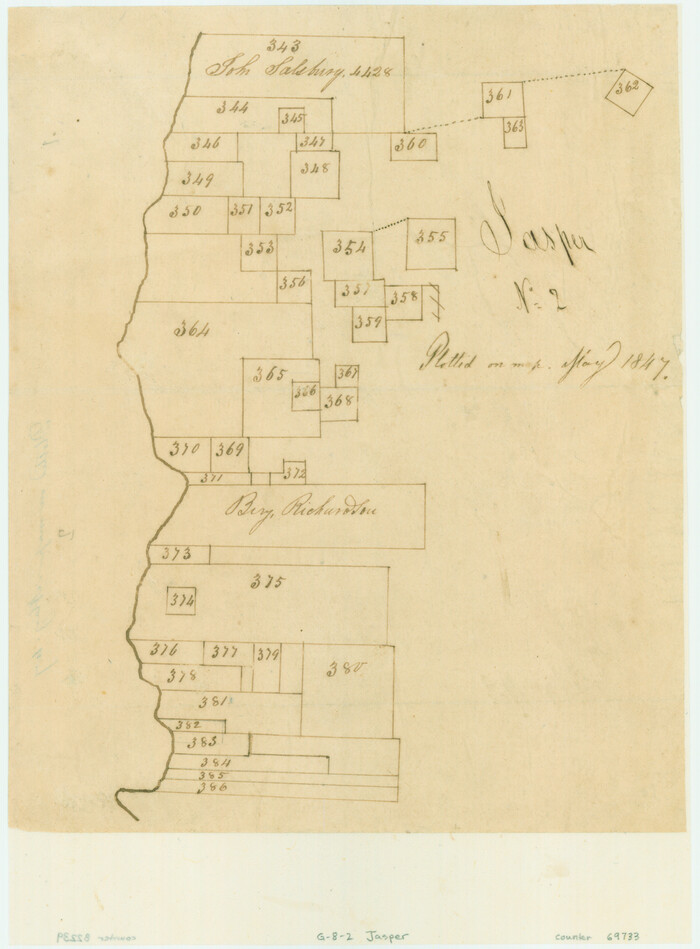
[Surveys along the Neches River in Jasper District]
Print $2.00
- Digital $50.00
[Surveys along the Neches River in Jasper District]
1847
Size: 9.2 x 6.8 inches
69733
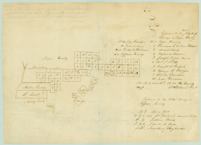
[Surveys along the Jefferson and Jasper County Boundary]
Print $3.00
- Digital $50.00
[Surveys along the Jefferson and Jasper County Boundary]
1841
Size: 11.8 x 16.3 inches
92
[Surveying Sketch of Jesse McGee, Jas McKim, W. S. Kennard, et al in Sabine and Newton Counties, Texas]
Print $20.00
- Digital $50.00
[Surveying Sketch of Jesse McGee, Jas McKim, W. S. Kennard, et al in Sabine and Newton Counties, Texas]
1916
Size: 32.0 x 37.5 inches
5066
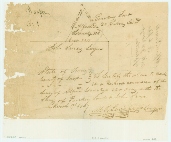
[John Schrier's league]
Print $2.00
- Digital $50.00
[John Schrier's league]
1847
Size: 7.2 x 8.6 inches
286
The Republic County of Jasper. Spring 1842

Print $20.00
The Republic County of Jasper. Spring 1842
2020
Size: 19.5 x 21.7 inches
96195
The Republic County of Jasper. January 29, 1842

Print $20.00
The Republic County of Jasper. January 29, 1842
2020
Size: 19.5 x 21.7 inches
96194
The Republic County of Jasper. December 29, 1845

Print $20.00
The Republic County of Jasper. December 29, 1845
2020
Size: 19.5 x 21.7 inches
96196
The Republic County of Jasper. Boundaries Defined, December 14, 1837

Print $20.00
The Republic County of Jasper. Boundaries Defined, December 14, 1837
2020
Size: 19.5 x 21.7 inches
96193
San Augustine County, Texas

Print $20.00
- Digital $50.00
San Augustine County, Texas
1879
Size: 22.7 x 17.5 inches
752
San Augustine County Working Sketch 7

Print $20.00
- Digital $50.00
San Augustine County Working Sketch 7
1935
Size: 24.7 x 34.8 inches
63694
Sabine County, Texas

Print $20.00
- Digital $50.00
Sabine County, Texas
1879
Size: 22.1 x 18.6 inches
751
Sabine County Working Sketch 14

Print $20.00
- Digital $50.00
Sabine County Working Sketch 14
1953
Size: 29.3 x 38.6 inches
63685
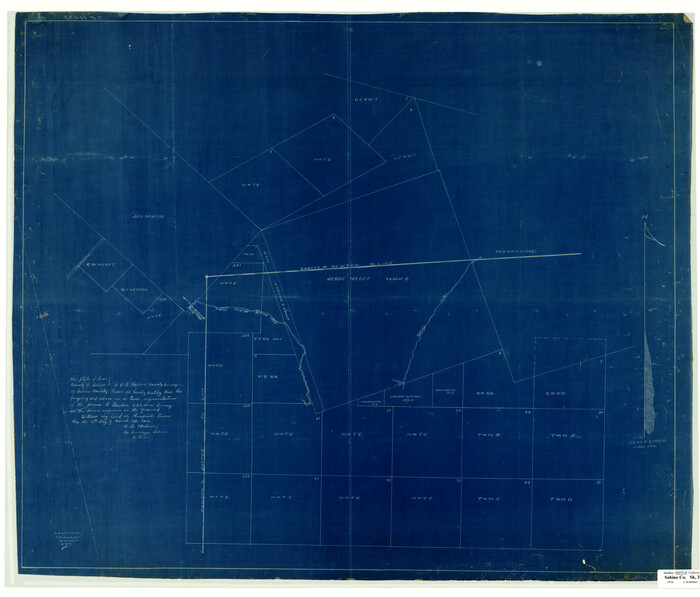
Sabine County Working Sketch 12

Print $20.00
- Digital $50.00
Sabine County Working Sketch 12
1935
Size: 39.2 x 45.9 inches
63683
Reconnoissance of Sabine River and Vicinty

Print $20.00
Reconnoissance of Sabine River and Vicinty
1863
Size: 30.4 x 42.3 inches
97497
Plat of Jasper, Sabine, San Augustine, Shelby, Harrison and South Part of Nacogdoches Counties

Print $2.00
- Digital $50.00
Plat of Jasper, Sabine, San Augustine, Shelby, Harrison and South Part of Nacogdoches Counties
1841
Size: 13.7 x 9.2 inches
3174
Orange County Working Sketch 20

Print $20.00
- Digital $50.00
Orange County Working Sketch 20
1933
Size: 16.0 x 23.3 inches
71352
Orange County Working Sketch 17

Print $20.00
- Digital $50.00
Orange County Working Sketch 17
1930
Size: 35.6 x 26.1 inches
71349
Orange County Sketch File B

Print $20.00
- Digital $50.00
Orange County Sketch File B
1890
Size: 17.6 x 26.0 inches
12130
Orange County Sketch File A

Print $40.00
- Digital $50.00
Orange County Sketch File A
1890
Size: 14.2 x 8.8 inches
33278
Orange County Sketch File 16a

Print $11.00
- Digital $50.00
Orange County Sketch File 16a
1891
Size: 11.9 x 12.9 inches
33332
Orange County Rolled Sketch 27

Print $20.00
- Digital $50.00
Orange County Rolled Sketch 27
1954
Size: 22.3 x 34.5 inches
7186
Newton County Working Sketch 6

Print $20.00
- Digital $50.00
Newton County Working Sketch 6
1930
Size: 35.5 x 25.9 inches
71252
Newton County Working Sketch 44

Print $20.00
- Digital $50.00
Newton County Working Sketch 44
1992
Size: 19.2 x 24.6 inches
71290
Newton County Working Sketch 25

Print $20.00
- Digital $50.00
Newton County Working Sketch 25
1953
Size: 25.4 x 23.8 inches
71271
Newton County Working Sketch 16

Print $20.00
- Digital $50.00
Newton County Working Sketch 16
1950
Size: 15.8 x 15.5 inches
71262
Newton County Sketch File 5

Print $8.00
- Digital $50.00
Newton County Sketch File 5
Size: 8.2 x 12.8 inches
32368
Newton County Sketch File 4b

Print $22.00
- Digital $50.00
Newton County Sketch File 4b
Size: 7.6 x 12.2 inches
32364
Newton County Sketch File 4a

Print $4.00
- Digital $50.00
Newton County Sketch File 4a
Size: 12.6 x 8.0 inches
32362
[Surveys in the Jasper District]
Print $2.00
- Digital $50.00
[Surveys in the Jasper District]
1847
-
Size
9.4 x 6.9 inches
-
Map/Doc
69734
-
Creation Date
1847
[Surveys along the boundary between Jasper and Jefferson Counties]
Print $3.00
- Digital $50.00
[Surveys along the boundary between Jasper and Jefferson Counties]
1841
-
Size
9.3 x 16.9 inches
-
Map/Doc
99
-
Creation Date
1841
[Surveys along the Neches River in Jasper District]
Print $2.00
- Digital $50.00
[Surveys along the Neches River in Jasper District]
1847
-
Size
9.2 x 6.8 inches
-
Map/Doc
69733
-
Creation Date
1847
[Surveys along the Jefferson and Jasper County Boundary]
Print $3.00
- Digital $50.00
[Surveys along the Jefferson and Jasper County Boundary]
1841
-
Size
11.8 x 16.3 inches
-
Map/Doc
92
-
Creation Date
1841
[Surveying Sketch of Jesse McGee, Jas McKim, W. S. Kennard, et al in Sabine and Newton Counties, Texas]
Print $20.00
- Digital $50.00
[Surveying Sketch of Jesse McGee, Jas McKim, W. S. Kennard, et al in Sabine and Newton Counties, Texas]
1916
-
Size
32.0 x 37.5 inches
-
Map/Doc
5066
-
Creation Date
1916
[John Schrier's league]
Print $2.00
- Digital $50.00
[John Schrier's league]
1847
-
Size
7.2 x 8.6 inches
-
Map/Doc
286
-
Creation Date
1847
The Republic County of Jasper. Spring 1842
Print $20.00
The Republic County of Jasper. Spring 1842
2020
-
Size
19.5 x 21.7 inches
-
Map/Doc
96195
-
Creation Date
2020
The Republic County of Jasper. January 29, 1842
Print $20.00
The Republic County of Jasper. January 29, 1842
2020
-
Size
19.5 x 21.7 inches
-
Map/Doc
96194
-
Creation Date
2020
The Republic County of Jasper. December 29, 1845
Print $20.00
The Republic County of Jasper. December 29, 1845
2020
-
Size
19.5 x 21.7 inches
-
Map/Doc
96196
-
Creation Date
2020
The Republic County of Jasper. Boundaries Defined, December 14, 1837
Print $20.00
The Republic County of Jasper. Boundaries Defined, December 14, 1837
2020
-
Size
19.5 x 21.7 inches
-
Map/Doc
96193
-
Creation Date
2020
San Augustine County, Texas
Print $20.00
- Digital $50.00
San Augustine County, Texas
1879
-
Size
22.7 x 17.5 inches
-
Map/Doc
752
-
Creation Date
1879
San Augustine County Working Sketch 7
Print $20.00
- Digital $50.00
San Augustine County Working Sketch 7
1935
-
Size
24.7 x 34.8 inches
-
Map/Doc
63694
-
Creation Date
1935
Sabine County, Texas
Print $20.00
- Digital $50.00
Sabine County, Texas
1879
-
Size
22.1 x 18.6 inches
-
Map/Doc
751
-
Creation Date
1879
Sabine County Working Sketch 14
Print $20.00
- Digital $50.00
Sabine County Working Sketch 14
1953
-
Size
29.3 x 38.6 inches
-
Map/Doc
63685
-
Creation Date
1953
Sabine County Working Sketch 12
Print $20.00
- Digital $50.00
Sabine County Working Sketch 12
1935
-
Size
39.2 x 45.9 inches
-
Map/Doc
63683
-
Creation Date
1935
Reconnoissance of Sabine River and Vicinty
Print $20.00
Reconnoissance of Sabine River and Vicinty
1863
-
Size
30.4 x 42.3 inches
-
Map/Doc
97497
-
Creation Date
1863
Plat of Jasper, Sabine, San Augustine, Shelby, Harrison and South Part of Nacogdoches Counties
Print $2.00
- Digital $50.00
Plat of Jasper, Sabine, San Augustine, Shelby, Harrison and South Part of Nacogdoches Counties
1841
-
Size
13.7 x 9.2 inches
-
Map/Doc
3174
-
Creation Date
1841
Orange County Working Sketch 20
Print $20.00
- Digital $50.00
Orange County Working Sketch 20
1933
-
Size
16.0 x 23.3 inches
-
Map/Doc
71352
-
Creation Date
1933
Orange County Working Sketch 17
Print $20.00
- Digital $50.00
Orange County Working Sketch 17
1930
-
Size
35.6 x 26.1 inches
-
Map/Doc
71349
-
Creation Date
1930
Orange County Sketch File B
Print $20.00
- Digital $50.00
Orange County Sketch File B
1890
-
Size
17.6 x 26.0 inches
-
Map/Doc
12130
-
Creation Date
1890
Orange County Sketch File A
Print $40.00
- Digital $50.00
Orange County Sketch File A
1890
-
Size
14.2 x 8.8 inches
-
Map/Doc
33278
-
Creation Date
1890
Orange County Sketch File 16a
Print $11.00
- Digital $50.00
Orange County Sketch File 16a
1891
-
Size
11.9 x 12.9 inches
-
Map/Doc
33332
-
Creation Date
1891
Orange County Rolled Sketch 27
Print $20.00
- Digital $50.00
Orange County Rolled Sketch 27
1954
-
Size
22.3 x 34.5 inches
-
Map/Doc
7186
-
Creation Date
1954
Newton County Working Sketch 6
Print $20.00
- Digital $50.00
Newton County Working Sketch 6
1930
-
Size
35.5 x 25.9 inches
-
Map/Doc
71252
-
Creation Date
1930
Newton County Working Sketch 44
Print $20.00
- Digital $50.00
Newton County Working Sketch 44
1992
-
Size
19.2 x 24.6 inches
-
Map/Doc
71290
-
Creation Date
1992
Newton County Working Sketch 25
Print $20.00
- Digital $50.00
Newton County Working Sketch 25
1953
-
Size
25.4 x 23.8 inches
-
Map/Doc
71271
-
Creation Date
1953
Newton County Working Sketch 16
Print $20.00
- Digital $50.00
Newton County Working Sketch 16
1950
-
Size
15.8 x 15.5 inches
-
Map/Doc
71262
-
Creation Date
1950
Newton County Sketch File 5
Print $8.00
- Digital $50.00
Newton County Sketch File 5
-
Size
8.2 x 12.8 inches
-
Map/Doc
32368
Newton County Sketch File 4b
Print $22.00
- Digital $50.00
Newton County Sketch File 4b
-
Size
7.6 x 12.2 inches
-
Map/Doc
32364
Newton County Sketch File 4a
Print $4.00
- Digital $50.00
Newton County Sketch File 4a
-
Size
12.6 x 8.0 inches
-
Map/Doc
32362