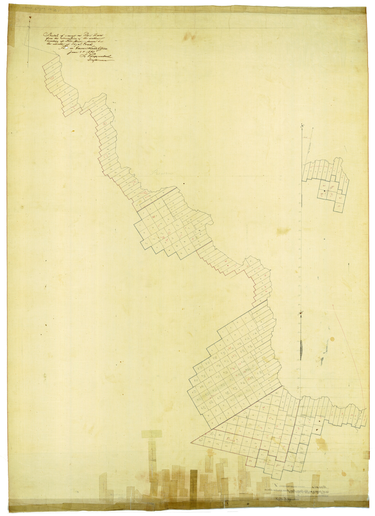
Reeves County Rolled Sketch 1
Sketch of surveys on Pecos River from the intersection of the southern boundary of New Mexico down to the mouth of Toyah Creek
-
Map/Doc
9844
-
Collection
General Map Collection
-
Object Dates
1873/6/2 (File Date)
-
Counties
Reeves
-
Subjects
Surveying Rolled Sketch
-
Height x Width
52.9 x 38.5 inches
134.4 x 97.8 cm
-
Medium
linen, manuscript
Part of: General Map Collection
Chambers County Rolled Sketch 23B

Print $20.00
- Digital $50.00
Chambers County Rolled Sketch 23B
1940
Size 40.9 x 40.8 inches
Map/Doc 8593
Austin County Sketch File 13

Print $40.00
- Digital $50.00
Austin County Sketch File 13
Size 13.9 x 13.2 inches
Map/Doc 10877
Hansford County Working Sketch 2

Print $40.00
- Digital $50.00
Hansford County Working Sketch 2
1934
Size 42.7 x 54.4 inches
Map/Doc 63374
Map of Stephens County

Print $20.00
- Digital $50.00
Map of Stephens County
1897
Size 43.2 x 37.6 inches
Map/Doc 16818

[Sketch for Mineral Application 13441 - Trinity River, Miller's Lake, Charlotte Lake, Florence Dunn]
![65657, [Sketch for Mineral Application 13441 - Trinity River, Miller's Lake, Charlotte Lake, Florence Dunn], General Map Collection](https://historictexasmaps.com/wmedia_w700/maps/65657.tif.jpg)
Print $40.00
- Digital $50.00
[Sketch for Mineral Application 13441 - Trinity River, Miller's Lake, Charlotte Lake, Florence Dunn]
1925
Size 104.1 x 43.3 inches
Map/Doc 65657


Starr County Rolled Sketch 17

Print $20.00
- Digital $50.00
Starr County Rolled Sketch 17
1911
Size 26.4 x 23.1 inches
Map/Doc 7802
Index Map No. 1 - Rio Bravo del Norte section of boundary between the United States & Mexico; agreed upon by the Joint Commission under the Treaty of Guadalupe Hidalgo

Print $20.00
- Digital $50.00
Index Map No. 1 - Rio Bravo del Norte section of boundary between the United States & Mexico; agreed upon by the Joint Commission under the Treaty of Guadalupe Hidalgo
1852
Size 18.5 x 27.4 inches
Map/Doc 72859
Calhoun County Rolled Sketch 21

Print $20.00
- Digital $50.00
Calhoun County Rolled Sketch 21
1957
Size 47.2 x 37.5 inches
Map/Doc 8551
El Paso County Boundary File 20

Print $9.00
- Digital $50.00
El Paso County Boundary File 20
Size 13.2 x 8.3 inches
Map/Doc 53210
You may also like
Lynn County Sketch File 15

Print $34.00
- Digital $50.00
Lynn County Sketch File 15
Size 14.2 x 8.7 inches
Map/Doc 30497
Andrews County Working Sketch 28

Print $20.00
- Digital $50.00
Andrews County Working Sketch 28
Size 32.2 x 35.6 inches
Map/Doc 67074
Limestone County Working Sketch 20

Print $20.00
- Digital $50.00
Limestone County Working Sketch 20
1976
Size 41.5 x 42.3 inches
Map/Doc 70570
North end of Brazos Island

Print $20.00
- Digital $50.00
North end of Brazos Island
Size 26.0 x 18.3 inches
Map/Doc 72915
Jackson County Rolled Sketch 9

Print $40.00
- Digital $50.00
Jackson County Rolled Sketch 9
1941
Size 50.7 x 32.1 inches
Map/Doc 9258
The Chief Justice County of Mina. Lands in Conflict with Colorado County

Print $20.00
The Chief Justice County of Mina. Lands in Conflict with Colorado County
2020
Size 15.8 x 21.7 inches
Map/Doc 96062
Pecos County Sketch File 85

Print $19.00
- Digital $50.00
Pecos County Sketch File 85
1948
Size 14.6 x 9.2 inches
Map/Doc 33955
Young County Sketch File 20

Print $20.00
- Digital $50.00
Young County Sketch File 20
1922
Size 27.4 x 23.9 inches
Map/Doc 12714
Presidio County Working Sketch 143

Print $20.00
- Digital $50.00
Presidio County Working Sketch 143
1990
Size 15.9 x 20.9 inches
Map/Doc 71821
![88957, Hutchinson Co[unty], Library of Congress](https://historictexasmaps.com/wmedia_w700/maps/88957.tif.jpg)
[Surveys along the Leona and Frio Rivers]
![16, [Surveys along the Leona and Frio Rivers], General Map Collection](https://historictexasmaps.com/wmedia_w700/maps/16.tif.jpg)
Print $20.00
- Digital $50.00
[Surveys along the Leona and Frio Rivers]
1841
Size 12.4 x 13.1 inches
Map/Doc 16
Motley County Sketch File F (S)

Print $14.00
- Digital $50.00
Motley County Sketch File F (S)
1904
Size 9.1 x 5.9 inches
Map/Doc 32179