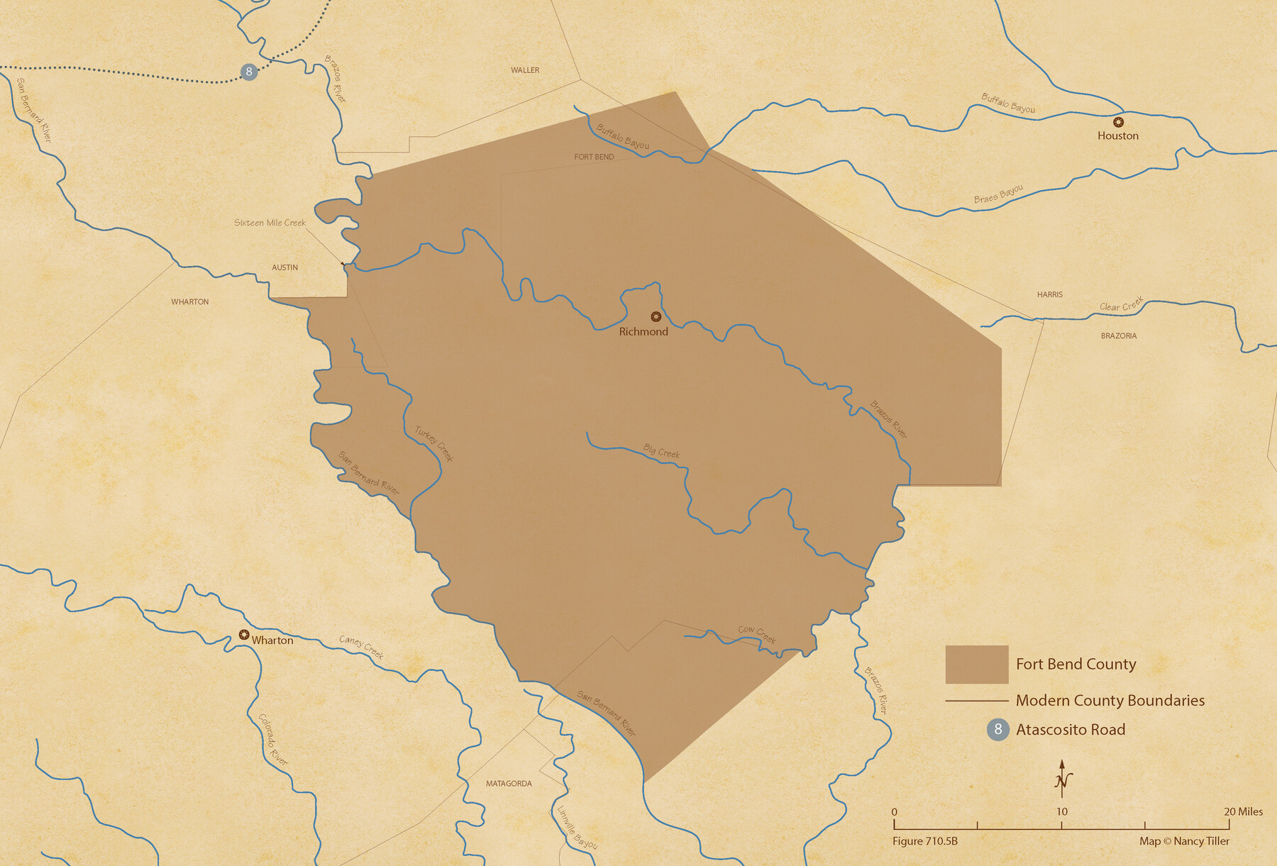
The Republic County of Fort Bend. February 4, 1841
Figure No. 710.5 from 'A Boundary Atlas of Texas, 1821-1845' by Jim Tiller
-
Map/Doc
96141
-
Collection
Nancy and Jim Tiller Digital Collection
-
Object Dates
2020/1/1 (Creation Date)
-
People and Organizations
Jim Tiller (Author)
Nancy Tiller (Cartographer)
Gang Gong (GIS Professional)
-
Counties
Fort Bend
-
Subjects
Atlas County Republic of Texas Texas Boundaries
-
Height x Width
14.7 x 21.6 inches
37.3 x 54.9 cm
-
Medium
digital image
-
Comments
To purchase a digital PDF copy of "A Boundary Atlas of Texas, 1821-1845" see 96437.
Part of: Nancy and Jim Tiller Digital Collection
The Chief Justice County of Matagorda. Lands in Conflict with Brazoria County

Print $20.00
The Chief Justice County of Matagorda. Lands in Conflict with Brazoria County
2020
Size 19.7 x 21.7 inches
Map/Doc 96058
The Chief Justice County of San Augustine. Lands in Conflict with Sabine County

Print $20.00
The Chief Justice County of San Augustine. Lands in Conflict with Sabine County
2020
Size 14.6 x 21.7 inches
Map/Doc 96071
The Republic County of Fort Bend. Created, December 29, 1837

Print $20.00
The Republic County of Fort Bend. Created, December 29, 1837
2020
Size 14.7 x 21.6 inches
Map/Doc 96137
The Republic County of San Patricio. Proposed, Late Fall 1837

Print $20.00
The Republic County of San Patricio. Proposed, Late Fall 1837
2020
Size 17.8 x 21.7 inches
Map/Doc 96273
The Republic County of Liberty. Spring 1842

Print $20.00
The Republic County of Liberty. Spring 1842
2020
Size 19.9 x 21.7 inches
Map/Doc 96212
The Land Offices. No. 11, Victoria, December 22, 1836

Print $20.00
The Land Offices. No. 11, Victoria, December 22, 1836
2020
Size 21.8 x 21.7 inches
Map/Doc 96424
The Republic County of Jefferson. Boundaries Defined, December 21, 1837

Print $20.00
The Republic County of Jefferson. Boundaries Defined, December 21, 1837
2020
Size 22.6 x 21.7 inches
Map/Doc 96197
The Republic County of Bowie. Spring 1842

Print $20.00
The Republic County of Bowie. Spring 1842
2020
Size 19.5 x 21.7 inches
Map/Doc 96105
Austin Empresario Colony. July 9, 1828

Print $20.00
Austin Empresario Colony. July 9, 1828
2020
Size 16.4 x 21.7 inches
Map/Doc 95982
The Judicial District/County of DeWitt. Abolished, Spring 1842

Print $20.00
The Judicial District/County of DeWitt. Abolished, Spring 1842
2020
Size 22.4 x 21.7 inches
Map/Doc 96326
The Republic County of Shelby. December 31, 1844

Print $20.00
The Republic County of Shelby. December 31, 1844
2020
Size 20.0 x 21.7 inches
Map/Doc 96286
The Kennedy and Pringle Colony. February 15, 1842

Print $20.00
The Kennedy and Pringle Colony. February 15, 1842
2020
Size 23.0 x 17.7 inches
Map/Doc 96367
You may also like
Map of Grimes County, Texas

Print $20.00
- Digital $50.00
Map of Grimes County, Texas
1880
Size 29.5 x 15.6 inches
Map/Doc 432
Flight Mission No. DAG-21K, Frame 41, Matagorda County

Print $20.00
- Digital $50.00
Flight Mission No. DAG-21K, Frame 41, Matagorda County
1952
Size 18.6 x 19.3 inches
Map/Doc 86408
Padre Island National Seashore

Print $2.00
- Digital $50.00
Padre Island National Seashore
Size 11.2 x 8.2 inches
Map/Doc 60524
Reagan County Sketch File 14

Print $6.00
- Digital $50.00
Reagan County Sketch File 14
Size 11.3 x 8.8 inches
Map/Doc 34993
Floyd County Sketch File 6

Print $2.00
- Digital $50.00
Floyd County Sketch File 6
Size 9.1 x 14.4 inches
Map/Doc 22696
Reagan County Boundary File 1

Print $8.00
- Digital $50.00
Reagan County Boundary File 1
Size 8.8 x 8.9 inches
Map/Doc 58151

Lamb County Sketch File 17

Print $20.00
- Digital $50.00
Lamb County Sketch File 17
1940
Size 25.4 x 12.3 inches
Map/Doc 11973
Lampasas County Boundary File 11

Print $4.00
- Digital $50.00
Lampasas County Boundary File 11
Size 14.0 x 8.6 inches
Map/Doc 56189
Maverick County Sketch File 13

Print $14.00
- Digital $50.00
Maverick County Sketch File 13
1882
Size 12.7 x 8.0 inches
Map/Doc 31102
Flight Mission No. BQR-7K, Frame 29, Brazoria County

Print $20.00
- Digital $50.00
Flight Mission No. BQR-7K, Frame 29, Brazoria County
1952
Size 19.6 x 25.0 inches
Map/Doc 84027
Waller County Working Sketch 3

Print $20.00
- Digital $50.00
Waller County Working Sketch 3
1959
Size 35.4 x 28.8 inches
Map/Doc 72302