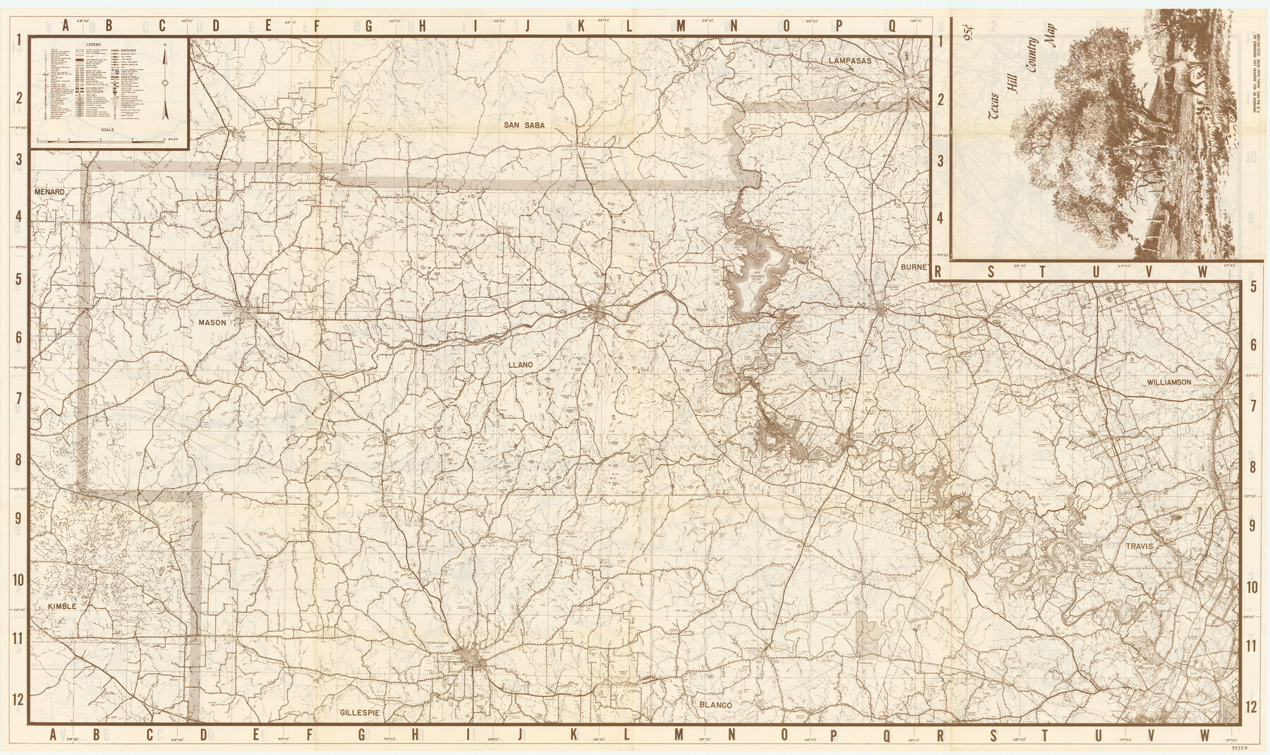
Texas Hill Country Map
[Recto]
-
Map/Doc
94377
-
Collection
General Map Collection
-
People and Organizations
Hill Country Life Insurance Co. (Publisher)
-
Height x Width
23.9 x 40.2 inches
60.7 x 102.1 cm
-
Medium
paper, etching/engraving/lithograph
-
Comments
For map of Hill Country on verso, see 94378. For research only.
Related maps

Part of: General Map Collection
Flight Mission No. BRA-8M, Frame 117, Jefferson County

Print $20.00
- Digital $50.00
Flight Mission No. BRA-8M, Frame 117, Jefferson County
1953
Size 18.5 x 22.3 inches
Map/Doc 85613
Glasscock County Sketch File 20

Print $40.00
- Digital $50.00
Glasscock County Sketch File 20
1935
Size 15.6 x 12.6 inches
Map/Doc 24196
El Paso County Working Sketch 48

Print $20.00
- Digital $50.00
El Paso County Working Sketch 48
1987
Size 32.7 x 29.4 inches
Map/Doc 69070
Hansford County

Print $20.00
- Digital $50.00
Hansford County
1878
Size 19.5 x 17.0 inches
Map/Doc 3623
[F. W. & D. C. Ry. Co. Alignment and Right of Way Map, Clay County]
![64729, [F. W. & D. C. Ry. Co. Alignment and Right of Way Map, Clay County], General Map Collection](https://historictexasmaps.com/wmedia_w700/maps/64729-1.tif.jpg)
Print $20.00
- Digital $50.00
[F. W. & D. C. Ry. Co. Alignment and Right of Way Map, Clay County]
1927
Size 18.5 x 11.7 inches
Map/Doc 64729
Atascosa County Sketch File 27

Print $42.00
- Digital $50.00
Atascosa County Sketch File 27
Size 8.7 x 8.3 inches
Map/Doc 13796
Foard County Working Sketch 2

Print $20.00
- Digital $50.00
Foard County Working Sketch 2
1911
Size 26.3 x 41.4 inches
Map/Doc 69192
Fort Bend County Sketch File 25

Print $20.00
- Digital $50.00
Fort Bend County Sketch File 25
Size 17.3 x 16.5 inches
Map/Doc 11510
King County Working Sketch 12

Print $20.00
- Digital $50.00
King County Working Sketch 12
1975
Size 42.6 x 28.4 inches
Map/Doc 70176
Bosque County Sketch File 6

Print $4.00
- Digital $50.00
Bosque County Sketch File 6
1851
Size 12.1 x 7.6 inches
Map/Doc 14748
Flight Mission No. CUG-1P, Frame 75, Kleberg County

Print $20.00
- Digital $50.00
Flight Mission No. CUG-1P, Frame 75, Kleberg County
1956
Size 18.5 x 22.3 inches
Map/Doc 86140
Coke County Rolled Sketch 13

Print $40.00
- Digital $50.00
Coke County Rolled Sketch 13
Size 44.5 x 69.9 inches
Map/Doc 8627
You may also like
Trinity River, Map of J. B. Bradley's Levee in Valley of Cummins Creek about 2 1/2 Miles South of Rice Showing Proposed Change of Location

Print $2.00
- Digital $50.00
Trinity River, Map of J. B. Bradley's Levee in Valley of Cummins Creek about 2 1/2 Miles South of Rice Showing Proposed Change of Location
1950
Size 13.9 x 16.1 inches
Map/Doc 65246
Dimmit County Sketch File 35

Print $6.00
- Digital $50.00
Dimmit County Sketch File 35
1885
Size 6.5 x 8.5 inches
Map/Doc 21155
Austin Empresario Colony. April 27, 1825

Print $20.00
Austin Empresario Colony. April 27, 1825
2020
Size 18.1 x 21.6 inches
Map/Doc 95979
Anderson County Working Sketch 14

Print $20.00
- Digital $50.00
Anderson County Working Sketch 14
1933
Size 20.3 x 26.0 inches
Map/Doc 67014
Map of Fannin County

Print $20.00
- Digital $50.00
Map of Fannin County
1845
Size 34.7 x 36.5 inches
Map/Doc 16827
Township No. 5 South Range No. 15 West, Indian Meridian, Oklahoma

Print $4.00
- Digital $50.00
Township No. 5 South Range No. 15 West, Indian Meridian, Oklahoma
1927
Size 18.2 x 23.9 inches
Map/Doc 75136
Menard County Working Sketch 15

Print $20.00
- Digital $50.00
Menard County Working Sketch 15
1943
Size 18.6 x 20.6 inches
Map/Doc 70962
Webb County Working Sketch 2

Print $20.00
- Digital $50.00
Webb County Working Sketch 2
1906
Size 11.2 x 12.5 inches
Map/Doc 72367
From the Red River to the Rio Grande from explorations and surveys made under the direction of the Hon. Jefferson Davis, Secretary of War by Captain John Pope, Corps Topl. Engrs. assisted by Lieutenant Kenner Gerrard, 1st Dragoons, 1854-6

Print $40.00
From the Red River to the Rio Grande from explorations and surveys made under the direction of the Hon. Jefferson Davis, Secretary of War by Captain John Pope, Corps Topl. Engrs. assisted by Lieutenant Kenner Gerrard, 1st Dragoons, 1854-6
1859
Size 28.0 x 57.9 inches
Map/Doc 93581
Montague County Boundary File 2c

Print $44.00
- Digital $50.00
Montague County Boundary File 2c
Size 9.0 x 14.5 inches
Map/Doc 57419
Blanco County Sketch File 36

Print $8.00
- Digital $50.00
Blanco County Sketch File 36
1889
Size 11.2 x 8.8 inches
Map/Doc 14642
Flight Mission No. DCL-7C, Frame 62, Kenedy County

Print $20.00
- Digital $50.00
Flight Mission No. DCL-7C, Frame 62, Kenedy County
1943
Size 15.4 x 15.3 inches
Map/Doc 86050