![92612, [Coleman County Sections 359, 360, and 361], Twichell Survey Records](https://historictexasmaps.com/wmedia_w1800h1800/maps/92612-1.tif.jpg)
[Coleman County Sections 359, 360, and 361]
CX103
-
Map/Doc
92612
-
Collection
Twichell Survey Records
-
Object Dates
5/3/1946 (Creation Date)
-
Counties
Coleman
-
Height x Width
33.4 x 40.0 inches
84.8 x 101.6 cm
Part of: Twichell Survey Records
[Blocks J, L, and Wilson County School Land]
![91277, [Blocks J, L, and Wilson County School Land], Twichell Survey Records](https://historictexasmaps.com/wmedia_w700/maps/91277-1.tif.jpg)
Print $20.00
- Digital $50.00
[Blocks J, L, and Wilson County School Land]
Size 15.8 x 20.4 inches
Map/Doc 91277

[Map Showing Fence Line between Blocks XIT and LS]
![91408, [Map Showing Fence Line between Blocks XIT and LS], Twichell Survey Records](https://historictexasmaps.com/wmedia_w700/maps/91408-1.tif.jpg)
Print $20.00
- Digital $50.00
[Map Showing Fence Line between Blocks XIT and LS]
1886
Size 18.4 x 16.7 inches
Map/Doc 91408
Working Sketch Armstrong County

Print $20.00
- Digital $50.00
Working Sketch Armstrong County
1909
Size 32.0 x 23.8 inches
Map/Doc 90264
[East Neches River]
![90420, [East Neches River], Twichell Survey Records](https://historictexasmaps.com/wmedia_w700/maps/90420-1.tif.jpg)
Print $20.00
- Digital $50.00
[East Neches River]
Size 25.8 x 29.3 inches
Map/Doc 90420
[H. & G.N. RR. Co. Block 4 and vicinity]
![92160, [H. & G.N. RR. Co. Block 4 and vicinity], Twichell Survey Records](https://historictexasmaps.com/wmedia_w700/maps/92160-1.tif.jpg)
Print $20.00
- Digital $50.00
[H. & G.N. RR. Co. Block 4 and vicinity]
Size 40.8 x 37.4 inches
Map/Doc 92160
[Madison County School Land, W. Perry and other surveys to the East]
![90429, [Madison County School Land, W. Perry and other surveys to the East], Twichell Survey Records](https://historictexasmaps.com/wmedia_w700/maps/90429-1.tif.jpg)
Print $20.00
- Digital $50.00
[Madison County School Land, W. Perry and other surveys to the East]
Size 13.8 x 16.3 inches
Map/Doc 90429
Ellis Addition to the City of Lubbock, Being a Subdivision of a Part of the SW/4 of SW/4 Sec. 4, Blk. A

Print $3.00
- Digital $50.00
Ellis Addition to the City of Lubbock, Being a Subdivision of a Part of the SW/4 of SW/4 Sec. 4, Blk. A
1952
Size 9.4 x 11.9 inches
Map/Doc 92709
[B. S. & F. Blocks 1 and 6, A. B. & M. Block 2 and surrounding surveys and blocks]
![91785, [B. S. & F. Blocks 1 and 6, A. B. & M. Block 2 and surrounding surveys and blocks], Twichell Survey Records](https://historictexasmaps.com/wmedia_w700/maps/91785-1.tif.jpg)
Print $20.00
- Digital $50.00
[B. S. & F. Blocks 1 and 6, A. B. & M. Block 2 and surrounding surveys and blocks]
Size 22.6 x 33.8 inches
Map/Doc 91785
[Blocks M18, M23, I, Z, and Block 47, Sections 16-28]
![91244, [Blocks M18, M23, I, Z, and Block 47, Sections 16-28], Twichell Survey Records](https://historictexasmaps.com/wmedia_w700/maps/91244-1.tif.jpg)
Print $20.00
- Digital $50.00
[Blocks M18, M23, I, Z, and Block 47, Sections 16-28]
Size 19.5 x 23.6 inches
Map/Doc 91244
[Texas & Pacific Block 32, T-4-N showing ties to triangulation stations]
![90142, [Texas & Pacific Block 32, T-4-N showing ties to triangulation stations], Twichell Survey Records](https://historictexasmaps.com/wmedia_w700/maps/90142-1.tif.jpg)
Print $20.00
- Digital $50.00
[Texas & Pacific Block 32, T-4-N showing ties to triangulation stations]
Size 20.4 x 11.6 inches
Map/Doc 90142
Laneer vs. Bivins, Potter County, Texas

Print $20.00
- Digital $50.00
Laneer vs. Bivins, Potter County, Texas
Size 21.2 x 18.8 inches
Map/Doc 93100
You may also like
Hopkins County Sketch File 29

Print $4.00
- Digital $50.00
Hopkins County Sketch File 29
1873
Size 10.0 x 8.1 inches
Map/Doc 26740
Map of Matagorda County
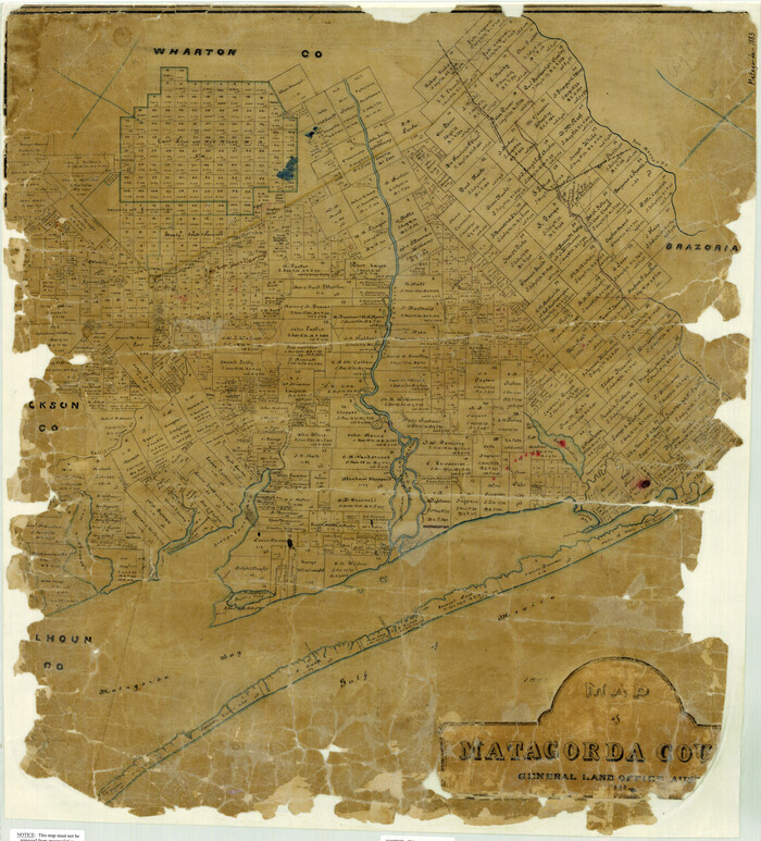
Print $20.00
- Digital $50.00
Map of Matagorda County
1883
Size 29.4 x 26.6 inches
Map/Doc 3840
San Saba County Sketch File 6

Print $6.00
- Digital $50.00
San Saba County Sketch File 6
1881
Size 10.9 x 8.4 inches
Map/Doc 36414
Foard County, Texas

Print $20.00
- Digital $50.00
Foard County, Texas
1891
Size 19.5 x 20.7 inches
Map/Doc 727
McCulloch County

Print $20.00
- Digital $50.00
McCulloch County
1874
Size 21.9 x 16.8 inches
Map/Doc 3856
Flight Mission No. BQR-13K, Frame 21, Brazoria County

Print $20.00
- Digital $50.00
Flight Mission No. BQR-13K, Frame 21, Brazoria County
1952
Size 18.8 x 22.4 inches
Map/Doc 84069
Nolan County Rolled Sketch 4

Print $20.00
- Digital $50.00
Nolan County Rolled Sketch 4
1982
Size 21.7 x 25.2 inches
Map/Doc 6862
Runnels County Boundary File 2a

Print $8.00
- Digital $50.00
Runnels County Boundary File 2a
Size 11.5 x 8.8 inches
Map/Doc 58526
Coryell County Rolled Sketch 2

Print $20.00
- Digital $50.00
Coryell County Rolled Sketch 2
1951
Size 15.7 x 19.1 inches
Map/Doc 5566
[St. L. S-W. Ry. of Texas Map of Lufkin Branch in Cherokee County Texas]
![64017, [St. L. S-W. Ry. of Texas Map of Lufkin Branch in Cherokee County Texas], General Map Collection](https://historictexasmaps.com/wmedia_w700/maps/64017.tif.jpg)
Print $40.00
- Digital $50.00
[St. L. S-W. Ry. of Texas Map of Lufkin Branch in Cherokee County Texas]
1912
Size 22.8 x 121.4 inches
Map/Doc 64017
Fayette County Working Sketch 8

Print $20.00
- Digital $50.00
Fayette County Working Sketch 8
1981
Size 14.4 x 11.5 inches
Map/Doc 69172
Anderson County Working Sketch 12

Print $20.00
- Digital $50.00
Anderson County Working Sketch 12
1914
Size 15.1 x 12.4 inches
Map/Doc 67012