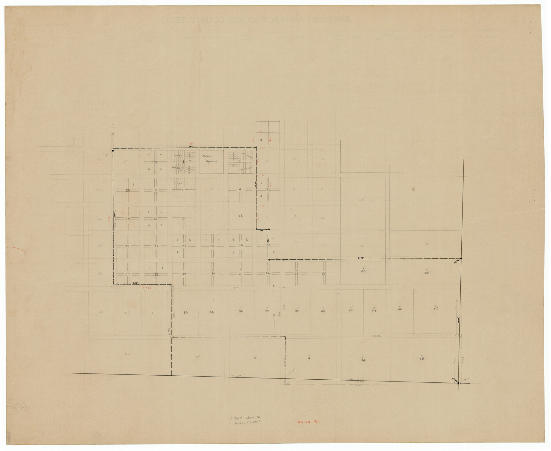
S. Part of Gomez
-
Map/Doc
92295
-
Collection
Twichell Survey Records
-
Counties
Terry
-
Height x Width
23.5 x 19.6 inches
59.7 x 49.8 cm
Part of: Twichell Survey Records
Double Lakes No. 2, T-Ranch

Print $20.00
- Digital $50.00
Double Lakes No. 2, T-Ranch
Size 19.9 x 20.3 inches
Map/Doc 92894
[Sketch of Part of B. S. & F. Block 9]
![93090, [Sketch of Part of B. S. & F. Block 9], Twichell Survey Records](https://historictexasmaps.com/wmedia_w700/maps/93090-1.tif.jpg)
Print $2.00
- Digital $50.00
[Sketch of Part of B. S. & F. Block 9]
Size 7.6 x 7.4 inches
Map/Doc 93090
[Block 47, Sections 66-76]
![91790, [Block 47, Sections 66-76], Twichell Survey Records](https://historictexasmaps.com/wmedia_w700/maps/91790-1.tif.jpg)
Print $3.00
- Digital $50.00
[Block 47, Sections 66-76]
Size 15.8 x 10.6 inches
Map/Doc 91790
[Sketch showing positions of surveys bordering on South boundary line of Archer County and North boundary line of Young County

Print $20.00
- Digital $50.00
[Sketch showing positions of surveys bordering on South boundary line of Archer County and North boundary line of Young County
1894
Size 14.0 x 36.8 inches
Map/Doc 90174
Sketch showing north boundary line of XIT lands and conflict of enclosure with L. & H. Blum land

Print $2.00
- Digital $50.00
Sketch showing north boundary line of XIT lands and conflict of enclosure with L. & H. Blum land
1906
Size 14.4 x 7.8 inches
Map/Doc 90519
[Capitol Leagues 217-228, 238, and vicinity]
![90693, [Capitol Leagues 217-228, 238, and vicinity], Twichell Survey Records](https://historictexasmaps.com/wmedia_w700/maps/90693-1.tif.jpg)
Print $20.00
- Digital $50.00
[Capitol Leagues 217-228, 238, and vicinity]
Size 24.7 x 10.6 inches
Map/Doc 90693
[LIT Ranch, Gunter & Munson surveys 52-55, Canadian River Meander]
![93011, [LIT Ranch, Gunter & Munson surveys 52-55, Canadian River Meander], Twichell Survey Records](https://historictexasmaps.com/wmedia_w700/maps/93011-1.tif.jpg)
Print $20.00
- Digital $50.00
[LIT Ranch, Gunter & Munson surveys 52-55, Canadian River Meander]
Size 18.4 x 12.8 inches
Map/Doc 93011
[North Part of Block G]
![92637, [North Part of Block G], Twichell Survey Records](https://historictexasmaps.com/wmedia_w700/maps/92637-1.tif.jpg)
Print $20.00
- Digital $50.00
[North Part of Block G]
Size 24.1 x 19.7 inches
Map/Doc 92637
[West half of county, south of John H. Stephens Block S2]
![92976, [West half of county, south of John H. Stephens Block S2], Twichell Survey Records](https://historictexasmaps.com/wmedia_w700/maps/92976-1.tif.jpg)
Print $2.00
- Digital $50.00
[West half of county, south of John H. Stephens Block S2]
1912
Size 8.6 x 5.9 inches
Map/Doc 92976
[Sketch of part of Blks. 4, 6, B5, 2Z, M6, M8, and M13]
![89643, [Sketch of part of Blks. 4, 6, B5, 2Z, M6, M8, and M13], Twichell Survey Records](https://historictexasmaps.com/wmedia_w700/maps/89643-1.tif.jpg)
Print $40.00
- Digital $50.00
[Sketch of part of Blks. 4, 6, B5, 2Z, M6, M8, and M13]
Size 55.2 x 26.8 inches
Map/Doc 89643
[Surveys along Halls Creek and Troublesome Creek]
![90934, [Surveys along Halls Creek and Troublesome Creek], Twichell Survey Records](https://historictexasmaps.com/wmedia_w700/maps/90934-1.tif.jpg)
Print $20.00
- Digital $50.00
[Surveys along Halls Creek and Troublesome Creek]
Size 34.1 x 28.6 inches
Map/Doc 90934
Section L Tech Memorial Park, Inc.

Print $3.00
- Digital $50.00
Section L Tech Memorial Park, Inc.
1950
Size 11.7 x 12.8 inches
Map/Doc 92270
You may also like
Flight Mission No. DQO-8K, Frame 58, Galveston County

Print $20.00
- Digital $50.00
Flight Mission No. DQO-8K, Frame 58, Galveston County
1952
Size 18.7 x 22.3 inches
Map/Doc 85165
Flight Mission No. CRK-5P, Frame 162, Refugio County

Print $20.00
- Digital $50.00
Flight Mission No. CRK-5P, Frame 162, Refugio County
1956
Size 18.5 x 22.3 inches
Map/Doc 86943
Wilda Stewart Farm, Crosby County, Texas

Print $20.00
- Digital $50.00
Wilda Stewart Farm, Crosby County, Texas
1949
Size 20.5 x 20.4 inches
Map/Doc 92599
Brazoria County Working Sketch 50b

Print $20.00
- Digital $50.00
Brazoria County Working Sketch 50b
2003
Size 34.8 x 34.6 inches
Map/Doc 78345
Morris County Working Sketch 1

Print $20.00
- Digital $50.00
Morris County Working Sketch 1
1948
Size 31.2 x 28.0 inches
Map/Doc 71200
Illinois, Missouri, Iowa, Wisconsin and Minnesota

Print $20.00
- Digital $50.00
Illinois, Missouri, Iowa, Wisconsin and Minnesota
1885
Size 12.2 x 9.0 inches
Map/Doc 93521
Hemphill County Rolled Sketch 16

Print $40.00
- Digital $50.00
Hemphill County Rolled Sketch 16
1961
Size 65.4 x 26.9 inches
Map/Doc 9156
Desdemona Oil Pool

Print $20.00
- Digital $50.00
Desdemona Oil Pool
Size 38.7 x 43.1 inches
Map/Doc 89773
Ector County Working Sketch 24

Print $40.00
- Digital $50.00
Ector County Working Sketch 24
1961
Size 42.2 x 51.7 inches
Map/Doc 68867
Flight Mission No. DCL-4C, Frame 147, Kenedy County

Print $20.00
- Digital $50.00
Flight Mission No. DCL-4C, Frame 147, Kenedy County
1943
Size 18.6 x 22.3 inches
Map/Doc 85825

El Paso County Sketch File 22a

Print $52.00
- Digital $50.00
El Paso County Sketch File 22a
1888
Size 14.2 x 8.7 inches
Map/Doc 22042