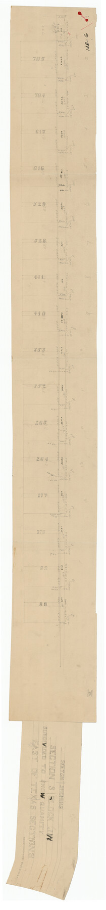
Sketch Showing Section 3, Block JW, Subdivided to Show Quantity East of Texas Sections
148-6
-
Map/Doc
91303
-
Collection
Twichell Survey Records
-
Counties
Lipscomb
-
Height x Width
5.8 x 49.9 inches
14.7 x 126.8 cm
Part of: Twichell Survey Records
Section Q Tech Memorial Park, Inc.

Print $20.00
- Digital $50.00
Section Q Tech Memorial Park, Inc.
1950
Size 28.5 x 31.6 inches
Map/Doc 92349
[University Blocks 17 and 18, Block Z, C4, 194, 178, A2, C3]
![93199, [University Blocks 17 and 18, Block Z, C4, 194, 178, A2, C3], Twichell Survey Records](https://historictexasmaps.com/wmedia_w700/maps/93199-1.tif.jpg)
Print $40.00
- Digital $50.00
[University Blocks 17 and 18, Block Z, C4, 194, 178, A2, C3]
1882
Size 81.8 x 54.1 inches
Map/Doc 93199
Working Sketch in Randall and Swisher Cos.

Print $20.00
- Digital $50.00
Working Sketch in Randall and Swisher Cos.
1917
Size 14.6 x 36.3 inches
Map/Doc 93048
[E. L. & R. R. RR. Co. Block D7 and G. H. & H. RR. Co. Block A1]
![91859, [E. L. & R. R. RR. Co. Block D7 and G. H. & H. RR. Co. Block A1], Twichell Survey Records](https://historictexasmaps.com/wmedia_w700/maps/91859-1.tif.jpg)
Print $20.00
- Digital $50.00
[E. L. & R. R. RR. Co. Block D7 and G. H. & H. RR. Co. Block A1]
Size 19.0 x 25.2 inches
Map/Doc 91859
South Part Brewster Co.

Print $40.00
- Digital $50.00
South Part Brewster Co.
Size 48.7 x 32.8 inches
Map/Doc 92468
[Area Surrounding Charles Ragsdale, M. George, and H. Ward Surveys]
![91535, [Area Surrounding Charles Ragsdale, M. George, and H. Ward Surveys], Twichell Survey Records](https://historictexasmaps.com/wmedia_w700/maps/91535-1.tif.jpg)
Print $20.00
- Digital $50.00
[Area Surrounding Charles Ragsdale, M. George, and H. Ward Surveys]
Size 20.0 x 23.3 inches
Map/Doc 91535
[Floyd County School Land Lgs. 180-183, Fisher County School Land Lgs. 105-108, and part of Blk. V]
![90191, [Floyd County Schoo Land Lgs. 180-183, Fisher County School Land Lgs. 105-108, and part of Blk. V], Twichell Survey Records](https://historictexasmaps.com/wmedia_w700/maps/90191-1.tif.jpg)
Print $2.00
- Digital $50.00
[Floyd County School Land Lgs. 180-183, Fisher County School Land Lgs. 105-108, and part of Blk. V]
Size 8.8 x 10.3 inches
Map/Doc 90191
[Plat showing well locations]
![91667, [Plat showing well locations], Twichell Survey Records](https://historictexasmaps.com/wmedia_w700/maps/91667-1.tif.jpg)
Print $3.00
- Digital $50.00
[Plat showing well locations]
Size 13.3 x 11.3 inches
Map/Doc 91667
Whitehead Second Addition, City of Lubbock

Print $20.00
- Digital $50.00
Whitehead Second Addition, City of Lubbock
1951
Size 14.1 x 24.0 inches
Map/Doc 92778
[River Meander along Jas. Tobin Survey and others]
![89814, [River Meander along Jas. Tobin Survey and others], Twichell Survey Records](https://historictexasmaps.com/wmedia_w700/maps/89814-1.tif.jpg)
Print $40.00
- Digital $50.00
[River Meander along Jas. Tobin Survey and others]
Size 73.6 x 43.9 inches
Map/Doc 89814

[Mrs. May Vinson Survey]
![91959, [Mrs. May Vinson Survey], Twichell Survey Records](https://historictexasmaps.com/wmedia_w700/maps/91959-1.tif.jpg)
Print $40.00
- Digital $50.00
[Mrs. May Vinson Survey]
Size 48.4 x 21.9 inches
Map/Doc 91959
You may also like
The Judicial District/County of Spring Creek. Abolished, Spring 1842

Print $20.00
The Judicial District/County of Spring Creek. Abolished, Spring 1842
2020
Size 15.7 x 21.7 inches
Map/Doc 96349
Stephens County Rolled Sketch 4

Print $20.00
- Digital $50.00
Stephens County Rolled Sketch 4
Size 20.0 x 18.5 inches
Map/Doc 7841
Map of Mexico, Including Yucatan & Upper California, exhibiting the Chief Cities and Towns, the Principal Travelling Routes &c.

Print $20.00
- Digital $50.00
Map of Mexico, Including Yucatan & Upper California, exhibiting the Chief Cities and Towns, the Principal Travelling Routes &c.
Size 33.3 x 25.4 inches
Map/Doc 95697
McMullen County Sketch File 44

Print $6.00
- Digital $50.00
McMullen County Sketch File 44
1942
Size 14.2 x 8.8 inches
Map/Doc 31426
The Land Offices. No. 10, Bexar, December 22, 1836

Print $20.00
The Land Offices. No. 10, Bexar, December 22, 1836
2020
Size 19.2 x 16.2 inches
Map/Doc 96423
Comal County Sketch File 14

Print $4.00
- Digital $50.00
Comal County Sketch File 14
1867
Size 7.7 x 7.6 inches
Map/Doc 19029
The Texas New Yorker's Map of the U. S. Accompanying the Map of Texas

Print $20.00
The Texas New Yorker's Map of the U. S. Accompanying the Map of Texas
1874
Size 32.3 x 22.8 inches
Map/Doc 76211
Live Oak County Working Sketch 6

Print $20.00
- Digital $50.00
Live Oak County Working Sketch 6
1930
Size 17.6 x 21.6 inches
Map/Doc 70591
Waller County

Print $20.00
- Digital $50.00
Waller County
1897
Size 46.0 x 30.2 inches
Map/Doc 63107
Zavala Empresario Colony. March 12, 1829

Print $20.00
Zavala Empresario Colony. March 12, 1829
2020
Size 24.7 x 21.7 inches
Map/Doc 96012
[Southeast Portion of Motley County]
![91508, [Southeast Portion of Motley County], Twichell Survey Records](https://historictexasmaps.com/wmedia_w700/maps/91508-1.tif.jpg)
Print $20.00
- Digital $50.00
[Southeast Portion of Motley County]
Size 31.2 x 34.3 inches
Map/Doc 91508
Liberty County Working Sketch Graphic Index - east part

Print $20.00
- Digital $50.00
Liberty County Working Sketch Graphic Index - east part
1977
Size 46.0 x 34.5 inches
Map/Doc 76620