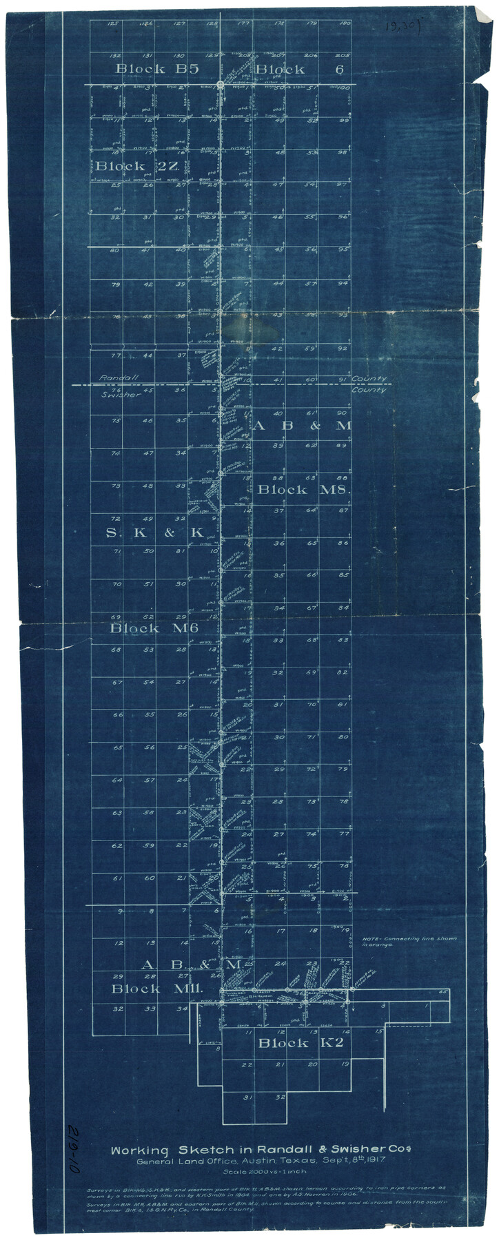
Working Sketch in Randall and Swisher Cos.
219-10
-
Map/Doc
93048
-
Collection
Twichell Survey Records
-
Object Dates
9/8/1917 (Creation Date)
-
Counties
Swisher Randall
-
Height x Width
14.6 x 36.3 inches
37.1 x 92.2 cm
Related maps
Working Sketch in Randall and Swisher Cos.

Print $2.00
- Digital $50.00
Working Sketch in Randall and Swisher Cos.
Size 5.8 x 4.1 inches
Map/Doc 93047
Part of: Twichell Survey Records
Brazos River Conservation and Reclamation District Official Boundary Line Survey, Parmer County

Print $20.00
- Digital $50.00
Brazos River Conservation and Reclamation District Official Boundary Line Survey, Parmer County
Size 24.7 x 16.8 inches
Map/Doc 91656
A. H. Baer Estate

Print $20.00
- Digital $50.00
A. H. Baer Estate
Size 18.4 x 15.6 inches
Map/Doc 92748
[River Secs. 68 1/2-73, Pt. Blk. GG]
![90478, [River Secs. 68 1/2-73, Pt. Blk. GG], Twichell Survey Records](https://historictexasmaps.com/wmedia_w700/maps/90478-1.tif.jpg)
Print $20.00
- Digital $50.00
[River Secs. 68 1/2-73, Pt. Blk. GG]
Size 27.6 x 20.7 inches
Map/Doc 90478
[Report showing connections and corners made on ground in south part of Yoakum County and north part of Gaines County, Texas]

[Report showing connections and corners made on ground in south part of Yoakum County and north part of Gaines County, Texas]
1938
Size 8.1 x 10.9 inches
Map/Doc 93256
Map of Hale County, Texas

Print $2.00
- Digital $50.00
Map of Hale County, Texas
1903
Size 9.2 x 11.6 inches
Map/Doc 90698
Subdivision of Midland County School Land, Hockley and Cochran Counties, Texas

Print $20.00
- Digital $50.00
Subdivision of Midland County School Land, Hockley and Cochran Counties, Texas
Size 30.5 x 23.3 inches
Map/Doc 92517
[H. & T. C. Block 47]
![91834, [H. & T. C. Block 47], Twichell Survey Records](https://historictexasmaps.com/wmedia_w700/maps/91834-1.tif.jpg)
Print $20.00
- Digital $50.00
[H. & T. C. Block 47]
Size 19.4 x 18.5 inches
Map/Doc 91834
"K" Sketch from Loving & Winkler Counties

Print $40.00
- Digital $50.00
"K" Sketch from Loving & Winkler Counties
1902
Size 49.4 x 39.7 inches
Map/Doc 89938
[Sketch of area just south of Levi Pruitt survey]
![91854, [Sketch of area just south of Levi Pruitt survey], Twichell Survey Records](https://historictexasmaps.com/wmedia_w700/maps/91854-1.tif.jpg)
Print $20.00
- Digital $50.00
[Sketch of area just south of Levi Pruitt survey]
Size 24.9 x 18.6 inches
Map/Doc 91854
Hill Ranch, Gaines County, Texas

Print $20.00
- Digital $50.00
Hill Ranch, Gaines County, Texas
1951
Size 21.2 x 16.6 inches
Map/Doc 92680
[Blocks A-10, A-11, and A-12]
![92669, [Blocks A-10, A-11, and A-12], Twichell Survey Records](https://historictexasmaps.com/wmedia_w700/maps/92669-1.tif.jpg)
Print $20.00
- Digital $50.00
[Blocks A-10, A-11, and A-12]
Size 19.7 x 20.0 inches
Map/Doc 92669
[Ezekiel Ables and surrounding surveys]
![90966, [Ezekiel Ables and surrounding surveys], Twichell Survey Records](https://historictexasmaps.com/wmedia_w700/maps/90966-1.tif.jpg)
Print $20.00
- Digital $50.00
[Ezekiel Ables and surrounding surveys]
Size 12.6 x 18.0 inches
Map/Doc 90966
You may also like
Galveston County NRC Article 33.136 Sketch 82

Print $82.00
- Digital $50.00
Galveston County NRC Article 33.136 Sketch 82
2015
Size 24.0 x 36.0 inches
Map/Doc 94601
Jefferson County Working Sketch 26

Print $20.00
- Digital $50.00
Jefferson County Working Sketch 26
1977
Size 39.9 x 36.8 inches
Map/Doc 66569
Map of Hopkins County

Print $20.00
- Digital $50.00
Map of Hopkins County
1863
Size 22.6 x 24.1 inches
Map/Doc 3679
Cherokee County Working Sketch 4

Print $20.00
- Digital $50.00
Cherokee County Working Sketch 4
1950
Size 33.1 x 31.5 inches
Map/Doc 67959
Briscoe County Sketch File O

Print $40.00
- Digital $50.00
Briscoe County Sketch File O
Size 27.1 x 32.4 inches
Map/Doc 11013
Presidio County Working Sketch 16

Print $20.00
- Digital $50.00
Presidio County Working Sketch 16
1942
Size 22.0 x 41.4 inches
Map/Doc 71692
Fort Bend County Rolled Sketch 6

Print $20.00
- Digital $50.00
Fort Bend County Rolled Sketch 6
1956
Size 39.6 x 34.8 inches
Map/Doc 5896
Arroyo Colorado, Rio Hondo Sheet

Print $40.00
- Digital $50.00
Arroyo Colorado, Rio Hondo Sheet
1929
Size 35.0 x 52.6 inches
Map/Doc 65129
Flight Mission No. BQY-4M, Frame 36, Harris County

Print $20.00
- Digital $50.00
Flight Mission No. BQY-4M, Frame 36, Harris County
1953
Size 18.6 x 22.3 inches
Map/Doc 85251
Montague County Working Sketch Graphic Index

Print $20.00
- Digital $50.00
Montague County Working Sketch Graphic Index
1924
Size 45.3 x 33.2 inches
Map/Doc 76645
Sabine County Sketch File 7a

Print $4.00
Sabine County Sketch File 7a
1882
Size 14.2 x 8.7 inches
Map/Doc 35620
Coast Chart No. 212 - From Latitude 26° 33' to the Rio Grande, Texas

Print $20.00
- Digital $50.00
Coast Chart No. 212 - From Latitude 26° 33' to the Rio Grande, Texas
1886
Size 30.5 x 24.1 inches
Map/Doc 73504