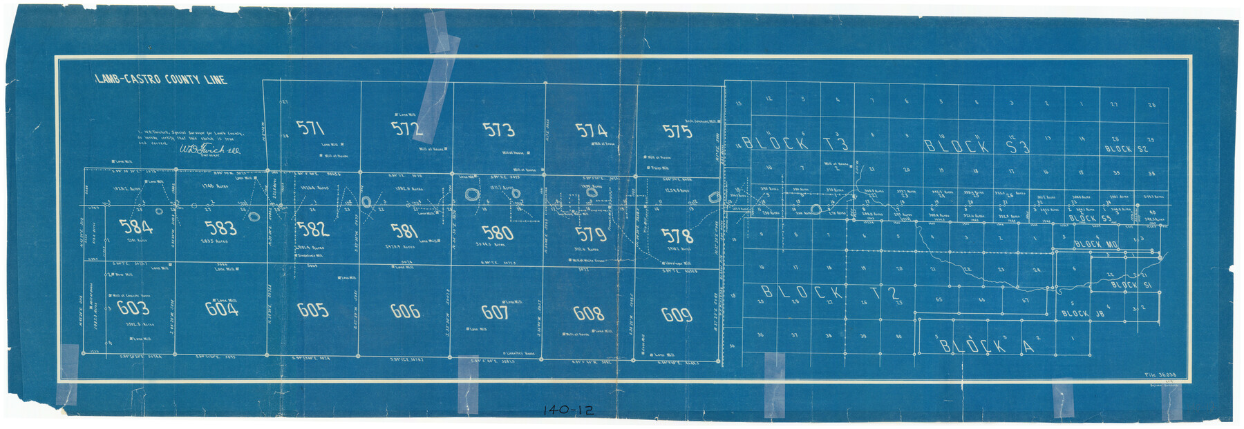
Lamb-Castro County Line
140-12
-
Map/Doc
91057
-
Collection
Twichell Survey Records
-
People and Organizations
W.D. Twichell (Surveyor/Engineer)
-
Counties
Lamb Castro
-
Height x Width
45.3 x 15.5 inches
115.1 x 39.4 cm
Part of: Twichell Survey Records
Van Zandt County

Print $40.00
- Digital $50.00
Van Zandt County
1921
Size 43.3 x 48.1 inches
Map/Doc 93124
[Sketch along Garza-Kent County Line]
![89920, [Sketch along Garza-Kent County Line], Twichell Survey Records](https://historictexasmaps.com/wmedia_w700/maps/89920-1.tif.jpg)
Print $20.00
- Digital $50.00
[Sketch along Garza-Kent County Line]
Size 41.5 x 43.7 inches
Map/Doc 89920
Working Sketch Bastrop County

Print $20.00
- Digital $50.00
Working Sketch Bastrop County
1923
Size 22.7 x 13.2 inches
Map/Doc 90149
[Sketch showing county line between Randall and Potter Counties]
![91760, [Sketch showing county line between Randall and Potter Counties], Twichell Survey Records](https://historictexasmaps.com/wmedia_w700/maps/91760-1.tif.jpg)
Print $20.00
- Digital $50.00
[Sketch showing county line between Randall and Potter Counties]
Size 18.8 x 37.0 inches
Map/Doc 91760
[Washington County RR. Co. Block 1 and Cherokee Iron Furnace Co. Block 1]
![92065, [Washington County RR. Co. Block 1 and Cherokee Iron Furnace Co. Block 1], Twichell Survey Records](https://historictexasmaps.com/wmedia_w700/maps/92065-1.tif.jpg)
Print $20.00
- Digital $50.00
[Washington County RR. Co. Block 1 and Cherokee Iron Furnace Co. Block 1]
1911
Size 22.4 x 25.4 inches
Map/Doc 92065
Plat of Connecting Line between Northwest Corner of Eddy Sparks 1-1662

Print $20.00
- Digital $50.00
Plat of Connecting Line between Northwest Corner of Eddy Sparks 1-1662
1945
Size 20.0 x 27.6 inches
Map/Doc 92602
[Leagues 247, 320, and 321]
![91291, [Leagues 247, 320, and 321], Twichell Survey Records](https://historictexasmaps.com/wmedia_w700/maps/91291-1.tif.jpg)
Print $2.00
- Digital $50.00
[Leagues 247, 320, and 321]
Size 8.2 x 15.1 inches
Map/Doc 91291
Slaughter Addition, Morton, Texas

Print $3.00
- Digital $50.00
Slaughter Addition, Morton, Texas
1951
Size 16.6 x 11.8 inches
Map/Doc 92541
[Sketch showing surveys near Brushy Creek and Old Thrall Oil Field]
![90421, [Sketch showing surveys near Brushy Creek and Old Thrall Oil Field], Twichell Survey Records](https://historictexasmaps.com/wmedia_w700/maps/90421-1.tif.jpg)
Print $20.00
- Digital $50.00
[Sketch showing surveys near Brushy Creek and Old Thrall Oil Field]
Size 27.4 x 42.6 inches
Map/Doc 90421
[Sketch showing T.&P. Blks. 35, 32, 33, 34, T3N, Blks. 1, 2 and T.T. R.R. Co. Blk. 2]
![89764, [Sketch showing T.&P. Blks. 35, 32, 33, 34, T3N, Blks. 1, 2 and T.T. R.R. Co. Blk. 2], Twichell Survey Records](https://historictexasmaps.com/wmedia_w700/maps/89764-1.tif.jpg)
Print $40.00
- Digital $50.00
[Sketch showing T.&P. Blks. 35, 32, 33, 34, T3N, Blks. 1, 2 and T.T. R.R. Co. Blk. 2]
Size 54.8 x 47.4 inches
Map/Doc 89764
[Blocks M18, M23, I, Z, and Block 47, Sections 16-28]
![91244, [Blocks M18, M23, I, Z, and Block 47, Sections 16-28], Twichell Survey Records](https://historictexasmaps.com/wmedia_w700/maps/91244-1.tif.jpg)
Print $20.00
- Digital $50.00
[Blocks M18, M23, I, Z, and Block 47, Sections 16-28]
Size 19.5 x 23.6 inches
Map/Doc 91244
[Gregg County League No. 2 Subdivided and vicinity]
![91567, [Gregg County League No. 2 Subdivided and vicinity], Twichell Survey Records](https://historictexasmaps.com/wmedia_w700/maps/91567-1.tif.jpg)
Print $20.00
- Digital $50.00
[Gregg County League No. 2 Subdivided and vicinity]
Size 17.7 x 16.3 inches
Map/Doc 91567
You may also like
Jefferson County Rolled Sketch 57

Print $20.00
- Digital $50.00
Jefferson County Rolled Sketch 57
1883
Size 18.6 x 25.9 inches
Map/Doc 6409
Sutton County Sketch File 3

Print $8.00
- Digital $50.00
Sutton County Sketch File 3
Size 12.9 x 8.5 inches
Map/Doc 37353


Presidio County Rolled Sketch MS

Print $20.00
- Digital $50.00
Presidio County Rolled Sketch MS
Size 35.9 x 19.0 inches
Map/Doc 7412
Scurry County Rolled Sketch 1

Print $40.00
- Digital $50.00
Scurry County Rolled Sketch 1
Size 70.5 x 44.9 inches
Map/Doc 9910
Flight Mission No. DQO-7K, Frame 112, Galveston County

Print $20.00
- Digital $50.00
Flight Mission No. DQO-7K, Frame 112, Galveston County
1952
Size 18.9 x 22.4 inches
Map/Doc 85127
Dawson County Working Sketch 11

Print $20.00
- Digital $50.00
Dawson County Working Sketch 11
1946
Size 25.3 x 21.9 inches
Map/Doc 68555
Hood County Sketch File 23

Print $20.00
- Digital $50.00
Hood County Sketch File 23
Size 24.5 x 18.6 inches
Map/Doc 11780
Tyler County Sketch File 5

Print $20.00
- Digital $50.00
Tyler County Sketch File 5
1854
Size 13.2 x 17.4 inches
Map/Doc 12497
[Blocks S1, O6, O, A1, A2, A3, A4, JK, JK2, JK4, and JD]
![90658, [Blocks S1, O6, O, A1, A2, A3, A4, JK, JK2, JK4, and JD], Twichell Survey Records](https://historictexasmaps.com/wmedia_w700/maps/90658-1.tif.jpg)
Print $20.00
- Digital $50.00
[Blocks S1, O6, O, A1, A2, A3, A4, JK, JK2, JK4, and JD]
Size 20.3 x 21.7 inches
Map/Doc 90658
Plat showing Deed Locations in East Half Section 2, Block E

Print $20.00
- Digital $50.00
Plat showing Deed Locations in East Half Section 2, Block E
Size 16.2 x 30.1 inches
Map/Doc 92736