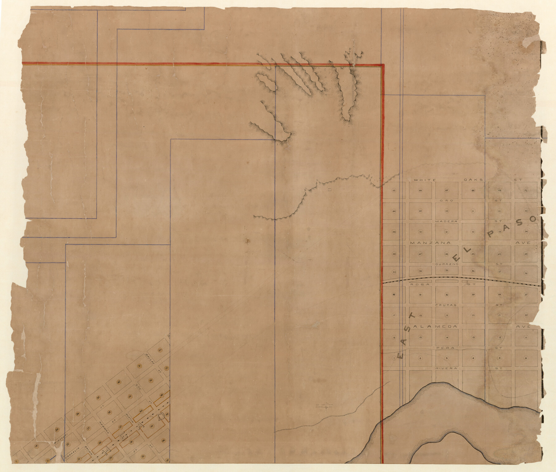
The Official Map of the City of El Paso, State of Texas
-
Map/Doc
89616
-
Collection
Non-GLO Digital Images
-
Object Dates
4/1889 (Creation Date)
-
People and Organizations
J.C. Hilzinger (Draftsman)
-
Counties
El Paso
-
Subjects
City
-
Height x Width
42.1 x 49.6 inches
106.9 x 126.0 cm
-
Medium
digital image
-
Scale
1" = 200 feet
-
Comments
See counters 89615, 89617, and 89618 for other segments of this map. See counter 89619 for digitally combined image. This map was adopted as the official map of the City of El Paso on April 5, 1889. Conservation funded in 2010 in honor of James R. Przepasnia.
Related maps
The Official Map of the City of El Paso, State of Texas

Print $20.00
The Official Map of the City of El Paso, State of Texas
1889
Size 42.2 x 50.5 inches
Map/Doc 89615
The Official Map of the City of El Paso, State of Texas

Print $20.00
The Official Map of the City of El Paso, State of Texas
1889
Size 42.4 x 54.4 inches
Map/Doc 89617
The Official Map of the City of El Paso, State of Texas

Print $20.00
The Official Map of the City of El Paso, State of Texas
1889
Size 41.9 x 46.2 inches
Map/Doc 89618
The Official Map of the City of El Paso, State of Texas

Print $40.00
The Official Map of the City of El Paso, State of Texas
1889
Size 83.6 x 97.2 inches
Map/Doc 89619
Part of: Non-GLO Digital Images

Waco, Tex., County Seat of McLennan Co.

Print $20.00
Waco, Tex., County Seat of McLennan Co.
1886
Size 23.1 x 32.7 inches
Map/Doc 89212
Map of Texas and part of New Mexico

Print $20.00
Map of Texas and part of New Mexico
1857
Size 17.4 x 23.1 inches
Map/Doc 95284
Carte de la Louisiane et Pays Voisins Pour servir a l'Histoire Generale des Voyages

Print $20.00
Carte de la Louisiane et Pays Voisins Pour servir a l'Histoire Generale des Voyages
1757
Size 9.6 x 14.9 inches
Map/Doc 94572
County Map of Texas, and Indian Territory

Print $20.00
County Map of Texas, and Indian Territory
1872
Size 18.9 x 16.1 inches
Map/Doc 88820
Map of North America engraved to illustrate Mitchell's school and family geography

Print $20.00
Map of North America engraved to illustrate Mitchell's school and family geography
1839
Size 11.3 x 8.7 inches
Map/Doc 93552
Carte de la Louisiane et du Cours du Mississipi

Print $20.00
Carte de la Louisiane et du Cours du Mississipi
1718
Size 16.6 x 21.8 inches
Map/Doc 89216
City Map of Weatherford, Texas

Print $20.00
City Map of Weatherford, Texas
Size 46.0 x 46.8 inches
Map/Doc 93697
Mapa de Texas con partes de los Estados Adyacentes

Mapa de Texas con partes de los Estados Adyacentes
1832
Size 6.8 x 5.7 inches
Map/Doc 94560

Map of Texas with Parts of the Adjoining States

Print $20.00
Map of Texas with Parts of the Adjoining States
1836
Size 29.8 x 24.1 inches
Map/Doc 93963
A Map of Austin's Colony and adjacent country in Texas drawn principally from actual survey by Stephen F. Austin

A Map of Austin's Colony and adjacent country in Texas drawn principally from actual survey by Stephen F. Austin
1820
Size 13.8 x 17.0 inches
Map/Doc 93353
You may also like
Layout of the porciones as described in the Visita General of Laredo, 1767

Layout of the porciones as described in the Visita General of Laredo, 1767
2009
Size 11.0 x 8.5 inches
Map/Doc 94042
Map of Stephens County

Print $20.00
- Digital $50.00
Map of Stephens County
1879
Size 24.0 x 19.6 inches
Map/Doc 4053
A Chart of the Internal Part of Louisiana

Print $20.00
A Chart of the Internal Part of Louisiana
1807
Size 19.2 x 16.5 inches
Map/Doc 79310
McMullen County

Print $20.00
- Digital $50.00
McMullen County
1889
Size 12.4 x 16.4 inches
Map/Doc 92957
Kerr County Working Sketch 6

Print $20.00
- Digital $50.00
Kerr County Working Sketch 6
1947
Size 32.8 x 26.3 inches
Map/Doc 70037
Nueces County Rolled Sketch 129

Print $20.00
- Digital $50.00
Nueces County Rolled Sketch 129
1998
Size 18.1 x 24.5 inches
Map/Doc 7164
Lampasas County Sketch File 11

Print $4.00
- Digital $50.00
Lampasas County Sketch File 11
1874
Size 12.2 x 7.9 inches
Map/Doc 29420
Dallam County Sketch File 14

Print $4.00
- Digital $50.00
Dallam County Sketch File 14
1949
Size 11.3 x 8.8 inches
Map/Doc 20379
Map of Maverick County

Print $20.00
Map of Maverick County
1893
Size 33.9 x 20.9 inches
Map/Doc 88979
Flight Mission No. DQO-8K, Frame 71, Galveston County

Print $20.00
- Digital $50.00
Flight Mission No. DQO-8K, Frame 71, Galveston County
1952
Size 18.6 x 22.4 inches
Map/Doc 85175
Wharton County Working Sketch 22

Print $20.00
- Digital $50.00
Wharton County Working Sketch 22
1919
Size 22.1 x 17.7 inches
Map/Doc 72486
[Floyd County School Land Lgs. 180-183, Fisher County School Land Lgs. 105-108, and part of Blk. V]
![90192, [Floyd County School Land Lgs. 180-183, Fisher County School Land Lgs. 105-108, and part of Blk. V], Twichell Survey Records](https://historictexasmaps.com/wmedia_w700/maps/90192-1.tif.jpg)
Print $2.00
- Digital $50.00
[Floyd County School Land Lgs. 180-183, Fisher County School Land Lgs. 105-108, and part of Blk. V]
Size 8.7 x 10.2 inches
Map/Doc 90192