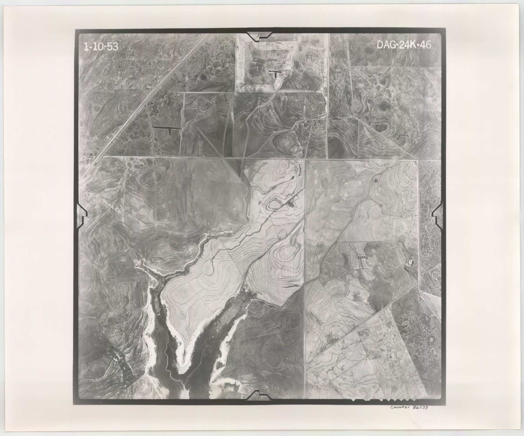
Flight Mission No. DAG-24K, Frame 46, Matagorda County
DAG-24K-46
-
Map/Doc
86533
-
Collection
General Map Collection
-
Object Dates
1953/1/10 (Creation Date)
-
People and Organizations
U. S. Department of Agriculture (Publisher)
-
Counties
Matagorda
-
Subjects
Aerial Photograph
-
Height x Width
18.5 x 22.2 inches
47.0 x 56.4 cm
-
Comments
Flown by Aero Exploration Company of Tulsa, Oklahoma.
Part of: General Map Collection
Jeff Davis County Working Sketch 21

Print $20.00
- Digital $50.00
Jeff Davis County Working Sketch 21
1957
Size 25.2 x 44.0 inches
Map/Doc 66516
Harris County Sketch File 100

Print $518.00
- Digital $50.00
Harris County Sketch File 100
1991
Size 11.5 x 8.8 inches
Map/Doc 25674
South Part Presidio County

Print $20.00
- Digital $50.00
South Part Presidio County
1975
Size 35.0 x 40.3 inches
Map/Doc 95617
Flight Mission No. DIX-6P, Frame 121, Aransas County

Print $20.00
- Digital $50.00
Flight Mission No. DIX-6P, Frame 121, Aransas County
1956
Size 18.9 x 22.6 inches
Map/Doc 83827
Val Verde County Sketch File 20

Print $20.00
- Digital $50.00
Val Verde County Sketch File 20
1881
Size 26.5 x 37.2 inches
Map/Doc 12569
Fractional Township No. 8 South Range No. 7 West of the Indian Meridian, Indian Territory

Print $20.00
- Digital $50.00
Fractional Township No. 8 South Range No. 7 West of the Indian Meridian, Indian Territory
1898
Size 19.2 x 24.3 inches
Map/Doc 75169
El Paso Street and Vicinity Map (Recto)

El Paso Street and Vicinity Map (Recto)
1962
Size 18.3 x 30.8 inches
Map/Doc 94175
Flight Mission No. DQN-1K, Frame 145, Calhoun County

Print $20.00
- Digital $50.00
Flight Mission No. DQN-1K, Frame 145, Calhoun County
1953
Size 18.6 x 22.3 inches
Map/Doc 84208
Map of the Northern Part of Houston District

Print $20.00
- Digital $50.00
Map of the Northern Part of Houston District
1849
Size 26.4 x 26.7 inches
Map/Doc 3223
Hartley County Sketch File 1a

Print $4.00
- Digital $50.00
Hartley County Sketch File 1a
1890
Size 7.8 x 8.2 inches
Map/Doc 26083
Outer Continental Shelf Leasing Maps (Louisiana Offshore Operations)

Print $20.00
- Digital $50.00
Outer Continental Shelf Leasing Maps (Louisiana Offshore Operations)
1959
Size 17.9 x 14.0 inches
Map/Doc 76097
Hale County Rolled Sketch 3

Print $40.00
- Digital $50.00
Hale County Rolled Sketch 3
1891
Size 51.7 x 24.1 inches
Map/Doc 9093
You may also like
Wharton County

Print $40.00
- Digital $50.00
Wharton County
1894
Size 55.8 x 36.0 inches
Map/Doc 87352

University Place - Addition

Print $20.00
- Digital $50.00
University Place - Addition
Size 20.2 x 12.0 inches
Map/Doc 92411
Duval County Working Sketch 37

Print $20.00
- Digital $50.00
Duval County Working Sketch 37
1958
Size 23.3 x 37.1 inches
Map/Doc 68761
[Sketch for Mineral Applications 7410, 7411, 7412, 7413, 7712 - Kleberg County]
![65624, [Sketch for Mineral Applications 7410, 7411, 7412, 7413, 7712 - Kleberg County], General Map Collection](https://historictexasmaps.com/wmedia_w700/maps/65624-1.tif.jpg)
Print $40.00
- Digital $50.00
[Sketch for Mineral Applications 7410, 7411, 7412, 7413, 7712 - Kleberg County]
1977
Size 91.9 x 44.5 inches
Map/Doc 65624
Hudspeth County Rolled Sketch 60

Print $20.00
- Digital $50.00
Hudspeth County Rolled Sketch 60
1982
Size 43.4 x 44.4 inches
Map/Doc 9225
Map of Texas and Pacific Ry. Company's Surveys in the 80 Mile Reserve

Print $40.00
- Digital $50.00
Map of Texas and Pacific Ry. Company's Surveys in the 80 Mile Reserve
1885
Map/Doc 2241
Kleberg County

Print $20.00
- Digital $50.00
Kleberg County
1913
Size 31.3 x 40.1 inches
Map/Doc 77343
Bosque County Working Sketch 20

Print $20.00
- Digital $50.00
Bosque County Working Sketch 20
1976
Size 37.4 x 32.8 inches
Map/Doc 67453
Webb County Working Sketch 4

Print $20.00
- Digital $50.00
Webb County Working Sketch 4
1907
Size 45.6 x 42.5 inches
Map/Doc 72369
[Sketch for Mineral Application 33721 - 33725 Incl. - Padre and Mustang Island]
![2875, [Sketch for Mineral Application 33721 - 33725 Incl. - Padre and Mustang Island], General Map Collection](https://historictexasmaps.com/wmedia_w700/maps/2875.tif.jpg)
Print $20.00
- Digital $50.00
[Sketch for Mineral Application 33721 - 33725 Incl. - Padre and Mustang Island]
1942
Size 30.9 x 22.0 inches
Map/Doc 2875
Zavala County Boundary File 2

Print $36.00
- Digital $50.00
Zavala County Boundary File 2
Size 9.2 x 4.3 inches
Map/Doc 60239