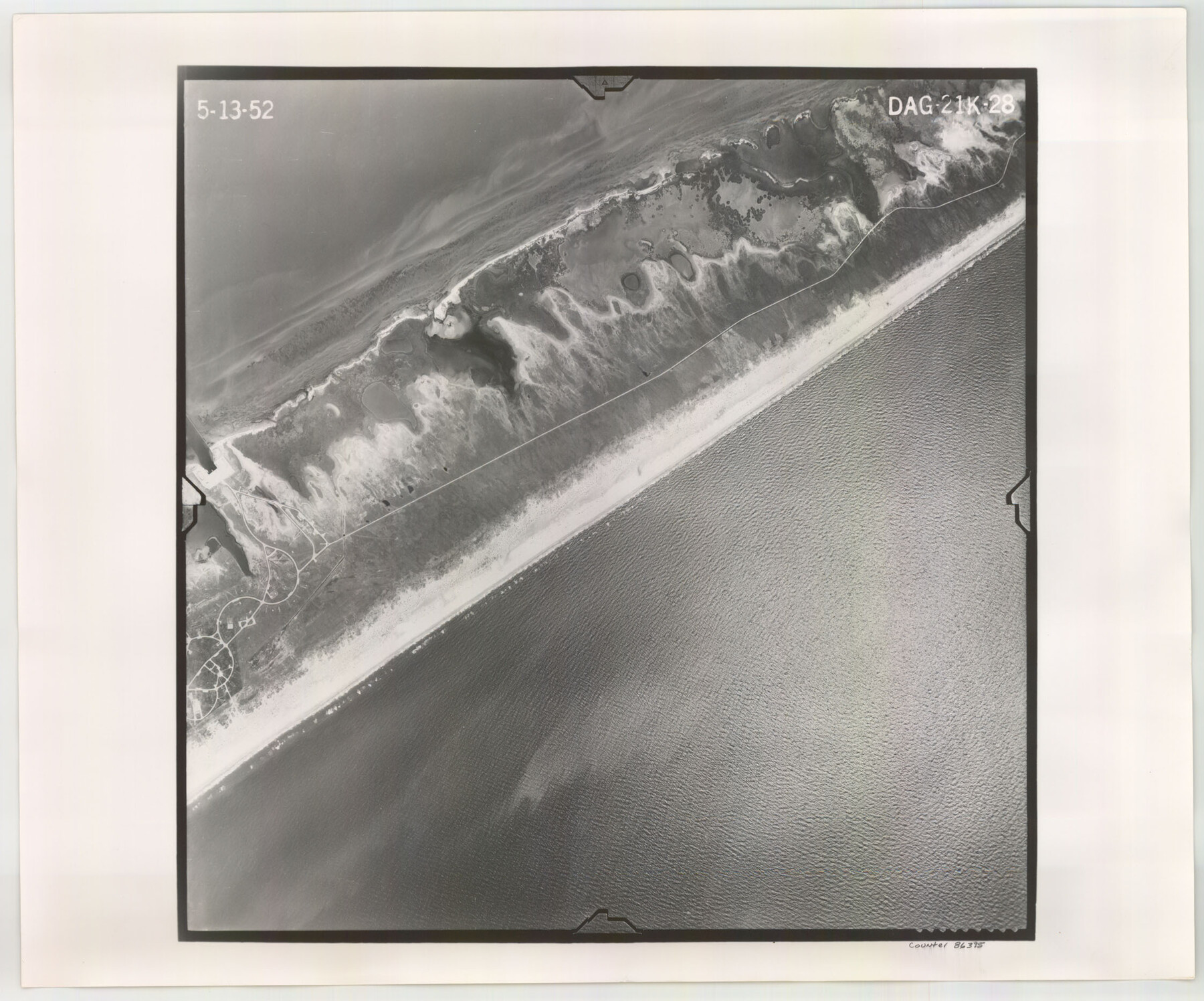
Flight Mission No. DAG-21K, Frame 28, Matagorda County
DAG-21K-28
-
Map/Doc
86395
-
Collection
General Map Collection
-
Object Dates
1952/5/13 (Creation Date)
-
People and Organizations
U. S. Department of Agriculture (Publisher)
-
Counties
Matagorda
-
Subjects
Aerial Photograph
-
Height x Width
18.6 x 22.4 inches
47.2 x 56.9 cm
-
Comments
Flown by Aero Exploration Company of Tulsa, Oklahoma.
Part of: General Map Collection
Wichita County Sketch File 32

Print $12.00
- Digital $50.00
Wichita County Sketch File 32
1939
Size 14.2 x 8.8 inches
Map/Doc 40146
Lampasas County Working Sketch 22

Print $20.00
- Digital $50.00
Lampasas County Working Sketch 22
1993
Size 34.5 x 34.7 inches
Map/Doc 70300
Dimmit County Working Sketch 27

Print $20.00
- Digital $50.00
Dimmit County Working Sketch 27
1956
Size 20.3 x 23.0 inches
Map/Doc 68688
Copy of a portion of Arista's map

Print $20.00
- Digital $50.00
Copy of a portion of Arista's map
1847
Size 27.5 x 18.3 inches
Map/Doc 73057
Comanche County Working Sketch 28

Print $20.00
- Digital $50.00
Comanche County Working Sketch 28
1984
Size 22.9 x 25.7 inches
Map/Doc 68162
Lavaca County Rolled Sketch 3

Print $20.00
- Digital $50.00
Lavaca County Rolled Sketch 3
1959
Size 42.8 x 32.8 inches
Map/Doc 9419
Concho County Sketch File 24

Print $12.00
- Digital $50.00
Concho County Sketch File 24
1885
Size 11.1 x 8.4 inches
Map/Doc 19149
Chicago & Rock Island

Print $40.00
- Digital $50.00
Chicago & Rock Island
1892
Size 8.4 x 70.7 inches
Map/Doc 64498
[Sketch for Mineral Application 36486 and 38244 - Liberty County]
![65621, [Sketch for Mineral Application 36486 and 38244 - Liberty County], General Map Collection](https://historictexasmaps.com/wmedia_w700/maps/65621.tif.jpg)
Print $20.00
- Digital $50.00
[Sketch for Mineral Application 36486 and 38244 - Liberty County]
1976
Size 24.0 x 43.9 inches
Map/Doc 65621
Nueces County Sketch File 66

Print $18.00
- Digital $50.00
Nueces County Sketch File 66
1981
Size 14.3 x 8.8 inches
Map/Doc 32989
Mason County Sketch File 13

Print $4.00
- Digital $50.00
Mason County Sketch File 13
Size 7.3 x 6.2 inches
Map/Doc 30701
Nolan County Working Sketch 8

Print $40.00
- Digital $50.00
Nolan County Working Sketch 8
1956
Size 70.8 x 33.0 inches
Map/Doc 71299
You may also like
Brown County Working Sketch 7

Print $20.00
- Digital $50.00
Brown County Working Sketch 7
1954
Size 26.5 x 28.7 inches
Map/Doc 67772
Newton County Working Sketch 25

Print $20.00
- Digital $50.00
Newton County Working Sketch 25
1953
Size 25.4 x 23.8 inches
Map/Doc 71271
Sherman County Rolled Sketch 5

Print $20.00
- Digital $50.00
Sherman County Rolled Sketch 5
1919
Size 36.9 x 41.4 inches
Map/Doc 9928
[Map of T&P Blocks 1 and 2 in Jeff Davis and Presidio Counties]
![88959, [Map of T&P Blocks 1 and 2 in Jeff Davis and Presidio Counties], Library of Congress](https://historictexasmaps.com/wmedia_w700/maps/88959.tif.jpg)
Print $20.00
[Map of T&P Blocks 1 and 2 in Jeff Davis and Presidio Counties]
Size 22.2 x 17.3 inches
Map/Doc 88959
Flight Mission No. CRK-5P, Frame 124, Refugio County

Print $20.00
- Digital $50.00
Flight Mission No. CRK-5P, Frame 124, Refugio County
1956
Size 18.7 x 22.5 inches
Map/Doc 86927


Kimble County Sketch File 34

Print $20.00
- Digital $50.00
Kimble County Sketch File 34
1963
Size 26.2 x 16.3 inches
Map/Doc 11931
[St. Louis & Southwestern]
![64275, [St. Louis & Southwestern], General Map Collection](https://historictexasmaps.com/wmedia_w700/maps/64275.tif.jpg)
Print $20.00
- Digital $50.00
[St. Louis & Southwestern]
Size 20.8 x 28.6 inches
Map/Doc 64275
Flight Mission No. DAG-21K, Frame 33, Matagorda County

Print $20.00
- Digital $50.00
Flight Mission No. DAG-21K, Frame 33, Matagorda County
1952
Size 18.5 x 22.3 inches
Map/Doc 86400
Terrell County Working Sketch 44

Print $40.00
- Digital $50.00
Terrell County Working Sketch 44
1957
Size 40.0 x 71.4 inches
Map/Doc 62137
Brazoria County NRC Article 33.136 Sketch 20

Print $36.00
- Digital $50.00
Brazoria County NRC Article 33.136 Sketch 20
2020
Map/Doc 96878