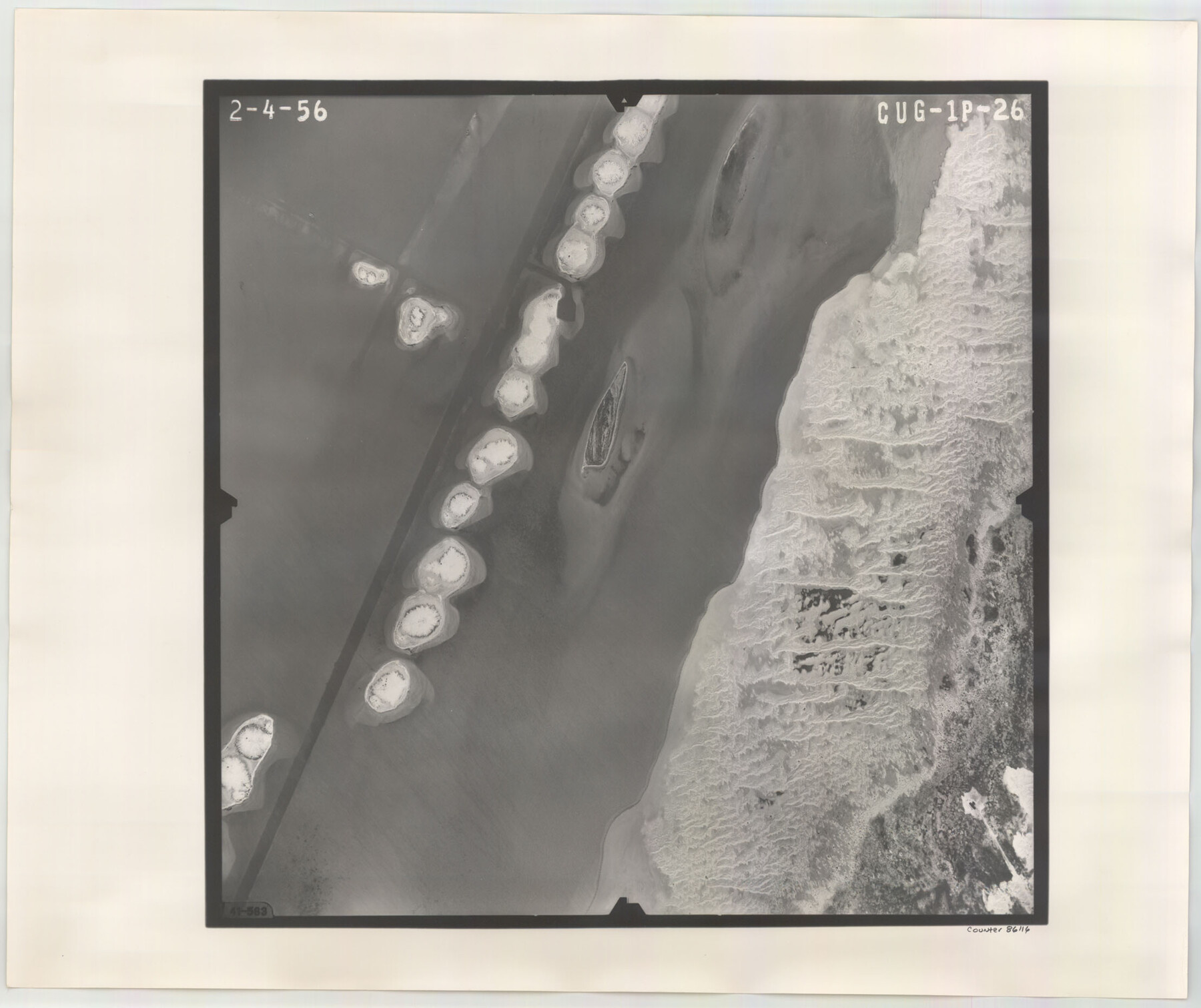
Flight Mission No. CUG-1P, Frame 26, Kleberg County
CUG-1P-26
-
Map/Doc
86116
-
Collection
General Map Collection
-
Object Dates
1956/2/4 (Creation Date)
-
People and Organizations
U. S. Department of Agriculture (Publisher)
-
Counties
Kleberg
-
Subjects
Aerial Photograph
-
Height x Width
18.6 x 22.2 inches
47.2 x 56.4 cm
-
Comments
Flown by V. L. Beavers and Associates of San Antonio, Texas.
Part of: General Map Collection
Brewster County Rolled Sketch 108

Print $20.00
- Digital $50.00
Brewster County Rolled Sketch 108
1958
Size 29.8 x 17.1 inches
Map/Doc 5260
Harrison County Working Sketch Graphic Index

Print $20.00
- Digital $50.00
Harrison County Working Sketch Graphic Index
1920
Size 44.9 x 41.7 inches
Map/Doc 76570
Kinney County Working Sketch 7

Print $20.00
- Digital $50.00
Kinney County Working Sketch 7
1908
Size 18.6 x 22.0 inches
Map/Doc 70189
Kleberg County Rolled Sketch 10-17

Print $20.00
- Digital $50.00
Kleberg County Rolled Sketch 10-17
1951
Size 38.1 x 32.0 inches
Map/Doc 9390
Flight Mission No. CLL-1N, Frame 34, Willacy County

Print $20.00
- Digital $50.00
Flight Mission No. CLL-1N, Frame 34, Willacy County
1954
Size 18.4 x 22.2 inches
Map/Doc 87015
Montgomery County Working Sketch 71

Print $20.00
- Digital $50.00
Montgomery County Working Sketch 71
1979
Size 37.2 x 29.8 inches
Map/Doc 71178
San Patricio County Working Sketch 13

Print $20.00
- Digital $50.00
San Patricio County Working Sketch 13
1949
Size 38.8 x 38.6 inches
Map/Doc 63775
Hardin County Working Sketch 24

Print $20.00
- Digital $50.00
Hardin County Working Sketch 24
1950
Size 15.3 x 11.9 inches
Map/Doc 63422
Chambers County Sketch File 18b

Print $15.00
- Digital $50.00
Chambers County Sketch File 18b
1901
Size 9.2 x 8.1 inches
Map/Doc 17571
Atascosa County Rolled Sketch 8

Print $20.00
- Digital $50.00
Atascosa County Rolled Sketch 8
1942
Size 34.8 x 41.9 inches
Map/Doc 8427
Flight Mission No. DIX-6P, Frame 120, Aransas County

Print $20.00
- Digital $50.00
Flight Mission No. DIX-6P, Frame 120, Aransas County
1956
Size 18.7 x 22.2 inches
Map/Doc 83826
Hidalgo County Rolled Sketch 16

Print $40.00
- Digital $50.00
Hidalgo County Rolled Sketch 16
1963
Size 68.9 x 42.2 inches
Map/Doc 9171
You may also like
Wichita County

Print $20.00
- Digital $50.00
Wichita County
1892
Size 20.2 x 24.3 inches
Map/Doc 75804
Terrell County Sketch File 24a

Print $20.00
- Digital $50.00
Terrell County Sketch File 24a
1932
Size 30.4 x 42.2 inches
Map/Doc 10388
Map of Grayson County

Print $20.00
- Digital $50.00
Map of Grayson County
1871
Size 19.5 x 17.8 inches
Map/Doc 1088
Pecos County Rolled Sketch 89

Print $40.00
- Digital $50.00
Pecos County Rolled Sketch 89
1934
Size 56.2 x 41.4 inches
Map/Doc 10719
Gray County, Texas

Print $20.00
- Digital $50.00
Gray County, Texas
1889
Size 23.7 x 17.4 inches
Map/Doc 630
King County Rolled Sketch 13

Print $40.00
- Digital $50.00
King County Rolled Sketch 13
Size 50.5 x 29.3 inches
Map/Doc 9353
Cooke County Rolled Sketch 2

Print $20.00
- Digital $50.00
Cooke County Rolled Sketch 2
1944
Size 29.4 x 28.1 inches
Map/Doc 5561
Live Oak County Sketch File A

Print $2.00
- Digital $50.00
Live Oak County Sketch File A
Size 7.9 x 4.7 inches
Map/Doc 30250
Burnet County Boundary File 5

Print $16.00
- Digital $50.00
Burnet County Boundary File 5
Size 12.7 x 7.9 inches
Map/Doc 50878
Childress County Working Sketch 3

Print $20.00
- Digital $50.00
Childress County Working Sketch 3
1927
Size 22.4 x 18.6 inches
Map/Doc 68019
[Plat showing 1.0 acre of land out of the NE/4 of Section 2, Block E]
![92706, [Plat showing 1.0 acre of land out of the NE/4 of Section 2, Block E], Twichell Survey Records](https://historictexasmaps.com/wmedia_w700/maps/92706-1.tif.jpg)
Print $3.00
- Digital $50.00
[Plat showing 1.0 acre of land out of the NE/4 of Section 2, Block E]
1954
Size 9.6 x 10.2 inches
Map/Doc 92706
Webb County Working Sketch 19

Print $20.00
- Digital $50.00
Webb County Working Sketch 19
1925
Size 32.6 x 29.8 inches
Map/Doc 72384