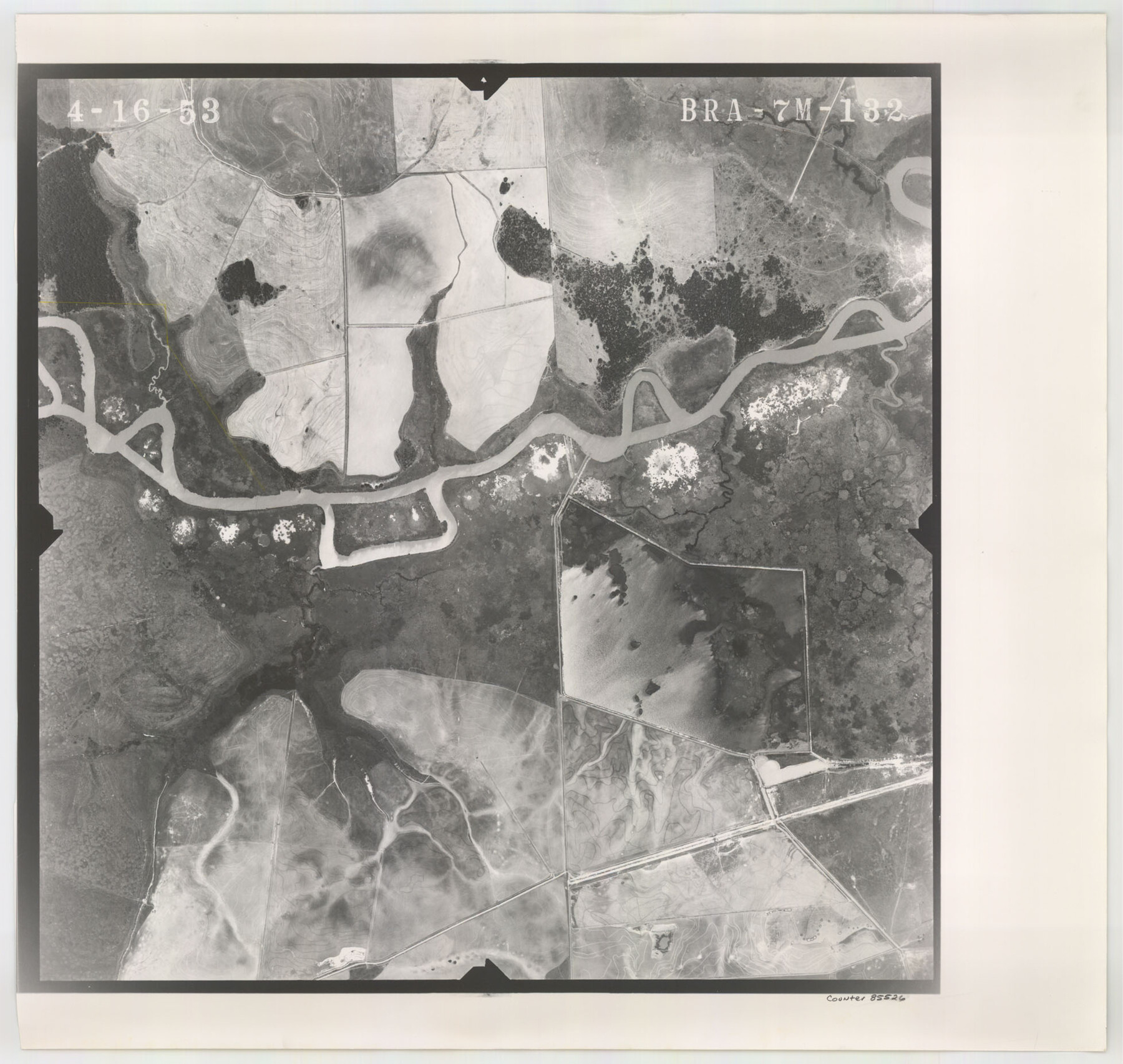
Flight Mission No. BRA-7M, Frame 132, Jefferson County
BRA-7M-132
-
Map/Doc
85526
-
Collection
General Map Collection
-
Object Dates
1953/4/16 (Creation Date)
-
People and Organizations
U. S. Department of Agriculture (Publisher)
-
Counties
Jefferson
-
Subjects
Aerial Photograph
-
Height x Width
18.5 x 19.6 inches
47.0 x 49.8 cm
-
Comments
Flown by Jack Ammann Photogrammetric Engineers of San Antonio, Texas.
Part of: General Map Collection
Flight Mission No. DAH-17M, Frame 18, Orange County

Print $20.00
- Digital $50.00
Flight Mission No. DAH-17M, Frame 18, Orange County
1953
Size 18.5 x 22.6 inches
Map/Doc 86881
Stonewall County Working Sketch 19

Print $20.00
- Digital $50.00
Stonewall County Working Sketch 19
1957
Size 35.3 x 35.1 inches
Map/Doc 62326
Dickens County Sketch File H

Print $28.00
- Digital $50.00
Dickens County Sketch File H
Size 13.2 x 8.9 inches
Map/Doc 20861
Panola County Sketch File 20

Print $22.00
- Digital $50.00
Panola County Sketch File 20
Size 8.3 x 14.6 inches
Map/Doc 33485
Travis County Sketch File 36

Print $4.00
- Digital $50.00
Travis County Sketch File 36
1912
Size 8.4 x 9.9 inches
Map/Doc 38355
Robertson County Sketch File 2

Print $16.00
Robertson County Sketch File 2
1858
Size 10.1 x 8.2 inches
Map/Doc 35343
Chambers County NRC Article 33.136 Sketch 14

Print $42.00
- Digital $50.00
Chambers County NRC Article 33.136 Sketch 14
Size 34.5 x 22.6 inches
Map/Doc 97016
[Sketch for Mineral Application 24072, San Jacinto River]
![65601, [Sketch for Mineral Application 24072, San Jacinto River], General Map Collection](https://historictexasmaps.com/wmedia_w700/maps/65601.tif.jpg)
Print $20.00
- Digital $50.00
[Sketch for Mineral Application 24072, San Jacinto River]
1929
Size 25.1 x 18.4 inches
Map/Doc 65601
Harris County NRC Article 33.136 Sketch 4

Print $22.00
- Digital $50.00
Harris County NRC Article 33.136 Sketch 4
2001
Size 36.1 x 24.3 inches
Map/Doc 61600
Flight Mission No. CLL-3N, Frame 16, Willacy County

Print $20.00
- Digital $50.00
Flight Mission No. CLL-3N, Frame 16, Willacy County
1954
Size 18.5 x 22.1 inches
Map/Doc 87082
[Sketch for Mineral Applications 7410, 7411, 7412, 7413, 7712 - Kleberg County]
![65623, [Sketch for Mineral Applications 7410, 7411, 7412, 7413, 7712 - Kleberg County], General Map Collection](https://historictexasmaps.com/wmedia_w700/maps/65623-1.tif.jpg)
Print $40.00
- Digital $50.00
[Sketch for Mineral Applications 7410, 7411, 7412, 7413, 7712 - Kleberg County]
1977
Size 44.6 x 92.4 inches
Map/Doc 65623
[Cotton Belt, St. Louis Southwestern Railway of Texas, Alignment through Smith County]
![64377, [Cotton Belt, St. Louis Southwestern Railway of Texas, Alignment through Smith County], General Map Collection](https://historictexasmaps.com/wmedia_w700/maps/64377.tif.jpg)
Print $20.00
- Digital $50.00
[Cotton Belt, St. Louis Southwestern Railway of Texas, Alignment through Smith County]
1903
Size 21.7 x 30.0 inches
Map/Doc 64377
You may also like
Brewster County Working Sketch 55

Print $40.00
- Digital $50.00
Brewster County Working Sketch 55
1953
Size 51.1 x 27.5 inches
Map/Doc 67656
Harris County Historic Topographic 32

Print $20.00
- Digital $50.00
Harris County Historic Topographic 32
1916
Size 29.3 x 21.6 inches
Map/Doc 65843
Bee County Sketch File 32

Print $4.00
- Digital $50.00
Bee County Sketch File 32
Size 7.9 x 12.6 inches
Map/Doc 14347
Coast Chart No. 210 Aransas Pass and Corpus Christi Bay with the coast to latitude 27° 12' Texas

Print $20.00
- Digital $50.00
Coast Chart No. 210 Aransas Pass and Corpus Christi Bay with the coast to latitude 27° 12' Texas
1887
Size 27.3 x 18.3 inches
Map/Doc 72803
Flight Mission No. DQN-5K, Frame 49, Calhoun County

Print $20.00
- Digital $50.00
Flight Mission No. DQN-5K, Frame 49, Calhoun County
1953
Size 17.4 x 22.3 inches
Map/Doc 84394
Blanco County Sketch File 24

Print $4.00
- Digital $50.00
Blanco County Sketch File 24
Size 8.9 x 14.4 inches
Map/Doc 14614
Presidio County Sketch File V

Print $6.00
- Digital $50.00
Presidio County Sketch File V
1915
Size 11.2 x 8.8 inches
Map/Doc 34549
Chambers County

Print $20.00
- Digital $50.00
Chambers County
1862
Size 20.2 x 27.8 inches
Map/Doc 3381
Flight Mission No. BRA-16M, Frame 182, Jefferson County

Print $20.00
- Digital $50.00
Flight Mission No. BRA-16M, Frame 182, Jefferson County
1953
Size 18.6 x 22.4 inches
Map/Doc 85780
Brewster County Working Sketch 15a

Print $40.00
- Digital $50.00
Brewster County Working Sketch 15a
1953
Size 22.6 x 49.1 inches
Map/Doc 67549
Randall County, Texas

Print $20.00
- Digital $50.00
Randall County, Texas
1887
Size 19.4 x 16.7 inches
Map/Doc 747
Flight Mission No. BQR-3K, Frame 152, Brazoria County

Print $20.00
- Digital $50.00
Flight Mission No. BQR-3K, Frame 152, Brazoria County
1952
Size 18.7 x 22.3 inches
Map/Doc 83979