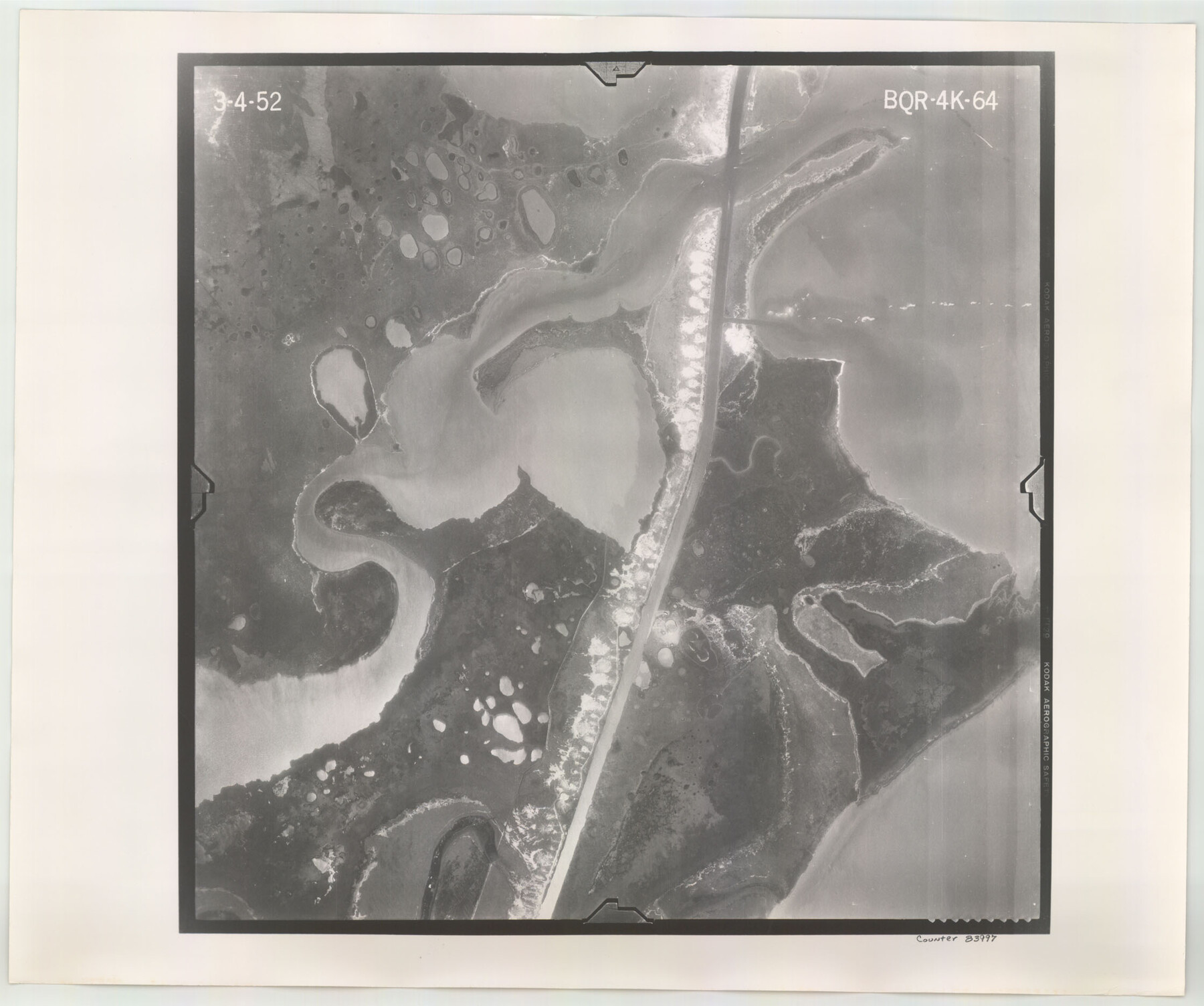
Flight Mission No. BQR-4K, Frame 64, Brazoria County
BQR-4K-64
-
Map/Doc
83997
-
Collection
General Map Collection
-
Object Dates
1952/3/4 (Creation Date)
-
People and Organizations
U. S. Department of Agriculture (Publisher)
-
Counties
Brazoria
-
Subjects
Aerial Photograph
-
Height x Width
18.7 x 22.4 inches
47.5 x 56.9 cm
-
Comments
Flown by Aero Exploration Company of Tulsa, Oklahoma.
Part of: General Map Collection
Flight Mission No. BQY-4M, Frame 70, Harris County

Print $20.00
- Digital $50.00
Flight Mission No. BQY-4M, Frame 70, Harris County
1953
Size 18.7 x 22.4 inches
Map/Doc 85279
Panola County Working Sketch 19

Print $40.00
- Digital $50.00
Panola County Working Sketch 19
1945
Map/Doc 71428
Map of Galveston Harbor and City

Print $40.00
- Digital $50.00
Map of Galveston Harbor and City
1850
Size 31.0 x 52.0 inches
Map/Doc 69856
C No. 3 - Sea Coast of Delaware, Maryland, and part of Virginia

Print $20.00
- Digital $50.00
C No. 3 - Sea Coast of Delaware, Maryland, and part of Virginia
1852
Size 30.4 x 22.2 inches
Map/Doc 97207
Cameron County Sketch File 7

Print $146.00
- Digital $50.00
Cameron County Sketch File 7
1980
Size 14.3 x 8.7 inches
Map/Doc 17042
Flight Mission No. CRC-5R, Frame 33, Chambers County

Print $20.00
- Digital $50.00
Flight Mission No. CRC-5R, Frame 33, Chambers County
1956
Size 18.6 x 22.5 inches
Map/Doc 84952
[Aerial photograph from Carancahua Bend of Caney Creek to Cedar Lake]
![78640, [Aerial photograph from Carancahua Bend of Caney Creek to Cedar Lake], General Map Collection](https://historictexasmaps.com/wmedia_w700/maps/78640.tif.jpg)
Print $20.00
- Digital $50.00
[Aerial photograph from Carancahua Bend of Caney Creek to Cedar Lake]
1991
Size 24.4 x 30.3 inches
Map/Doc 78640
Dallas County Working Sketch 21

Print $20.00
- Digital $50.00
Dallas County Working Sketch 21
2008
Size 32.6 x 33.9 inches
Map/Doc 88761
Jack County Working Sketch 7

Print $20.00
- Digital $50.00
Jack County Working Sketch 7
1953
Size 37.2 x 31.9 inches
Map/Doc 66433
Hutchinson County Rolled Sketch 42

Print $40.00
- Digital $50.00
Hutchinson County Rolled Sketch 42
1993
Size 38.0 x 49.6 inches
Map/Doc 6308

Flight Mission No. DQN-3K, Frame 36, Calhoun County

Print $20.00
- Digital $50.00
Flight Mission No. DQN-3K, Frame 36, Calhoun County
1953
Size 18.6 x 22.2 inches
Map/Doc 84349
You may also like
Morris County Rolled Sketch 2A

Print $20.00
- Digital $50.00
Morris County Rolled Sketch 2A
Size 22.7 x 17.7 inches
Map/Doc 10227
Wharton County

Print $40.00
- Digital $50.00
Wharton County
1946
Size 43.1 x 49.7 inches
Map/Doc 95671
Kinney County Rolled Sketch 3

Print $20.00
- Digital $50.00
Kinney County Rolled Sketch 3
Size 31.4 x 23.2 inches
Map/Doc 6535
Texas, nach den besten Quellen entw. u. gez. vom Hauptm. Radefeld

Print $20.00
- Digital $50.00
Texas, nach den besten Quellen entw. u. gez. vom Hauptm. Radefeld
1851
Size 15.0 x 18.4 inches
Map/Doc 93776
Gaines County Rolled Sketch 15C

Print $20.00
- Digital $50.00
Gaines County Rolled Sketch 15C
Size 33.6 x 22.7 inches
Map/Doc 75929
Nueces County Rolled Sketch 54

Print $67.00
- Digital $50.00
Nueces County Rolled Sketch 54
1978
Size 9.8 x 15.0 inches
Map/Doc 47875
[Brooks & Burleson Block 1]
![90514, [Brooks & Burleson Block 1], Twichell Survey Records](https://historictexasmaps.com/wmedia_w700/maps/90514-1.tif.jpg)
Print $2.00
- Digital $50.00
[Brooks & Burleson Block 1]
1906
Size 9.2 x 11.1 inches
Map/Doc 90514
Angelina County Working Sketch 36

Print $20.00
- Digital $50.00
Angelina County Working Sketch 36
1957
Size 14.4 x 18.3 inches
Map/Doc 67119
Loving County Sketch File 7

Print $2.00
- Digital $50.00
Loving County Sketch File 7
1977
Size 12.1 x 8.8 inches
Map/Doc 30417
Flight Mission No. DCL-6C, Frame 125, Kenedy County

Print $20.00
- Digital $50.00
Flight Mission No. DCL-6C, Frame 125, Kenedy County
1943
Size 18.7 x 22.3 inches
Map/Doc 85955
Kinney County

Print $40.00
- Digital $50.00
Kinney County
1955
Size 48.9 x 42.4 inches
Map/Doc 77342
Duval County Rolled Sketch WSR

Print $20.00
- Digital $50.00
Duval County Rolled Sketch WSR
1938
Size 39.2 x 26.8 inches
Map/Doc 5772