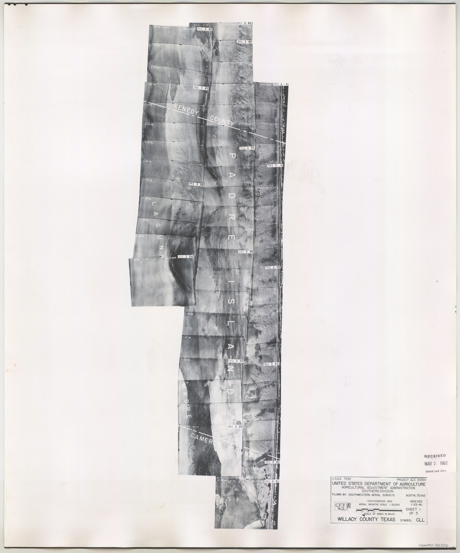
Willacy County Aerial Photograph Index Sheet 1
Willacy County Aerial Photograph Index 2
-
Map/Doc
83756
-
Collection
General Map Collection
-
Object Dates
1940/1/25 (Creation Date)
-
People and Organizations
U. S. Department of Agriculture (Publisher)
-
Counties
Willacy
-
Subjects
Aerial Photograph
-
Height x Width
24.3 x 20.2 inches
61.7 x 51.3 cm
-
Comments
Flying completed January 1940 by Southwestern Aerial Surveys of Austin, Texas.
Received in office May 7, 1962.
Part of: General Map Collection
Victoria County Rolled Sketch 3

Print $20.00
- Digital $50.00
Victoria County Rolled Sketch 3
1950
Size 41.9 x 37.8 inches
Map/Doc 10094
Kimble County Working Sketch 6

Print $20.00
- Digital $50.00
Kimble County Working Sketch 6
1915
Size 24.4 x 26.5 inches
Map/Doc 70074
Trinity County Working Sketch 4

Print $20.00
- Digital $50.00
Trinity County Working Sketch 4
1908
Size 21.3 x 18.5 inches
Map/Doc 69452
Irion County Boundary File 3a

Print $2.00
- Digital $50.00
Irion County Boundary File 3a
Size 12.9 x 8.3 inches
Map/Doc 55349
Treaty to Resolve Pending Boundary Differences and Maintain the Rio Grande and Colorado River as the International Boundary Between the United States of American and Mexico

Print $4.00
- Digital $50.00
Treaty to Resolve Pending Boundary Differences and Maintain the Rio Grande and Colorado River as the International Boundary Between the United States of American and Mexico
1970
Size 10.9 x 18.1 inches
Map/Doc 83101
Starr County Sketch File 28

Print $12.00
- Digital $50.00
Starr County Sketch File 28
1933
Size 11.2 x 8.8 inches
Map/Doc 36948
Flight Mission No. DQN-3K, Frame 66, Calhoun County

Print $20.00
- Digital $50.00
Flight Mission No. DQN-3K, Frame 66, Calhoun County
1953
Size 18.7 x 22.5 inches
Map/Doc 84357
Randall County Rolled Sketch 9B

Print $20.00
- Digital $50.00
Randall County Rolled Sketch 9B
1985
Size 45.0 x 34.5 inches
Map/Doc 9810
Pecos County Working Sketch 23

Print $20.00
- Digital $50.00
Pecos County Working Sketch 23
1927
Size 45.6 x 40.6 inches
Map/Doc 71494
[Surveys in Austin's Colony by Horatio Chriesman along Mill and Cummins Creeks]
![68, [Surveys in Austin's Colony by Horatio Chriesman along Mill and Cummins Creeks], General Map Collection](https://historictexasmaps.com/wmedia_w700/maps/68.tif.jpg)
Print $20.00
- Digital $50.00
[Surveys in Austin's Colony by Horatio Chriesman along Mill and Cummins Creeks]
1830
Size 30.7 x 25.7 inches
Map/Doc 68
Flight Mission No. DCL-6C, Frame 133, Kenedy County

Print $20.00
- Digital $50.00
Flight Mission No. DCL-6C, Frame 133, Kenedy County
1943
Size 18.6 x 22.3 inches
Map/Doc 85963
Somervell County Working Sketch 7

Print $20.00
- Digital $50.00
Somervell County Working Sketch 7
2008
Size 27.9 x 34.2 inches
Map/Doc 88889
You may also like
Sketch in Dawson County, Texas

Print $3.00
- Digital $50.00
Sketch in Dawson County, Texas
1950
Size 9.5 x 12.8 inches
Map/Doc 92627
Polk County Sketch File 4

Print $4.00
- Digital $50.00
Polk County Sketch File 4
1859
Size 10.2 x 8.0 inches
Map/Doc 34126
Map of Wilbarger County

Print $20.00
- Digital $50.00
Map of Wilbarger County
1874
Size 23.8 x 22.2 inches
Map/Doc 4147
Flight Mission No. CRC-3R, Frame 24, Chambers County

Print $20.00
- Digital $50.00
Flight Mission No. CRC-3R, Frame 24, Chambers County
1956
Size 18.6 x 22.2 inches
Map/Doc 84798
Map of the County of Cameron, Texas

Print $40.00
- Digital $50.00
Map of the County of Cameron, Texas
1884
Size 54.7 x 34.5 inches
Map/Doc 3141
[Sketch showing details along East line of Lipscomb County]
![89939, [Sketch showing details along East line of Lipscomb County], Twichell Survey Records](https://historictexasmaps.com/wmedia_w700/maps/89939-1.tif.jpg)
Print $40.00
- Digital $50.00
[Sketch showing details along East line of Lipscomb County]
Size 15.4 x 66.7 inches
Map/Doc 89939
Dawson County Rolled Sketch 5

Print $20.00
- Digital $50.00
Dawson County Rolled Sketch 5
1913
Size 33.6 x 28.0 inches
Map/Doc 5691
Hardin County Rolled Sketch 8

Print $20.00
- Digital $50.00
Hardin County Rolled Sketch 8
1947
Size 23.7 x 25.8 inches
Map/Doc 6081
Shelby County Working Sketch 26

Print $20.00
- Digital $50.00
Shelby County Working Sketch 26
1990
Size 11.3 x 12.2 inches
Map/Doc 63880
Block M6 in Castro, Swisher, and Randall Co's, Tex.

Print $20.00
- Digital $50.00
Block M6 in Castro, Swisher, and Randall Co's, Tex.
Size 13.8 x 17.2 inches
Map/Doc 90397
[Map of Matagorda County]
![3841, [Map of Matagorda County], General Map Collection](https://historictexasmaps.com/wmedia_w700/maps/3841.tif.jpg)
Print $20.00
- Digital $50.00
[Map of Matagorda County]
Size 24.4 x 25.6 inches
Map/Doc 3841
[Subdivision of Nueces Bay and list of Court Decrees]
![2086, [Subdivision of Nueces Bay and list of Court Decrees], General Map Collection](https://historictexasmaps.com/wmedia_w700/maps/2086-1.tif.jpg)
Print $40.00
- Digital $50.00
[Subdivision of Nueces Bay and list of Court Decrees]
1940
Size 34.2 x 48.8 inches
Map/Doc 2086