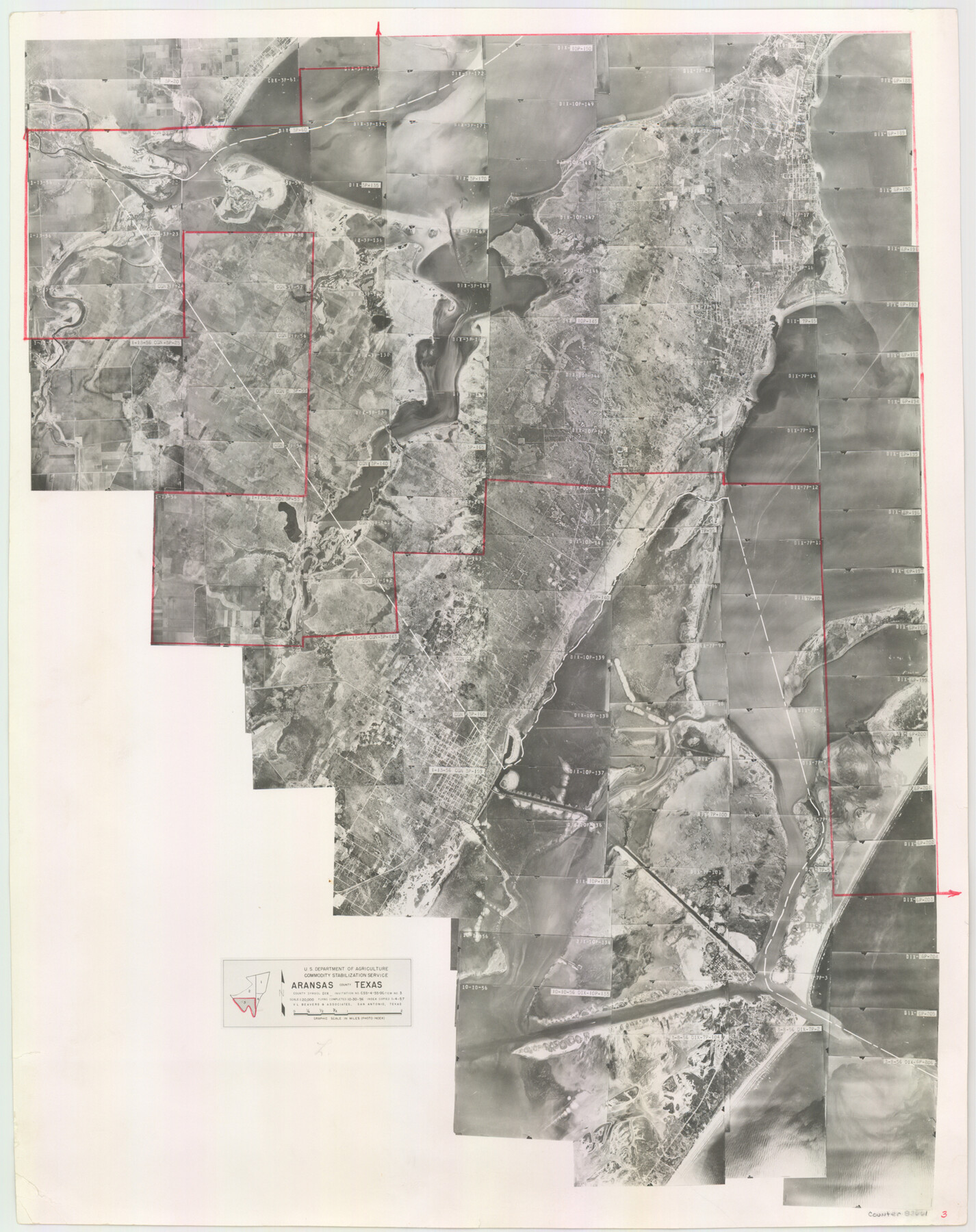
Aransas County Aerial Photograph Index Sheet 3
Aransas County Aerial Photograph Index 3
-
Map/Doc
83661
-
Collection
General Map Collection
-
Object Dates
1957/1/4 (Creation Date)
-
People and Organizations
U. S. Department of Agriculture (Publisher)
-
Counties
Aransas
-
Subjects
Aerial Photograph
-
Height x Width
22.8 x 18.1 inches
57.9 x 46.0 cm
-
Comments
Flying completed October 30, 1956 by V. L. Beavers and Associates of San Antonio, Texas.
Part of: General Map Collection
Edwards County Working Sketch 66

Print $20.00
- Digital $50.00
Edwards County Working Sketch 66
1957
Size 24.1 x 17.3 inches
Map/Doc 68942

The Great Texas Coastal Birding Trail, Central Texas Coast

The Great Texas Coastal Birding Trail, Central Texas Coast
Size 33.1 x 36.0 inches
Map/Doc 94339
United States - Gulf Coast - From Latitude 26° 33' to the Rio Grande Texas

Print $20.00
- Digital $50.00
United States - Gulf Coast - From Latitude 26° 33' to the Rio Grande Texas
1918
Size 18.4 x 24.1 inches
Map/Doc 72848
Bee County Sketch File X1

Print $20.00
- Digital $50.00
Bee County Sketch File X1
1834
Size 14.2 x 8.9 inches
Map/Doc 14245
Map of Webb County

Print $20.00
- Digital $50.00
Map of Webb County
1888
Size 33.6 x 27.7 inches
Map/Doc 4128
Menard County Sketch File 17

Print $20.00
- Digital $50.00
Menard County Sketch File 17
1914
Size 35.4 x 20.1 inches
Map/Doc 12075
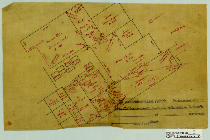
Somervell County Rolled Sketch C
Print $3.00
- Digital $50.00
Somervell County Rolled Sketch C
Size 9.0 x 13.4 inches
Map/Doc 7793
Gillespie County Working Sketch 13

Print $20.00
- Digital $50.00
Gillespie County Working Sketch 13
2008
Size 22.8 x 31.8 inches
Map/Doc 88831
Dawson County Working Sketch 10

Print $20.00
- Digital $50.00
Dawson County Working Sketch 10
1944
Size 15.6 x 13.6 inches
Map/Doc 68554
Tarrant County Sketch File 32

Print $16.00
- Digital $50.00
Tarrant County Sketch File 32
1946
Size 11.3 x 8.8 inches
Map/Doc 37751
Dickens County Rolled Sketch 9

Print $20.00
- Digital $50.00
Dickens County Rolled Sketch 9
1954
Size 41.0 x 30.3 inches
Map/Doc 5708
You may also like
Temple Morrow Irrigated Farm South Half of Section 1, Block D6

Print $3.00
- Digital $50.00
Temple Morrow Irrigated Farm South Half of Section 1, Block D6
Size 9.5 x 12.8 inches
Map/Doc 92311
Kinney County Working Sketch 23

Print $20.00
- Digital $50.00
Kinney County Working Sketch 23
1950
Size 20.8 x 24.3 inches
Map/Doc 70205
Sabine County Working Sketch 9

Print $20.00
- Digital $50.00
Sabine County Working Sketch 9
1923
Size 23.9 x 27.1 inches
Map/Doc 63680
Hunt County Sketch File 2

Print $4.00
- Digital $50.00
Hunt County Sketch File 2
1857
Size 10.1 x 7.8 inches
Map/Doc 27083
Terrell County Rolled Sketch 29

Print $20.00
- Digital $50.00
Terrell County Rolled Sketch 29
1929
Size 27.5 x 41.9 inches
Map/Doc 7936
Proceedings of the International Boundary Commission, United States and Mexico, American Section, Elimination of Bancos, Treaty of 1905

Proceedings of the International Boundary Commission, United States and Mexico, American Section, Elimination of Bancos, Treaty of 1905
Size 12.4 x 9.6 inches
Map/Doc 83125
Williamson County Sketch File 14

Print $6.00
- Digital $50.00
Williamson County Sketch File 14
1871
Size 9.4 x 15.4 inches
Map/Doc 40332
Gaines County Rolled Sketch 17

Print $20.00
- Digital $50.00
Gaines County Rolled Sketch 17
1940
Size 24.5 x 17.8 inches
Map/Doc 5934
Zavala County Working Sketch 30

Print $20.00
- Digital $50.00
Zavala County Working Sketch 30
1989
Size 36.8 x 28.1 inches
Map/Doc 62105
Atascosa County Working Sketch 22

Print $20.00
- Digital $50.00
Atascosa County Working Sketch 22
1956
Size 31.6 x 25.5 inches
Map/Doc 67218
Sutton County Sketch File 38

Print $20.00
- Digital $50.00
Sutton County Sketch File 38
1935
Size 18.2 x 28.3 inches
Map/Doc 12388
![91466, [Block B7], Twichell Survey Records](https://historictexasmaps.com/wmedia_w700/maps/91466-1.tif.jpg)