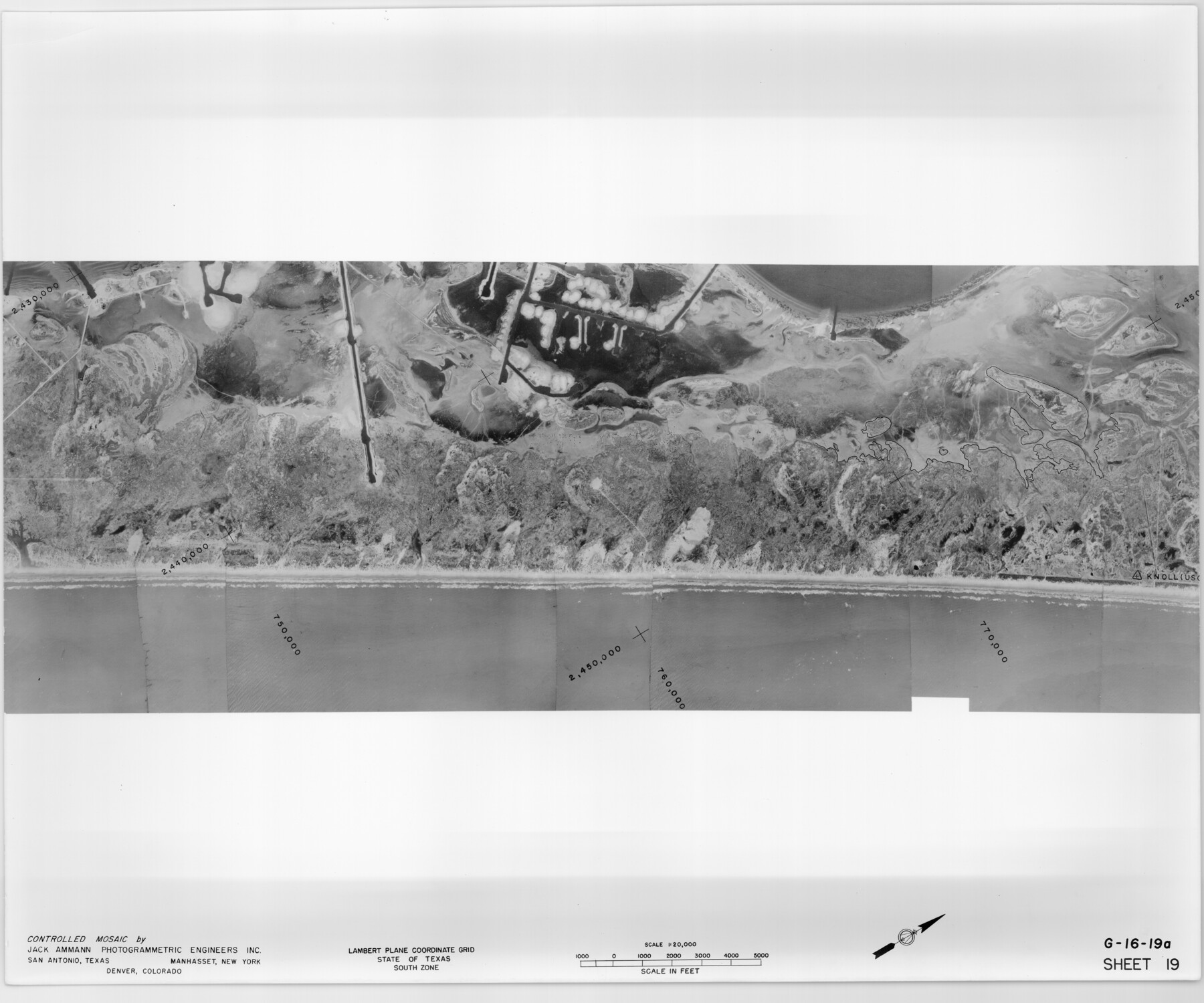
Controlled Mosaic by Jack Amman Photogrammetric Engineers, Inc - Sheet 19
[Coastal Aerial Photograph]
G-16-19a-b
-
Map/Doc
83464
-
Collection
General Map Collection
-
Object Dates
1954 (Creation Date)
-
Subjects
Aerial Photograph
-
Height x Width
20.0 x 24.0 inches
50.8 x 61.0 cm
-
Comments
Statement on reverse side: "The reverse reflects the data shown thereon which was obtained by aerial survey made from December 31, 1953 to March 17, 1954 by Jack Ammann Photogrammetric Engineers, Inc."
Part of: General Map Collection
Flight Mission No. DIX-6P, Frame 127, Aransas County

Print $20.00
- Digital $50.00
Flight Mission No. DIX-6P, Frame 127, Aransas County
1956
Size 19.1 x 23.0 inches
Map/Doc 83833
Johnson County Boundary File 1

Print $66.00
- Digital $50.00
Johnson County Boundary File 1
Size 14.1 x 8.5 inches
Map/Doc 55551
Fractional Township No. 10 South Range No. 25 East of the Indian Meridian, Indian Territory

Print $20.00
- Digital $50.00
Fractional Township No. 10 South Range No. 25 East of the Indian Meridian, Indian Territory
1898
Size 19.2 x 24.3 inches
Map/Doc 75244
Flight Mission No. BRA-3M, Frame 126, Jefferson County

Print $20.00
- Digital $50.00
Flight Mission No. BRA-3M, Frame 126, Jefferson County
1953
Size 18.7 x 21.8 inches
Map/Doc 85400
Duval County Rolled Sketch 48

Print $20.00
- Digital $50.00
Duval County Rolled Sketch 48
Size 21.8 x 18.5 inches
Map/Doc 5762
Flight Mission No. CGI-1N, Frame 142, Cameron County

Print $20.00
- Digital $50.00
Flight Mission No. CGI-1N, Frame 142, Cameron County
1955
Size 18.5 x 22.2 inches
Map/Doc 84498
Bosque County Sketch File 27

Print $40.00
- Digital $50.00
Bosque County Sketch File 27
Size 14.7 x 17.5 inches
Map/Doc 10937
Montgomery County Sketch File 21

Print $8.00
- Digital $50.00
Montgomery County Sketch File 21
1934
Size 9.0 x 13.2 inches
Map/Doc 31856
Kimble County Working Sketch 66

Print $6.00
- Digital $50.00
Kimble County Working Sketch 66
1965
Size 31.1 x 27.2 inches
Map/Doc 70134
Cameron County Sketch File 8

Print $73.00
- Digital $50.00
Cameron County Sketch File 8
1982
Size 11.4 x 8.9 inches
Map/Doc 17124
Hockley County Working Sketch 4

Print $40.00
- Digital $50.00
Hockley County Working Sketch 4
1973
Size 38.7 x 52.3 inches
Map/Doc 66194
Jasper County Sketch File 26

Print $16.00
- Digital $50.00
Jasper County Sketch File 26
1944
Size 11.2 x 8.8 inches
Map/Doc 27834
You may also like
Red River County Working Sketch 22

Print $5.00
- Digital $50.00
Red River County Working Sketch 22
1955
Size 27.9 x 26.8 inches
Map/Doc 72005
Sutton County Working Sketch 56

Print $20.00
- Digital $50.00
Sutton County Working Sketch 56
Size 27.6 x 28.8 inches
Map/Doc 62399

Hunt County Sketch File 35

Print $4.00
- Digital $50.00
Hunt County Sketch File 35
Size 5.3 x 8.3 inches
Map/Doc 27148
[Sketch for Mineral Application 12206 - Cow Bayou, O. B. Sawyer]
![65570, [Sketch for Mineral Application 12206 - Cow Bayou, O. B. Sawyer], General Map Collection](https://historictexasmaps.com/wmedia_w700/maps/65570.tif.jpg)
Print $40.00
- Digital $50.00
[Sketch for Mineral Application 12206 - Cow Bayou, O. B. Sawyer]
Size 37.0 x 63.3 inches
Map/Doc 65570
Upton County Sketch File 41

Print $20.00
- Digital $50.00
Upton County Sketch File 41
1964
Size 33.8 x 26.0 inches
Map/Doc 12525
Kendall County

Print $20.00
- Digital $50.00
Kendall County
1946
Size 41.1 x 35.3 inches
Map/Doc 77336
Revised Sectional Map No. 3 Showing Land Surveys in Counties of Loving and Reeves and Portions of Winkler, Ward, Pecos, Jeff Davis and El Paso

Print $20.00
- Digital $50.00
Revised Sectional Map No. 3 Showing Land Surveys in Counties of Loving and Reeves and Portions of Winkler, Ward, Pecos, Jeff Davis and El Paso
Size 24.7 x 19.4 inches
Map/Doc 92902
Index for Texas Railroad ROW & track maps available on microfilm at THD & Archives and Records

Print $2.00
- Digital $50.00
Index for Texas Railroad ROW & track maps available on microfilm at THD & Archives and Records
1977
Size 11.1 x 8.7 inches
Map/Doc 60762
Hutchinson County Sketch File 41

Print $14.00
- Digital $50.00
Hutchinson County Sketch File 41
1955
Size 9.8 x 8.5 inches
Map/Doc 27298
Coke County Sketch File 35

Print $6.00
- Digital $50.00
Coke County Sketch File 35
1967
Size 14.2 x 8.6 inches
Map/Doc 18649
Newton County Sketch File 46

Print $18.00
- Digital $50.00
Newton County Sketch File 46
1962
Size 11.2 x 8.6 inches
Map/Doc 32451