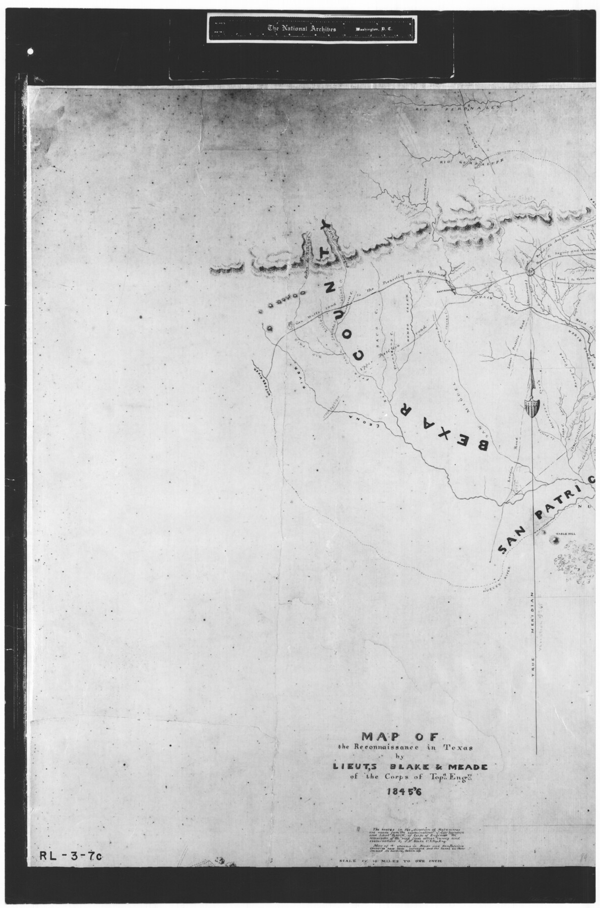
Map of the Reconnaissance in Texas by Lieuts Blake & Meade of the Corps of Topl. Engrs.
RL-3-7c
-
Map/Doc
72891
-
Collection
General Map Collection
-
Object Dates
1845 - 1846 (Creation Date)
-
People and Organizations
Blake (Author)
Meade (Author)
Saunders (Surveyor/Engineer)
Scaritt (Surveyor/Engineer)
Meade (Surveyor/Engineer)
J.E. Blake (Surveyor/Engineer)
-
Counties
San Patricio Bexar
-
Subjects
Military
-
Height x Width
27.6 x 18.2 inches
70.1 x 46.2 cm
-
Comments
B/W photostat copy from National Archives in multiple pieces.
Part of: General Map Collection
Sabine County Working Sketch 10

Print $20.00
- Digital $50.00
Sabine County Working Sketch 10
1925
Size 18.6 x 24.2 inches
Map/Doc 63681
Supreme Court of the United States, October Term, 1923, No. 15, Original - The State of Oklahoma, Complainant vs. The State of Texas, Defendant, The United States, Intervener; Report of the Boundary Commissioners

Print $20.00
- Digital $50.00
Supreme Court of the United States, October Term, 1923, No. 15, Original - The State of Oklahoma, Complainant vs. The State of Texas, Defendant, The United States, Intervener; Report of the Boundary Commissioners
1923
Size 46.4 x 33.4 inches
Map/Doc 75122
Maps of Gulf Intracoastal Waterway, Texas - Sabine River to the Rio Grande and connecting waterways including ship channels

Print $20.00
- Digital $50.00
Maps of Gulf Intracoastal Waterway, Texas - Sabine River to the Rio Grande and connecting waterways including ship channels
1966
Size 14.5 x 22.3 inches
Map/Doc 61949
Parker County Boundary File 68

Print $12.00
- Digital $50.00
Parker County Boundary File 68
Size 8.1 x 3.6 inches
Map/Doc 57848
Map of Nacogdoches County

Print $20.00
- Digital $50.00
Map of Nacogdoches County
1881
Size 24.5 x 21.5 inches
Map/Doc 4600

Dallam County Sketch File 2

Print $260.00
- Digital $50.00
Dallam County Sketch File 2
1886
Size 29.9 x 17.4 inches
Map/Doc 11278
Edwards County

Print $20.00
- Digital $50.00
Edwards County
1893
Size 26.7 x 30.2 inches
Map/Doc 4650
Flight Mission No. BRA-16M, Frame 85, Jefferson County

Print $20.00
- Digital $50.00
Flight Mission No. BRA-16M, Frame 85, Jefferson County
1953
Size 18.6 x 22.4 inches
Map/Doc 85697
San Saba County Sketch File 4a

Print $4.00
- Digital $50.00
San Saba County Sketch File 4a
1854
Size 9.6 x 8.5 inches
Map/Doc 36410
Throckmorton County Working Sketch 6

Print $20.00
- Digital $50.00
Throckmorton County Working Sketch 6
1952
Size 24.7 x 21.7 inches
Map/Doc 62115
Flight Mission No. DAG-21K, Frame 118, Matagorda County

Print $20.00
- Digital $50.00
Flight Mission No. DAG-21K, Frame 118, Matagorda County
1952
Size 18.5 x 18.4 inches
Map/Doc 86443
You may also like
Right of Way and Track Map International & Gt. Northern Ry. operated by the International & Gt. Northern Ry. Co., Columbia Branch, Gulf Division

Print $40.00
- Digital $50.00
Right of Way and Track Map International & Gt. Northern Ry. operated by the International & Gt. Northern Ry. Co., Columbia Branch, Gulf Division
1917
Size 25.0 x 56.8 inches
Map/Doc 64599
University Land Field Notes for Blocks 1, 2, 8, 9, and 10 in Reagan County, Blocks 6 and 7 in Crockett and Reagan Counties, Blocks 3, 4, and 58 in Reagan and Upton Counties, and Block 5 in Crockett, Reagan, and Upton Counties

University Land Field Notes for Blocks 1, 2, 8, 9, and 10 in Reagan County, Blocks 6 and 7 in Crockett and Reagan Counties, Blocks 3, 4, and 58 in Reagan and Upton Counties, and Block 5 in Crockett, Reagan, and Upton Counties
Map/Doc 81716
Gillespie County Sketch File 17

Print $8.00
- Digital $50.00
Gillespie County Sketch File 17
1994
Size 11.2 x 8.7 inches
Map/Doc 24157
Mills County Working Sketch 24

Print $20.00
- Digital $50.00
Mills County Working Sketch 24
1988
Size 40.3 x 36.5 inches
Map/Doc 71054
Pecos County Rolled Sketch 188

Print $40.00
- Digital $50.00
Pecos County Rolled Sketch 188
1984
Size 59.4 x 43.5 inches
Map/Doc 9753
Trinity County Sketch File 33

Print $6.00
- Digital $50.00
Trinity County Sketch File 33
1922
Size 11.2 x 8.9 inches
Map/Doc 38572
Map of the River Sabine from its Mouth on the Gulf of Mexico in the Sea to Logan's Ferry in Latitude 31° 58' 25" North

Print $20.00
Map of the River Sabine from its Mouth on the Gulf of Mexico in the Sea to Logan's Ferry in Latitude 31° 58' 25" North
1840
Size 35.5 x 9.1 inches
Map/Doc 79294
Map of Zapata County

Print $40.00
- Digital $50.00
Map of Zapata County
1901
Size 55.1 x 47.7 inches
Map/Doc 16937
General Highway Map, Crockett County, Texas

Print $20.00
General Highway Map, Crockett County, Texas
1940
Size 18.3 x 25.1 inches
Map/Doc 79062
Frio County Rolled Sketch 7

Print $20.00
- Digital $50.00
Frio County Rolled Sketch 7
Size 21.0 x 17.4 inches
Map/Doc 5918
Hidalgo County Sketch File 7a

Print $4.00
- Digital $50.00
Hidalgo County Sketch File 7a
1886
Size 12.8 x 8.2 inches
Map/Doc 26405
Nueces County Sketch File 76

Print $54.00
- Digital $50.00
Nueces County Sketch File 76
1992
Size 11.0 x 8.6 inches
Map/Doc 33032