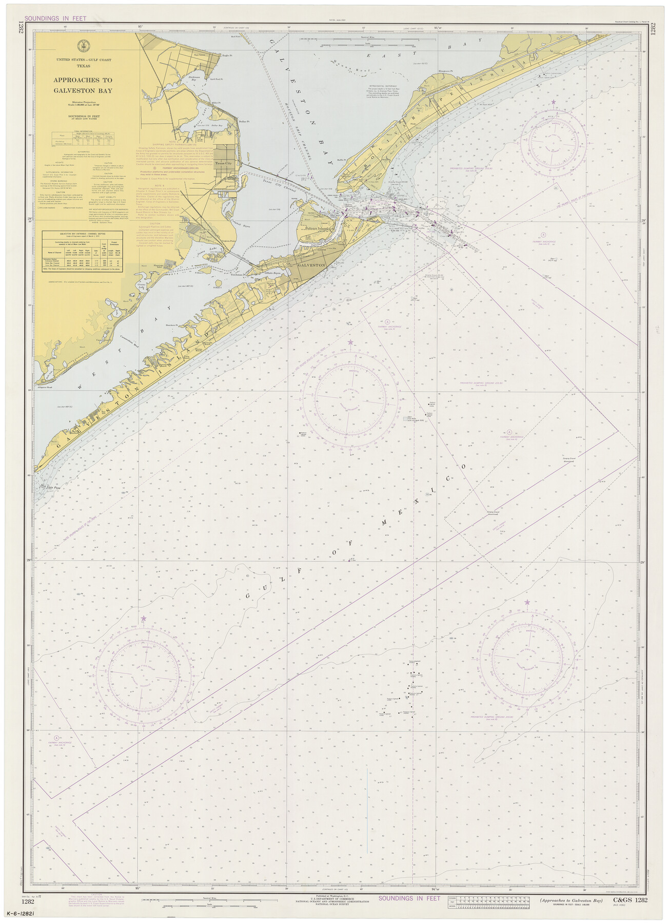
Approaches to Galveston Bay
K-6-1282i
-
Map/Doc
69881
-
Collection
General Map Collection
-
Object Dates
4/8/1972 (Creation Date)
-
Counties
Galveston
-
Subjects
Nautical Charts
-
Height x Width
50.2 x 36.0 inches
127.5 x 91.4 cm
Part of: General Map Collection
Map of Crockett County

Print $40.00
- Digital $50.00
Map of Crockett County
1878
Size 62.6 x 49.7 inches
Map/Doc 93373
Hutchinson County Sketch File 27

Print $20.00
- Digital $50.00
Hutchinson County Sketch File 27
Size 21.0 x 24.9 inches
Map/Doc 11817
Schleicher Co.

Print $20.00
- Digital $50.00
Schleicher Co.
1893
Size 20.8 x 29.3 inches
Map/Doc 63025
Uvalde County Working Sketch 38

Print $20.00
- Digital $50.00
Uvalde County Working Sketch 38
1970
Size 33.3 x 30.8 inches
Map/Doc 72108
Cochran County Rolled Sketch 3

Print $20.00
- Digital $50.00
Cochran County Rolled Sketch 3
1944
Size 29.3 x 43.4 inches
Map/Doc 8607
Somervell County

Print $20.00
- Digital $50.00
Somervell County
1884
Size 29.5 x 31.3 inches
Map/Doc 63041
Wise County Sketch File 49

Print $20.00
- Digital $50.00
Wise County Sketch File 49
1882
Size 15.5 x 20.8 inches
Map/Doc 12702
Brazoria County Sketch File 47

Print $10.00
- Digital $50.00
Brazoria County Sketch File 47
Size 14.3 x 8.9 inches
Map/Doc 15106
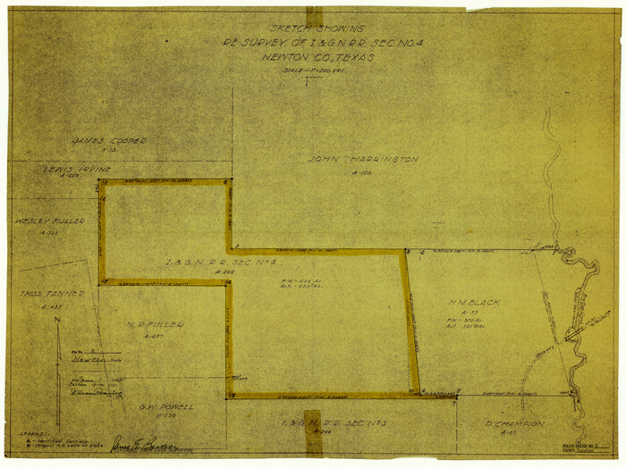
Newton County Sketch File 4b

Print $22.00
- Digital $50.00
Newton County Sketch File 4b
Size 7.6 x 12.2 inches
Map/Doc 32364
Flight Mission No. CUG-3P, Frame 83, Kleberg County

Print $20.00
- Digital $50.00
Flight Mission No. CUG-3P, Frame 83, Kleberg County
1956
Size 18.7 x 22.4 inches
Map/Doc 86258
Newton County Rolled Sketch 8
Print $20.00
- Digital $50.00
Newton County Rolled Sketch 8
1945
Size 21.5 x 28.7 inches
Map/Doc 6844
Flight Mission No. DAG-18K, Frame 179, Matagorda County

Print $20.00
- Digital $50.00
Flight Mission No. DAG-18K, Frame 179, Matagorda County
1952
Size 16.2 x 16.0 inches
Map/Doc 86371
You may also like
Upton County Sketch File 27

Print $20.00
- Digital $50.00
Upton County Sketch File 27
1928
Size 42.9 x 22.6 inches
Map/Doc 10416
Oldham County Boundary File 1d

Print $68.00
- Digital $50.00
Oldham County Boundary File 1d
Size 14.0 x 8.5 inches
Map/Doc 57759
Live Oak County Rolled Sketch 9

Print $20.00
- Digital $50.00
Live Oak County Rolled Sketch 9
1982
Size 25.6 x 23.3 inches
Map/Doc 6636
Dimmit County Sketch File 22

Print $47.00
- Digital $50.00
Dimmit County Sketch File 22
1906
Size 9.3 x 8.6 inches
Map/Doc 21129
Dallas County Working Sketch 17

Print $40.00
- Digital $50.00
Dallas County Working Sketch 17
Size 23.3 x 50.5 inches
Map/Doc 68583
Description of Best Route from Austin to San Antonio, Texas

Print $20.00
Description of Best Route from Austin to San Antonio, Texas
1865
Size 12.9 x 13.1 inches
Map/Doc 79296
Dawson County Rolled Sketch 7

Print $20.00
- Digital $50.00
Dawson County Rolled Sketch 7
Size 18.5 x 39.3 inches
Map/Doc 5692
Uvalde County Working Sketch 59

Print $20.00
- Digital $50.00
Uvalde County Working Sketch 59
1989
Size 25.1 x 39.1 inches
Map/Doc 72129
Cooke County Boundary File 19

Print $30.00
- Digital $50.00
Cooke County Boundary File 19
Size 8.7 x 4.0 inches
Map/Doc 51858

Lamb County Rolled Sketch 10

Print $40.00
- Digital $50.00
Lamb County Rolled Sketch 10
1912
Size 31.7 x 70.6 inches
Map/Doc 9418
[Blocks M18, M23, I, Z, and Block 47, Sections 16-28]
![91244, [Blocks M18, M23, I, Z, and Block 47, Sections 16-28], Twichell Survey Records](https://historictexasmaps.com/wmedia_w700/maps/91244-1.tif.jpg)
Print $20.00
- Digital $50.00
[Blocks M18, M23, I, Z, and Block 47, Sections 16-28]
Size 19.5 x 23.6 inches
Map/Doc 91244