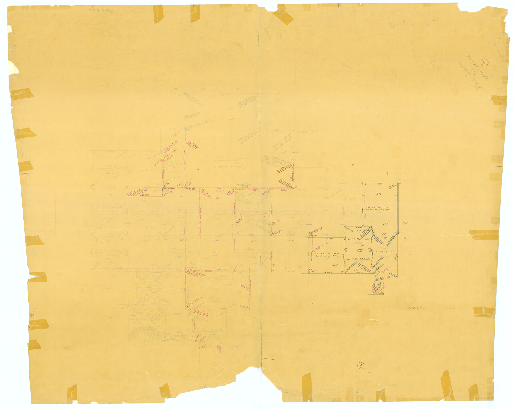
Duval County Working Sketch 5
-
Map/Doc
68718
-
Collection
General Map Collection
-
Object Dates
1933 (Creation Date)
-
Counties
Duval
-
Subjects
Surveying Working Sketch
-
Height x Width
43.2 x 54.2 inches
109.7 x 137.7 cm
Part of: General Map Collection
Map of Portion of Laguna Madre in Nueces & Kleberg Counties showing subdivision thereof for mineral development

Print $20.00
- Digital $50.00
Map of Portion of Laguna Madre in Nueces & Kleberg Counties showing subdivision thereof for mineral development
1937
Size 38.6 x 30.8 inches
Map/Doc 2918
Bee County Sketch File 3a

Print $8.00
- Digital $50.00
Bee County Sketch File 3a
1875
Size 12.7 x 8.2 inches
Map/Doc 14264
Live Oak County Sketch File 28

Print $10.00
- Digital $50.00
Live Oak County Sketch File 28
1922
Size 14.3 x 8.5 inches
Map/Doc 30314
Calhoun County Rolled Sketch 9

Print $20.00
- Digital $50.00
Calhoun County Rolled Sketch 9
Size 24.4 x 38.7 inches
Map/Doc 5365
Flight Mission No. DQN-2K, Frame 189, Calhoun County

Print $20.00
- Digital $50.00
Flight Mission No. DQN-2K, Frame 189, Calhoun County
1953
Size 16.1 x 16.0 inches
Map/Doc 84330
Controlled Mosaic by Jack Amman Photogrammetric Engineers, Inc - Sheet 7

Print $20.00
- Digital $50.00
Controlled Mosaic by Jack Amman Photogrammetric Engineers, Inc - Sheet 7
1954
Size 20.0 x 24.0 inches
Map/Doc 83451
Presidio County Sketch File 85

Print $6.00
- Digital $50.00
Presidio County Sketch File 85
1950
Size 14.3 x 8.9 inches
Map/Doc 34745
Tarrant County Working Sketch 7

Print $40.00
- Digital $50.00
Tarrant County Working Sketch 7
1981
Size 18.9 x 54.3 inches
Map/Doc 62424
[Sketch for Mineral Application 11108 - Greens Bayou]
![76156, [Sketch for Mineral Application 11108 - Greens Bayou], General Map Collection](https://historictexasmaps.com/wmedia_w700/maps/76156.tif.jpg)
Print $40.00
- Digital $50.00
[Sketch for Mineral Application 11108 - Greens Bayou]
Size 58.2 x 31.4 inches
Map/Doc 76156
Map of Galveston County

Print $20.00
- Digital $50.00
Map of Galveston County
1864
Size 19.6 x 28.0 inches
Map/Doc 3576
Anderson County

Print $40.00
- Digital $50.00
Anderson County
1942
Size 52.9 x 47.9 inches
Map/Doc 66702
Wood County Sketch File 8

Print $6.00
- Digital $50.00
Wood County Sketch File 8
1850
Size 12.5 x 8.3 inches
Map/Doc 40653
You may also like

Rusk County Working Sketch 38

Print $20.00
- Digital $50.00
Rusk County Working Sketch 38
2008
Size 16.3 x 23.3 inches
Map/Doc 88815
Flight Mission No. DAH-17M, Frame 24, Orange County

Print $20.00
- Digital $50.00
Flight Mission No. DAH-17M, Frame 24, Orange County
1953
Size 18.5 x 22.4 inches
Map/Doc 86887
[Plat of the Town of Lockhart]
![82534, [Plat of the Town of Lockhart], General Map Collection](https://historictexasmaps.com/wmedia_w700/maps/82534-1.tif.jpg)
Print $20.00
- Digital $50.00
[Plat of the Town of Lockhart]
Size 19.5 x 25.0 inches
Map/Doc 82534
Map of Wise County

Print $20.00
- Digital $50.00
Map of Wise County
1895
Size 41.8 x 37.2 inches
Map/Doc 16932
Throckmorton County Sketch File 7b

Print $4.00
- Digital $50.00
Throckmorton County Sketch File 7b
Size 13.0 x 6.5 inches
Map/Doc 38097
Ward County Rolled Sketch 24A

Print $20.00
- Digital $50.00
Ward County Rolled Sketch 24A
Size 19.9 x 42.3 inches
Map/Doc 8164
Ellis County, Texas

Print $20.00
- Digital $50.00
Ellis County, Texas
1879
Size 21.2 x 29.6 inches
Map/Doc 714
Jeff Davis County Sketch File 45

Print $10.00
- Digital $50.00
Jeff Davis County Sketch File 45
1890
Size 14.0 x 8.5 inches
Map/Doc 28075
Hunt County, Texas

Print $20.00
- Digital $50.00
Hunt County, Texas
1871
Size 25.8 x 19.4 inches
Map/Doc 462

Deaf Smith County Sketch File 1a

Print $21.00
- Digital $50.00
Deaf Smith County Sketch File 1a
Size 11.5 x 9.2 inches
Map/Doc 20616