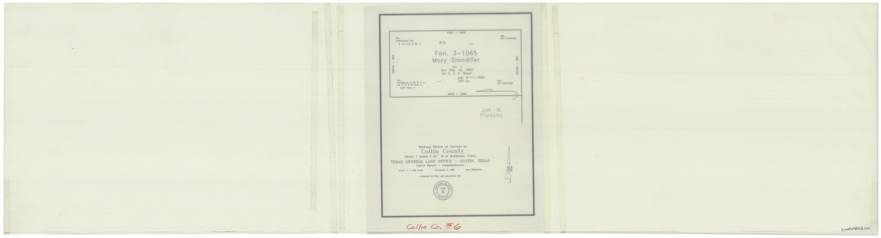
Collin County Working Sketch 6
-
Map/Doc
68100
-
Collection
General Map Collection
-
Object Dates
12/4/1996 (Creation Date)
-
People and Organizations
Joan Kilpatrick (Draftsman)
-
Counties
Collin
-
Subjects
Surveying Working Sketch
-
Height x Width
11.2 x 42.2 inches
28.5 x 107.2 cm
-
Scale
1" = 200 varas
Part of: General Map Collection
Madison County Working Sketch 7

Print $20.00
- Digital $50.00
Madison County Working Sketch 7
1982
Size 12.7 x 17.4 inches
Map/Doc 70769
Bee County Sketch File 16

Print $4.00
- Digital $50.00
Bee County Sketch File 16
1878
Size 8.6 x 7.7 inches
Map/Doc 14299
Cass County Working Sketch 23

Print $40.00
- Digital $50.00
Cass County Working Sketch 23
1966
Size 56.8 x 37.1 inches
Map/Doc 67926
Map of the Paluxy Artesian Reservoirs of the Black and Grand Prairies of Texas including the Eastern and Western Cross Timbers

Print $20.00
- Digital $50.00
Map of the Paluxy Artesian Reservoirs of the Black and Grand Prairies of Texas including the Eastern and Western Cross Timbers
1900
Size 24.8 x 24.4 inches
Map/Doc 75919

Voyages Autour du Monde, et vers les deux poles par terre et par mer - Tome Premier

Voyages Autour du Monde, et vers les deux poles par terre et par mer - Tome Premier
1782
Map/Doc 97085
Lampasas County Sketch File 10

Print $8.00
- Digital $50.00
Lampasas County Sketch File 10
1872
Size 12.7 x 7.9 inches
Map/Doc 29416
[Galveston, Harrisburg & San Antonio through El Paso County]
![64003, [Galveston, Harrisburg & San Antonio through El Paso County], General Map Collection](https://historictexasmaps.com/wmedia_w700/maps/64003.tif.jpg)
Print $20.00
- Digital $50.00
[Galveston, Harrisburg & San Antonio through El Paso County]
1907
Size 13.7 x 33.9 inches
Map/Doc 64003
Harris County Rolled Sketch 80B

Print $20.00
- Digital $50.00
Harris County Rolled Sketch 80B
Size 32.0 x 44.2 inches
Map/Doc 9137
Newton County Rolled Sketch 7

Print $20.00
- Digital $50.00
Newton County Rolled Sketch 7
1943
Size 21.4 x 37.2 inches
Map/Doc 6843
Sketch showing Mineral Leases in Nueces Bay

Print $20.00
- Digital $50.00
Sketch showing Mineral Leases in Nueces Bay
1942
Size 14.3 x 24.3 inches
Map/Doc 3019
La Salle County Sketch File 23

Print $40.00
- Digital $50.00
La Salle County Sketch File 23
Size 14.2 x 17.3 inches
Map/Doc 29530
You may also like
Calhoun County Sketch File 12

Print $120.00
- Digital $50.00
Calhoun County Sketch File 12
Size 23.0 x 36.9 inches
Map/Doc 11033
Flight Mission No. DIX-10P, Frame 171, Aransas County

Print $20.00
- Digital $50.00
Flight Mission No. DIX-10P, Frame 171, Aransas County
1956
Size 18.8 x 22.3 inches
Map/Doc 83961
Flight Mission No. BRA-8M, Frame 126, Jefferson County

Print $20.00
- Digital $50.00
Flight Mission No. BRA-8M, Frame 126, Jefferson County
1953
Size 19.1 x 22.7 inches
Map/Doc 85622
Flight Mission No. DQO-8K, Frame 40, Galveston County

Print $20.00
- Digital $50.00
Flight Mission No. DQO-8K, Frame 40, Galveston County
1952
Size 18.5 x 22.3 inches
Map/Doc 85147
[T. & P. Blocks 31-33, Township 5N]
![90568, [T. & P. Blocks 31-33, Township 5N], Twichell Survey Records](https://historictexasmaps.com/wmedia_w700/maps/90568-1.tif.jpg)
Print $20.00
- Digital $50.00
[T. & P. Blocks 31-33, Township 5N]
Size 14.6 x 17.7 inches
Map/Doc 90568
Map of Lipscomb County

Print $20.00
- Digital $50.00
Map of Lipscomb County
1899
Size 42.2 x 38.9 inches
Map/Doc 95572
United States - Gulf Coast - Galveston to Rio Grande

Print $20.00
- Digital $50.00
United States - Gulf Coast - Galveston to Rio Grande
1941
Size 26.6 x 18.5 inches
Map/Doc 72752
Flight Mission No. BQY-4M, Frame 36, Harris County

Print $20.00
- Digital $50.00
Flight Mission No. BQY-4M, Frame 36, Harris County
1953
Size 18.6 x 22.3 inches
Map/Doc 85251
Donley County Sketch File B1

Print $20.00
- Digital $50.00
Donley County Sketch File B1
Size 32.0 x 21.3 inches
Map/Doc 11371
Aransas County NRC Article 33.136 Location Key Sheet

Print $20.00
- Digital $50.00
Aransas County NRC Article 33.136 Location Key Sheet
1975
Size 27.0 x 23.0 inches
Map/Doc 77004
Cherokee County Working Sketch 4

Print $20.00
- Digital $50.00
Cherokee County Working Sketch 4
1950
Size 33.1 x 31.5 inches
Map/Doc 67959
