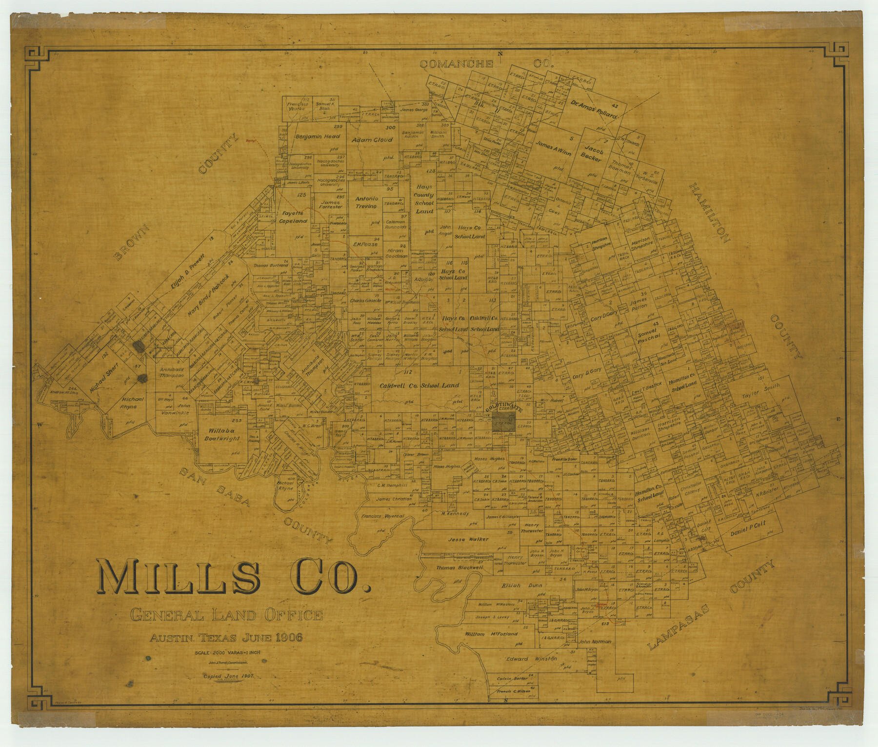
Mills Co.
-
Map/Doc
66934
-
Collection
General Map Collection
-
Object Dates
1906 (Creation Date)
-
People and Organizations
Texas General Land Office (Publisher)
Frank R. Sweeney (Draftsman)
John J. Terrell (GLO Commissioner)
Frank R. Sweeney (Compiler)
-
Counties
Mills
-
Subjects
County
-
Height x Width
39.6 x 46.5 inches
100.6 x 118.1 cm
-
Comments
Copied in June 1907 by S. C. Clark.
Part of: General Map Collection
Baylor County

Print $20.00
- Digital $50.00
Baylor County
1961
Size 43.0 x 35.2 inches
Map/Doc 95426
Flight Mission No. BRE-1P, Frame 33, Nueces County

Print $20.00
- Digital $50.00
Flight Mission No. BRE-1P, Frame 33, Nueces County
1956
Size 18.5 x 22.2 inches
Map/Doc 86629
New Map of Texas with the Contiguous American and Mexican States

Print $20.00
- Digital $50.00
New Map of Texas with the Contiguous American and Mexican States
1836
Size 13.7 x 19.7 inches
Map/Doc 76795
Hardin County

Print $20.00
- Digital $50.00
Hardin County
1894
Size 46.8 x 43.4 inches
Map/Doc 16846
Montague County Rolled Sketch 5

Print $20.00
- Digital $50.00
Montague County Rolled Sketch 5
Size 27.3 x 30.2 inches
Map/Doc 6789
Southern Part of Laguna Madre

Print $20.00
- Digital $50.00
Southern Part of Laguna Madre
1949
Size 44.5 x 35.4 inches
Map/Doc 73535
Flight Mission No. CRK-7P, Frame 27, Refugio County

Print $20.00
- Digital $50.00
Flight Mission No. CRK-7P, Frame 27, Refugio County
1956
Size 18.3 x 22.1 inches
Map/Doc 86947
Nueces County Working Sketch 9

Print $20.00
- Digital $50.00
Nueces County Working Sketch 9
1977
Size 36.1 x 24.1 inches
Map/Doc 71311
Matagorda Light to Aransas Pass

Print $20.00
- Digital $50.00
Matagorda Light to Aransas Pass
1961
Size 35.9 x 44.7 inches
Map/Doc 73396
Pecos County Rolled Sketch 44

Print $20.00
- Digital $50.00
Pecos County Rolled Sketch 44
1912
Size 22.9 x 37.6 inches
Map/Doc 7222
[Abstract Numbering Register - Kaufman through Reagan]
![82967, [Abstract Numbering Register - Kaufman through Reagan], General Map Collection](https://historictexasmaps.com/wmedia_w700/pdf_converted_jpg/qi_pdf_thumbnail_30614.jpg)
[Abstract Numbering Register - Kaufman through Reagan]
Map/Doc 82967
Tom Green County Sketch File 82

Print $20.00
- Digital $50.00
Tom Green County Sketch File 82
1888
Size 18.5 x 20.9 inches
Map/Doc 12454
You may also like
The Rand-McNally New Commercial Atlas Map of Texas

Print $20.00
The Rand-McNally New Commercial Atlas Map of Texas
1914
Size 28.6 x 42.4 inches
Map/Doc 78225
Presidio County Sketch File H

Print $4.00
- Digital $50.00
Presidio County Sketch File H
Size 5.8 x 9.6 inches
Map/Doc 34431
Parker County Sketch File 47

Print $20.00
- Digital $50.00
Parker County Sketch File 47
1857
Size 16.4 x 34.7 inches
Map/Doc 12151
Hill County Boundary File 1a

Print $40.00
- Digital $50.00
Hill County Boundary File 1a
Size 18.4 x 23.3 inches
Map/Doc 54732
[H. & G. N. RR. Company, Block 1 and Vicinity]
![91232, [H. & G. N. RR. Company, Block 1 and Vicinity], Twichell Survey Records](https://historictexasmaps.com/wmedia_w700/maps/91232-1.tif.jpg)
Print $20.00
- Digital $50.00
[H. & G. N. RR. Company, Block 1 and Vicinity]
Size 14.1 x 17.7 inches
Map/Doc 91232
Cherokee County Working Sketch 24

Print $20.00
- Digital $50.00
Cherokee County Working Sketch 24
1972
Size 37.2 x 38.8 inches
Map/Doc 67979
Liberty County Rolled Sketch M

Print $40.00
- Digital $50.00
Liberty County Rolled Sketch M
1953
Size 23.6 x 56.6 inches
Map/Doc 10651
Map of Hamilton County

Print $20.00
- Digital $50.00
Map of Hamilton County
1872
Size 15.1 x 22.1 inches
Map/Doc 4555
Martin County Working Sketch 18

Print $20.00
- Digital $50.00
Martin County Working Sketch 18
1982
Size 39.9 x 37.4 inches
Map/Doc 70836
Tyler County Sketch File 30

Print $4.00
- Digital $50.00
Tyler County Sketch File 30
1989
Size 14.3 x 8.8 inches
Map/Doc 38721
Eastland County Working Sketch 56

Print $20.00
- Digital $50.00
Eastland County Working Sketch 56
1984
Size 39.2 x 43.3 inches
Map/Doc 68837
Nueces County Rolled Sketch 128 A-E

Print $10.00
- Digital $50.00
Nueces County Rolled Sketch 128 A-E
1998
Size 11.0 x 8.5 inches
Map/Doc 41611