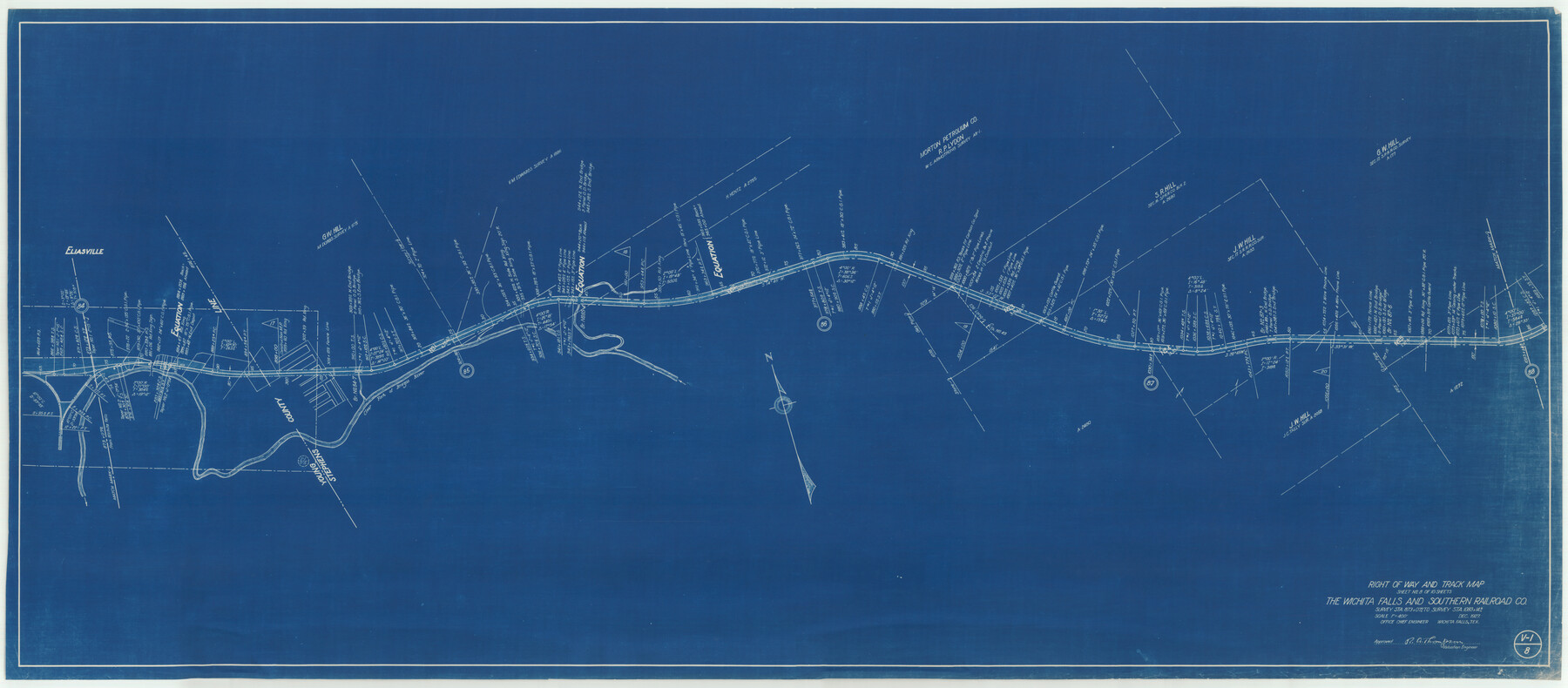
Right of Way and Track Map of The Wichita Falls & Southern Railroad Company
Z-2-160
-
Map/Doc
64521
-
Collection
General Map Collection
-
Object Dates
1927
1942 (Creation Date)
-
Counties
Young Stephens
-
Subjects
Railroads
-
Height x Width
24.7 x 56.3 inches
62.7 x 143.0 cm
-
Medium
blueprint/diazo
-
Scale
1"=400'
-
Comments
Sheet No. 8 of 10 sheets. Survey Sta. 873+070 to Survey Sta. 1083+148. See counter nos. 64514 through 64520 for other sheets.
-
Features
WF&S
Clear Fork Brazos River
Part of: General Map Collection
Ector County Working Sketch 33

Print $20.00
- Digital $50.00
Ector County Working Sketch 33
1982
Size 24.7 x 29.0 inches
Map/Doc 68876
Burnet County Working Sketch 24

Print $20.00
- Digital $50.00
Burnet County Working Sketch 24
1990
Size 19.9 x 26.8 inches
Map/Doc 67867
Wichita County Working Sketch 12b

Print $20.00
- Digital $50.00
Wichita County Working Sketch 12b
1920
Size 21.2 x 14.9 inches
Map/Doc 72522
Presidio County Rolled Sketch 131A

Print $3.00
- Digital $50.00
Presidio County Rolled Sketch 131A
Size 15.8 x 9.3 inches
Map/Doc 10708
Parker County Sketch File 34

Print $20.00
- Digital $50.00
Parker County Sketch File 34
1878
Size 21.3 x 13.6 inches
Map/Doc 12148
Hale County Sketch File 24

Print $22.00
- Digital $50.00
Hale County Sketch File 24
1908
Size 8.9 x 7.9 inches
Map/Doc 24761
Falls County Working Sketch 1

Print $20.00
- Digital $50.00
Falls County Working Sketch 1
1922
Size 23.0 x 33.1 inches
Map/Doc 69176
Hardin County Rolled Sketch 20

Print $20.00
- Digital $50.00
Hardin County Rolled Sketch 20
1960
Size 27.7 x 35.9 inches
Map/Doc 6089
Parker County Working Sketch 18

Print $20.00
- Digital $50.00
Parker County Working Sketch 18
2000
Map/Doc 71468
Map of University Land in Shackelford and Callahan Counties

Print $20.00
- Digital $50.00
Map of University Land in Shackelford and Callahan Counties
1905
Size 33.4 x 25.3 inches
Map/Doc 2435
Leon County Sketch File 9

Print $4.00
- Digital $50.00
Leon County Sketch File 9
1863
Size 15.1 x 8.3 inches
Map/Doc 29726
Ward County Working Sketch 17

Print $20.00
- Digital $50.00
Ward County Working Sketch 17
1948
Size 30.1 x 32.5 inches
Map/Doc 72323
You may also like
General Highway Map, Mason County, Texas

Print $20.00
General Highway Map, Mason County, Texas
1940
Size 18.2 x 24.5 inches
Map/Doc 79186
North Shore of West Bay and Galveston Island

Print $40.00
- Digital $50.00
North Shore of West Bay and Galveston Island
1933
Size 36.4 x 56.9 inches
Map/Doc 69931
El Paso County Sketch File 22

Print $22.00
- Digital $50.00
El Paso County Sketch File 22
1888
Size 14.2 x 9.0 inches
Map/Doc 22031
Haskell County Sketch File 5

Print $4.00
- Digital $50.00
Haskell County Sketch File 5
1856
Size 10.1 x 8.1 inches
Map/Doc 26124
Hutchinson County Working Sketch 9

Print $20.00
- Digital $50.00
Hutchinson County Working Sketch 9
1920
Size 38.5 x 43.3 inches
Map/Doc 66367
[Stephen F. Austin's Map of Texas]
![95825, [Stephen F. Austin's Map of Texas], Non-GLO Digital Images](https://historictexasmaps.com/wmedia_w700/maps/95825.tif.jpg)
[Stephen F. Austin's Map of Texas]
1829
Size 21.7 x 17.9 inches
Map/Doc 95825
Live Oak County Boundary File 60c

Print $4.00
- Digital $50.00
Live Oak County Boundary File 60c
Size 14.0 x 8.7 inches
Map/Doc 56421
Galveston - Texas City, Texas

Galveston - Texas City, Texas
2008
Size 26.9 x 39.0 inches
Map/Doc 96858
Flight Mission No. CLL-11AA, Frame 172, Willacy County

Print $20.00
- Digital $50.00
Flight Mission No. CLL-11AA, Frame 172, Willacy County
1962
Size 18.4 x 18.2 inches
Map/Doc 87091
Pecos County Working Sketch 22

Print $20.00
- Digital $50.00
Pecos County Working Sketch 22
1926
Size 14.3 x 23.5 inches
Map/Doc 71492
Map of Location of the Pecos & Northern Texas Railway from Station 7879+36 to Station 8010+08 = 2.48 Miles through Castro County, Texas

Print $20.00
- Digital $50.00
Map of Location of the Pecos & Northern Texas Railway from Station 7879+36 to Station 8010+08 = 2.48 Miles through Castro County, Texas
1898
Size 14.1 x 25.3 inches
Map/Doc 64060
Andrews County Rolled Sketch 29

Print $20.00
- Digital $50.00
Andrews County Rolled Sketch 29
1949
Size 36.6 x 16.3 inches
Map/Doc 77173