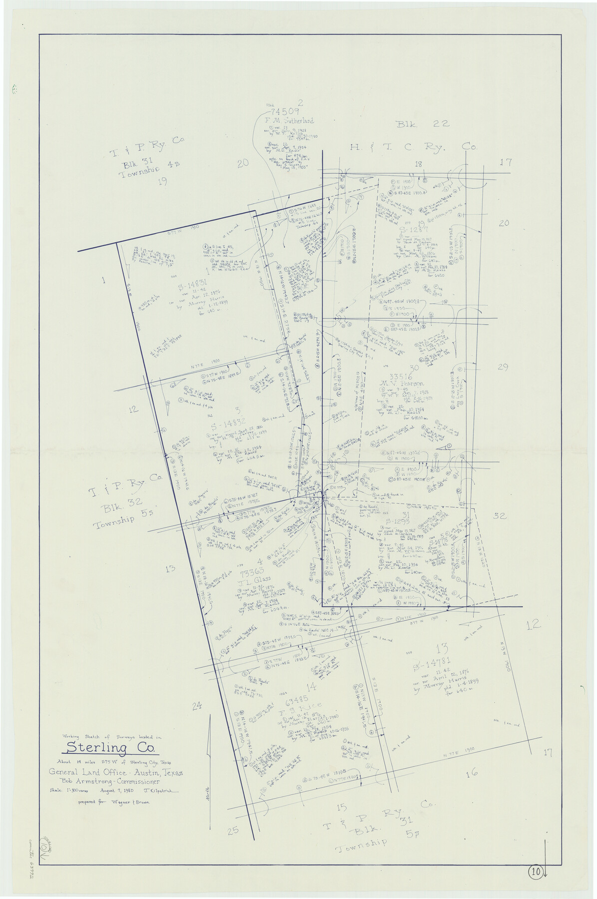
Sterling County Working Sketch 10
-
Map/Doc
63992
-
Collection
General Map Collection
-
Object Dates
8/7/1980 (Creation Date)
-
People and Organizations
Joan Kilpatrick (Draftsman)
-
Counties
Sterling
-
Subjects
Surveying Working Sketch
-
Height x Width
39.6 x 26.3 inches
100.6 x 66.8 cm
-
Scale
1" = 300 varas
Part of: General Map Collection
Red River County Working Sketch 74

Print $20.00
- Digital $50.00
Red River County Working Sketch 74
1980
Size 24.2 x 22.8 inches
Map/Doc 72057
Flight Mission No. DAG-17K, Frame 75, Matagorda County

Print $20.00
- Digital $50.00
Flight Mission No. DAG-17K, Frame 75, Matagorda County
1952
Size 16.5 x 16.5 inches
Map/Doc 86334
Pecos County Sketch File 60

Print $6.00
- Digital $50.00
Pecos County Sketch File 60
Size 8.2 x 16.5 inches
Map/Doc 33786
Donley County Sketch File 1a

Print $20.00
- Digital $50.00
Donley County Sketch File 1a
Size 23.6 x 16.6 inches
Map/Doc 11362
Ward County Working Sketch 35

Print $20.00
- Digital $50.00
Ward County Working Sketch 35
1968
Size 46.4 x 43.0 inches
Map/Doc 72341
Hall County Sketch File 15

Print $6.00
- Digital $50.00
Hall County Sketch File 15
Size 5.7 x 16.9 inches
Map/Doc 24814
Flight Mission No. DQO-2K, Frame 164, Galveston County

Print $20.00
- Digital $50.00
Flight Mission No. DQO-2K, Frame 164, Galveston County
1952
Size 18.7 x 22.3 inches
Map/Doc 85053
Foard County Sketch File XX

Print $40.00
- Digital $50.00
Foard County Sketch File XX
1884
Size 14.0 x 16.4 inches
Map/Doc 22802
Nautical Chart 152-SC - Galveston Bay, Texas

Print $20.00
- Digital $50.00
Nautical Chart 152-SC - Galveston Bay, Texas
1972
Size 15.1 x 32.6 inches
Map/Doc 69892
Map of Crockett Co.

Print $20.00
- Digital $50.00
Map of Crockett Co.
1901
Size 33.9 x 45.8 inches
Map/Doc 66791
Kinney County Sketch File 21

Print $50.00
- Digital $50.00
Kinney County Sketch File 21
1887
Size 14.4 x 8.8 inches
Map/Doc 29135
Flight Mission No. CRC-3R, Frame 165, Chambers County

Print $20.00
- Digital $50.00
Flight Mission No. CRC-3R, Frame 165, Chambers County
1956
Size 18.8 x 22.5 inches
Map/Doc 84847
You may also like
"Iron Mountain Route" to all parts of Texas - I. & G. N., T. & P., Iron Mountain - "The Way to Texas"

Print $20.00
- Digital $50.00
"Iron Mountain Route" to all parts of Texas - I. & G. N., T. & P., Iron Mountain - "The Way to Texas"
1909
Size 21.8 x 24.0 inches
Map/Doc 95793
Crane County Sketch File 11

Print $40.00
- Digital $50.00
Crane County Sketch File 11
Size 18.5 x 8.9 inches
Map/Doc 19569
Kerr County State Real Property Sketch 1

Print $20.00
- Digital $50.00
Kerr County State Real Property Sketch 1
2007
Size 24.9 x 35.1 inches
Map/Doc 88669
Collingsworth County Rolled Sketch 2A

Print $20.00
- Digital $50.00
Collingsworth County Rolled Sketch 2A
1888
Size 15.3 x 45.8 inches
Map/Doc 8638
Galveston County Working Sketch 21

Print $20.00
- Digital $50.00
Galveston County Working Sketch 21
1987
Size 28.9 x 23.9 inches
Map/Doc 69358
Webb County Sketch File 10

Print $20.00
- Digital $50.00
Webb County Sketch File 10
1878
Size 18.9 x 13.0 inches
Map/Doc 12624
Gaines County Rolled Sketch 14A

Print $40.00
- Digital $50.00
Gaines County Rolled Sketch 14A
1940
Size 22.8 x 81.2 inches
Map/Doc 76431
Travis County Boundary File 32

Print $5.00
- Digital $50.00
Travis County Boundary File 32
Size 11.8 x 9.4 inches
Map/Doc 59473
[Blocks S1, O6, O, A1, A2, A3, A4, JK, JK2, JK4, and JD]
![90658, [Blocks S1, O6, O, A1, A2, A3, A4, JK, JK2, JK4, and JD], Twichell Survey Records](https://historictexasmaps.com/wmedia_w700/maps/90658-1.tif.jpg)
Print $20.00
- Digital $50.00
[Blocks S1, O6, O, A1, A2, A3, A4, JK, JK2, JK4, and JD]
Size 20.3 x 21.7 inches
Map/Doc 90658
El Paso County Sketch File 17

Print $20.00
- Digital $50.00
El Paso County Sketch File 17
1885
Size 20.1 x 30.9 inches
Map/Doc 11453
Reagan County Rolled Sketch 17A

Print $20.00
- Digital $50.00
Reagan County Rolled Sketch 17A
1948
Size 33.8 x 32.4 inches
Map/Doc 9813
Montgomery County Sketch File 22

Print $12.00
- Digital $50.00
Montgomery County Sketch File 22
1839
Size 8.8 x 7.6 inches
Map/Doc 31860