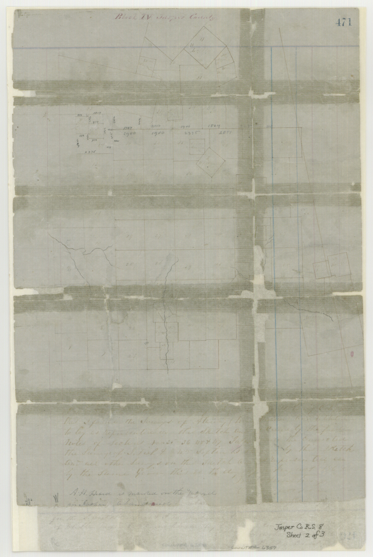
Jasper County Rolled Sketch 8
Block IV, Jasper County, Texas
-
Map/Doc
6357
-
Collection
General Map Collection
-
Counties
Jasper
-
Subjects
Surveying Rolled Sketch
-
Height x Width
17.7 x 11.9 inches
45.0 x 30.2 cm
Part of: General Map Collection
Kaufman County Boundary File 6

Print $14.00
- Digital $50.00
Kaufman County Boundary File 6
Size 11.2 x 8.7 inches
Map/Doc 55956
Calhoun County Working Sketch 7

Print $20.00
- Digital $50.00
Calhoun County Working Sketch 7
1943
Size 20.1 x 22.0 inches
Map/Doc 67823
Harris County Working Sketch 41

Print $20.00
- Digital $50.00
Harris County Working Sketch 41
1940
Size 37.8 x 29.9 inches
Map/Doc 65933
Comanche County Sketch File 17

Print $14.00
- Digital $50.00
Comanche County Sketch File 17
Size 8.5 x 8.2 inches
Map/Doc 19086
Gray County Boundary File 9

Print $6.00
- Digital $50.00
Gray County Boundary File 9
Size 11.6 x 9.1 inches
Map/Doc 53902
Hockley County Boundary File 4

Print $76.00
- Digital $50.00
Hockley County Boundary File 4
Size 14.3 x 8.7 inches
Map/Doc 54810
Pecos County Rolled Sketch 35

Print $20.00
- Digital $50.00
Pecos County Rolled Sketch 35
Size 33.2 x 38.1 inches
Map/Doc 9693
El Paso County Rolled Sketch 38
Print $40.00
- Digital $50.00
El Paso County Rolled Sketch 38
1922
Size 14.1 x 61.3 inches
Map/Doc 8866
Culberson County Rolled Sketch 64

Print $20.00
- Digital $50.00
Culberson County Rolled Sketch 64
1987
Size 24.3 x 19.4 inches
Map/Doc 5680
Galveston County Sketch File 2a

Print $4.00
- Digital $50.00
Galveston County Sketch File 2a
1848
Size 14.3 x 8.8 inches
Map/Doc 23350
Sutton County Working Sketch 22

Print $20.00
- Digital $50.00
Sutton County Working Sketch 22
1981
Size 33.7 x 33.4 inches
Map/Doc 62365
Hudspeth County Rolled Sketch 61

Print $40.00
- Digital $50.00
Hudspeth County Rolled Sketch 61
1982
Size 71.3 x 45.1 inches
Map/Doc 9626
You may also like
Webb County Rolled Sketch 19

Print $40.00
- Digital $50.00
Webb County Rolled Sketch 19
1928
Size 27.9 x 53.7 inches
Map/Doc 10119
Atascosa County Working Sketch 18

Print $20.00
- Digital $50.00
Atascosa County Working Sketch 18
1950
Size 43.2 x 25.8 inches
Map/Doc 67214
A Boundary Atlas of Texas, 1821-1845

Digital $50.00
A Boundary Atlas of Texas, 1821-1845
2020
Map/Doc 96437
Nueces County Rolled Sketch 90

Print $129.00
Nueces County Rolled Sketch 90
1983
Size 24.8 x 37.1 inches
Map/Doc 7008
Armstrong County Sketch File 4

Print $40.00
- Digital $50.00
Armstrong County Sketch File 4
1887
Size 17.9 x 20.1 inches
Map/Doc 10840
Henderson County Working Sketch 44

Print $20.00
- Digital $50.00
Henderson County Working Sketch 44
1998
Size 19.0 x 33.0 inches
Map/Doc 66177
Montague County Working Sketch 46

Print $20.00
- Digital $50.00
Montague County Working Sketch 46
2014
Size 14.7 x 20.4 inches
Map/Doc 93689
Flight Mission No. CRC-2R, Frame 121, Chambers County

Print $20.00
- Digital $50.00
Flight Mission No. CRC-2R, Frame 121, Chambers County
1956
Size 18.7 x 22.4 inches
Map/Doc 84745
Copy of Surveyor's Field Book, Morris Browning - In Blocks 7, 5 & 4, I&GNRRCo., Hutchinson and Carson Counties, Texas

Print $3.00
- Digital $50.00
Copy of Surveyor's Field Book, Morris Browning - In Blocks 7, 5 & 4, I&GNRRCo., Hutchinson and Carson Counties, Texas
1888
Size 12.7 x 9.7 inches
Map/Doc 62258
Houston County

Print $40.00
- Digital $50.00
Houston County
1944
Size 48.3 x 49.7 inches
Map/Doc 1859
Flight Mission No. CGI-3N, Frame 136, Cameron County

Print $20.00
- Digital $50.00
Flight Mission No. CGI-3N, Frame 136, Cameron County
1954
Size 18.6 x 22.3 inches
Map/Doc 84609
Brewster County Sketch File N-19

Print $40.00
- Digital $50.00
Brewster County Sketch File N-19
1946
Size 18.7 x 26.2 inches
Map/Doc 10966