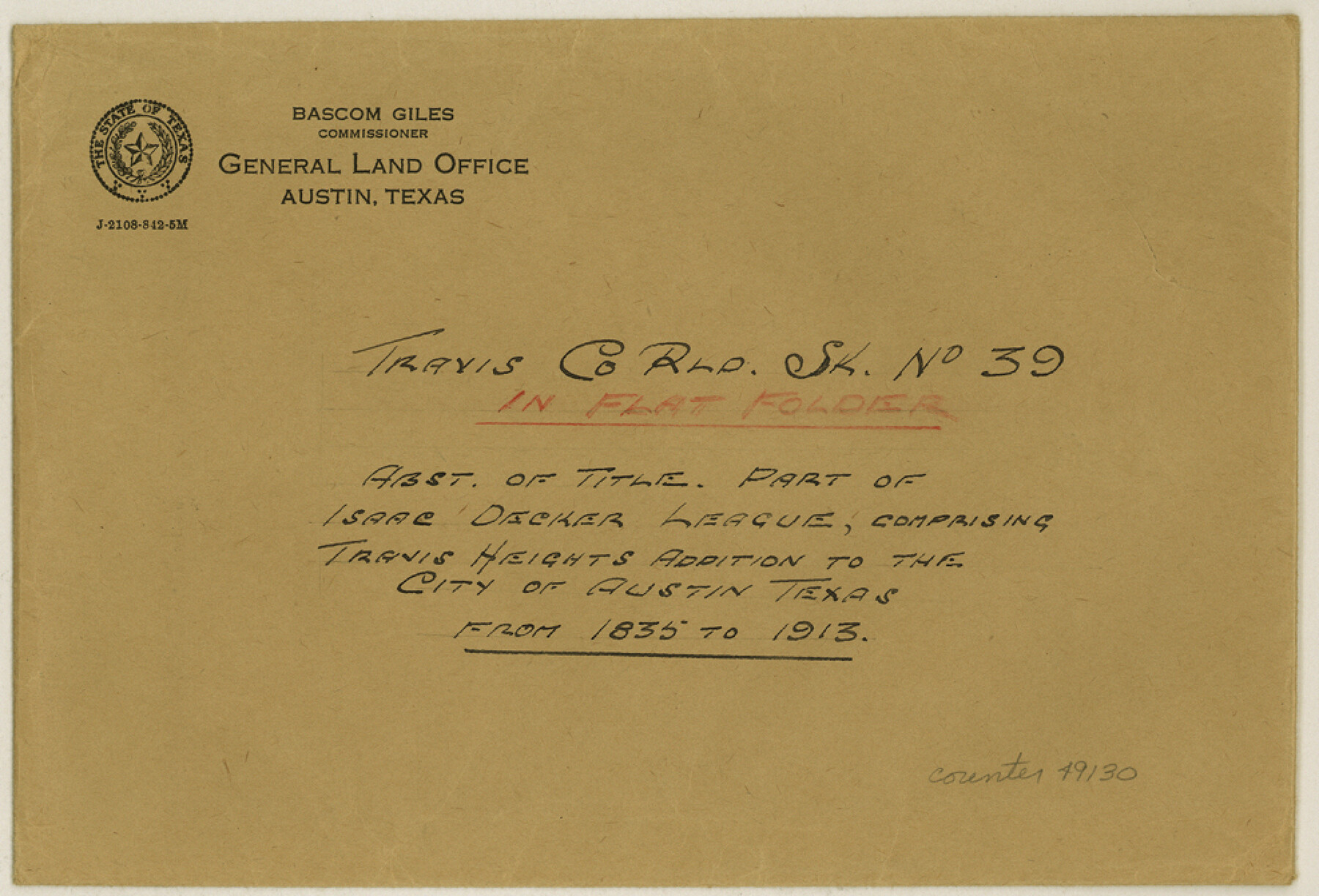
Travis County Rolled Sketch 39
Abstract of Title to 234 acres of land, more or less part of Isaac Decker league, comprising Travis Heights addition to the City of Austin, Texas
-
Map/Doc
49130
-
Collection
General Map Collection
-
People and Organizations
Bergen, Daniel & Gracy Abstract Co. (Publisher)
A.C. Baldwin & Sons (Printer)
-
Counties
Travis
-
Subjects
Surveying Rolled Sketch
-
Height x Width
6.7 x 9.9 inches
17.0 x 25.1 cm
-
Medium
paper, print
Part of: General Map Collection
Milam County Working Sketch 7

Print $40.00
- Digital $50.00
Milam County Working Sketch 7
1969
Size 42.7 x 48.0 inches
Map/Doc 71022
Starr County Rolled Sketch 25

Print $20.00
- Digital $50.00
Starr County Rolled Sketch 25
1939
Size 28.0 x 38.5 inches
Map/Doc 7809
Castro County Rolled Sketch 8

Print $20.00
- Digital $50.00
Castro County Rolled Sketch 8
Size 34.1 x 28.8 inches
Map/Doc 5418
Flight Mission No. BQR-3K, Frame 151, Brazoria County

Print $20.00
- Digital $50.00
Flight Mission No. BQR-3K, Frame 151, Brazoria County
1952
Size 18.7 x 22.4 inches
Map/Doc 83978
Dickens County Sketch File 34

Print $22.00
- Digital $50.00
Dickens County Sketch File 34
1938
Size 8.5 x 8.7 inches
Map/Doc 21030
Anderson County Sketch File 13

Print $10.00
- Digital $50.00
Anderson County Sketch File 13
1856
Size 8.1 x 8.3 inches
Map/Doc 12774
Tyler County Rolled Sketch 3

Print $20.00
- Digital $50.00
Tyler County Rolled Sketch 3
1946
Size 45.5 x 35.6 inches
Map/Doc 10027
Flight Mission No. CRC-3R, Frame 11, Chambers County

Print $20.00
- Digital $50.00
Flight Mission No. CRC-3R, Frame 11, Chambers County
1956
Size 18.7 x 22.4 inches
Map/Doc 84785
Flight Mission No. CGI-4N, Frame 24, Cameron County

Print $20.00
- Digital $50.00
Flight Mission No. CGI-4N, Frame 24, Cameron County
1954
Size 18.6 x 22.3 inches
Map/Doc 84657
Clay County Boundary File 18

Print $12.00
- Digital $50.00
Clay County Boundary File 18
Size 14.2 x 8.5 inches
Map/Doc 51437
Carte de la Louisiane et Pays Voisins pour servir a l'Histoire Generale des Voyages

Print $20.00
- Digital $50.00
Carte de la Louisiane et Pays Voisins pour servir a l'Histoire Generale des Voyages
1757
Size 10.1 x 15.5 inches
Map/Doc 97278
Brazoria County NRC Article 33.136 Sketch 29

Print $24.00
Brazoria County NRC Article 33.136 Sketch 29
2025
Map/Doc 97474
You may also like
[Part of Block GG and river sections 65-75]
![90469, [Part of Block GG and river sections 65-75], Twichell Survey Records](https://historictexasmaps.com/wmedia_w700/maps/90469-1.tif.jpg)
Print $20.00
- Digital $50.00
[Part of Block GG and river sections 65-75]
Size 21.9 x 20.2 inches
Map/Doc 90469
Map of Brewster County

Print $20.00
- Digital $50.00
Map of Brewster County
1939
Size 24.5 x 19.5 inches
Map/Doc 3329
Township No. 5 South Range No. 14 West of the Indian Meridian

Print $4.00
- Digital $50.00
Township No. 5 South Range No. 14 West of the Indian Meridian
1875
Size 17.8 x 22.8 inches
Map/Doc 75147
Williamson County Rolled Sketch 7

Print $40.00
- Digital $50.00
Williamson County Rolled Sketch 7
1924
Size 38.4 x 54.5 inches
Map/Doc 10146
Donley County Sketch File 12

Print $2.00
- Digital $50.00
Donley County Sketch File 12
Size 12.9 x 8.2 inches
Map/Doc 21248
Zapata County Sketch File 4

Print $22.00
- Digital $50.00
Zapata County Sketch File 4
1892
Size 14.5 x 17.5 inches
Map/Doc 40906
Armstrong County Working Sketch Graphic Index

Print $20.00
- Digital $50.00
Armstrong County Working Sketch Graphic Index
1933
Size 40.3 x 40.0 inches
Map/Doc 76457
Hidalgo County Rolled Sketch 7

Print $20.00
- Digital $50.00
Hidalgo County Rolled Sketch 7
1905
Size 20.4 x 26.1 inches
Map/Doc 6208
Chambers County Sketch File 10b

Print $4.00
- Digital $50.00
Chambers County Sketch File 10b
1841
Size 9.6 x 8.2 inches
Map/Doc 17552
Flight Mission No. CRK-8P, Frame 105, Refugio County

Print $20.00
- Digital $50.00
Flight Mission No. CRK-8P, Frame 105, Refugio County
1956
Size 18.2 x 22.0 inches
Map/Doc 86966
Archer County Sketch File 11

Print $4.00
- Digital $50.00
Archer County Sketch File 11
Size 10.4 x 8.5 inches
Map/Doc 13644
Brooks County Working Sketch 13

Print $20.00
- Digital $50.00
Brooks County Working Sketch 13
1943
Size 22.4 x 31.9 inches
Map/Doc 67797