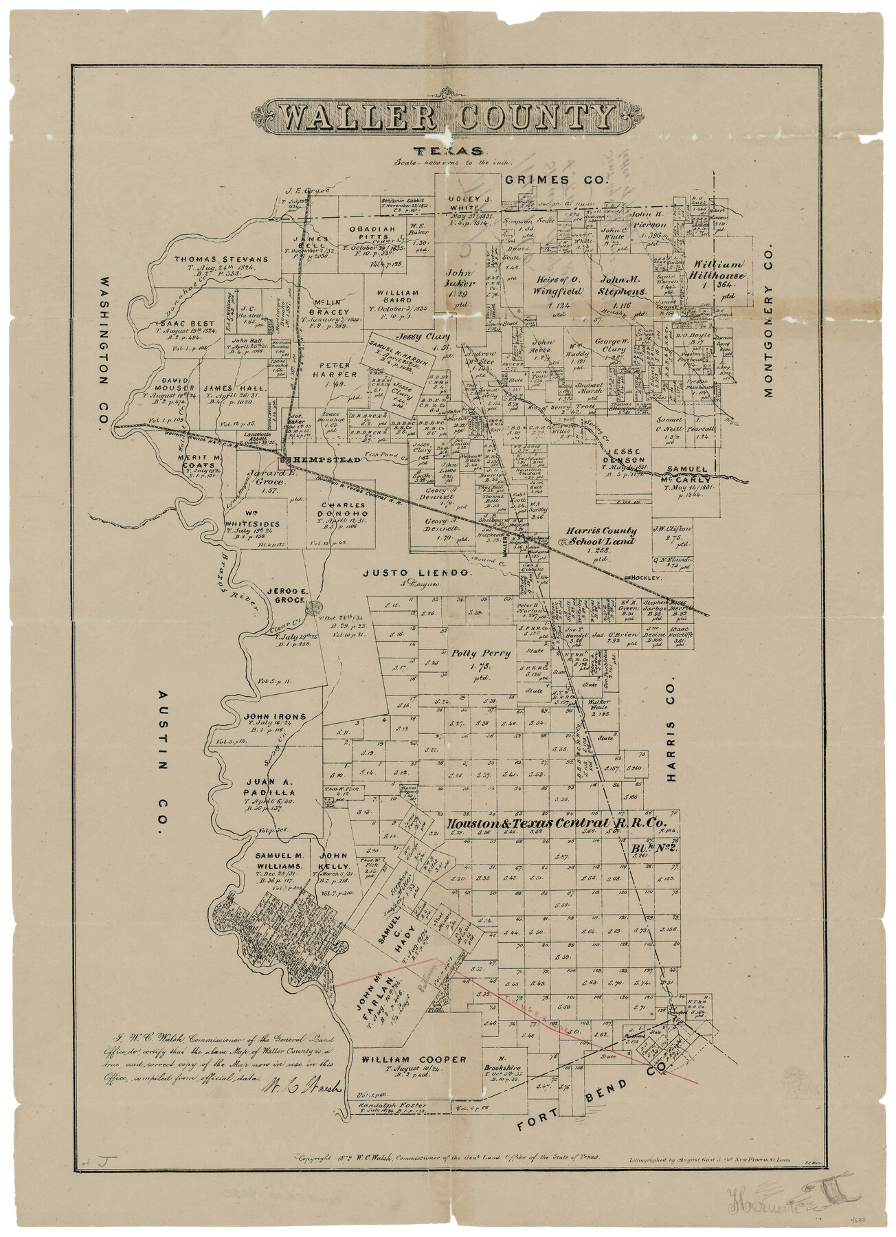
Waller County
Waller County Sketch File 8
-
Map/Doc
4640
-
Collection
General Map Collection
-
Object Dates
1879 (Creation Date)
-
People and Organizations
W.C. Walsh (GLO Commissioner)
August Gast & Co. (Lithographer)
-
Counties
Waller
-
Subjects
County
-
Height x Width
23.8 x 17.0 inches
60.5 x 43.2 cm
-
Comments
Sent in by J. A. Jones in letter of January 14, 1897 to show location of the Texas Western Narrow Gauge Railroad.
Conservation funded in 2012.
Part of: General Map Collection
Flight Mission No. DCL-7C, Frame 114, Kenedy County

Print $20.00
- Digital $50.00
Flight Mission No. DCL-7C, Frame 114, Kenedy County
1943
Size 18.6 x 22.2 inches
Map/Doc 86079
Flight Mission No. DCL-7C, Frame 20, Kenedy County

Print $20.00
- Digital $50.00
Flight Mission No. DCL-7C, Frame 20, Kenedy County
1943
Size 15.5 x 15.1 inches
Map/Doc 86012
Galveston County Sketch File 52

Print $27.00
- Digital $50.00
Galveston County Sketch File 52
1915
Size 10.1 x 12.3 inches
Map/Doc 23516
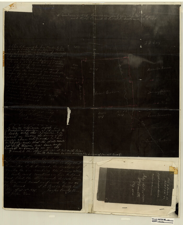
Newton County Rolled Sketch 23
Print $20.00
- Digital $50.00
Newton County Rolled Sketch 23
1893
Size 22.7 x 18.5 inches
Map/Doc 6850

[Surveys near Brushy Creek]
![361, [Surveys near Brushy Creek], General Map Collection](https://historictexasmaps.com/wmedia_w700/maps/361.tif.jpg)
Print $2.00
- Digital $50.00
[Surveys near Brushy Creek]
1846
Size 9.1 x 7.7 inches
Map/Doc 361
Reclamation & Navigation Map of Trinity River Flood Plain

Print $40.00
- Digital $50.00
Reclamation & Navigation Map of Trinity River Flood Plain
1930
Size 24.3 x 75.8 inches
Map/Doc 65178
Gillespie County Working Sketch 8

Print $20.00
- Digital $50.00
Gillespie County Working Sketch 8
1993
Size 31.1 x 24.2 inches
Map/Doc 63171
Nueces County Aerial Photograph Index Sheet 21

Print $20.00
- Digital $50.00
Nueces County Aerial Photograph Index Sheet 21
1938
Size 24.3 x 20.2 inches
Map/Doc 86842
Jefferson County Working Sketch 8

Print $20.00
- Digital $50.00
Jefferson County Working Sketch 8
1931
Size 34.9 x 18.2 inches
Map/Doc 66551
Polk County Rolled Sketch 33

Print $20.00
- Digital $50.00
Polk County Rolled Sketch 33
Size 26.5 x 38.5 inches
Map/Doc 7319
Donley County

Print $20.00
- Digital $50.00
Donley County
1944
Size 43.6 x 37.7 inches
Map/Doc 77266
You may also like
General Highway Map. Detail of Cities and Towns in Wharton County, Texas [El Campo and Wharton]
![79275, General Highway Map. Detail of Cities and Towns in Wharton County, Texas [El Campo and Wharton], Texas State Library and Archives](https://historictexasmaps.com/wmedia_w700/maps/79275.tif.jpg)
Print $20.00
General Highway Map. Detail of Cities and Towns in Wharton County, Texas [El Campo and Wharton]
1940
Size 18.4 x 24.8 inches
Map/Doc 79275
Houston County Working Sketch 18

Print $20.00
- Digital $50.00
Houston County Working Sketch 18
Size 18.8 x 22.5 inches
Map/Doc 66248
Bandera County Sketch File 29

Print $40.00
- Digital $50.00
Bandera County Sketch File 29
1939
Size 17.3 x 17.4 inches
Map/Doc 10898
Fannin County

Print $20.00
- Digital $50.00
Fannin County
1946
Size 40.6 x 35.4 inches
Map/Doc 77277
Galveston County Rolled Sketch 44

Print $20.00
- Digital $50.00
Galveston County Rolled Sketch 44
1992
Size 30.6 x 23.7 inches
Map/Doc 5977
Loving County Rolled Sketch 3

Print $40.00
- Digital $50.00
Loving County Rolled Sketch 3
1952
Size 13.7 x 145.1 inches
Map/Doc 78185
Liberty County Rolled Sketch 12

Print $20.00
- Digital $50.00
Liberty County Rolled Sketch 12
1983
Size 26.5 x 22.6 inches
Map/Doc 6618
Spade Ranch Hockley County, Texas

Print $3.00
- Digital $50.00
Spade Ranch Hockley County, Texas
1948
Size 17.6 x 7.7 inches
Map/Doc 92226
Map of Nacogdoches County

Print $20.00
- Digital $50.00
Map of Nacogdoches County
1881
Size 24.5 x 21.5 inches
Map/Doc 4600
Ochiltree County Boundary File 1

Print $14.00
- Digital $50.00
Ochiltree County Boundary File 1
Size 12.7 x 8.2 inches
Map/Doc 57657

The Republic County of Matagorda. January 1, 1838

Print $20.00
The Republic County of Matagorda. January 1, 1838
2020
Size 21.0 x 21.7 inches
Map/Doc 96216