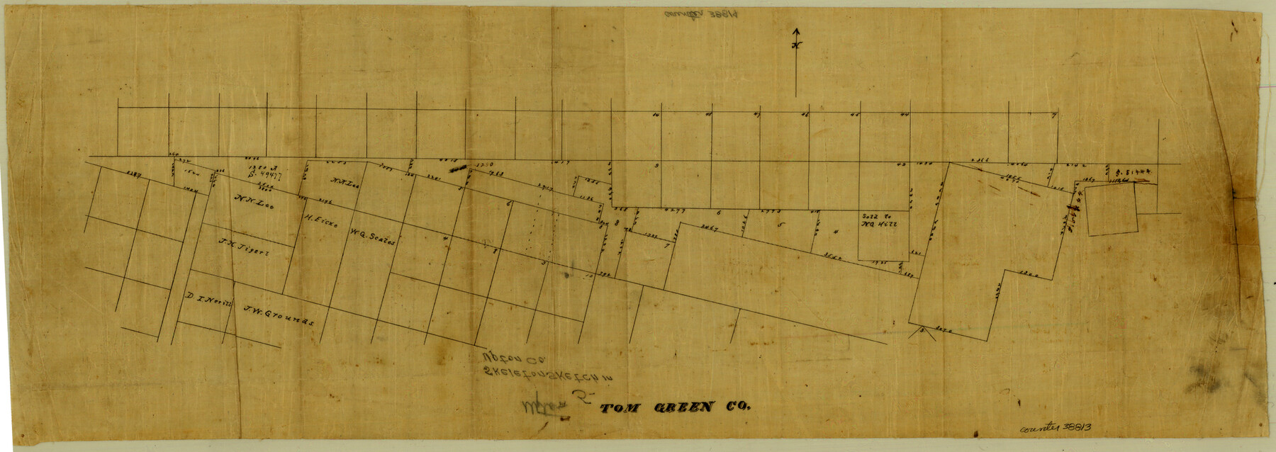
Upton County Sketch File 5
[Skeleton Sketch]
-
Map/Doc
38813
-
Collection
General Map Collection
-
Counties
Upton
-
Subjects
Surveying Sketch File
-
Height x Width
8.7 x 24.4 inches
22.1 x 62.0 cm
-
Medium
linen, manuscript
Part of: General Map Collection
Pecos County Working Sketch 131

Print $20.00
- Digital $50.00
Pecos County Working Sketch 131
1977
Size 27.8 x 21.1 inches
Map/Doc 71605
Henderson County Rolled Sketch 11

Print $20.00
- Digital $50.00
Henderson County Rolled Sketch 11
1915
Size 29.4 x 42.4 inches
Map/Doc 75957
Red River Co.

Print $20.00
- Digital $50.00
Red River Co.
1905
Size 46.7 x 39.6 inches
Map/Doc 66994
Hunt County Boundary File 2b

Print $2.00
- Digital $50.00
Hunt County Boundary File 2b
Size 12.8 x 7.9 inches
Map/Doc 55207
Coleman County Sketch File 43

Print $12.00
- Digital $50.00
Coleman County Sketch File 43
1892
Size 9.2 x 8.8 inches
Map/Doc 18775
Hunt County Sketch File 8

Print $4.00
- Digital $50.00
Hunt County Sketch File 8
1848
Size 8.2 x 12.7 inches
Map/Doc 27097
Ward County Working Sketch 1

Print $20.00
- Digital $50.00
Ward County Working Sketch 1
1937
Size 24.7 x 24.5 inches
Map/Doc 72307
Williamson County Sketch File 25

Print $14.00
- Digital $50.00
Williamson County Sketch File 25
1878
Size 8.9 x 8.3 inches
Map/Doc 40361
Andrews County Working Sketch Graphic Index

Print $40.00
- Digital $50.00
Andrews County Working Sketch Graphic Index
1951
Size 41.3 x 53.7 inches
Map/Doc 76453
[Map showing resurvey of Capitol Leagues in Hartley & Oldham Counties, Texas]
![1754, [Map showing resurvey of Capitol Leagues in Hartley & Oldham Counties, Texas], General Map Collection](https://historictexasmaps.com/wmedia_w700/maps/1754-1.tif.jpg)
Print $20.00
- Digital $50.00
[Map showing resurvey of Capitol Leagues in Hartley & Oldham Counties, Texas]
1918
Size 30.8 x 37.4 inches
Map/Doc 1754
Flight Mission No. CUG-2P, Frame 23, Kleberg County

Print $20.00
- Digital $50.00
Flight Mission No. CUG-2P, Frame 23, Kleberg County
1956
Size 18.6 x 22.3 inches
Map/Doc 86187
Kimble County Working Sketch 59

Print $20.00
- Digital $50.00
Kimble County Working Sketch 59
1963
Size 24.6 x 40.8 inches
Map/Doc 70127
You may also like
Walker County Sketch File 4

Print $4.00
- Digital $50.00
Walker County Sketch File 4
Size 7.8 x 7.3 inches
Map/Doc 39553
Grayson County Working Sketch 13

Print $20.00
- Digital $50.00
Grayson County Working Sketch 13
1952
Size 31.1 x 38.0 inches
Map/Doc 63252
Flight Mission No. BRA-9M, Frame 60, Jefferson County

Print $20.00
- Digital $50.00
Flight Mission No. BRA-9M, Frame 60, Jefferson County
1953
Size 18.6 x 22.4 inches
Map/Doc 85643
Gillespie County Boundary File 6

Print $2.00
- Digital $50.00
Gillespie County Boundary File 6
Size 11.3 x 8.9 inches
Map/Doc 53770
Roberts County School Lands, Bailey County, Texas

Print $2.00
- Digital $50.00
Roberts County School Lands, Bailey County, Texas
1918
Size 8.8 x 11.3 inches
Map/Doc 90199
Childress County

Print $20.00
- Digital $50.00
Childress County
1921
Size 43.4 x 32.3 inches
Map/Doc 1800
[H. & G. N. RR. Company, Block B3]
![90718, [H. & G. N. RR. Company, Block B3], Twichell Survey Records](https://historictexasmaps.com/wmedia_w700/maps/90718-1.tif.jpg)
Print $20.00
- Digital $50.00
[H. & G. N. RR. Company, Block B3]
Size 34.9 x 28.8 inches
Map/Doc 90718
Irion County Rolled Sketch 9

Print $20.00
- Digital $50.00
Irion County Rolled Sketch 9
1940
Size 31.9 x 30.6 inches
Map/Doc 6321
Sketch Showing surveys on Harbor Island in Nueces County

Print $20.00
- Digital $50.00
Sketch Showing surveys on Harbor Island in Nueces County
1951
Size 45.7 x 34.6 inches
Map/Doc 1915
Mills County Rolled Sketch 1

Print $20.00
- Digital $50.00
Mills County Rolled Sketch 1
Size 29.6 x 30.4 inches
Map/Doc 6779
Double Lakes No. 1, T-Ranch

Print $20.00
- Digital $50.00
Double Lakes No. 1, T-Ranch
Size 37.1 x 34.0 inches
Map/Doc 92944
Flight Mission No. CGN-1G, Frame 26, San Patricio County

Print $20.00
- Digital $50.00
Flight Mission No. CGN-1G, Frame 26, San Patricio County
1950
Size 9.4 x 9.4 inches
Map/Doc 87113