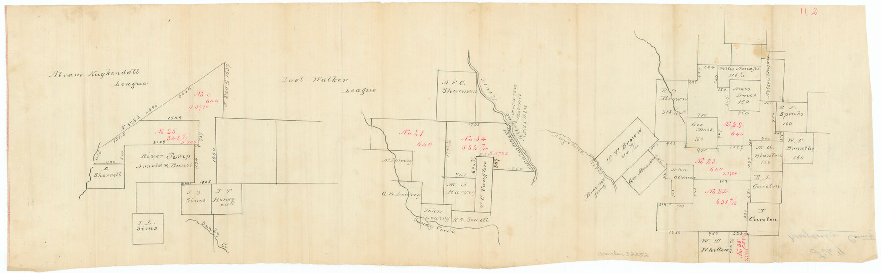
Nacogdoches County Sketch File 9
[Sketch in southeast part of county]
-
Map/Doc
32252
-
Collection
General Map Collection
-
Counties
Nacogdoches
-
Subjects
Surveying Sketch File
-
Height x Width
8.3 x 26.9 inches
21.1 x 68.3 cm
-
Medium
paper, manuscript
-
Features
Alloyac [sic] River
Angelina River
Brown's Ferry
Sandy Creek
Part of: General Map Collection
Rockwall County

Print $20.00
- Digital $50.00
Rockwall County
1941
Size 28.7 x 23.0 inches
Map/Doc 73277
Panola County Working Sketch Graphic Index

Print $20.00
- Digital $50.00
Panola County Working Sketch Graphic Index
1947
Map/Doc 76660
Upton County Rolled Sketch 59

Print $40.00
- Digital $50.00
Upton County Rolled Sketch 59
1994
Size 36.3 x 49.0 inches
Map/Doc 10638
Panola County Working Sketch 28

Print $20.00
- Digital $50.00
Panola County Working Sketch 28
1977
Map/Doc 71437
Parker County Sketch File 34

Print $20.00
- Digital $50.00
Parker County Sketch File 34
1878
Size 21.3 x 13.6 inches
Map/Doc 12148
Terrell County Sketch File 37

Print $4.00
- Digital $50.00
Terrell County Sketch File 37
Size 14.5 x 9.1 inches
Map/Doc 37999
Hartley County Working Sketch 3

Print $20.00
- Digital $50.00
Hartley County Working Sketch 3
1928
Size 24.6 x 24.0 inches
Map/Doc 66053
Goliad County Sketch File 11

Print $40.00
- Digital $50.00
Goliad County Sketch File 11
Size 13.4 x 12.5 inches
Map/Doc 24228
Wise County Sketch File 19

Print $4.00
- Digital $50.00
Wise County Sketch File 19
1857
Size 11.0 x 8.2 inches
Map/Doc 40555
Aransas County Rolled Sketch 21

Print $20.00
- Digital $50.00
Aransas County Rolled Sketch 21
Size 43.0 x 43.8 inches
Map/Doc 8415
Hood County Working Sketch 17

Print $40.00
- Digital $50.00
Hood County Working Sketch 17
1987
Size 42.2 x 54.4 inches
Map/Doc 66211
Map of Harris County Showing Abandoned Surveys

Print $40.00
- Digital $50.00
Map of Harris County Showing Abandoned Surveys
1938
Size 42.5 x 67.1 inches
Map/Doc 2053
You may also like
Brewster County Sketch File NS-7

Print $14.00
- Digital $50.00
Brewster County Sketch File NS-7
1945
Size 11.3 x 8.8 inches
Map/Doc 15992
Red River County Working Sketch 44

Print $20.00
- Digital $50.00
Red River County Working Sketch 44
1968
Size 28.1 x 28.3 inches
Map/Doc 72027
Kerr County Rolled Sketch 15

Print $20.00
- Digital $50.00
Kerr County Rolled Sketch 15
1951
Size 14.8 x 20.8 inches
Map/Doc 7720
Reeves County Sketch File 14

Print $4.00
- Digital $50.00
Reeves County Sketch File 14
1872
Size 8.0 x 12.7 inches
Map/Doc 35192
Flight Mission No. CUG-1P, Frame 50, Kleberg County

Print $20.00
- Digital $50.00
Flight Mission No. CUG-1P, Frame 50, Kleberg County
1956
Size 18.6 x 22.3 inches
Map/Doc 86128
Trinity River, North Extension Bazzette Sheet

Print $20.00
- Digital $50.00
Trinity River, North Extension Bazzette Sheet
1925
Size 16.3 x 24.3 inches
Map/Doc 69691
Burnet County Sketch File 6

Print $8.00
- Digital $50.00
Burnet County Sketch File 6
1854
Size 10.1 x 8.1 inches
Map/Doc 16682
Val Verde Co.

Print $20.00
- Digital $50.00
Val Verde Co.
1908
Size 39.1 x 37.7 inches
Map/Doc 63102
[Gunter & Munson, Maddox Bros. & Anderson Blocks F and A and State University Lands Blocks 15-17 and 50]
![91847, [Gunter & Munson, Maddox Bros. & Anderson Blocks F and A and State University Lands Blocks 15-17 and 50], Twichell Survey Records](https://historictexasmaps.com/wmedia_w700/maps/91847-1.tif.jpg)
Print $20.00
- Digital $50.00
[Gunter & Munson, Maddox Bros. & Anderson Blocks F and A and State University Lands Blocks 15-17 and 50]
1884
Size 12.2 x 16.2 inches
Map/Doc 91847
Harris County Sketch File 105

Print $28.00
- Digital $50.00
Harris County Sketch File 105
1925
Size 11.2 x 9.0 inches
Map/Doc 42929
[Lamb County, Block A]
![90991, [Lamb County, Block A], Twichell Survey Records](https://historictexasmaps.com/wmedia_w700/maps/90991-1.tif.jpg)
Print $20.00
- Digital $50.00
[Lamb County, Block A]
Size 22.9 x 17.9 inches
Map/Doc 90991
Presidio County Working Sketch 112

Print $20.00
- Digital $50.00
Presidio County Working Sketch 112
1979
Size 41.7 x 35.6 inches
Map/Doc 71789