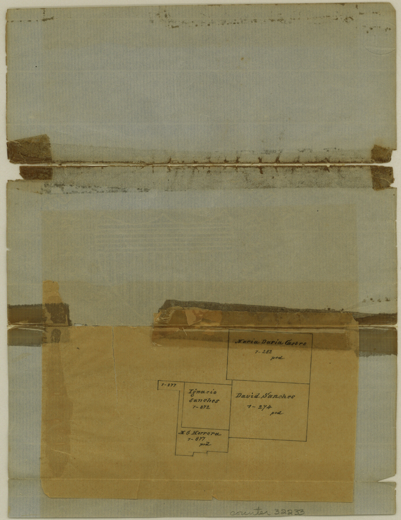
Nacogdoches County Sketch File 1
[Sketch northeast of Nacogdoches on Naconiche Bayou]
-
Map/Doc
32233
-
Collection
General Map Collection
-
Counties
Nacogdoches
-
Subjects
Surveying Sketch File
-
Height x Width
10.2 x 7.8 inches
25.9 x 19.8 cm
-
Medium
paper, manuscript
-
Features
Naconiche Bayou
Part of: General Map Collection
Harris County Working Sketch 42

Print $20.00
- Digital $50.00
Harris County Working Sketch 42
1940
Size 31.8 x 38.5 inches
Map/Doc 65934
Newton County Aerial Photograph Index Sheet 2

Print $20.00
- Digital $50.00
Newton County Aerial Photograph Index Sheet 2
1953
Size 23.8 x 16.7 inches
Map/Doc 83731
Map of Irion County

Print $20.00
- Digital $50.00
Map of Irion County
1893
Size 43.6 x 37.3 inches
Map/Doc 16857
Galveston County Working Sketch 15

Print $20.00
- Digital $50.00
Galveston County Working Sketch 15
1978
Size 32.0 x 27.8 inches
Map/Doc 69352
Runnels County Working Sketch 29

Print $20.00
- Digital $50.00
Runnels County Working Sketch 29
1959
Size 27.1 x 30.0 inches
Map/Doc 63625
Lamb County Rolled Sketch 4
Print $20.00
- Digital $50.00
Lamb County Rolled Sketch 4
1917
Size 31.1 x 43.1 inches
Map/Doc 9414
Flight Mission No. CUI-1H, Frame 96, Milam County

Print $20.00
- Digital $50.00
Flight Mission No. CUI-1H, Frame 96, Milam County
1951
Size 18.7 x 22.5 inches
Map/Doc 86604
Starr County Rolled Sketch 23
Print $20.00
- Digital $50.00
Starr County Rolled Sketch 23
1938
Size 36.8 x 24.9 inches
Map/Doc 7807
Val Verde County Working Sketch 44

Print $40.00
- Digital $50.00
Val Verde County Working Sketch 44
1945
Size 49.7 x 39.5 inches
Map/Doc 72179
Webb County Sketch File 12d

Print $20.00
- Digital $50.00
Webb County Sketch File 12d
1886
Size 17.0 x 17.9 inches
Map/Doc 12629
Cottle County Sketch File 7 1/2

Print $26.00
- Digital $50.00
Cottle County Sketch File 7 1/2
1889
Size 40.2 x 21.0 inches
Map/Doc 10342

You may also like
Henderson County Sketch File 8a

Print $18.00
- Digital $50.00
Henderson County Sketch File 8a
1861
Size 10.3 x 8.4 inches
Map/Doc 26334
Hardin County Sketch File 9

Print $4.00
- Digital $50.00
Hardin County Sketch File 9
1865
Size 12.4 x 8.2 inches
Map/Doc 25106

Kansas and Nebraska

Print $20.00
- Digital $50.00
Kansas and Nebraska
Size 30.8 x 19.4 inches
Map/Doc 93994
Map of Portland, Texas in San Patricio County

Print $20.00
- Digital $50.00
Map of Portland, Texas in San Patricio County
Size 39.8 x 46.0 inches
Map/Doc 48886
Childress County Rolled Sketch 5A

Print $20.00
- Digital $50.00
Childress County Rolled Sketch 5A
Size 32.9 x 21.9 inches
Map/Doc 5440

Northwest Section of Ramsey State Farm

Print $20.00
- Digital $50.00
Northwest Section of Ramsey State Farm
Size 12.6 x 17.2 inches
Map/Doc 94281
San Saba County

Print $20.00
- Digital $50.00
San Saba County
1918
Size 23.6 x 18.4 inches
Map/Doc 78397
[H. & T. C. Blocks 1 and 2]
![91049, [H. & T. C. Blocks 1 and 2], Twichell Survey Records](https://historictexasmaps.com/wmedia_w700/maps/91049-1.tif.jpg)
Print $3.00
- Digital $50.00
[H. & T. C. Blocks 1 and 2]
Size 13.3 x 11.7 inches
Map/Doc 91049
Sutton County Sketch File 27

Print $20.00
- Digital $50.00
Sutton County Sketch File 27
Size 38.8 x 15.1 inches
Map/Doc 10377
Terrell County Rolled Sketch N

Print $20.00
- Digital $50.00
Terrell County Rolled Sketch N
Size 13.8 x 33.4 inches
Map/Doc 7978