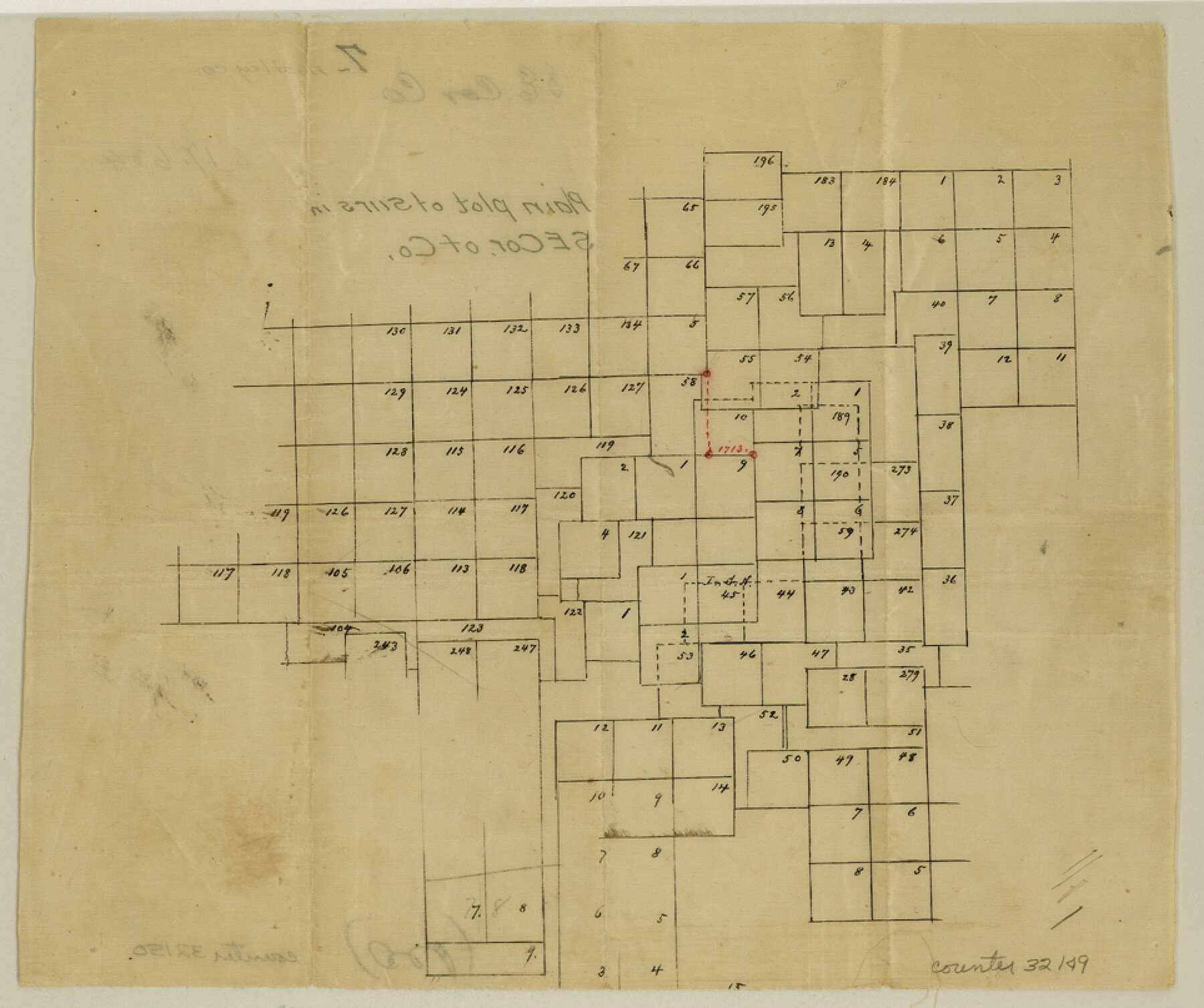
Motley County Sketch File 7 (S)
[Plain plot of surveys in southeast corner of county]
-
Map/Doc
32149
-
Collection
General Map Collection
-
Counties
Motley Cottle King Dickens
-
Subjects
Surveying Sketch File
-
Height x Width
8.1 x 9.6 inches
20.6 x 24.4 cm
-
Medium
paper, manuscript
Part of: General Map Collection
Cooke County Sketch File 15

Print $4.00
- Digital $50.00
Cooke County Sketch File 15
1860
Size 12.5 x 8.1 inches
Map/Doc 19250
Crosby County Working Sketch 4

Print $20.00
- Digital $50.00
Crosby County Working Sketch 4
1907
Size 19.9 x 14.0 inches
Map/Doc 68438

Brewster County Rolled Sketch 126

Print $225.00
- Digital $50.00
Brewster County Rolled Sketch 126
1908
Map/Doc 43230
Cottle County Boundary File 1

Print $22.00
- Digital $50.00
Cottle County Boundary File 1
Size 8.8 x 3.8 inches
Map/Doc 51944
Wichita County Sketch File 23

Print $20.00
- Digital $50.00
Wichita County Sketch File 23
1911
Size 32.8 x 29.4 inches
Map/Doc 10432
Harris County Rolled Sketch 44

Print $20.00
- Digital $50.00
Harris County Rolled Sketch 44
Size 22.5 x 29.9 inches
Map/Doc 6102
Menard County Sketch File 4

Print $20.00
- Digital $50.00
Menard County Sketch File 4
Size 18.3 x 25.5 inches
Map/Doc 12072
Flight Mission No. DIX-5P, Frame 143, Aransas County

Print $20.00
- Digital $50.00
Flight Mission No. DIX-5P, Frame 143, Aransas County
1956
Size 17.0 x 17.1 inches
Map/Doc 83804
Wharton County Boundary File 1a

Print $12.00
- Digital $50.00
Wharton County Boundary File 1a
Size 11.7 x 9.2 inches
Map/Doc 59851
Flight Mission No. DAG-23K, Frame 169, Matagorda County

Print $20.00
- Digital $50.00
Flight Mission No. DAG-23K, Frame 169, Matagorda County
1953
Size 16.0 x 15.8 inches
Map/Doc 86507
Erath County Working Sketch 22

Print $20.00
- Digital $50.00
Erath County Working Sketch 22
1965
Size 29.8 x 36.8 inches
Map/Doc 69103
You may also like
[Sketch of surveys in the vicinity of sections 171 and 172 along Pedernales]
![91882, [Sketch of surveys in the vicinity of sections 171 and 172 along Pedernales], Twichell Survey Records](https://historictexasmaps.com/wmedia_w700/maps/91882-1.tif.jpg)
Print $20.00
- Digital $50.00
[Sketch of surveys in the vicinity of sections 171 and 172 along Pedernales]
Size 17.2 x 12.9 inches
Map/Doc 91882
Duval County Sketch File 26

Print $4.00
- Digital $50.00
Duval County Sketch File 26
1882
Size 13.0 x 9.0 inches
Map/Doc 21332
Boundary Line Between Texas and New Mexico, Supreme Court Decision - Oct. Term, 1930

Print $304.00
Boundary Line Between Texas and New Mexico, Supreme Court Decision - Oct. Term, 1930
1930
Map/Doc 81688
Panola County Rolled Sketch 3

Print $1246.00
- Digital $50.00
Panola County Rolled Sketch 3
1949
Size 10.3 x 15.2 inches
Map/Doc 47978
Flight Mission No. CLL-1N, Frame 108, Willacy County

Print $20.00
- Digital $50.00
Flight Mission No. CLL-1N, Frame 108, Willacy County
1954
Size 18.3 x 22.0 inches
Map/Doc 87042
Culberson County Sketch File 15

Print $20.00
- Digital $50.00
Culberson County Sketch File 15
1933
Size 30.4 x 24.4 inches
Map/Doc 11267
Flight Mission No. DQN-2K, Frame 146, Calhoun County

Print $20.00
- Digital $50.00
Flight Mission No. DQN-2K, Frame 146, Calhoun County
1953
Size 18.9 x 22.5 inches
Map/Doc 84315
Pecos County Rolled Sketch 62

Print $20.00
- Digital $50.00
Pecos County Rolled Sketch 62
1927
Size 44.2 x 39.4 inches
Map/Doc 9698
Borden County Working Sketch of Geo. Spiller's Resurvey of Block 97 made in 1887

Print $3.00
- Digital $50.00
Borden County Working Sketch of Geo. Spiller's Resurvey of Block 97 made in 1887
1903
Size 10.1 x 16.6 inches
Map/Doc 90211
Lavaca County Sketch File 22

Print $28.00
- Digital $50.00
Lavaca County Sketch File 22
1959
Size 14.2 x 8.7 inches
Map/Doc 29654

Brazoria County Sketch File 40

Print $8.00
- Digital $50.00
Brazoria County Sketch File 40
1935
Size 14.3 x 8.9 inches
Map/Doc 15049