Montague County Sketch File 7
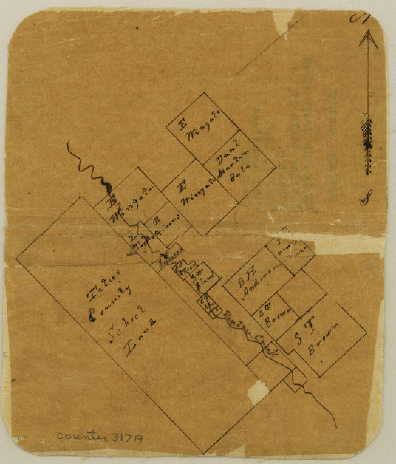
[Sketch of area to the northeast of Titus County School land on Denton Creek in the southern part of the county]
-
Map/Doc
31719
-
Collection
General Map Collection
-
Object Dates
11/7/1860 (Creation Date)
11/21/1860 (File Date)
-
People and Organizations
John Scandland (Surveyor/Engineer)
-
Counties
Montague
-
Subjects
Surveying Sketch File
-
Height x Width
6.3 x 5.4 inches
16.0 x 13.7 cm
-
Medium
paper, manuscript
-
Features
Denton Creek
Part of: General Map Collection
Map of Jack County

Print $20.00
- Digital $50.00
Map of Jack County
1882
Size 21.6 x 24.5 inches
Map/Doc 3706
South Part Presidio County

Print $20.00
- Digital $50.00
South Part Presidio County
1975
Size 35.0 x 40.3 inches
Map/Doc 95617
Presidio County Sketch File 72

Print $6.00
- Digital $50.00
Presidio County Sketch File 72
1943
Size 13.3 x 8.8 inches
Map/Doc 34679
Cameron County

Print $20.00
- Digital $50.00
Cameron County
1976
Size 30.9 x 38.1 inches
Map/Doc 77230
Palo Pinto County Rolled Sketch 2

Print $20.00
- Digital $50.00
Palo Pinto County Rolled Sketch 2
1917
Size 37.5 x 43.8 inches
Map/Doc 9669
Comanche County Rolled Sketch 2

Print $40.00
- Digital $50.00
Comanche County Rolled Sketch 2
1989
Size 36.9 x 48.6 inches
Map/Doc 10299
Township No. 5 South Range No. 10 West of the Indian Meridian

Print $20.00
- Digital $50.00
Township No. 5 South Range No. 10 West of the Indian Meridian
1874
Size 19.2 x 24.5 inches
Map/Doc 75161
Gulf, Texas & Western Railway

Print $40.00
- Digital $50.00
Gulf, Texas & Western Railway
1913
Size 19.4 x 61.3 inches
Map/Doc 64440
Midland County Rolled Sketch 14

Print $40.00
- Digital $50.00
Midland County Rolled Sketch 14
Size 56.6 x 43.5 inches
Map/Doc 73574
Flight Mission No. DCL-7C, Frame 147, Kenedy County

Print $20.00
- Digital $50.00
Flight Mission No. DCL-7C, Frame 147, Kenedy County
1943
Size 18.3 x 22.4 inches
Map/Doc 86104
North Part of Brewster Co.

Print $20.00
- Digital $50.00
North Part of Brewster Co.
1956
Size 40.0 x 37.9 inches
Map/Doc 77220
Bailey County Sketch File 11

Print $80.00
- Digital $50.00
Bailey County Sketch File 11
Size 21.6 x 20.5 inches
Map/Doc 10886
You may also like
Newton County Working Sketch 2

Print $20.00
- Digital $50.00
Newton County Working Sketch 2
1905
Size 14.5 x 19.3 inches
Map/Doc 71248

[Texas Gulf Coast from Rio Grande to Sabine Lake]
![72686, [Texas Gulf Coast from Rio Grande to Sabine Lake], General Map Collection](https://historictexasmaps.com/wmedia_w700/maps/72686.tif.jpg)
Print $20.00
- Digital $50.00
[Texas Gulf Coast from Rio Grande to Sabine Lake]
Size 28.0 x 18.3 inches
Map/Doc 72686
Rusk County Sketch File 38

Print $6.00
Rusk County Sketch File 38
1951
Size 11.3 x 8.8 inches
Map/Doc 35576
Goliad County Working Sketch 16

Print $20.00
- Digital $50.00
Goliad County Working Sketch 16
1949
Size 30.0 x 46.9 inches
Map/Doc 63206
Sutton County Boundary File 5a

Print $20.00
- Digital $50.00
Sutton County Boundary File 5a
Size 14.5 x 8.9 inches
Map/Doc 59060
Flight Mission No. BRE-1P, Frame 51, Nueces County

Print $20.00
- Digital $50.00
Flight Mission No. BRE-1P, Frame 51, Nueces County
1956
Size 18.3 x 22.2 inches
Map/Doc 86640
Presidio County Rolled Sketch 116

Print $20.00
- Digital $50.00
Presidio County Rolled Sketch 116
1981
Size 30.9 x 25.0 inches
Map/Doc 9795
Coleman County Sketch File 44

Print $17.00
- Digital $50.00
Coleman County Sketch File 44
Size 14.1 x 8.6 inches
Map/Doc 18783
Flight Mission No. DAG-23K, Frame 18, Matagorda County

Print $20.00
- Digital $50.00
Flight Mission No. DAG-23K, Frame 18, Matagorda County
1953
Size 18.5 x 22.2 inches
Map/Doc 86480
Crockett County Rolled Sketch 58

Print $20.00
- Digital $50.00
Crockett County Rolled Sketch 58
Size 19.0 x 32.8 inches
Map/Doc 5600
Refugio County Boundary File 74

Print $172.00
- Digital $50.00
Refugio County Boundary File 74
Size 9.3 x 4.4 inches
Map/Doc 58272