![2841, [Sketch for Mineral Application 26501 - Sabine River, T. A. Oldhausen], General Map Collection](https://historictexasmaps.com/wmedia_w1800h1800/maps/2841.tif.jpg)
[Sketch for Mineral Application 26501 - Sabine River, T. A. Oldhausen]
K-1-26
-
Map/Doc
2841
-
Collection
General Map Collection
-
Object Dates
1931 (Creation Date)
-
People and Organizations
W.E. Jones (Surveyor/Engineer)
-
Counties
Gregg
-
Subjects
Energy Offshore Submerged Area
-
Height x Width
24.4 x 36.8 inches
62.0 x 93.5 cm
Part of: General Map Collection
Treaty to Resolve Pending Boundary Differences and Maintain the Rio Grande and Colorado River as the International Boundary Between the United States of American and Mexico

Print $20.00
- Digital $50.00
Treaty to Resolve Pending Boundary Differences and Maintain the Rio Grande and Colorado River as the International Boundary Between the United States of American and Mexico
1970
Size 11.0 x 35.3 inches
Map/Doc 83103
Map of Galveston, Turtle & East Bays & portion of the Gulf of Mexico in Chambers & Galveston Counties, Texas showing subdivision therof for mineral development

Print $20.00
- Digital $50.00
Map of Galveston, Turtle & East Bays & portion of the Gulf of Mexico in Chambers & Galveston Counties, Texas showing subdivision therof for mineral development
1935
Size 40.7 x 47.7 inches
Map/Doc 2939
Travis County Boundary File 27

Print $2.00
- Digital $50.00
Travis County Boundary File 27
Size 8.4 x 12.9 inches
Map/Doc 59463
Crockett County Sketch File 45

Print $14.00
- Digital $50.00
Crockett County Sketch File 45
Size 12.7 x 8.8 inches
Map/Doc 19772
Val Verde County Sketch File 27

Print $40.00
- Digital $50.00
Val Verde County Sketch File 27
Size 8.7 x 19.4 inches
Map/Doc 39234
Maverick County Sketch File 11

Print $40.00
- Digital $50.00
Maverick County Sketch File 11
1879
Size 8.3 x 8.8 inches
Map/Doc 31092
Travis County Boundary File 28

Print $8.00
- Digital $50.00
Travis County Boundary File 28
Size 14.7 x 9.0 inches
Map/Doc 59464
Map of Young County

Print $20.00
- Digital $50.00
Map of Young County
1896
Size 41.6 x 35.0 inches
Map/Doc 4172
Flight Mission No. BRE-5P, Frame 190, Nueces County

Print $20.00
- Digital $50.00
Flight Mission No. BRE-5P, Frame 190, Nueces County
1956
Size 18.8 x 22.5 inches
Map/Doc 86836
Jackson County

Print $20.00
- Digital $50.00
Jackson County
1840
Size 33.5 x 26.7 inches
Map/Doc 4505
Sabine Pass and Lake
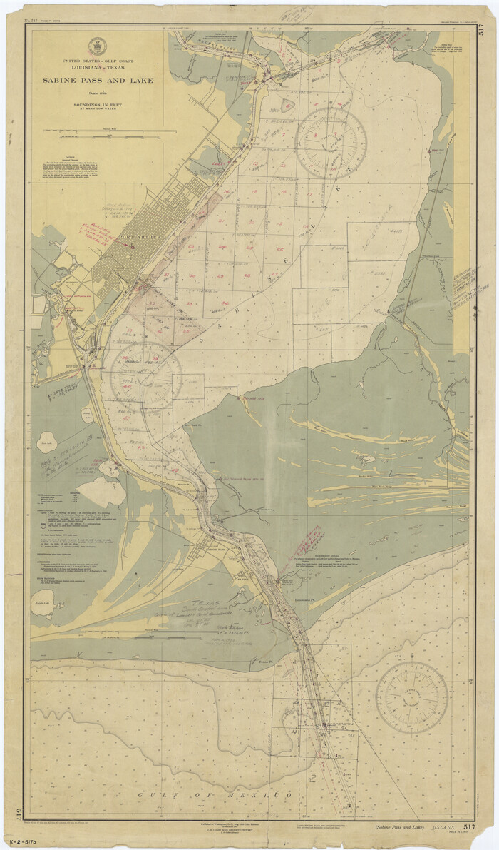
Print $20.00
- Digital $50.00
Sabine Pass and Lake
1945
Size 46.5 x 27.3 inches
Map/Doc 69822
Hudspeth County Sketch File AQ1

Print $4.00
- Digital $50.00
Hudspeth County Sketch File AQ1
1902
Size 10.9 x 8.7 inches
Map/Doc 26922
You may also like
Map of section no. 12 of a survey of Padre Island made for the Office of the Attorney General of the State of Texas

Print $40.00
- Digital $50.00
Map of section no. 12 of a survey of Padre Island made for the Office of the Attorney General of the State of Texas
1941
Size 75.9 x 41.0 inches
Map/Doc 2268
Sketch Showing Boundary Between Randall and Deaf Smith Counties

Print $20.00
- Digital $50.00
Sketch Showing Boundary Between Randall and Deaf Smith Counties
Size 13.4 x 33.3 inches
Map/Doc 91832
Garza County Sketch File 8

Print $8.00
- Digital $50.00
Garza County Sketch File 8
1900
Size 10.3 x 8.2 inches
Map/Doc 24062
Lipscomb County Working Sketch 1

Print $20.00
- Digital $50.00
Lipscomb County Working Sketch 1
1964
Size 30.7 x 34.1 inches
Map/Doc 70577
Hudspeth County Rolled Sketch 69

Print $20.00
- Digital $50.00
Hudspeth County Rolled Sketch 69
1973
Size 12.3 x 19.8 inches
Map/Doc 7719
Travis County Appraisal District Plat Map 2_2003

Print $20.00
- Digital $50.00
Travis County Appraisal District Plat Map 2_2003
Size 21.6 x 26.5 inches
Map/Doc 94202
Rio Grande, Laguna Atascosa Sheet

Print $20.00
- Digital $50.00
Rio Grande, Laguna Atascosa Sheet
1935
Size 37.4 x 37.6 inches
Map/Doc 65112
Map of Stephens County, Texas

Print $20.00
- Digital $50.00
Map of Stephens County, Texas
Size 36.8 x 40.1 inches
Map/Doc 93026
Webb County Working Sketch 72

Print $20.00
- Digital $50.00
Webb County Working Sketch 72
1974
Size 22.1 x 38.2 inches
Map/Doc 72439
Brazos River, Widths of Floodways/Brazos and Navasota Rivers

Print $20.00
- Digital $50.00
Brazos River, Widths of Floodways/Brazos and Navasota Rivers
1921
Size 38.1 x 24.5 inches
Map/Doc 65292
Liberty County Rolled Sketch 13

Print $20.00
- Digital $50.00
Liberty County Rolled Sketch 13
1983
Size 27.0 x 37.8 inches
Map/Doc 6619
Sutton County Sketch File J

Print $4.00
- Digital $50.00
Sutton County Sketch File J
Size 14.5 x 8.8 inches
Map/Doc 37505