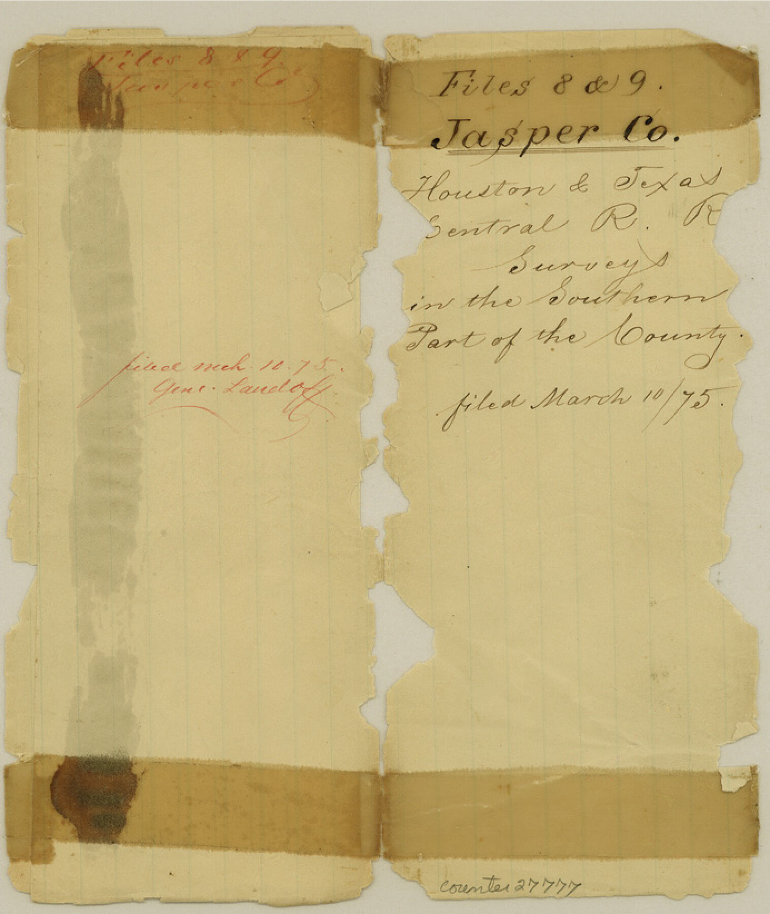
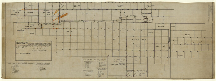
Jasper County Sketch File 8 and 9
[Multiple sketches of H. & T. C. RR. Co. surveys in southern part of county]
-
Map/Doc
27777
-
Collection
General Map Collection
-
Object Dates
3/10/1875 (File Date)
7/1/1874 (File Date)
-
People and Organizations
James J. Ingalls (Surveyor/Engineer)
S.W. Pipkin (Chainman)
James Ingalls (Chainman)
-
Counties
Jasper Orange
-
Subjects
Surveying Sketch File
-
Height x Width
8.2 x 6.9 inches
20.8 x 17.5 cm
-
Medium
paper, manuscript
-
Features
Naches [sic] River
Richardson's Bluff
Jasper Road
Ten Mile Creek
Nix's Ferry Road
Big Thicket
Part of: General Map Collection
Flight Mission No. CUG-2P, Frame 61, Kleberg County

Print $20.00
- Digital $50.00
Flight Mission No. CUG-2P, Frame 61, Kleberg County
1956
Size 18.5 x 22.2 inches
Map/Doc 86198
Harris County State Real Property Sketch 3

Print $42.00
- Digital $50.00
Harris County State Real Property Sketch 3
2004
Size 24.9 x 36.9 inches
Map/Doc 81952
Duval County Working Sketch 47

Print $20.00
- Digital $50.00
Duval County Working Sketch 47
1981
Size 20.8 x 30.9 inches
Map/Doc 68771
Map of Europe to illustrate Olney's school geography (Inset: Central Europe)

Print $20.00
- Digital $50.00
Map of Europe to illustrate Olney's school geography (Inset: Central Europe)
1844
Size 12.1 x 19.0 inches
Map/Doc 93546
[Capitol lands granted for purpose of building State Capitol]
![2073, [Capitol lands granted for purpose of building State Capitol], General Map Collection](https://historictexasmaps.com/wmedia_w700/maps/2073.tif.jpg)
Print $20.00
- Digital $50.00
[Capitol lands granted for purpose of building State Capitol]
1956
Size 31.5 x 13.0 inches
Map/Doc 2073
Flight Mission No. DQN-2K, Frame 69, Calhoun County

Print $20.00
- Digital $50.00
Flight Mission No. DQN-2K, Frame 69, Calhoun County
1953
Size 16.2 x 16.1 inches
Map/Doc 84261
Flight Mission No. DQO-8K, Frame 10, Galveston County

Print $20.00
- Digital $50.00
Flight Mission No. DQO-8K, Frame 10, Galveston County
1952
Size 18.7 x 22.4 inches
Map/Doc 85133
Crockett County Rolled Sketch 27A
Print $40.00
- Digital $50.00
Crockett County Rolled Sketch 27A
1925
Size 22.3 x 59.5 inches
Map/Doc 8692
Hudspeth County Working Sketch 22

Print $40.00
- Digital $50.00
Hudspeth County Working Sketch 22
1967
Size 45.8 x 62.8 inches
Map/Doc 66304
Flight Mission No. BQY-4M, Frame 124, Harris County

Print $20.00
- Digital $50.00
Flight Mission No. BQY-4M, Frame 124, Harris County
1953
Size 18.7 x 22.4 inches
Map/Doc 85292
Polk County Working Sketch 41

Print $20.00
- Digital $50.00
Polk County Working Sketch 41
1985
Size 26.3 x 27.8 inches
Map/Doc 71658
Loving County Working Sketch 17

Print $20.00
- Digital $50.00
Loving County Working Sketch 17
1976
Size 43.5 x 38.2 inches
Map/Doc 70651
You may also like
San Jacinto County Rolled Sketch 9

Print $20.00
- Digital $50.00
San Jacinto County Rolled Sketch 9
1944
Size 39.9 x 36.8 inches
Map/Doc 9881
[Section of] El Nuevo Mexico y Tierras Adyacentes Mapa Levantado para la demarcacion de los Limites de los Dominios Españoles y de los Estados Unidos

[Section of] El Nuevo Mexico y Tierras Adyacentes Mapa Levantado para la demarcacion de los Limites de los Dominios Españoles y de los Estados Unidos
1811
Size 17.9 x 26.7 inches
Map/Doc 97484
Lamar County Working Sketch 7

Print $20.00
- Digital $50.00
Lamar County Working Sketch 7
1964
Size 18.7 x 17.6 inches
Map/Doc 70268
Castro County Sketch File 15

Print $4.00
- Digital $50.00
Castro County Sketch File 15
1978
Size 11.2 x 8.7 inches
Map/Doc 17511
Presidio County Rolled Sketch 96

Print $20.00
- Digital $50.00
Presidio County Rolled Sketch 96
Size 12.3 x 45.9 inches
Map/Doc 9782
Rand, McNally & Co.'s Texas

Print $20.00
- Digital $50.00
Rand, McNally & Co.'s Texas
1887
Size 27.2 x 30.7 inches
Map/Doc 95884
Fort Bend County State Real Property Sketch 12

Print $40.00
- Digital $50.00
Fort Bend County State Real Property Sketch 12
1986
Size 43.2 x 35.0 inches
Map/Doc 61686
Harris County Rolled Sketch 101

Print $20.00
- Digital $50.00
Harris County Rolled Sketch 101
2004
Size 24.3 x 36.2 inches
Map/Doc 83063
Schleicher County Rolled Sketch 25

Print $20.00
- Digital $50.00
Schleicher County Rolled Sketch 25
1969
Size 32.3 x 37.9 inches
Map/Doc 9908
Flight Mission No. DQO-2K, Frame 88, Galveston County

Print $20.00
- Digital $50.00
Flight Mission No. DQO-2K, Frame 88, Galveston County
1952
Size 18.8 x 22.5 inches
Map/Doc 85015
Fractional Township No. 8 South Range No. 6 East of the Indian Meridian, Indian Territory

Print $20.00
- Digital $50.00
Fractional Township No. 8 South Range No. 6 East of the Indian Meridian, Indian Territory
1898
Size 19.3 x 24.4 inches
Map/Doc 75210
Flight Mission No. CRC-3R, Frame 10, Chambers County

Print $20.00
- Digital $50.00
Flight Mission No. CRC-3R, Frame 10, Chambers County
1956
Size 18.5 x 22.2 inches
Map/Doc 84784