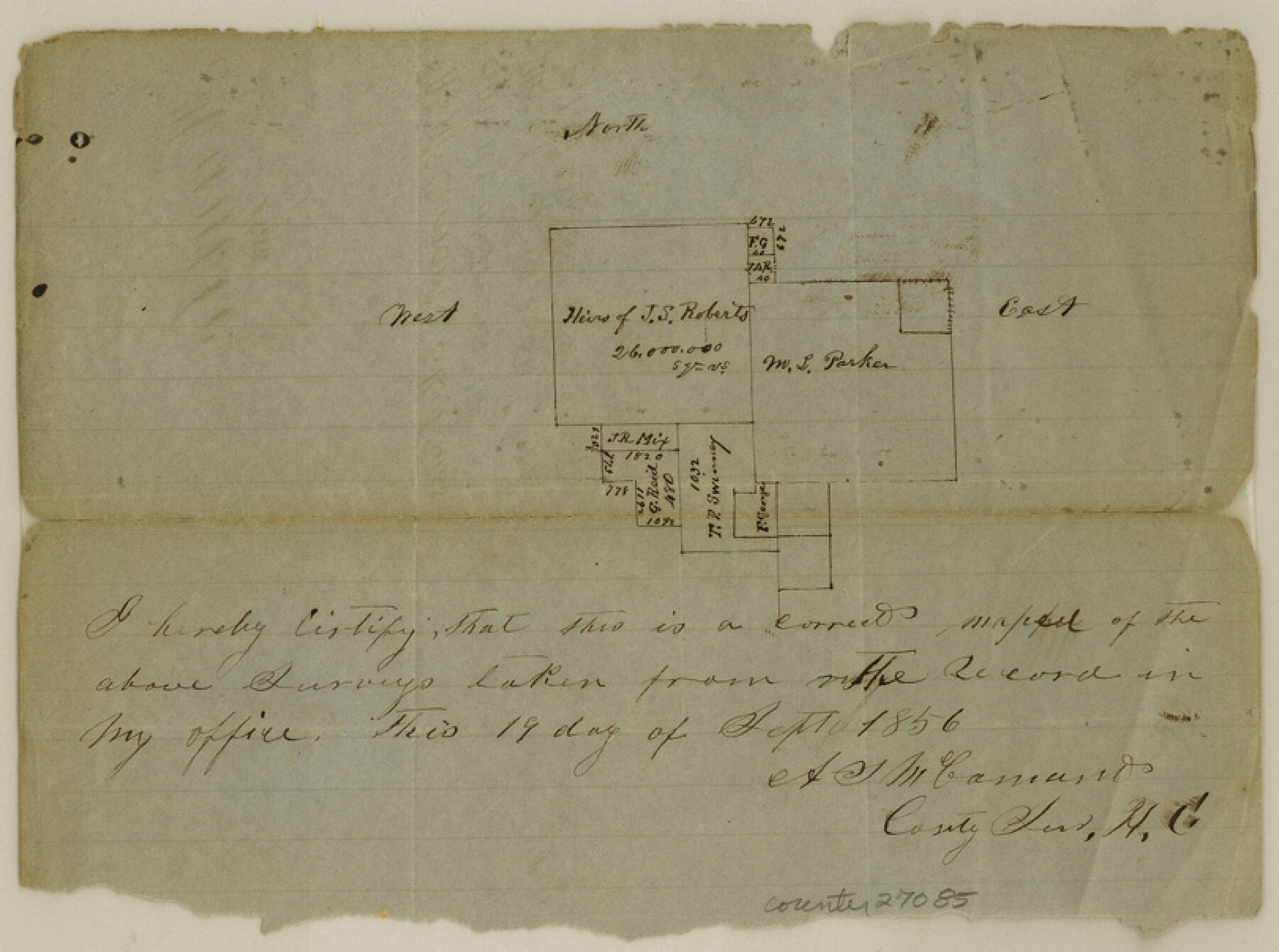
Hunt County Sketch File 3
[Sketch of surveys northeast of Greenville]
-
Map/Doc
27085
-
Collection
General Map Collection
-
Object Dates
9/19/1856 (Creation Date)
9/1856 (File Date)
-
People and Organizations
A.S. McCamant (Surveyor/Engineer)
-
Counties
Hunt
-
Subjects
Surveying Sketch File
-
Height x Width
6.0 x 8.1 inches
15.2 x 20.6 cm
-
Medium
paper, manuscript
Part of: General Map Collection
Map showing the environs of Brazos Island, Texas

Print $20.00
- Digital $50.00
Map showing the environs of Brazos Island, Texas
Size 18.1 x 25.0 inches
Map/Doc 72926
Dickens County Working Sketch 8

Print $40.00
- Digital $50.00
Dickens County Working Sketch 8
1947
Size 68.5 x 43.7 inches
Map/Doc 68656

[Sketch for Mineral Application 24072, San Jacinto River]
![65601, [Sketch for Mineral Application 24072, San Jacinto River], General Map Collection](https://historictexasmaps.com/wmedia_w700/maps/65601.tif.jpg)
Print $20.00
- Digital $50.00
[Sketch for Mineral Application 24072, San Jacinto River]
1929
Size 25.1 x 18.4 inches
Map/Doc 65601
Northwest Part of Webb County

Print $40.00
- Digital $50.00
Northwest Part of Webb County
1984
Size 42.6 x 52.2 inches
Map/Doc 73319
Lavaca County Rolled Sketch 3

Print $20.00
- Digital $50.00
Lavaca County Rolled Sketch 3
1959
Size 42.8 x 32.8 inches
Map/Doc 9419
[Neches River Bed, Plat and Calculations]
![77101, [Neches River Bed, Plat and Calculations], General Map Collection](https://historictexasmaps.com/wmedia_w700/maps/77101.tif.jpg)
Print $20.00
- Digital $50.00
[Neches River Bed, Plat and Calculations]
1928
Size 23.2 x 19.8 inches
Map/Doc 77101
Map of Uvalde Co.

Print $20.00
- Digital $50.00
Map of Uvalde Co.
1893
Size 42.7 x 42.5 inches
Map/Doc 16911
United States - Gulf Coast - Galveston to Rio Grande

Print $20.00
- Digital $50.00
United States - Gulf Coast - Galveston to Rio Grande
1919
Size 27.1 x 18.3 inches
Map/Doc 72745
Collin County Sketch File 7

Print $40.00
- Digital $50.00
Collin County Sketch File 7
1852
Size 17.3 x 14.0 inches
Map/Doc 18866
Stephens County Sketch File 12

Print $8.00
- Digital $50.00
Stephens County Sketch File 12
1884
Size 10.8 x 8.3 inches
Map/Doc 37057

You may also like
Donley County Sketch File 21

Print $4.00
- Digital $50.00
Donley County Sketch File 21
Size 8.4 x 9.5 inches
Map/Doc 21256
![92632, [League 280], Twichell Survey Records](https://historictexasmaps.com/wmedia_w700/maps/92632-1.tif.jpg)
Clay County Boundary File 4

Print $14.00
- Digital $50.00
Clay County Boundary File 4
Size 10.1 x 6.7 inches
Map/Doc 51366
Ward County Boundary File 1

Print $12.00
- Digital $50.00
Ward County Boundary File 1
Size 14.4 x 9.0 inches
Map/Doc 59667
Pecos County Working Sketch 60

Print $20.00
- Digital $50.00
Pecos County Working Sketch 60
1950
Size 37.0 x 29.5 inches
Map/Doc 71532
San Antonio & Aransas Pass

Print $40.00
- Digital $50.00
San Antonio & Aransas Pass
Size 30.9 x 74.5 inches
Map/Doc 64633
Tech Town a Subdivision of the Northeast Quarter Section 18, Block B

Print $20.00
- Digital $50.00
Tech Town a Subdivision of the Northeast Quarter Section 18, Block B
Size 17.5 x 21.6 inches
Map/Doc 92792
Reeves County Rolled Sketch 25

Print $20.00
- Digital $50.00
Reeves County Rolled Sketch 25
1982
Size 22.3 x 20.6 inches
Map/Doc 7494
Flight Mission No. DAG-24K, Frame 157, Matagorda County

Print $20.00
- Digital $50.00
Flight Mission No. DAG-24K, Frame 157, Matagorda County
1953
Size 18.6 x 22.5 inches
Map/Doc 86571
Titus County Sketch File 8

Print $4.00
- Digital $50.00
Titus County Sketch File 8
1855
Size 12.7 x 7.9 inches
Map/Doc 38144
Leon County Working Sketch 45

Print $20.00
- Digital $50.00
Leon County Working Sketch 45
1980
Size 45.4 x 37.4 inches
Map/Doc 70444
Crosby County Working Sketch 3

Print $20.00
- Digital $50.00
Crosby County Working Sketch 3
1903
Size 25.7 x 36.0 inches
Map/Doc 68437