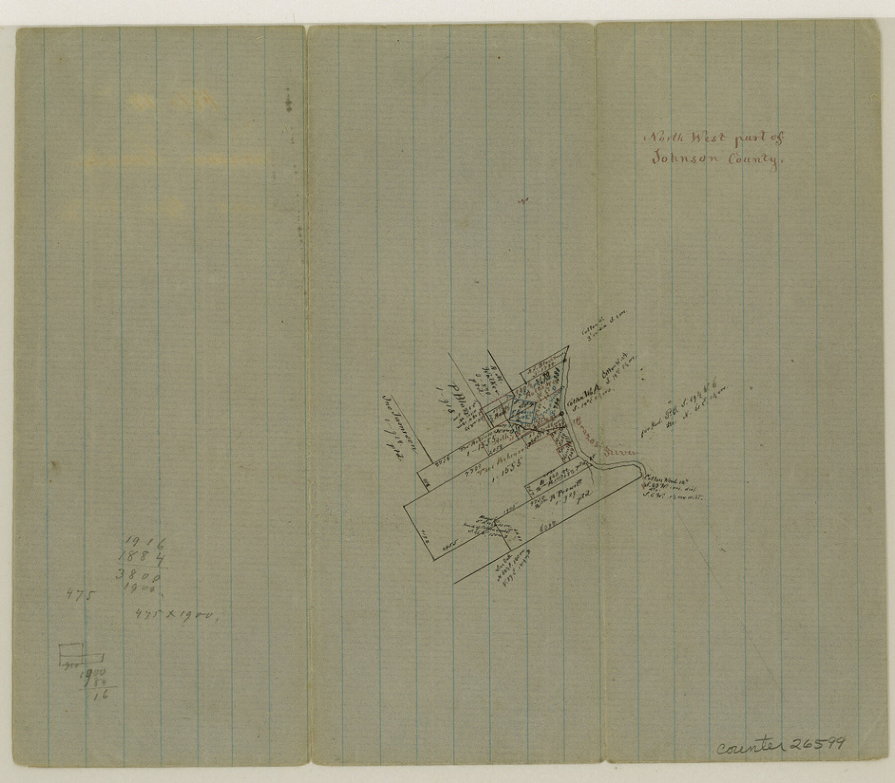
Hood County Sketch File 17
[Sketch north of Comanche Peak]
-
Map/Doc
26599
-
Collection
General Map Collection
-
Object Dates
10/13/1860 (File Date)
10/13/1860 (Creation Date)
-
Counties
Hood
-
Subjects
Surveying Sketch File
-
Height x Width
8.2 x 9.4 inches
20.8 x 23.9 cm
-
Medium
paper, manuscript
-
Features
Brazos River
Part of: General Map Collection
Hutchinson County Sketch File 9

Print $4.00
- Digital $50.00
Hutchinson County Sketch File 9
1900
Size 12.7 x 9.2 inches
Map/Doc 27209
Sherman County Sketch File A

Print $4.00
- Digital $50.00
Sherman County Sketch File A
1917
Size 11.2 x 8.8 inches
Map/Doc 44250
Concho County Sketch File 1

Print $5.00
- Digital $50.00
Concho County Sketch File 1
1856
Size 5.0 x 6.6 inches
Map/Doc 19121
Caldwell County Sketch File 4a

Print $8.00
- Digital $50.00
Caldwell County Sketch File 4a
1898
Size 11.2 x 8.8 inches
Map/Doc 35835
Flight Mission No. DAH-9M, Frame 85, Orange County

Print $20.00
- Digital $50.00
Flight Mission No. DAH-9M, Frame 85, Orange County
1953
Size 18.5 x 22.7 inches
Map/Doc 86849
Van Zandt County Sketch File 16b

Print $2.00
- Digital $50.00
Van Zandt County Sketch File 16b
Size 12.8 x 8.3 inches
Map/Doc 39416
Flight Mission No. CUG-3P, Frame 81, Kleberg County

Print $20.00
- Digital $50.00
Flight Mission No. CUG-3P, Frame 81, Kleberg County
1956
Size 18.3 x 22.1 inches
Map/Doc 86256
Sabine County

Print $20.00
- Digital $50.00
Sabine County
1920
Size 41.2 x 31.8 inches
Map/Doc 77413
Crane County Working Sketch 11

Print $20.00
- Digital $50.00
Crane County Working Sketch 11
1941
Size 18.8 x 18.4 inches
Map/Doc 68288
Wilbarger County Working Sketch 17

Print $20.00
- Digital $50.00
Wilbarger County Working Sketch 17
1957
Size 7.5 x 18.4 inches
Map/Doc 72555
Parker County Working Sketch 9

Print $20.00
- Digital $50.00
Parker County Working Sketch 9
1958
Map/Doc 71459
McMullen County Rolled Sketch 8

Print $20.00
- Digital $50.00
McMullen County Rolled Sketch 8
Size 26.0 x 26.3 inches
Map/Doc 6725
You may also like
[Blocks D3 and GP]
![91505, [Blocks D3 and GP], Twichell Survey Records](https://historictexasmaps.com/wmedia_w700/maps/91505-1.tif.jpg)
Print $20.00
- Digital $50.00
[Blocks D3 and GP]
Size 18.9 x 20.2 inches
Map/Doc 91505
Austin County Boundary File 5a

Print $6.00
- Digital $50.00
Austin County Boundary File 5a
Size 14.1 x 8.7 inches
Map/Doc 50252
Polk County Sketch File 24

Print $20.00
- Digital $50.00
Polk County Sketch File 24
Size 14.3 x 30.8 inches
Map/Doc 12193
Calhoun County Working Sketch 3

Print $20.00
- Digital $50.00
Calhoun County Working Sketch 3
1923
Size 18.4 x 42.4 inches
Map/Doc 67819
Brewster County Sketch File NS-X

Print $42.00
- Digital $50.00
Brewster County Sketch File NS-X
1882
Size 20.1 x 10.5 inches
Map/Doc 15943
Upton County Rolled Sketch 26

Print $20.00
- Digital $50.00
Upton County Rolled Sketch 26
1942
Size 35.7 x 37.2 inches
Map/Doc 10045
Flight Mission No. BRA-16M, Frame 172, Jefferson County

Print $20.00
- Digital $50.00
Flight Mission No. BRA-16M, Frame 172, Jefferson County
1953
Size 18.6 x 22.3 inches
Map/Doc 85770
Flight Mission No. DAG-21K, Frame 91, Matagorda County

Print $20.00
- Digital $50.00
Flight Mission No. DAG-21K, Frame 91, Matagorda County
1952
Size 18.5 x 22.4 inches
Map/Doc 86420

Uvalde County Boundary File 3

Print $28.00
- Digital $50.00
Uvalde County Boundary File 3
Size 13.1 x 8.4 inches
Map/Doc 59558
[Blocks Y2 and I]
![91261, [Blocks Y2 and I], Twichell Survey Records](https://historictexasmaps.com/wmedia_w700/maps/91261-1.tif.jpg)
Print $20.00
- Digital $50.00
[Blocks Y2 and I]
Size 17.8 x 13.8 inches
Map/Doc 91261
Wilson County Boundary File 3

Print $26.00
- Digital $50.00
Wilson County Boundary File 3
Size 14.3 x 8.7 inches
Map/Doc 60083