![2083, [Aransas County, Texas], General Map Collection](https://historictexasmaps.com/wmedia_w1800h1800/maps/2083.tif.jpg)
[Aransas County, Texas]
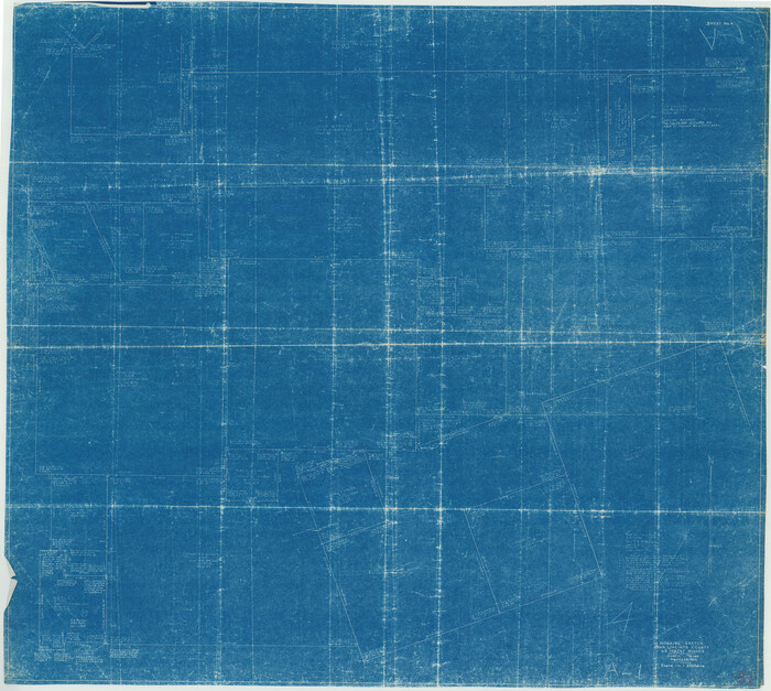
Working Sketch of surveys in Aransas County
N-2-36
-
Map/Doc
2083
-
Collection
General Map Collection
-
Object Dates
1928/2/24 (Creation Date)
-
People and Organizations
General Land Office (Publisher)
-
Counties
Aransas
-
Subjects
Gulf of Mexico
-
Height x Width
37.5 x 31.3 inches
95.3 x 79.5 cm
Part of: General Map Collection
Tyler County Sketch File 6

Print $6.00
- Digital $50.00
Tyler County Sketch File 6
1848
Size 6.0 x 7.1 inches
Map/Doc 38630
Real County Working Sketch 81

Print $20.00
- Digital $50.00
Real County Working Sketch 81
1984
Size 19.9 x 17.1 inches
Map/Doc 71973
Burnet County Boundary File 3

Print $18.00
- Digital $50.00
Burnet County Boundary File 3
Size 12.8 x 8.2 inches
Map/Doc 50863
Harris County Sketch File 59

Print $32.00
- Digital $50.00
Harris County Sketch File 59
1921
Size 14.3 x 9.0 inches
Map/Doc 25480
Reagan County Sketch File 17

Print $40.00
- Digital $50.00
Reagan County Sketch File 17
Size 11.8 x 14.2 inches
Map/Doc 35006
Lamar County Working Sketch 2

Print $20.00
- Digital $50.00
Lamar County Working Sketch 2
Size 27.9 x 25.6 inches
Map/Doc 70263
Shackelford County Working Sketch 12

Print $20.00
- Digital $50.00
Shackelford County Working Sketch 12
1998
Size 27.0 x 22.3 inches
Map/Doc 63852
Flight Mission No. DQO-13T, Frame 49, Galveston County

Print $20.00
- Digital $50.00
Flight Mission No. DQO-13T, Frame 49, Galveston County
1958
Size 18.5 x 18.4 inches
Map/Doc 85214
Map of Prison Property in Walker County, Texas

Print $20.00
- Digital $50.00
Map of Prison Property in Walker County, Texas
Size 37.6 x 42.9 inches
Map/Doc 62993
Aransas County Sketch File 1

Print $4.00
- Digital $50.00
Aransas County Sketch File 1
Size 7.5 x 5.3 inches
Map/Doc 13098
Crockett County Working Sketch 34

Print $40.00
- Digital $50.00
Crockett County Working Sketch 34
1926
Size 24.7 x 59.5 inches
Map/Doc 68367
Flight Mission No. DQN-1K, Frame 49, Calhoun County

Print $20.00
- Digital $50.00
Flight Mission No. DQN-1K, Frame 49, Calhoun County
1953
Size 18.6 x 22.4 inches
Map/Doc 84149
You may also like
Sherman County

Print $20.00
- Digital $50.00
Sherman County
1889
Size 22.3 x 19.0 inches
Map/Doc 4036
Milam County Sketch File 3

Print $4.00
- Digital $50.00
Milam County Sketch File 3
1853
Size 12.9 x 8.1 inches
Map/Doc 31628
Erath County Working Sketch 41

Print $20.00
- Digital $50.00
Erath County Working Sketch 41
Size 25.5 x 29.0 inches
Map/Doc 69122
Presidio County Sketch File 28A

Print $20.00
- Digital $50.00
Presidio County Sketch File 28A
1890
Size 16.3 x 17.9 inches
Map/Doc 11710
San Jacinto County Working Sketch 8
Print $20.00
- Digital $50.00
San Jacinto County Working Sketch 8
1935
Size 38.4 x 42.9 inches
Map/Doc 63721
Rusk County Sketch File 37

Print $20.00
Rusk County Sketch File 37
1951
Size 23.3 x 26.2 inches
Map/Doc 12275
Tom Green County Rolled Sketch 22

Print $20.00
- Digital $50.00
Tom Green County Rolled Sketch 22
1966
Size 38.0 x 43.6 inches
Map/Doc 10006
Brown County Sketch File 10

Print $40.00
- Digital $50.00
Brown County Sketch File 10
1868
Size 17.4 x 22.3 inches
Map/Doc 11019
Map of Hale County

Print $40.00
- Digital $50.00
Map of Hale County
1900
Size 49.3 x 41.0 inches
Map/Doc 4691

Flight Mission No. BRA-7M, Frame 185, Jefferson County

Print $20.00
- Digital $50.00
Flight Mission No. BRA-7M, Frame 185, Jefferson County
1953
Size 18.6 x 22.3 inches
Map/Doc 85553
Jefferson County Rolled Sketch 57

Print $20.00
- Digital $50.00
Jefferson County Rolled Sketch 57
1883
Size 25.9 x 18.6 inches
Map/Doc 6407