Val Verde County Sketch File Z9
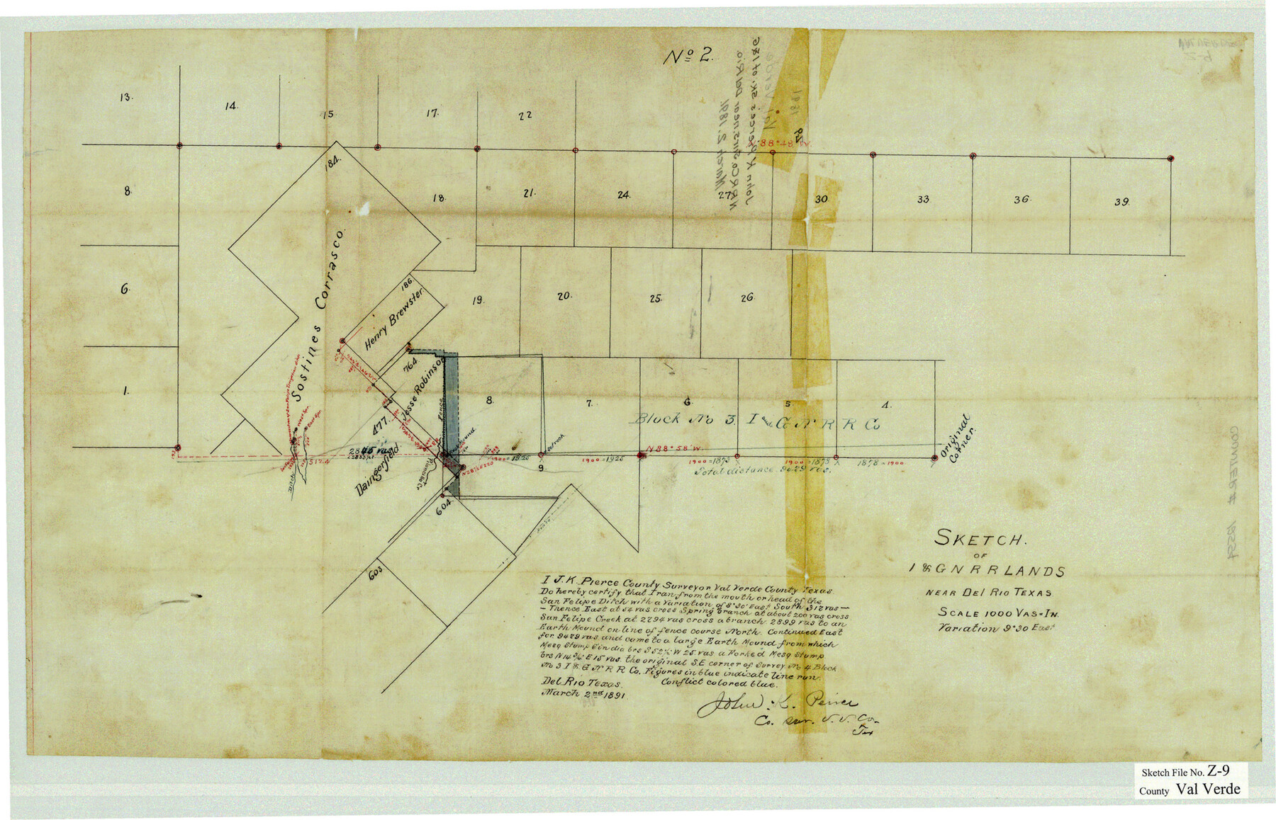
[Sketch of surveys in I. & G. N. Ry. Co. Blocks 3 and 4 northeast from Del Rio]
-
Map/Doc
12554
-
Collection
General Map Collection
-
Object Dates
3/2/1891 (Creation Date)
-
People and Organizations
John K. Peirce (Surveyor/Engineer)
-
Counties
Val Verde
-
Subjects
Surveying Sketch File
-
Height x Width
15.9 x 24.8 inches
40.4 x 63.0 cm
-
Medium
paper, manuscript
-
Features
Daingerfield
Piloncillo Creek
San Felipe Ditch
Spring Branch
San Felipe Creek
Part of: General Map Collection
Borden - Garza County Line as agreed upon in the 118th Judicial District Court, Howard County, Texas Case No. 13,023

Print $40.00
- Digital $50.00
Borden - Garza County Line as agreed upon in the 118th Judicial District Court, Howard County, Texas Case No. 13,023
1965
Size 19.0 x 102.2 inches
Map/Doc 1697
Trinity County Working Sketch 9

Print $20.00
- Digital $50.00
Trinity County Working Sketch 9
1947
Size 23.5 x 28.1 inches
Map/Doc 69458
Bee County Working Sketch 7

Print $20.00
- Digital $50.00
Bee County Working Sketch 7
1939
Size 17.8 x 20.6 inches
Map/Doc 67257
La Salle County Rolled Sketch 3

Print $20.00
- Digital $50.00
La Salle County Rolled Sketch 3
1937
Size 32.6 x 38.9 inches
Map/Doc 6568
Rusk County Sketch File 40

Print $20.00
Rusk County Sketch File 40
1951
Size 23.2 x 26.6 inches
Map/Doc 12276
Briscoe County Sketch File A

Print $40.00
- Digital $50.00
Briscoe County Sketch File A
1894
Size 17.3 x 21.1 inches
Map/Doc 10997
Pecos County Rolled Sketch 32A

Print $7.00
- Digital $50.00
Pecos County Rolled Sketch 32A
1890
Size 10.5 x 15.2 inches
Map/Doc 48096
Presidio County Sketch File 120

Print $16.00
- Digital $50.00
Presidio County Sketch File 120
Size 14.2 x 8.8 inches
Map/Doc 34934
Midland County Rolled Sketch 3

Print $40.00
- Digital $50.00
Midland County Rolled Sketch 3
Size 71.7 x 24.4 inches
Map/Doc 9514
Fayette County Working Sketch 1

Print $20.00
- Digital $50.00
Fayette County Working Sketch 1
1949
Size 25.4 x 18.0 inches
Map/Doc 69165
La Salle County Sketch File 46

Print $20.00
- Digital $50.00
La Salle County Sketch File 46
Size 14.1 x 8.6 inches
Map/Doc 29603
Webb County Working Sketch 82

Print $40.00
- Digital $50.00
Webb County Working Sketch 82
1979
Size 32.9 x 62.9 inches
Map/Doc 72449
You may also like
[Sketch of Pecos County School Land surveys along Pecos River in Val Verde County]
![369, [Sketch of Pecos County School Land surveys along Pecos River in Val Verde County], Maddox Collection](https://historictexasmaps.com/wmedia_w700/maps/0369-1.tif.jpg)
Print $2.00
- Digital $50.00
[Sketch of Pecos County School Land surveys along Pecos River in Val Verde County]
1882
Size 10.2 x 8.9 inches
Map/Doc 369
Refugio County Boundary File 4

Print $28.00
- Digital $50.00
Refugio County Boundary File 4
Size 14.0 x 8.8 inches
Map/Doc 58251
Lampasas County Sketch File A1

Print $2.00
- Digital $50.00
Lampasas County Sketch File A1
Size 6.8 x 6.3 inches
Map/Doc 29385
Freestone County Boundary File 30

Print $8.00
- Digital $50.00
Freestone County Boundary File 30
Size 10.7 x 8.3 inches
Map/Doc 53588
VanZandt County Showing the Located Route of the Texas and Pacific R.R.

Print $20.00
- Digital $50.00
VanZandt County Showing the Located Route of the Texas and Pacific R.R.
1872
Size 24.5 x 22.3 inches
Map/Doc 64136
Map A [showing surveys along river and in vicinity of Archer County School Land League 3]
![89751, Map A [showing surveys along river and in vicinity of Archer County School Land League 3], Twichell Survey Records](https://historictexasmaps.com/wmedia_w700/maps/89751-1.tif.jpg)
Print $20.00
- Digital $50.00
Map A [showing surveys along river and in vicinity of Archer County School Land League 3]
Size 42.3 x 38.0 inches
Map/Doc 89751
Webb County Rolled Sketch 68

Print $43.00
- Digital $50.00
Webb County Rolled Sketch 68
1910
Size 9.6 x 15.1 inches
Map/Doc 49485
Flight Mission No. CLL-3N, Frame 31, Willacy County

Print $20.00
- Digital $50.00
Flight Mission No. CLL-3N, Frame 31, Willacy County
1954
Size 18.5 x 22.2 inches
Map/Doc 87087
Map of Panama, Texas

Print $5.00
- Digital $50.00
Map of Panama, Texas
1908
Size 10.4 x 15.6 inches
Map/Doc 94104
Fort Bend County Sketch File 36

Print $6.00
- Digital $50.00
Fort Bend County Sketch File 36
1997
Size 11.4 x 8.9 inches
Map/Doc 23007
Stephens County Working Sketch 35

Print $20.00
- Digital $50.00
Stephens County Working Sketch 35
1978
Size 14.5 x 26.0 inches
Map/Doc 63978
[Jack District]
![1993, [Jack District], General Map Collection](https://historictexasmaps.com/wmedia_w700/maps/1993-1.tif.jpg)
Print $40.00
- Digital $50.00
[Jack District]
1878
Size 42.1 x 64.5 inches
Map/Doc 1993