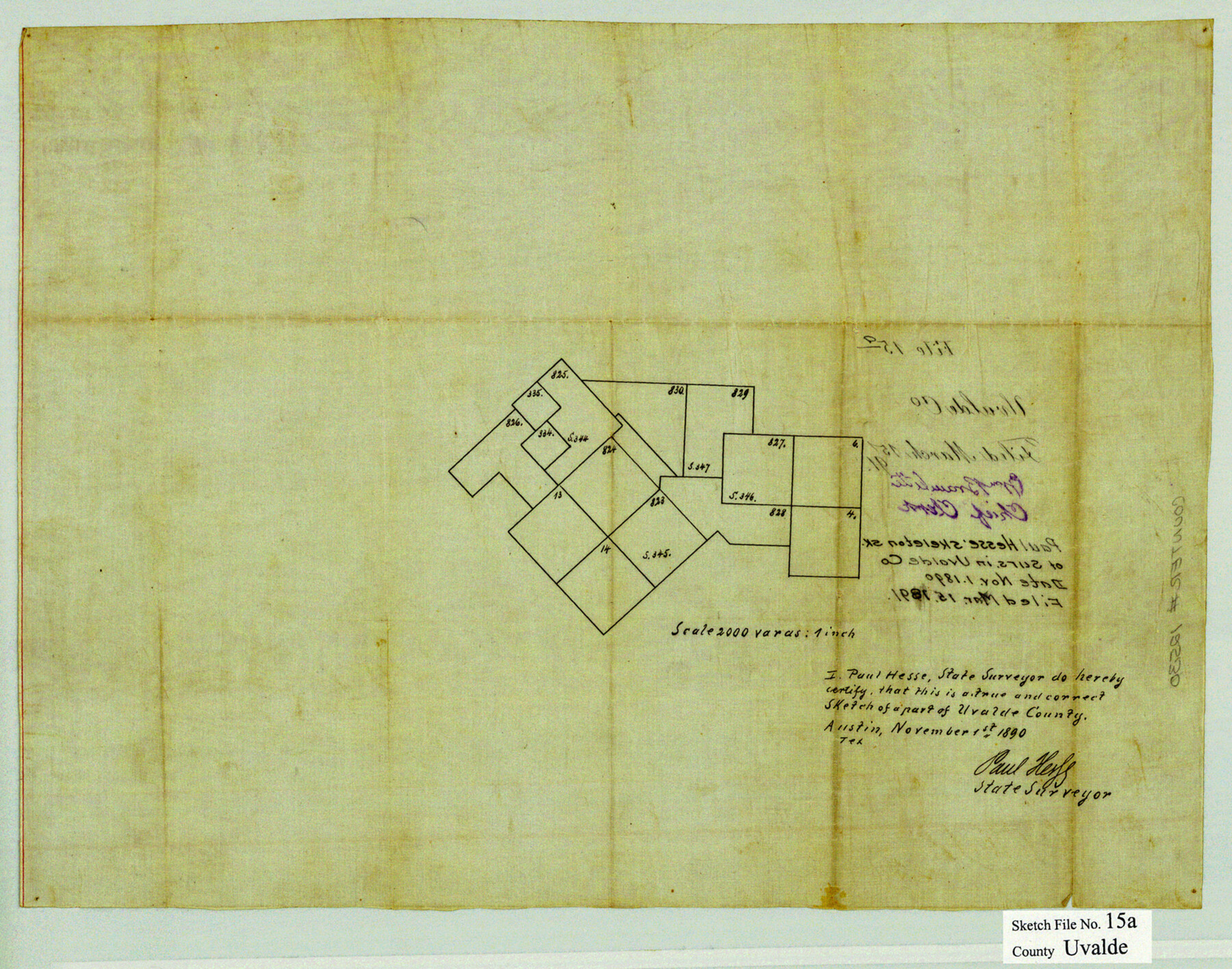
Uvalde County Sketch File 15a
[Sketch of area around survey 828 north of Uvalde]
-
Map/Doc
12530
-
Collection
General Map Collection
-
Object Dates
11/1/1890 (Creation Date)
3/15/1891 (File Date)
-
People and Organizations
Paul Hesse (Surveyor/Engineer)
-
Counties
Uvalde
-
Subjects
Surveying Sketch File
-
Height x Width
13.2 x 16.7 inches
33.5 x 42.4 cm
-
Scale
1" = 2000 varas
Part of: General Map Collection

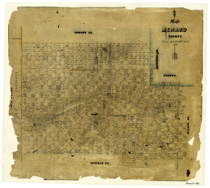
Map of Menard County
Print $20.00
- Digital $50.00
Map of Menard County
1860
Size 20.9 x 23.3 inches
Map/Doc 3874
Bandera County Boundary File 6

Print $42.00
- Digital $50.00
Bandera County Boundary File 6
1972
Size 14.2 x 8.9 inches
Map/Doc 50303
Photo Index of Texas Coast - Sheet 4 of 6

Print $20.00
- Digital $50.00
Photo Index of Texas Coast - Sheet 4 of 6
1954
Size 20.0 x 24.0 inches
Map/Doc 83442
Map of the City of Beaumont, Texas

Print $20.00
- Digital $50.00
Map of the City of Beaumont, Texas
1897
Size 31.7 x 30.9 inches
Map/Doc 64146
McCulloch County Working Sketch 9

Print $20.00
- Digital $50.00
McCulloch County Working Sketch 9
1978
Size 35.6 x 32.7 inches
Map/Doc 70684
Coast of Texas from head of East Bay Galveston Harbor to Sabine Pass

Print $40.00
- Digital $50.00
Coast of Texas from head of East Bay Galveston Harbor to Sabine Pass
1882
Size 32.2 x 54.1 inches
Map/Doc 69839
Motley County Rolled Sketch 1

Print $20.00
- Digital $50.00
Motley County Rolled Sketch 1
1989
Size 39.0 x 47.6 inches
Map/Doc 9552
Flight Mission No. CRC-3R, Frame 201, Chambers County

Print $20.00
- Digital $50.00
Flight Mission No. CRC-3R, Frame 201, Chambers County
1956
Size 18.6 x 22.4 inches
Map/Doc 84856
Texas, Corpus Christi Bay, Mustang Island

Print $40.00
- Digital $50.00
Texas, Corpus Christi Bay, Mustang Island
1934
Size 48.6 x 31.4 inches
Map/Doc 73460
La Salle County Working Sketch 48

Print $20.00
- Digital $50.00
La Salle County Working Sketch 48
1983
Size 26.2 x 36.0 inches
Map/Doc 70349
Maverick County Working Sketch 16

Print $20.00
- Digital $50.00
Maverick County Working Sketch 16
1975
Size 38.1 x 27.6 inches
Map/Doc 70908
You may also like
Greer County Sketch File 7

Print $40.00
- Digital $50.00
Greer County Sketch File 7
Size 12.8 x 17.5 inches
Map/Doc 24526
Dawson County Sketch File D

Print $20.00
- Digital $50.00
Dawson County Sketch File D
1917
Size 30.0 x 40.3 inches
Map/Doc 10363
Matagorda County NRC Article 33.136 Sketch 10

Print $46.00
- Digital $50.00
Matagorda County NRC Article 33.136 Sketch 10
2013
Size 24.0 x 36.0 inches
Map/Doc 94519
General Highway Map, Bexar County, Texas

Print $20.00
General Highway Map, Bexar County, Texas
1940
Size 18.3 x 25.1 inches
Map/Doc 79017

Aransas County NRC Article 33.136 Sketch 12

Print $44.00
- Digital $50.00
Aransas County NRC Article 33.136 Sketch 12
2012
Size 36.0 x 48.0 inches
Map/Doc 94510
Webb County Rolled Sketch 64

Print $20.00
- Digital $50.00
Webb County Rolled Sketch 64
1948
Size 42.0 x 27.3 inches
Map/Doc 8213
Double Lakes No. 1 T-Ranch Lynn County, Texas

Print $20.00
- Digital $50.00
Double Lakes No. 1 T-Ranch Lynn County, Texas
Size 36.8 x 31.8 inches
Map/Doc 93216

Webb County Rolled Sketch 78

Print $20.00
- Digital $50.00
Webb County Rolled Sketch 78
2011
Size 33.1 x 24.6 inches
Map/Doc 90052
Ochiltree County Boundary File 1c

Print $2.00
- Digital $50.00
Ochiltree County Boundary File 1c
Size 10.6 x 8.1 inches
Map/Doc 57674
Hamilton County Working Sketch 32

Print $20.00
- Digital $50.00
Hamilton County Working Sketch 32
1993
Size 26.3 x 34.3 inches
Map/Doc 63370