Upton County Sketch File 12
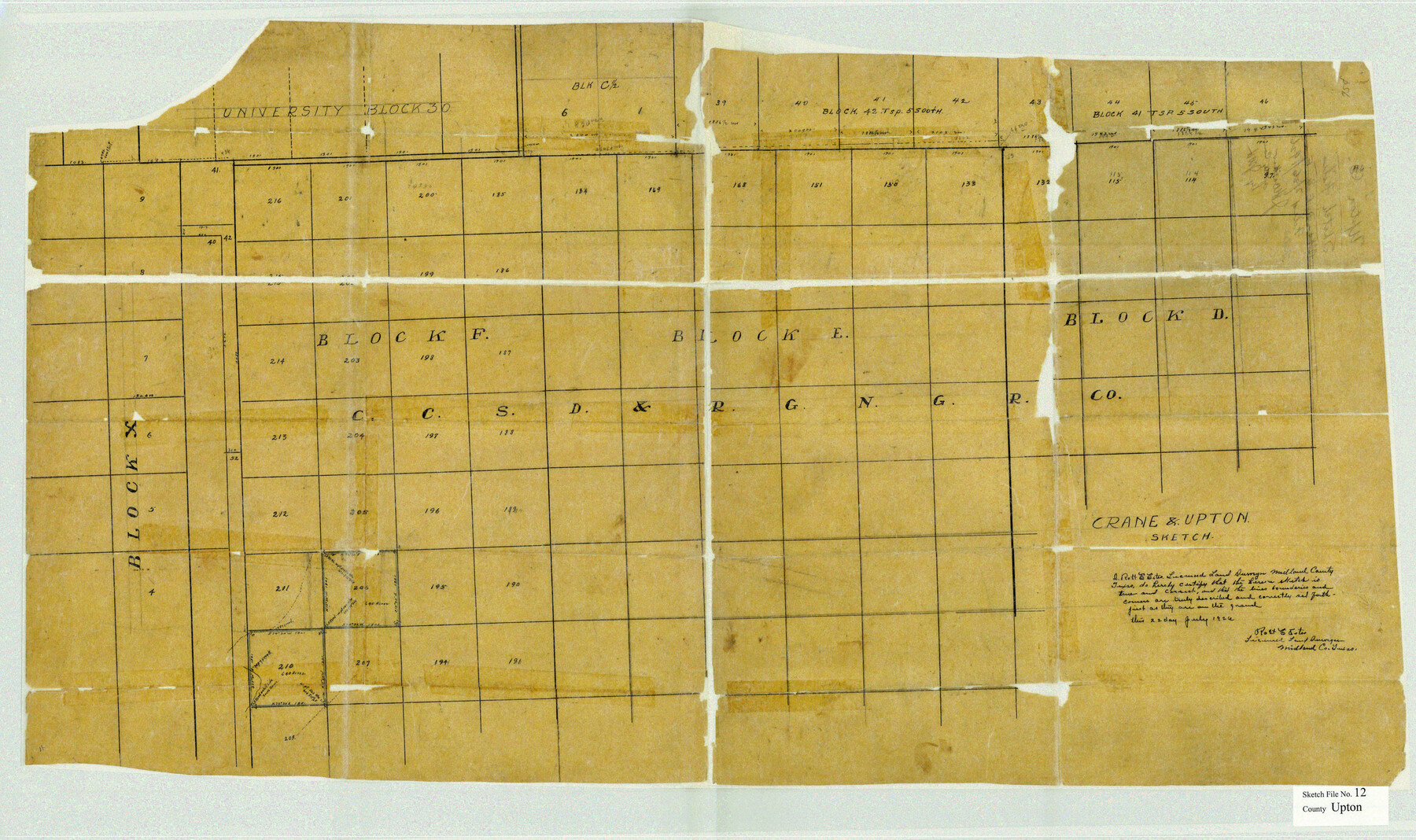
[Sketch of C. C. S. D. & R. G. N. G. R.R. Co. Blocks D, E, and F]
-
Map/Doc
12512
-
Collection
General Map Collection
-
Object Dates
7/22/1926 (Creation Date)
7/26/1926 (File Date)
-
People and Organizations
Robert E. Estes (Surveyor/Engineer)
-
Counties
Upton Crane
-
Subjects
Surveying Sketch File
-
Height x Width
20.6 x 34.8 inches
52.3 x 88.4 cm
-
Medium
paper, manuscript
Part of: General Map Collection
Van Zandt County Sketch File 27

Print $4.00
- Digital $50.00
Van Zandt County Sketch File 27
1859
Size 13.1 x 8.3 inches
Map/Doc 39447
Swisher County Rolled Sketch 3

Print $20.00
- Digital $50.00
Swisher County Rolled Sketch 3
Size 21.3 x 19.4 inches
Map/Doc 7904
Ector County Working Sketch 27

Print $20.00
- Digital $50.00
Ector County Working Sketch 27
Size 28.0 x 32.7 inches
Map/Doc 68870
Map of Crockett County

Print $40.00
- Digital $50.00
Map of Crockett County
1878
Size 62.5 x 51.1 inches
Map/Doc 93372
Shelby County Sketch File 7

Print $4.00
- Digital $50.00
Shelby County Sketch File 7
1855
Size 8.9 x 13.3 inches
Map/Doc 36605
Wharton County Sketch File A3

Print $26.00
- Digital $50.00
Wharton County Sketch File A3
1899
Size 18.2 x 18.6 inches
Map/Doc 12671
Marion County Rolled Sketch 4

Print $40.00
- Digital $50.00
Marion County Rolled Sketch 4
1951
Size 43.1 x 58.0 inches
Map/Doc 9491
San Antonio - Downtown - Riverwalk

San Antonio - Downtown - Riverwalk
Size 11.8 x 17.8 inches
Map/Doc 94290
Crockett County Working Sketch 68

Print $40.00
- Digital $50.00
Crockett County Working Sketch 68
1959
Size 23.7 x 55.6 inches
Map/Doc 68401
Flight Mission No. CRC-3R, Frame 49, Chambers County

Print $20.00
- Digital $50.00
Flight Mission No. CRC-3R, Frame 49, Chambers County
1956
Size 18.6 x 22.3 inches
Map/Doc 84822
Rusk County Working Sketch 12

Print $20.00
- Digital $50.00
Rusk County Working Sketch 12
1979
Size 17.0 x 15.8 inches
Map/Doc 63647
Galveston County Sketch File 1b

Print $6.00
- Digital $50.00
Galveston County Sketch File 1b
1845
Size 16.2 x 11.0 inches
Map/Doc 23347
You may also like
Carte de la Louisiane et du Cours du Mississipi

Print $20.00
- Digital $50.00
Carte de la Louisiane et du Cours du Mississipi
1718
Size 20.6 x 27.3 inches
Map/Doc 93821
Comanche County Sketch File 22b

Print $40.00
- Digital $50.00
Comanche County Sketch File 22b
1872
Size 12.1 x 14.8 inches
Map/Doc 19109
Dallam County Sketch File 12

Print $40.00
- Digital $50.00
Dallam County Sketch File 12
Size 50.0 x 9.1 inches
Map/Doc 10360
Webb County Sketch File 7-1

Print $20.00
- Digital $50.00
Webb County Sketch File 7-1
1875
Size 21.2 x 13.1 inches
Map/Doc 12617
Montgomery County Sketch File 22

Print $12.00
- Digital $50.00
Montgomery County Sketch File 22
1839
Size 8.8 x 7.6 inches
Map/Doc 31860
Johnson County Working Sketch 5

Print $20.00
- Digital $50.00
Johnson County Working Sketch 5
1950
Size 25.8 x 22.3 inches
Map/Doc 66618
[Surveying Sketch in Tom Green County]
![75550, [Surveying Sketch in Tom Green County], Maddox Collection](https://historictexasmaps.com/wmedia_w700/maps/75550.tif.jpg)
Print $3.00
- Digital $50.00
[Surveying Sketch in Tom Green County]
Size 11.4 x 12.4 inches
Map/Doc 75550
Polk County Working Sketch 29

Print $40.00
- Digital $50.00
Polk County Working Sketch 29
1960
Size 56.0 x 45.0 inches
Map/Doc 71645
Nolan County Boundary File 1

Print $60.00
- Digital $50.00
Nolan County Boundary File 1
Size 8.8 x 3.9 inches
Map/Doc 57617
McMullen County Sketch File 12

Print $4.00
- Digital $50.00
McMullen County Sketch File 12
1876
Size 10.9 x 8.3 inches
Map/Doc 31357
Map of the World: and chart exhibiting the size of each country, nation or kingdom, its population as a whole and to a square mile also the different states of society, forms of government, religion &c.

Print $20.00
- Digital $50.00
Map of the World: and chart exhibiting the size of each country, nation or kingdom, its population as a whole and to a square mile also the different states of society, forms of government, religion &c.
1850
Size 12.2 x 19.4 inches
Map/Doc 93882
Flight Mission No. CGI-2N, Frame 186, Cameron County

Print $20.00
- Digital $50.00
Flight Mission No. CGI-2N, Frame 186, Cameron County
1954
Size 19.5 x 25.0 inches
Map/Doc 84546