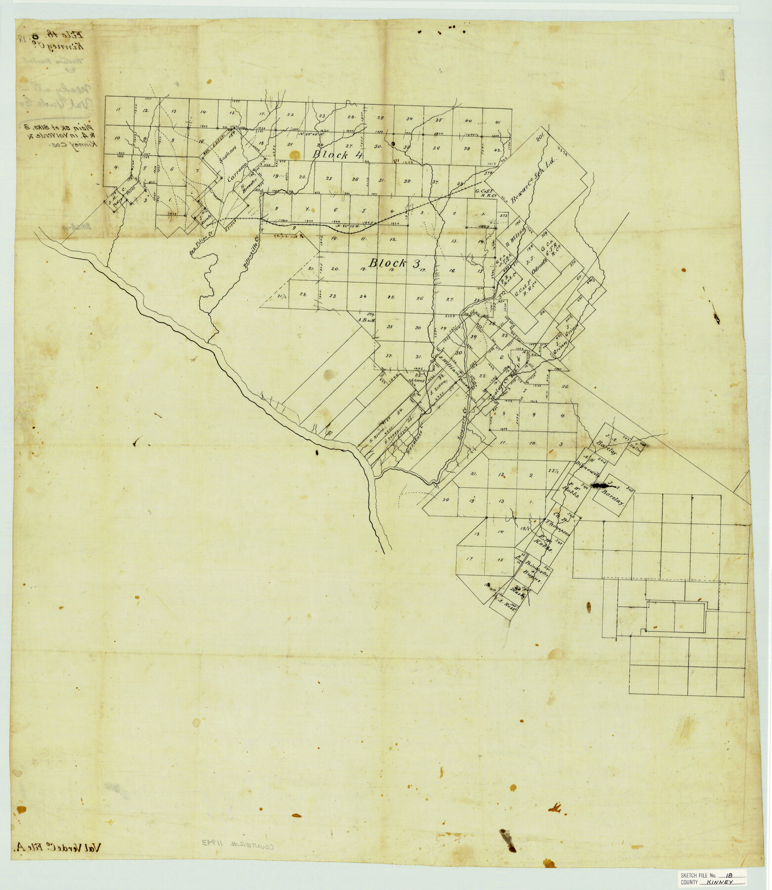
Kinney County Sketch File 18
[Sketch of Blocks 2, 3 & 4 near the Rio Grande in Kinney and Val Verde Counties]
-
Map/Doc
11943
-
Collection
General Map Collection
-
Counties
Kinney Val Verde
-
Subjects
Surveying Sketch File
-
Height x Width
29.0 x 25.2 inches
73.7 x 64.0 cm
-
Medium
paper, manuscript
-
Features
San Felipe Creek
Piloncillo Creek
Zacatoso Creek
Sycamore Creek
Part of: General Map Collection
El Paso County Working Sketch 6

Print $20.00
- Digital $50.00
El Paso County Working Sketch 6
1928
Size 25.4 x 16.7 inches
Map/Doc 69028
Map of Hale County

Print $40.00
- Digital $50.00
Map of Hale County
1900
Size 49.3 x 41.0 inches
Map/Doc 4691
North Part Brewster Co.

Print $40.00
- Digital $50.00
North Part Brewster Co.
1914
Size 40.6 x 49.2 inches
Map/Doc 66729
Flight Mission No. DQN-3K, Frame 12, Calhoun County

Print $20.00
- Digital $50.00
Flight Mission No. DQN-3K, Frame 12, Calhoun County
1953
Size 18.8 x 22.4 inches
Map/Doc 84344
Harris County Aerial Photograph Index Sheet 10

Print $20.00
- Digital $50.00
Harris County Aerial Photograph Index Sheet 10
1953
Size 22.1 x 16.9 inches
Map/Doc 83704
Flight Mission No. DAG-21K, Frame 118, Matagorda County

Print $20.00
- Digital $50.00
Flight Mission No. DAG-21K, Frame 118, Matagorda County
1952
Size 18.5 x 18.4 inches
Map/Doc 86443
Pecos County Rolled Sketch 122

Print $20.00
- Digital $50.00
Pecos County Rolled Sketch 122
1945
Size 32.5 x 39.1 inches
Map/Doc 7263
Bowie County Working Sketch 8

Print $20.00
- Digital $50.00
Bowie County Working Sketch 8
1953
Size 25.9 x 24.0 inches
Map/Doc 67412
[Sketch for Mineral Application 36425 - Jefferson County, Ley C. Moore]
![65616, [Sketch for Mineral Application 36425 - Jefferson County, Ley C. Moore], General Map Collection](https://historictexasmaps.com/wmedia_w700/maps/65616.tif.jpg)
Print $40.00
- Digital $50.00
[Sketch for Mineral Application 36425 - Jefferson County, Ley C. Moore]
1942
Size 49.2 x 35.0 inches
Map/Doc 65616
Hardeman County Sketch File Y

Print $4.00
- Digital $50.00
Hardeman County Sketch File Y
Size 9.2 x 8.5 inches
Map/Doc 25054
Flight Mission No. DQN-3K, Frame 70, Calhoun County

Print $20.00
- Digital $50.00
Flight Mission No. DQN-3K, Frame 70, Calhoun County
1953
Size 18.6 x 22.5 inches
Map/Doc 84361
Haskell County Boundary File 3

Print $6.00
- Digital $50.00
Haskell County Boundary File 3
Size 11.0 x 8.6 inches
Map/Doc 54539
You may also like
Section 160, Block G, Gaines County, Texas

Print $20.00
- Digital $50.00
Section 160, Block G, Gaines County, Texas
1958
Size 17.1 x 19.3 inches
Map/Doc 92679
Flight Mission No. CRK-5P, Frame 128, Refugio County

Print $20.00
- Digital $50.00
Flight Mission No. CRK-5P, Frame 128, Refugio County
1956
Size 18.6 x 22.5 inches
Map/Doc 86931
Gonzales County

Print $40.00
- Digital $50.00
Gonzales County
1986
Size 39.9 x 52.0 inches
Map/Doc 77292
General Highway Map, Oldham County, Texas

Print $20.00
General Highway Map, Oldham County, Texas
1961
Size 24.5 x 18.1 inches
Map/Doc 79619
PSL Field Notes for Blocks A19, A20, A22, A23, A26, A28, A29, A30, A31, A32, A33, A34, A35, A36, A37, A38, A39, A40, A41 in Andrews County

PSL Field Notes for Blocks A19, A20, A22, A23, A26, A28, A29, A30, A31, A32, A33, A34, A35, A36, A37, A38, A39, A40, A41 in Andrews County
Map/Doc 81642
Carden L. Green Farm Part Sections 13 & 22, Block JS

Print $20.00
- Digital $50.00
Carden L. Green Farm Part Sections 13 & 22, Block JS
Size 14.0 x 24.1 inches
Map/Doc 92324
Upshur County Sketch File 7

Print $4.00
- Digital $50.00
Upshur County Sketch File 7
1849
Size 8.2 x 10.2 inches
Map/Doc 38744
Flight Mission No. DAG-24K, Frame 158, Matagorda County

Print $20.00
- Digital $50.00
Flight Mission No. DAG-24K, Frame 158, Matagorda County
1953
Size 18.6 x 22.5 inches
Map/Doc 86572
Somervell County Working Sketch 3

Print $20.00
- Digital $50.00
Somervell County Working Sketch 3
1968
Size 23.0 x 30.4 inches
Map/Doc 63907
Map of the River Sabine from its Mouth on the Gulf of Mexico in the Sea to Logan's Ferry in Latitude 31°58'24" north

Print $40.00
Map of the River Sabine from its Mouth on the Gulf of Mexico in the Sea to Logan's Ferry in Latitude 31°58'24" north
1840
Size 35.0 x 170.0 inches
Map/Doc 88901
Coleman County Boundary File 17a

Print $84.00
- Digital $50.00
Coleman County Boundary File 17a
Size 17.5 x 17.1 inches
Map/Doc 51663
Right-of-Way & Track Map, Houston and Brazos Valley Ry. Co. operated by the Houston and Brazos Valley Ry. Co.

Print $40.00
- Digital $50.00
Right-of-Way & Track Map, Houston and Brazos Valley Ry. Co. operated by the Houston and Brazos Valley Ry. Co.
1918
Size 24.7 x 56.7 inches
Map/Doc 64604