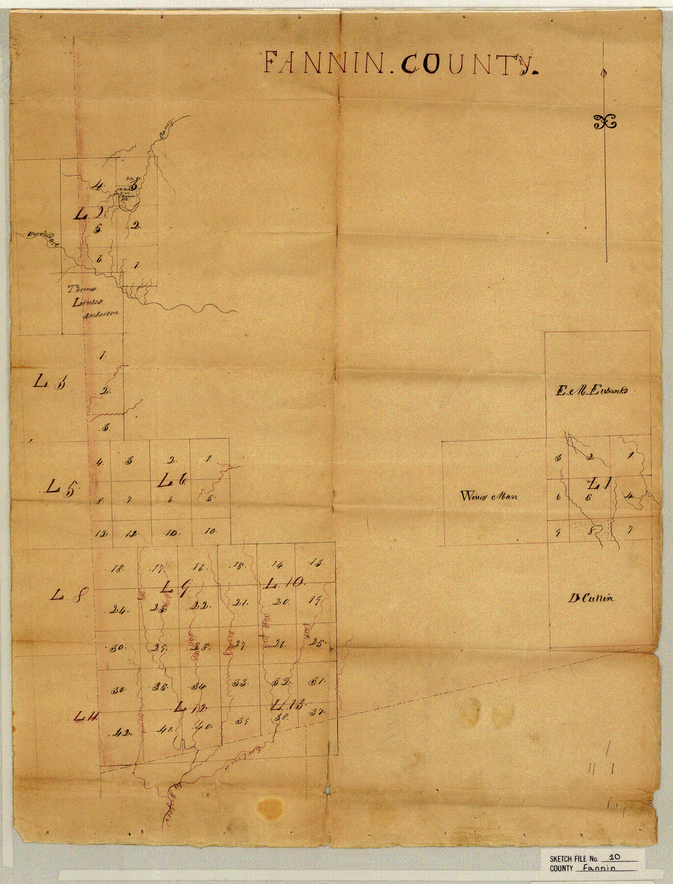
Fannin County Sketch File 10
On the south part of the Co.
-
Map/Doc
11471
-
Collection
General Map Collection
-
Counties
Fannin
-
Subjects
Surveying Sketch File
-
Height x Width
21.0 x 16.0 inches
53.3 x 40.6 cm
-
Medium
paper, manuscript
-
Features
Caney Creek
Bois D'Arc Creek
Bear Creek
East Fork [of Bear Creek]
West Fork [of Bear Creek]
Brushy Creek
Sicamore [sic] Creek
Dry Creek
Part of: General Map Collection
Rockwall County Boundary File 4b

Print $10.00
- Digital $50.00
Rockwall County Boundary File 4b
Size 11.4 x 8.8 inches
Map/Doc 58403
Armstrong County Working Sketch 9

Print $20.00
- Digital $50.00
Armstrong County Working Sketch 9
1993
Size 40.9 x 33.6 inches
Map/Doc 67240
Laguna Madre, Register No. 1477A

Print $40.00
- Digital $50.00
Laguna Madre, Register No. 1477A
1880
Size 34.3 x 56.0 inches
Map/Doc 73606

Harris County Historic Topographic 12

Print $20.00
- Digital $50.00
Harris County Historic Topographic 12
1915
Size 19.5 x 23.5 inches
Map/Doc 65822
Medina County Rolled Sketch 14

Print $20.00
- Digital $50.00
Medina County Rolled Sketch 14
1980
Size 29.2 x 32.0 inches
Map/Doc 6748
University Land Field Notes for Block 52 in Crockett, Irion, and Schleicher Counties, Blocks 55 and 56 in Crockett and Schleicher Counties, Block 53 in Irion and Schleicher Counties, and Blocks 54 and 57 in Schleicher County

University Land Field Notes for Block 52 in Crockett, Irion, and Schleicher Counties, Blocks 55 and 56 in Crockett and Schleicher Counties, Block 53 in Irion and Schleicher Counties, and Blocks 54 and 57 in Schleicher County
Map/Doc 81719
Flight Mission No. DCL-6C, Frame 5, Kenedy County

Print $20.00
- Digital $50.00
Flight Mission No. DCL-6C, Frame 5, Kenedy County
1943
Size 18.4 x 22.4 inches
Map/Doc 85865
Willacy County Aerial Photograph Index Sheet 5

Print $20.00
- Digital $50.00
Willacy County Aerial Photograph Index Sheet 5
1940
Size 20.1 x 24.4 inches
Map/Doc 83758
Fannin County Sketch File 25

Print $4.00
- Digital $50.00
Fannin County Sketch File 25
1847
Size 8.5 x 10.9 inches
Map/Doc 22493
Township 8 South Range 13 West, South Western District, Louisiana

Print $20.00
- Digital $50.00
Township 8 South Range 13 West, South Western District, Louisiana
1879
Size 19.5 x 24.8 inches
Map/Doc 65888
Jackson County Working Sketch 10

Print $20.00
- Digital $50.00
Jackson County Working Sketch 10
1991
Size 35.9 x 36.1 inches
Map/Doc 66458
You may also like
Hemphill County Working Sketch 11

Print $20.00
- Digital $50.00
Hemphill County Working Sketch 11
1965
Size 23.1 x 41.2 inches
Map/Doc 66106
Maps showing Arkansas Central, the Helena & Corinth, and the Pine Bluff & Southwestern Railroads together forming the Texas & Northeastern Railway.

Print $20.00
Maps showing Arkansas Central, the Helena & Corinth, and the Pine Bluff & Southwestern Railroads together forming the Texas & Northeastern Railway.
1872
Size 26.8 x 29.1 inches
Map/Doc 93609
Texas Intracoastal Waterway - Port O'Connor to San Antonio Bay, Including Pass Cavallo

Print $20.00
- Digital $50.00
Texas Intracoastal Waterway - Port O'Connor to San Antonio Bay, Including Pass Cavallo
1957
Size 28.1 x 40.0 inches
Map/Doc 73372
Sutton County Sketch File J

Print $4.00
- Digital $50.00
Sutton County Sketch File J
Size 14.5 x 8.8 inches
Map/Doc 37505
Flight Mission No. DAH-17M, Frame 63, Orange County

Print $20.00
- Digital $50.00
Flight Mission No. DAH-17M, Frame 63, Orange County
1953
Size 18.6 x 22.4 inches
Map/Doc 86897
Ellis Addition to the City of Lubbock, Being a Subdivision of a Part of the SW/4 of SW/4 Sec. 4, Blk. A

Print $3.00
- Digital $50.00
Ellis Addition to the City of Lubbock, Being a Subdivision of a Part of the SW/4 of SW/4 Sec. 4, Blk. A
1952
Size 9.4 x 11.9 inches
Map/Doc 92709
Kerr County Sketch File 4

Print $10.00
- Digital $50.00
Kerr County Sketch File 4
1873
Size 8.1 x 7.7 inches
Map/Doc 28860
Jeff Davis County Rolled Sketch 33

Print $20.00
- Digital $50.00
Jeff Davis County Rolled Sketch 33
1986
Size 39.8 x 30.6 inches
Map/Doc 6379
Travis County Sketch File 78

Print $102.00
- Digital $50.00
Travis County Sketch File 78
2010
Size 11.0 x 8.5 inches
Map/Doc 90085
Montague County Working Sketch 39

Print $20.00
- Digital $50.00
Montague County Working Sketch 39
1994
Size 34.4 x 45.0 inches
Map/Doc 71105
Flight Mission No. DQN-5K, Frame 24, Calhoun County

Print $20.00
- Digital $50.00
Flight Mission No. DQN-5K, Frame 24, Calhoun County
1953
Size 18.5 x 22.1 inches
Map/Doc 84375
Cochran County

Print $20.00
- Digital $50.00
Cochran County
1913
Size 28.9 x 20.8 inches
Map/Doc 66756