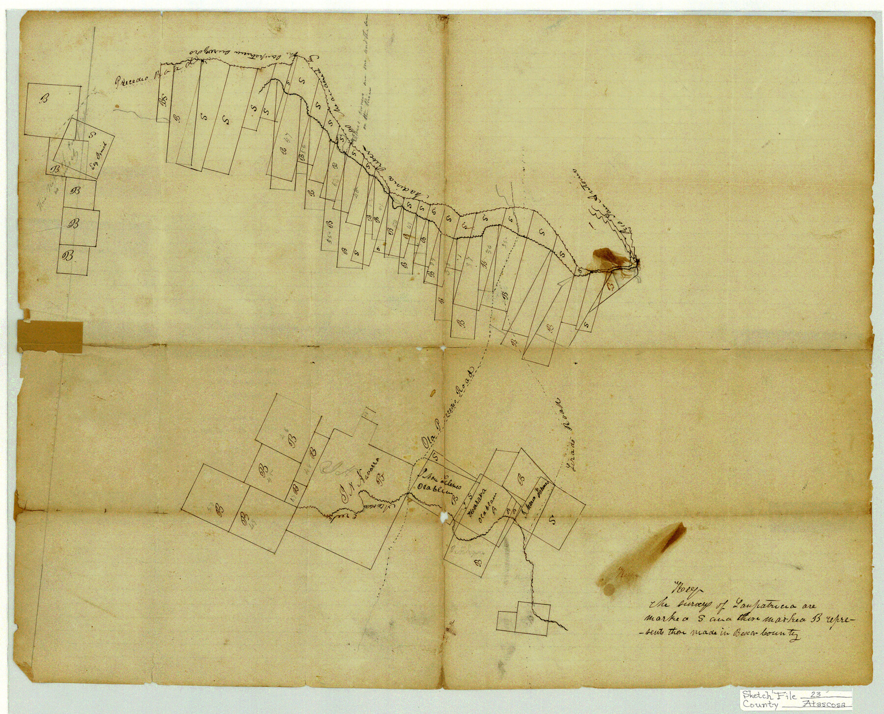
Atascosa County Sketch File 23
[Sketch of surveys on Atascosa River in Atascosa County and on Medina River in Bexar County]
-
Map/Doc
10860
-
Collection
General Map Collection
-
Counties
Atascosa Bexar
-
Subjects
Surveying Sketch File
-
Height x Width
17.1 x 21.2 inches
43.4 x 53.8 cm
-
Medium
paper, manuscript
-
Features
Precedio [sic] Road
Madina [sic] River
Rio San Antonio
Old Precedio [sic] Road
Atascosa Creek
Lirado [sic] Road
Part of: General Map Collection
McClennan County Robertson District East of the Brazos Milam District West of the Brazos

Print $20.00
- Digital $50.00
McClennan County Robertson District East of the Brazos Milam District West of the Brazos
1877
Size 21.9 x 24.5 inches
Map/Doc 3864
Map of Wilbarger County

Print $40.00
- Digital $50.00
Map of Wilbarger County
1887
Size 52.2 x 47.0 inches
Map/Doc 16926
Hutchinson County Sketch File 6a

Print $42.00
- Digital $50.00
Hutchinson County Sketch File 6a
1898
Size 7.6 x 8.6 inches
Map/Doc 27202
Coryell County Working Sketch 26

Print $20.00
- Digital $50.00
Coryell County Working Sketch 26
1988
Size 30.7 x 30.6 inches
Map/Doc 68233
Runnels County Working Sketch 1

Print $20.00
- Digital $50.00
Runnels County Working Sketch 1
Size 15.9 x 14.4 inches
Map/Doc 63597
McCulloch County Boundary File 2

Print $6.00
- Digital $50.00
McCulloch County Boundary File 2
Size 12.9 x 8.3 inches
Map/Doc 56908

McLennan County Working Sketch 9

Print $20.00
- Digital $50.00
McLennan County Working Sketch 9
2008
Size 23.0 x 28.9 inches
Map/Doc 88768
Denton County Boundary File 3

Print $34.00
- Digital $50.00
Denton County Boundary File 3
Size 6.1 x 3.9 inches
Map/Doc 52424

Hall County Working Sketch Graphic Index

Print $20.00
- Digital $50.00
Hall County Working Sketch Graphic Index
1972
Size 41.7 x 33.7 inches
Map/Doc 76563
Lavaca County Working Sketch 6

Print $20.00
- Digital $50.00
Lavaca County Working Sketch 6
1941
Size 20.8 x 22.0 inches
Map/Doc 70359
You may also like
Hays County Rolled Sketch 31

Print $20.00
- Digital $50.00
Hays County Rolled Sketch 31
2001
Size 24.0 x 34.7 inches
Map/Doc 76421
Brewster County Rolled Sketch 22D

Print $20.00
- Digital $50.00
Brewster County Rolled Sketch 22D
1910
Size 32.3 x 24.9 inches
Map/Doc 5205
Flight Mission No. DAG-14K, Frame 42, Matagorda County

Print $20.00
- Digital $50.00
Flight Mission No. DAG-14K, Frame 42, Matagorda County
1952
Size 18.5 x 22.3 inches
Map/Doc 86300

The Mexican Municipality of Matagorda. December 5, 1835

Print $20.00
The Mexican Municipality of Matagorda. December 5, 1835
2020
Size 15.9 x 21.7 inches
Map/Doc 96027
Edwards County Working Sketch 116

Print $20.00
- Digital $50.00
Edwards County Working Sketch 116
1973
Size 26.5 x 39.1 inches
Map/Doc 68992
Kent County Working Sketch 15

Print $40.00
- Digital $50.00
Kent County Working Sketch 15
1971
Size 32.3 x 48.3 inches
Map/Doc 70022
From Citizens of Austin and Harris Counties Living in What Was to Become Fort Bend County for the Creation of a New County (Unnamed), Undated

Print $20.00
From Citizens of Austin and Harris Counties Living in What Was to Become Fort Bend County for the Creation of a New County (Unnamed), Undated
2020
Size 22.6 x 21.7 inches
Map/Doc 96399
Map of Bexar County

Print $20.00
- Digital $50.00
Map of Bexar County
1896
Size 45.2 x 40.2 inches
Map/Doc 4885
Hood County Working Sketch 31

Print $20.00
- Digital $50.00
Hood County Working Sketch 31
1998
Size 33.6 x 35.8 inches
Map/Doc 66225
Newton County Sketch File 4

Print $22.00
- Digital $50.00
Newton County Sketch File 4
1876
Size 8.0 x 12.8 inches
Map/Doc 32360
Hemphill County Rolled Sketch 8

Print $20.00
- Digital $50.00
Hemphill County Rolled Sketch 8
1903
Size 22.7 x 30.5 inches
Map/Doc 6191