Falls County Sketch File 32

Print $20.00
- Digital $50.00
Falls County Sketch File 32
Size: 36.3 x 24.7 inches
11468
Falls County Sketch File 28

Print $2.00
- Digital $50.00
Falls County Sketch File 28
Size: 7.7 x 10.3 inches
22438
Limestone County Sketch File 1

Print $4.00
- Digital $50.00
Limestone County Sketch File 1
Size: 9.8 x 8.1 inches
30155
Robertson County Sketch File 11

Print $12.00
Robertson County Sketch File 11
Size: 9.4 x 7.9 inches
35398
Robertson County Sketch File 10 (1)

Print $3.00
- Digital $50.00
Robertson County Sketch File 10 (1)
Size: 13.0 x 10.4 inches
43369
Robertson County Working Sketch 16

Print $20.00
- Digital $50.00
Robertson County Working Sketch 16
Size: 21.7 x 33.0 inches
63589
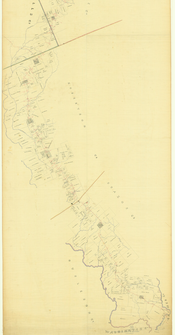
[Map of the Line of the H. & Texas Cen. Railway from the Navasota River, 72 1/2 Miles from Houston, to Corsicana in Navarro Co., 211 mls from Houston]
Print $40.00
- Digital $50.00
[Map of the Line of the H. & Texas Cen. Railway from the Navasota River, 72 1/2 Miles from Houston, to Corsicana in Navarro Co., 211 mls from Houston]
Size: 75.6 x 39.6 inches
64087
Robertson County Rolled Sketch 6

Print $20.00
- Digital $50.00
Robertson County Rolled Sketch 6
Size: 22.8 x 15.6 inches
7512
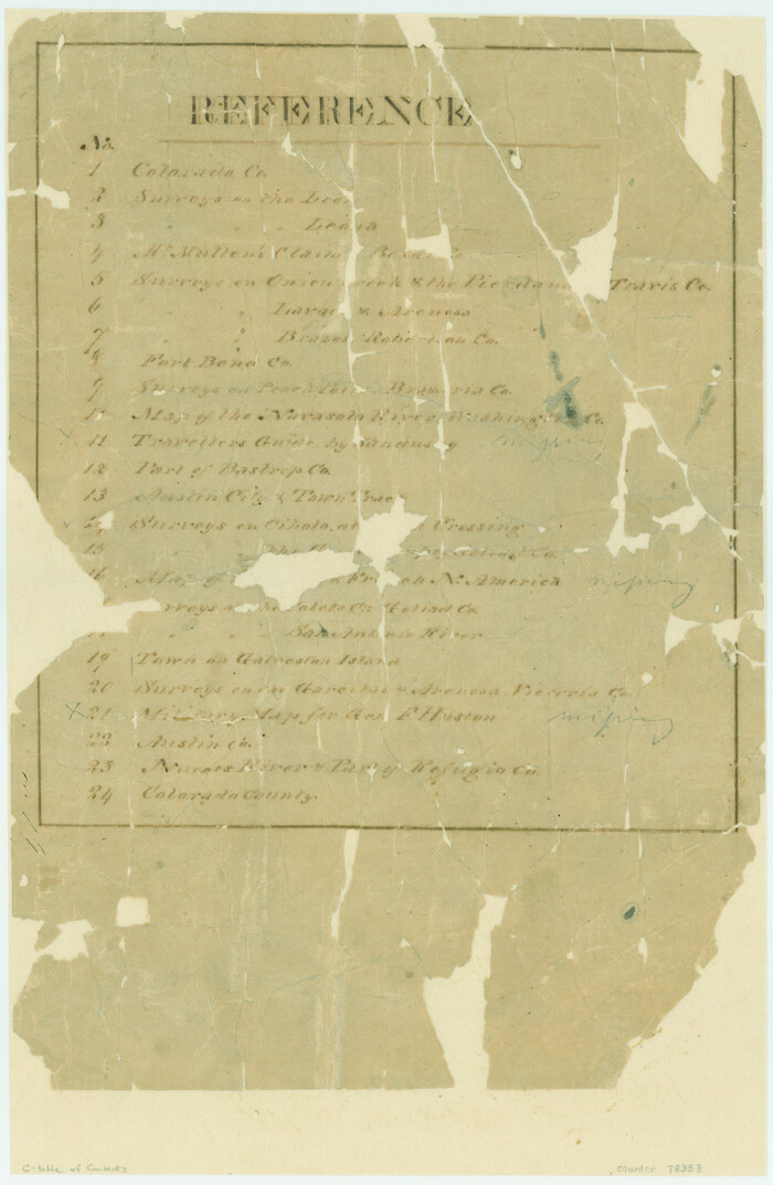
[Atlas C, Table of Contents]
Print $3.00
- Digital $50.00
[Atlas C, Table of Contents]
Size: 14.7 x 9.6 inches
78353
Revised Map of Calvert, Robertson County, Texas

Print $20.00
- Digital $50.00
Revised Map of Calvert, Robertson County, Texas
Size: 25.4 x 19.4 inches
88741
[Surveys in Austin's Colony along the Brazos River]
Print $20.00
- Digital $50.00
[Surveys in Austin's Colony along the Brazos River]
1833
Size: 25.0 x 23.9 inches
164
Map of the lower surveys in Robertsons Colony Sold by the State of Coahuila and Texas

Print $20.00
- Digital $50.00
Map of the lower surveys in Robertsons Colony Sold by the State of Coahuila and Texas
1834
Size: 22.0 x 28.5 inches
122
English Field Notes of the Spanish Archives - Book A-B

English Field Notes of the Spanish Archives - Book A-B
1835
96540
English Field Notes of the Spanish Archives - Books BTB, GA, BT, and X

English Field Notes of the Spanish Archives - Books BTB, GA, BT, and X
1835
96554
Map of Robertson County

Print $40.00
- Digital $50.00
Map of Robertson County
1839
Size: 56.2 x 33.0 inches
4656
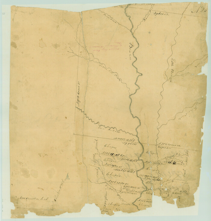
[Large surveys along the Navasota River]
Print $20.00
- Digital $50.00
[Large surveys along the Navasota River]
1840
Size: 24.5 x 14.3 inches
48
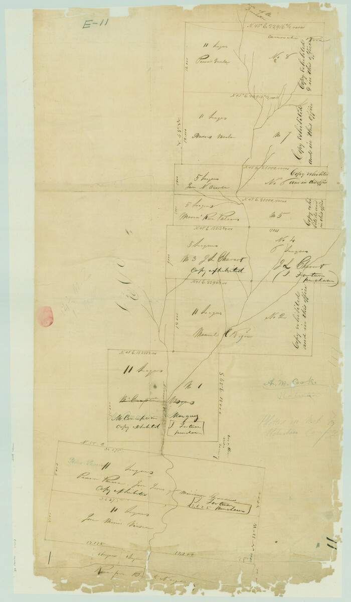
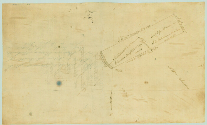
[Sketch of the Robertson League on the Brazos River showing a conflict with T.J. Chambers]
Print $2.00
- Digital $50.00
[Sketch of the Robertson League on the Brazos River showing a conflict with T.J. Chambers]
1841
Size: 7.6 x 12.6 inches
3178
University Lands Situated in Robertson County

Print $20.00
- Digital $50.00
University Lands Situated in Robertson County
1841
Size: 22.8 x 26.2 inches
281
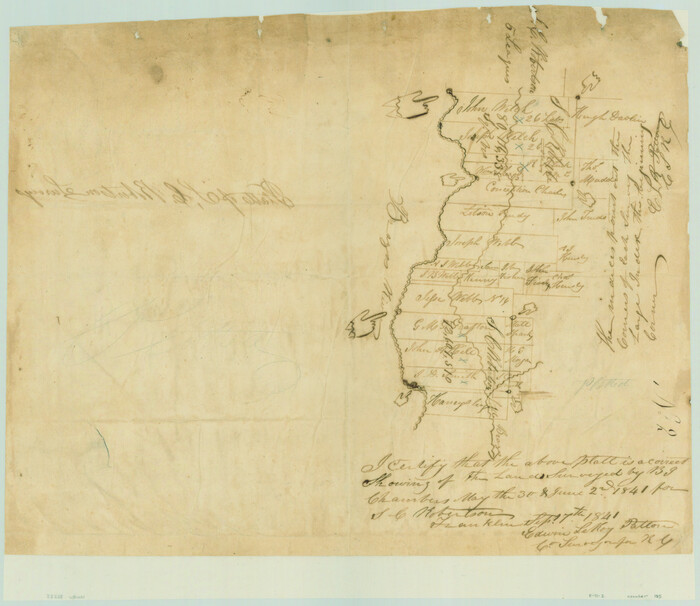
Platts [sic] of S. C. Robertson Surveys
Print $20.00
- Digital $50.00
Platts [sic] of S. C. Robertson Surveys
1841
Size: 13.6 x 15.7 inches
105
Field Notes of Mercer's Colony, Robertson, Nac[a]gdoches, Fannin, & Lamar Counties.
![1953, Field Notes of Mercer's Colony, Robertson, Nac[a]gdoches, Fannin, & Lamar Counties., General Map Collection](https://historictexasmaps.com/wmedia_w700/pdf_converted_jpg/qi_pdf_thumbnail_897.jpg)
Print $30.00
- Digital $50.00
Field Notes of Mercer's Colony, Robertson, Nac[a]gdoches, Fannin, & Lamar Counties.
1845
Size: 9.5 x 14.8 inches
1953
Robertson County Sketch File 9

Print $68.00
Robertson County Sketch File 9
1846
Size: 10.2 x 8.3 inches
35366
Robertson County Sketch File 10

Print $22.00
Robertson County Sketch File 10
1846
Size: 12.8 x 8.4 inches
35392
Map of Robertson District

Print $40.00
- Digital $50.00
Map of Robertson District
1846
Size: 81.3 x 45.3 inches
3032
Map of the Connection of S. C. Robertson's Survey

Print $3.00
- Digital $50.00
Map of the Connection of S. C. Robertson's Survey
1846
Size: 10.5 x 16.0 inches
334
Robertson County Sketch File 1

Print $7.00
- Digital $50.00
Robertson County Sketch File 1
1857
Size: 12.8 x 8.2 inches
35340
Robertson County Sketch File 3

Print $22.00
- Digital $50.00
Robertson County Sketch File 3
1860
Size: 12.6 x 15.8 inches
35350
Robertson County Sketch File 2

Print $16.00
Robertson County Sketch File 2
1858
Size: 10.1 x 8.2 inches
35343
Robertson County Sketch File 5 1/2

Print $2.00
- Digital $50.00
Robertson County Sketch File 5 1/2
Size: 8.1 x 4.2 inches
35361
Robertson County Sketch File 4

Print $12.00
Robertson County Sketch File 4
1862
Size: 11.0 x 8.0 inches
35352
Robertson County Sketch File 5

Print $6.00
Robertson County Sketch File 5
1863
Size: 12.0 x 9.0 inches
35358
Falls County Sketch File 32
Print $20.00
- Digital $50.00
Falls County Sketch File 32
-
Size
36.3 x 24.7 inches
-
Map/Doc
11468
Falls County Sketch File 28
Print $2.00
- Digital $50.00
Falls County Sketch File 28
-
Size
7.7 x 10.3 inches
-
Map/Doc
22438
Limestone County Sketch File 1
Print $4.00
- Digital $50.00
Limestone County Sketch File 1
-
Size
9.8 x 8.1 inches
-
Map/Doc
30155
Robertson County Sketch File 11
Print $12.00
Robertson County Sketch File 11
-
Size
9.4 x 7.9 inches
-
Map/Doc
35398
Robertson County Sketch File 10 (1)
Print $3.00
- Digital $50.00
Robertson County Sketch File 10 (1)
-
Size
13.0 x 10.4 inches
-
Map/Doc
43369
Robertson County Working Sketch 16
Print $20.00
- Digital $50.00
Robertson County Working Sketch 16
-
Size
21.7 x 33.0 inches
-
Map/Doc
63589
[Map of the Line of the H. & Texas Cen. Railway from the Navasota River, 72 1/2 Miles from Houston, to Corsicana in Navarro Co., 211 mls from Houston]
Print $40.00
- Digital $50.00
[Map of the Line of the H. & Texas Cen. Railway from the Navasota River, 72 1/2 Miles from Houston, to Corsicana in Navarro Co., 211 mls from Houston]
-
Size
75.6 x 39.6 inches
-
Map/Doc
64087
Robertson County Rolled Sketch 6
Print $20.00
- Digital $50.00
Robertson County Rolled Sketch 6
-
Size
22.8 x 15.6 inches
-
Map/Doc
7512
[Atlas C, Table of Contents]
Print $3.00
- Digital $50.00
[Atlas C, Table of Contents]
-
Size
14.7 x 9.6 inches
-
Map/Doc
78353
Revised Map of Calvert, Robertson County, Texas
Print $20.00
- Digital $50.00
Revised Map of Calvert, Robertson County, Texas
-
Size
25.4 x 19.4 inches
-
Map/Doc
88741
[Surveys in Austin's Colony along the Brazos River]
Print $20.00
- Digital $50.00
[Surveys in Austin's Colony along the Brazos River]
1833
-
Size
25.0 x 23.9 inches
-
Map/Doc
164
-
Creation Date
1833
Map of the lower surveys in Robertsons Colony Sold by the State of Coahuila and Texas
Print $20.00
- Digital $50.00
Map of the lower surveys in Robertsons Colony Sold by the State of Coahuila and Texas
1834
-
Size
22.0 x 28.5 inches
-
Map/Doc
122
-
Creation Date
1834
English Field Notes of the Spanish Archives - Book A-B
English Field Notes of the Spanish Archives - Book A-B
1835
-
Map/Doc
96540
-
Creation Date
1835
English Field Notes of the Spanish Archives - Books BTB, GA, BT, and X
English Field Notes of the Spanish Archives - Books BTB, GA, BT, and X
1835
-
Map/Doc
96554
-
Creation Date
1835
Map of Robertson County
Print $40.00
- Digital $50.00
Map of Robertson County
1839
-
Size
56.2 x 33.0 inches
-
Map/Doc
4656
-
Creation Date
1839
[Large surveys along the Navasota River]
Print $20.00
- Digital $50.00
[Large surveys along the Navasota River]
1840
-
Size
24.5 x 14.3 inches
-
Map/Doc
48
-
Creation Date
1840
[Sketch of the Robertson League on the Brazos River showing a conflict with T.J. Chambers]
Print $2.00
- Digital $50.00
[Sketch of the Robertson League on the Brazos River showing a conflict with T.J. Chambers]
1841
-
Size
7.6 x 12.6 inches
-
Map/Doc
3178
-
Creation Date
1841
University Lands Situated in Robertson County
Print $20.00
- Digital $50.00
University Lands Situated in Robertson County
1841
-
Size
22.8 x 26.2 inches
-
Map/Doc
281
-
Creation Date
1841
Platts [sic] of S. C. Robertson Surveys
Print $20.00
- Digital $50.00
Platts [sic] of S. C. Robertson Surveys
1841
-
Size
13.6 x 15.7 inches
-
Map/Doc
105
-
Creation Date
1841
Field Notes of Mercer's Colony, Robertson, Nac[a]gdoches, Fannin, & Lamar Counties.
Print $30.00
- Digital $50.00
Field Notes of Mercer's Colony, Robertson, Nac[a]gdoches, Fannin, & Lamar Counties.
1845
-
Size
9.5 x 14.8 inches
-
Map/Doc
1953
-
Creation Date
1845
Robertson County Sketch File 9
Print $68.00
Robertson County Sketch File 9
1846
-
Size
10.2 x 8.3 inches
-
Map/Doc
35366
-
Creation Date
1846
Robertson County Sketch File 10
Print $22.00
Robertson County Sketch File 10
1846
-
Size
12.8 x 8.4 inches
-
Map/Doc
35392
-
Creation Date
1846
Map of Robertson District
Print $40.00
- Digital $50.00
Map of Robertson District
1846
-
Size
81.3 x 45.3 inches
-
Map/Doc
3032
-
Creation Date
1846
Map of the Connection of S. C. Robertson's Survey
Print $3.00
- Digital $50.00
Map of the Connection of S. C. Robertson's Survey
1846
-
Size
10.5 x 16.0 inches
-
Map/Doc
334
-
Creation Date
1846
Robertson County Sketch File 1
Print $7.00
- Digital $50.00
Robertson County Sketch File 1
1857
-
Size
12.8 x 8.2 inches
-
Map/Doc
35340
-
Creation Date
1857
Robertson County Sketch File 3
Print $22.00
- Digital $50.00
Robertson County Sketch File 3
1860
-
Size
12.6 x 15.8 inches
-
Map/Doc
35350
-
Creation Date
1860
Robertson County Sketch File 2
Print $16.00
Robertson County Sketch File 2
1858
-
Size
10.1 x 8.2 inches
-
Map/Doc
35343
-
Creation Date
1858
Robertson County Sketch File 5 1/2
Print $2.00
- Digital $50.00
Robertson County Sketch File 5 1/2
-
Size
8.1 x 4.2 inches
-
Map/Doc
35361
Robertson County Sketch File 4
Print $12.00
Robertson County Sketch File 4
1862
-
Size
11.0 x 8.0 inches
-
Map/Doc
35352
-
Creation Date
1862
Robertson County Sketch File 5
Print $6.00
Robertson County Sketch File 5
1863
-
Size
12.0 x 9.0 inches
-
Map/Doc
35358
-
Creation Date
1863