Clay County Working Sketch 14

Print $20.00
- Digital $50.00
Clay County Working Sketch 14
1984
Size: 46.9 x 34.5 inches
68037
Wichita County Working Sketch 27

Print $20.00
- Digital $50.00
Wichita County Working Sketch 27
1984
Size: 35.6 x 34.6 inches
72537
Clay County Working Sketch Graphic Index

Print $40.00
- Digital $50.00
Clay County Working Sketch Graphic Index
1971
Size: 58.4 x 34.3 inches
76494
General Highway Map, Clay County, Texas

Print $20.00
General Highway Map, Clay County, Texas
1961
Size: 24.8 x 18.2 inches
79409
Clay County Working Sketch 13

Print $20.00
- Digital $50.00
Clay County Working Sketch 13
1955
Size: 14.7 x 14.3 inches
68036
Clay County Working Sketch 12

Print $20.00
- Digital $50.00
Clay County Working Sketch 12
1955
Size: 30.6 x 39.4 inches
68035
Clay County Sketch File 41

Print $6.00
- Digital $50.00
Clay County Sketch File 41
1949
Size: 14.2 x 8.6 inches
18482
Clay County Rolled Sketch 4

Print $20.00
- Digital $50.00
Clay County Rolled Sketch 4
1949
Size: 32.2 x 25.6 inches
5486
Clay County Rolled Sketch 4A

Print $20.00
- Digital $50.00
Clay County Rolled Sketch 4A
1949
Size: 22.0 x 24.0 inches
5498
Archer County Working Sketch 15

Print $20.00
- Digital $50.00
Archer County Working Sketch 15
1948
Size: 20.7 x 31.9 inches
67156
Clay County Working Sketch 11

Print $20.00
- Digital $50.00
Clay County Working Sketch 11
1941
Size: 27.7 x 27.1 inches
68034
Clay County Working Sketch 10

Print $20.00
- Digital $50.00
Clay County Working Sketch 10
1941
Size: 35.5 x 26.5 inches
68033
Clay County Rolled Sketch 1

Print $20.00
- Digital $50.00
Clay County Rolled Sketch 1
1940
Size: 47.0 x 37.9 inches
8621
Clay County Sketch File 39

Print $10.00
- Digital $50.00
Clay County Sketch File 39
1940
Size: 14.3 x 8.7 inches
18472
Clay County Rolled Sketch 2

Print $20.00
- Digital $50.00
Clay County Rolled Sketch 2
1940
Size: 35.9 x 26.8 inches
5485
General Highway Map, Clay County, Texas

Print $20.00
General Highway Map, Clay County, Texas
1940
Size: 25.2 x 18.6 inches
79047
Clay County Sketch File 38a

Print $6.00
- Digital $50.00
Clay County Sketch File 38a
1939
Size: 14.3 x 8.8 inches
18469
Clay County Working Sketch 9

Print $20.00
- Digital $50.00
Clay County Working Sketch 9
1938
Size: 37.5 x 29.4 inches
68032
Clay County Working Sketch 8

Print $20.00
- Digital $50.00
Clay County Working Sketch 8
1937
Size: 23.1 x 22.0 inches
68031
Clay County Sketch File 37

Print $8.00
- Digital $50.00
Clay County Sketch File 37
1935
Size: 11.6 x 7.2 inches
18465
Clay County Sketch File 49

Print $78.00
- Digital $50.00
Clay County Sketch File 49
1928
Size: 14.2 x 8.8 inches
18500
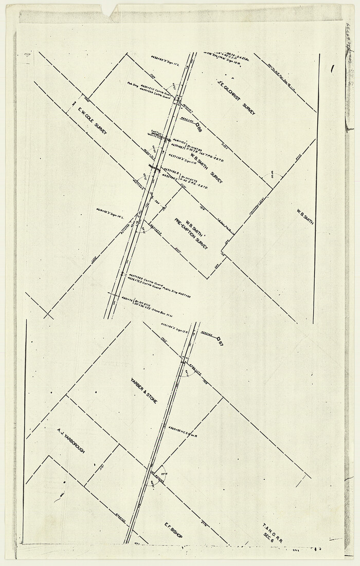
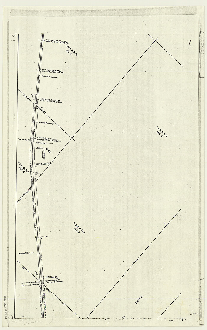
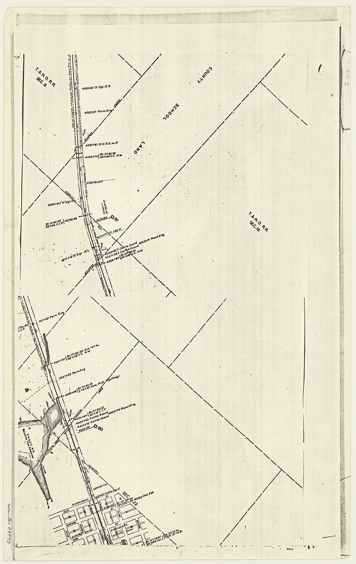
[F. W. & D. C. Ry. Co. Alignment and Right of Way Map, Clay County]
Print $20.00
- Digital $50.00
[F. W. & D. C. Ry. Co. Alignment and Right of Way Map, Clay County]
1927
Size: 18.6 x 11.8 inches
64734
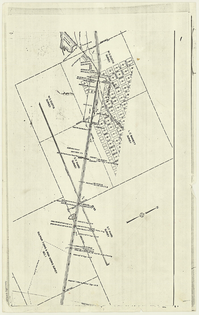
[F. W. & D. C. Ry. Co. Alignment and Right of Way Map, Clay County]
Print $20.00
- Digital $50.00
[F. W. & D. C. Ry. Co. Alignment and Right of Way Map, Clay County]
1927
Size: 18.6 x 11.8 inches
64737
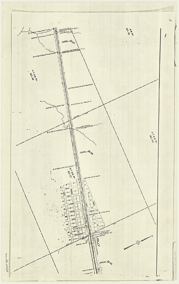
[F. W. & D. C. Ry. Co. Alignment and Right of Way Map, Clay County]
Print $20.00
- Digital $50.00
[F. W. & D. C. Ry. Co. Alignment and Right of Way Map, Clay County]
1927
Size: 18.6 x 11.7 inches
64739
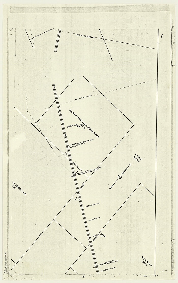
[F. W. & D. C. Ry. Co. Alignment and Right of Way Map, Clay County]
Print $20.00
- Digital $50.00
[F. W. & D. C. Ry. Co. Alignment and Right of Way Map, Clay County]
1927
Size: 18.7 x 11.8 inches
64740
[F. W. & D. C. Ry. Co. Alignment and Right of Way Map, Clay County]
Print $20.00
- Digital $50.00
[F. W. & D. C. Ry. Co. Alignment and Right of Way Map, Clay County]
1927
Size: 18.8 x 11.8 inches
64742
[F. W. & D. C. Ry. Co. Alignment and Right of Way Map, Clay County]
Print $20.00
- Digital $50.00
[F. W. & D. C. Ry. Co. Alignment and Right of Way Map, Clay County]
1927
Size: 18.6 x 11.8 inches
64743
Clay County Working Sketch 14
Print $20.00
- Digital $50.00
Clay County Working Sketch 14
1984
-
Size
46.9 x 34.5 inches
-
Map/Doc
68037
-
Creation Date
1984
Wichita County Working Sketch 27
Print $20.00
- Digital $50.00
Wichita County Working Sketch 27
1984
-
Size
35.6 x 34.6 inches
-
Map/Doc
72537
-
Creation Date
1984
Clay County

Print $40.00
- Digital $50.00
Clay County
1971
-
Size
59.1 x 34.8 inches
-
Map/Doc
73106
-
Creation Date
1971
Clay County

Print $40.00
- Digital $50.00
Clay County
1971
-
Size
59.0 x 33.3 inches
-
Map/Doc
77238
-
Creation Date
1971
Clay County

Print $40.00
- Digital $50.00
Clay County
1971
-
Size
60.2 x 35.0 inches
-
Map/Doc
95455
-
Creation Date
1971
Clay County Working Sketch Graphic Index
Print $40.00
- Digital $50.00
Clay County Working Sketch Graphic Index
1971
-
Size
58.4 x 34.3 inches
-
Map/Doc
76494
-
Creation Date
1971
General Highway Map, Clay County, Texas
Print $20.00
General Highway Map, Clay County, Texas
1961
-
Size
24.8 x 18.2 inches
-
Map/Doc
79409
-
Creation Date
1961
Clay County Working Sketch 13
Print $20.00
- Digital $50.00
Clay County Working Sketch 13
1955
-
Size
14.7 x 14.3 inches
-
Map/Doc
68036
-
Creation Date
1955
Clay County Working Sketch 12
Print $20.00
- Digital $50.00
Clay County Working Sketch 12
1955
-
Size
30.6 x 39.4 inches
-
Map/Doc
68035
-
Creation Date
1955
Clay County Sketch File 41
Print $6.00
- Digital $50.00
Clay County Sketch File 41
1949
-
Size
14.2 x 8.6 inches
-
Map/Doc
18482
-
Creation Date
1949
Clay County Rolled Sketch 4
Print $20.00
- Digital $50.00
Clay County Rolled Sketch 4
1949
-
Size
32.2 x 25.6 inches
-
Map/Doc
5486
-
Creation Date
1949
Clay County Rolled Sketch 4A
Print $20.00
- Digital $50.00
Clay County Rolled Sketch 4A
1949
-
Size
22.0 x 24.0 inches
-
Map/Doc
5498
-
Creation Date
1949
Archer County Working Sketch 15
Print $20.00
- Digital $50.00
Archer County Working Sketch 15
1948
-
Size
20.7 x 31.9 inches
-
Map/Doc
67156
-
Creation Date
1948
Clay County Working Sketch 11
Print $20.00
- Digital $50.00
Clay County Working Sketch 11
1941
-
Size
27.7 x 27.1 inches
-
Map/Doc
68034
-
Creation Date
1941
Clay County Working Sketch 10
Print $20.00
- Digital $50.00
Clay County Working Sketch 10
1941
-
Size
35.5 x 26.5 inches
-
Map/Doc
68033
-
Creation Date
1941
Clay County Rolled Sketch 1
Print $20.00
- Digital $50.00
Clay County Rolled Sketch 1
1940
-
Size
47.0 x 37.9 inches
-
Map/Doc
8621
-
Creation Date
1940
Clay County Sketch File 39
Print $10.00
- Digital $50.00
Clay County Sketch File 39
1940
-
Size
14.3 x 8.7 inches
-
Map/Doc
18472
-
Creation Date
1940
Clay County Rolled Sketch 2
Print $20.00
- Digital $50.00
Clay County Rolled Sketch 2
1940
-
Size
35.9 x 26.8 inches
-
Map/Doc
5485
-
Creation Date
1940
General Highway Map, Clay County, Texas
Print $20.00
General Highway Map, Clay County, Texas
1940
-
Size
25.2 x 18.6 inches
-
Map/Doc
79047
-
Creation Date
1940
Clay County Sketch File 38a
Print $6.00
- Digital $50.00
Clay County Sketch File 38a
1939
-
Size
14.3 x 8.8 inches
-
Map/Doc
18469
-
Creation Date
1939
Clay County Working Sketch 9
Print $20.00
- Digital $50.00
Clay County Working Sketch 9
1938
-
Size
37.5 x 29.4 inches
-
Map/Doc
68032
-
Creation Date
1938
Clay County Working Sketch 8
Print $20.00
- Digital $50.00
Clay County Working Sketch 8
1937
-
Size
23.1 x 22.0 inches
-
Map/Doc
68031
-
Creation Date
1937
Clay County Sketch File 37
Print $8.00
- Digital $50.00
Clay County Sketch File 37
1935
-
Size
11.6 x 7.2 inches
-
Map/Doc
18465
-
Creation Date
1935
Clay County Sketch File 49
Print $78.00
- Digital $50.00
Clay County Sketch File 49
1928
-
Size
14.2 x 8.8 inches
-
Map/Doc
18500
-
Creation Date
1928
[F. W. & D. C. Ry. Co. Alignment and Right of Way Map, Clay County]
Print $20.00
- Digital $50.00
[F. W. & D. C. Ry. Co. Alignment and Right of Way Map, Clay County]
1927
-
Size
18.6 x 11.8 inches
-
Map/Doc
64734
-
Creation Date
1927
[F. W. & D. C. Ry. Co. Alignment and Right of Way Map, Clay County]
Print $20.00
- Digital $50.00
[F. W. & D. C. Ry. Co. Alignment and Right of Way Map, Clay County]
1927
-
Size
18.6 x 11.8 inches
-
Map/Doc
64737
-
Creation Date
1927
[F. W. & D. C. Ry. Co. Alignment and Right of Way Map, Clay County]
Print $20.00
- Digital $50.00
[F. W. & D. C. Ry. Co. Alignment and Right of Way Map, Clay County]
1927
-
Size
18.6 x 11.7 inches
-
Map/Doc
64739
-
Creation Date
1927
[F. W. & D. C. Ry. Co. Alignment and Right of Way Map, Clay County]
Print $20.00
- Digital $50.00
[F. W. & D. C. Ry. Co. Alignment and Right of Way Map, Clay County]
1927
-
Size
18.7 x 11.8 inches
-
Map/Doc
64740
-
Creation Date
1927
[F. W. & D. C. Ry. Co. Alignment and Right of Way Map, Clay County]
Print $20.00
- Digital $50.00
[F. W. & D. C. Ry. Co. Alignment and Right of Way Map, Clay County]
1927
-
Size
18.8 x 11.8 inches
-
Map/Doc
64742
-
Creation Date
1927
[F. W. & D. C. Ry. Co. Alignment and Right of Way Map, Clay County]
Print $20.00
- Digital $50.00
[F. W. & D. C. Ry. Co. Alignment and Right of Way Map, Clay County]
1927
-
Size
18.6 x 11.8 inches
-
Map/Doc
64743
-
Creation Date
1927