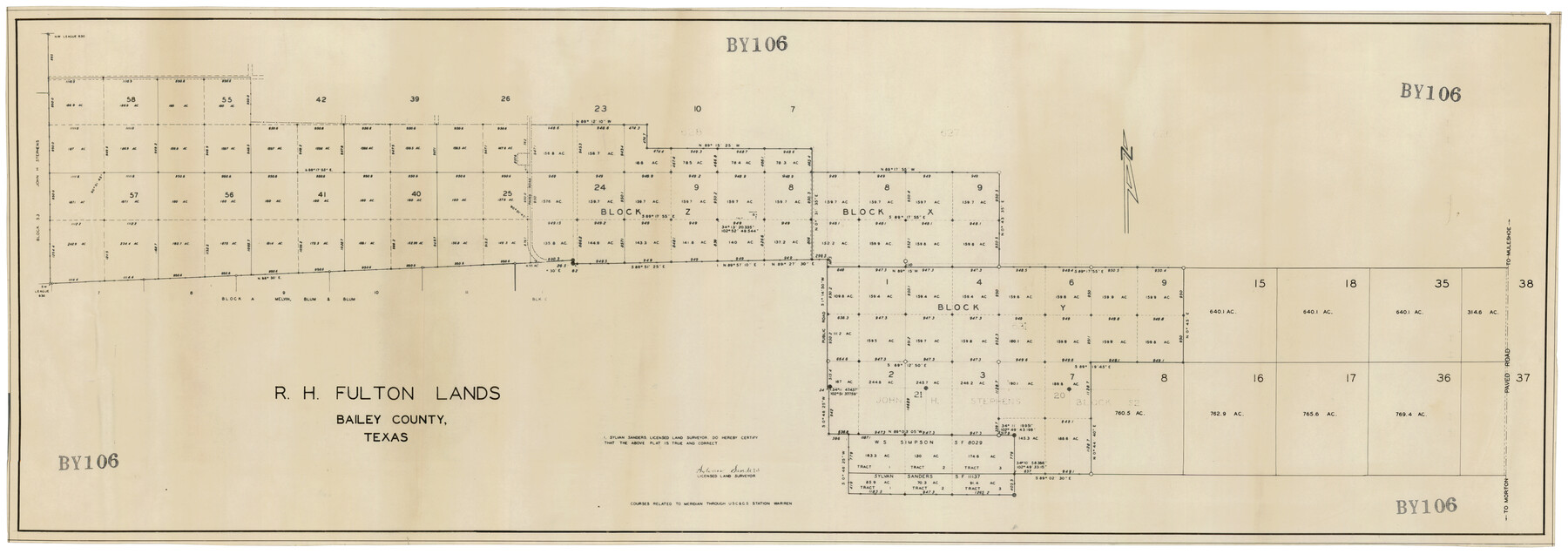
R. H. Fulton Lands
BY106
-
Map/Doc
92509
-
Collection
Twichell Survey Records
-
People and Organizations
Sylvan Sanders (Surveyor/Engineer)
-
Counties
Bailey
-
Height x Width
39.9 x 14.3 inches
101.4 x 36.3 cm
Part of: Twichell Survey Records
[Yates Field showing well locations]
![91670, [Yates Field showing well locations], Twichell Survey Records](https://historictexasmaps.com/wmedia_w700/maps/91670-1.tif.jpg)
Print $3.00
- Digital $50.00
[Yates Field showing well locations]
Size 14.4 x 11.3 inches
Map/Doc 91670
[Worksheets related to the Wilson Strickland survey and vicinity]
![91302, [Worksheets related to the Wilson Strickland survey and vicinity], Twichell Survey Records](https://historictexasmaps.com/wmedia_w700/maps/91302-1.tif.jpg)
Print $20.00
- Digital $50.00
[Worksheets related to the Wilson Strickland survey and vicinity]
Size 22.0 x 25.6 inches
Map/Doc 91302
Hockley County Sketch Mineral Application Number 38322- 38379

Print $20.00
- Digital $50.00
Hockley County Sketch Mineral Application Number 38322- 38379
1946
Size 34.1 x 27.8 inches
Map/Doc 92242
[I. & G. N. Block 1, sections 64, 65, 67-71 and 545 along river]
![91605, [I. & G. N. Block 1, sections 64, 65, 67-71 and 545 along river], Twichell Survey Records](https://historictexasmaps.com/wmedia_w700/maps/91605-1.tif.jpg)
Print $2.00
- Digital $50.00
[I. & G. N. Block 1, sections 64, 65, 67-71 and 545 along river]
Size 9.1 x 14.7 inches
Map/Doc 91605
[Section 34, Block 194 G. C. & S. F.]
![91671, [Section 34, Block 194 G. C. & S. F.], Twichell Survey Records](https://historictexasmaps.com/wmedia_w700/maps/91671-1.tif.jpg)
Print $2.00
- Digital $50.00
[Section 34, Block 194 G. C. & S. F.]
1927
Size 7.6 x 5.9 inches
Map/Doc 91671
[Block 47, Sections 17- 29]
![91176, [Block 47, Sections 17- 29], Twichell Survey Records](https://historictexasmaps.com/wmedia_w700/maps/91176-1.tif.jpg)
Print $20.00
- Digital $50.00
[Block 47, Sections 17- 29]
Size 25.2 x 18.4 inches
Map/Doc 91176
[Mary Fury and B. H. Epperson surveys]
![93068, [Mary Fury and B. H. Epperson surveys], Twichell Survey Records](https://historictexasmaps.com/wmedia_w700/maps/93068-1.tif.jpg)
Print $3.00
- Digital $50.00
[Mary Fury and B. H. Epperson surveys]
Size 10.8 x 15.7 inches
Map/Doc 93068
Subdivision of Alexander Ranch, Cochran County, Texas

Print $20.00
- Digital $50.00
Subdivision of Alexander Ranch, Cochran County, Texas
Size 15.4 x 29.8 inches
Map/Doc 92496
J. E. and J. W. Rhea's Ranch situated in Parmer Co., Texas

Print $20.00
- Digital $50.00
J. E. and J. W. Rhea's Ranch situated in Parmer Co., Texas
Size 23.2 x 24.3 inches
Map/Doc 91607
[Capitol Leagues 661-729]
![91187, [Capitol Leagues 661-729], Twichell Survey Records](https://historictexasmaps.com/wmedia_w700/maps/91187-1.tif.jpg)
Print $20.00
- Digital $50.00
[Capitol Leagues 661-729]
Size 20.6 x 28.6 inches
Map/Doc 91187
Gordon Addition to Idalou

Print $20.00
- Digital $50.00
Gordon Addition to Idalou
1954
Size 22.6 x 10.8 inches
Map/Doc 92827
Tierra Blanca Water Conservation Project Dam

Print $20.00
- Digital $50.00
Tierra Blanca Water Conservation Project Dam
1937
Size 37.7 x 25.1 inches
Map/Doc 92157
You may also like
Bandera County Sketch File 31

Print $40.00
- Digital $50.00
Bandera County Sketch File 31
1949
Size 17.7 x 22.2 inches
Map/Doc 10900
Wise County Working Sketch 1

Print $20.00
- Digital $50.00
Wise County Working Sketch 1
1929
Size 22.4 x 19.4 inches
Map/Doc 72615
DeWitt County

Print $40.00
- Digital $50.00
DeWitt County
1987
Size 41.4 x 49.9 inches
Map/Doc 77263
Presidio County Rolled Sketch 54

Print $20.00
- Digital $50.00
Presidio County Rolled Sketch 54
1913
Size 17.1 x 18.5 inches
Map/Doc 7348
Rio Grande Rectification Project, El Paso and Juarez Valley

Print $20.00
- Digital $50.00
Rio Grande Rectification Project, El Paso and Juarez Valley
1935
Size 10.7 x 29.6 inches
Map/Doc 60865
Martin County Working Sketch 17

Print $20.00
- Digital $50.00
Martin County Working Sketch 17
1981
Size 32.4 x 41.4 inches
Map/Doc 70835
Jefferson County Rolled Sketch 61B

Print $20.00
- Digital $50.00
Jefferson County Rolled Sketch 61B
1928
Size 27.3 x 40.3 inches
Map/Doc 6411
Brewster County Working Sketch 18

Print $20.00
- Digital $50.00
Brewster County Working Sketch 18
1934
Size 35.9 x 37.8 inches
Map/Doc 67552
Nueces County Working Sketch 10

Print $20.00
- Digital $50.00
Nueces County Working Sketch 10
1963
Size 26.7 x 27.7 inches
Map/Doc 71312
Kendall County Working Sketch 28

Print $20.00
- Digital $50.00
Kendall County Working Sketch 28
1995
Size 36.0 x 37.2 inches
Map/Doc 70001
Sectional map of Texas traversed by the Missouri, Kansas & Texas Railway, showing the crops adapted to each section, with the elevation and annual rainfall

Print $20.00
- Digital $50.00
Sectional map of Texas traversed by the Missouri, Kansas & Texas Railway, showing the crops adapted to each section, with the elevation and annual rainfall
1904
Size 21.9 x 22.6 inches
Map/Doc 95813
Presidio County Rolled Sketch 96

Print $20.00
- Digital $50.00
Presidio County Rolled Sketch 96
Size 12.3 x 45.9 inches
Map/Doc 9782