[John H. Gibson Block D Showing Patented Sections]
-
Map/Doc
92450
-
Collection
Twichell Survey Records
-
People and Organizations
Sylvan Sanders (Surveyor/Engineer)
-
Counties
Yoakum
-
Height x Width
14.7 x 16.1 inches
37.3 x 40.9 cm
Part of: Twichell Survey Records
[Part of Wichita County in the vicinity of Elizabeth Stanley survey 812 and W. M. Rivers survey 810]
![91970, [Part of Wichita County in the vicinity of Elizabeth Stanley survey 812 and W. M. Rivers survey 810], Twichell Survey Records](https://historictexasmaps.com/wmedia_w700/maps/91970-1.tif.jpg)
![91970, [Part of Wichita County in the vicinity of Elizabeth Stanley survey 812 and W. M. Rivers survey 810], Twichell Survey Records](https://historictexasmaps.com/wmedia_w700/maps/91970-1.tif.jpg)
Print $3.00
- Digital $50.00
[Part of Wichita County in the vicinity of Elizabeth Stanley survey 812 and W. M. Rivers survey 810]
1920
Size 11.6 x 11.0 inches
Map/Doc 91970
[Panhandle Counties]
![89951, [Panhandle Counties], Twichell Survey Records](https://historictexasmaps.com/wmedia_w700/maps/89951-1.tif.jpg)
![89951, [Panhandle Counties], Twichell Survey Records](https://historictexasmaps.com/wmedia_w700/maps/89951-1.tif.jpg)
Print $20.00
- Digital $50.00
[Panhandle Counties]
Size 41.8 x 43.2 inches
Map/Doc 89951
[Leagues 7, 8, 9, and 10]
![92216, [Leagues 7, 8, 9, and 10], Twichell Survey Records](https://historictexasmaps.com/wmedia_w700/maps/92216-1.tif.jpg)
![92216, [Leagues 7, 8, 9, and 10], Twichell Survey Records](https://historictexasmaps.com/wmedia_w700/maps/92216-1.tif.jpg)
Print $20.00
- Digital $50.00
[Leagues 7, 8, 9, and 10]
Size 38.3 x 26.2 inches
Map/Doc 92216
[Blocks 3T, 1, and 6T]
![91421, [Blocks 3T, 1, and 6T], Twichell Survey Records](https://historictexasmaps.com/wmedia_w700/maps/91421-1.tif.jpg)
![91421, [Blocks 3T, 1, and 6T], Twichell Survey Records](https://historictexasmaps.com/wmedia_w700/maps/91421-1.tif.jpg)
Print $20.00
- Digital $50.00
[Blocks 3T, 1, and 6T]
Size 26.2 x 25.7 inches
Map/Doc 91421
[Sketch showing area around Runnels County School Land, Yates survey 34 1/2 and Runnels County School Land]
![91683, [Sketch showing area around Runnels County School Land, Yates survey 34 1/2 and Runnels County School Land], Twichell Survey Records](https://historictexasmaps.com/wmedia_w700/maps/91683-1.tif.jpg)
![91683, [Sketch showing area around Runnels County School Land, Yates survey 34 1/2 and Runnels County School Land], Twichell Survey Records](https://historictexasmaps.com/wmedia_w700/maps/91683-1.tif.jpg)
Print $20.00
- Digital $50.00
[Sketch showing area around Runnels County School Land, Yates survey 34 1/2 and Runnels County School Land]
Size 17.5 x 12.5 inches
Map/Doc 91683
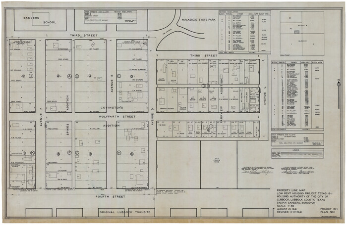
Property Line Map, Low Rent Housing Project Texas 18-1, Housing Authority of the City of Lubbock

Print $20.00
- Digital $50.00
Property Line Map, Low Rent Housing Project Texas 18-1, Housing Authority of the City of Lubbock
1941
Size 42.2 x 27.9 inches
Map/Doc 92753
[SW Corner of Lynn County]
![92903, [SW Corner of Lynn County], Twichell Survey Records](https://historictexasmaps.com/wmedia_w700/maps/92903-1.tif.jpg)
![92903, [SW Corner of Lynn County], Twichell Survey Records](https://historictexasmaps.com/wmedia_w700/maps/92903-1.tif.jpg)
Print $20.00
- Digital $50.00
[SW Corner of Lynn County]
1954
Size 32.2 x 31.1 inches
Map/Doc 92903
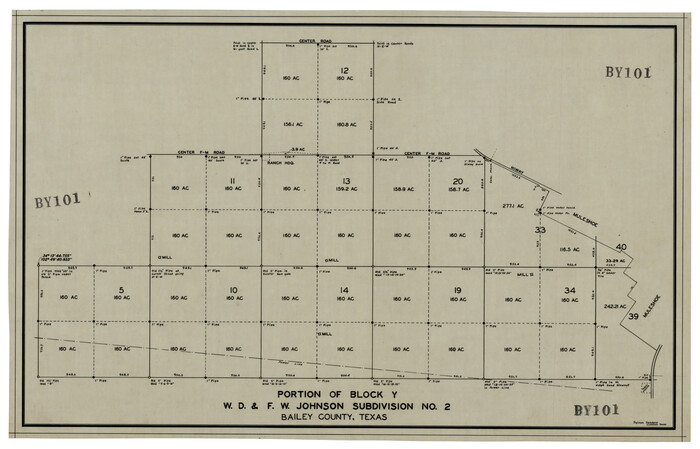
Portion of Block Y, W. D. and F. W. Johnson Subdivision Number 2

Print $20.00
- Digital $50.00
Portion of Block Y, W. D. and F. W. Johnson Subdivision Number 2
Size 23.9 x 15.3 inches
Map/Doc 92500
[Caddo Lake Area]
![91389, [Caddo Lake Area], Twichell Survey Records](https://historictexasmaps.com/wmedia_w700/maps/91389-1.tif.jpg)
![91389, [Caddo Lake Area], Twichell Survey Records](https://historictexasmaps.com/wmedia_w700/maps/91389-1.tif.jpg)
Print $20.00
- Digital $50.00
[Caddo Lake Area]
1918
Size 28.4 x 35.3 inches
Map/Doc 91389
[Central Part of Hockley County]
![91192, [Central Part of Hockley County], Twichell Survey Records](https://historictexasmaps.com/wmedia_w700/maps/91192-1.tif.jpg)
![91192, [Central Part of Hockley County], Twichell Survey Records](https://historictexasmaps.com/wmedia_w700/maps/91192-1.tif.jpg)
Print $20.00
- Digital $50.00
[Central Part of Hockley County]
Size 34.6 x 21.0 inches
Map/Doc 91192
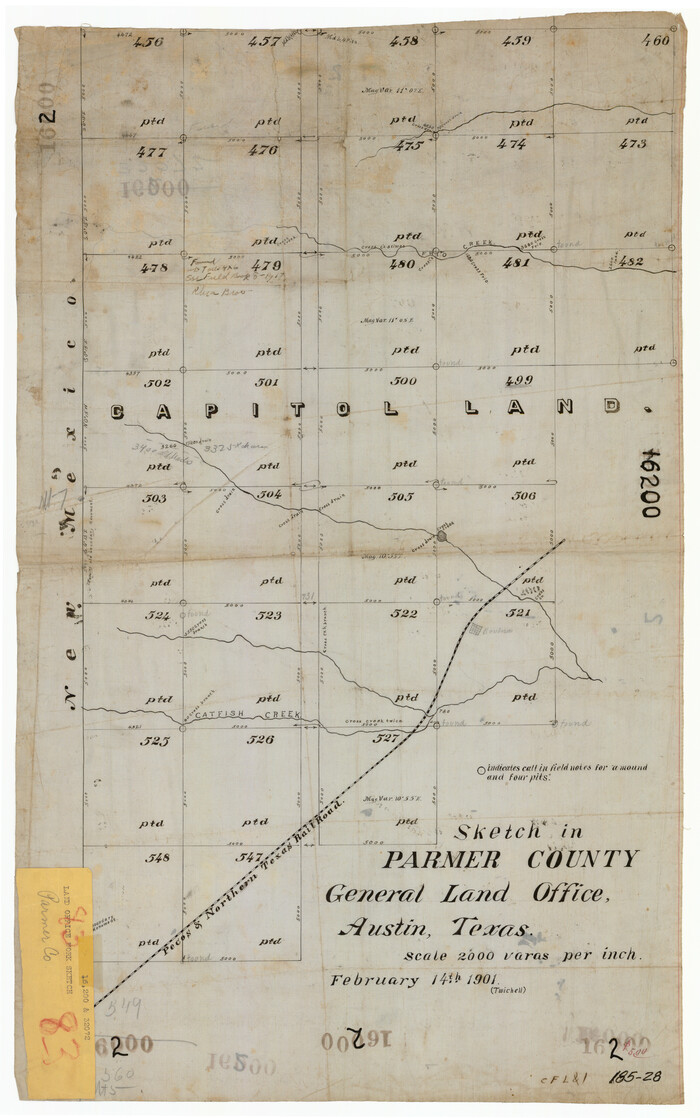
Sketch in Parmer County

Print $20.00
- Digital $50.00
Sketch in Parmer County
1901
Size 15.1 x 23.8 inches
Map/Doc 91644
[Madison County School Land, W. Perry and other surveys to the East]
![90429, [Madison County School Land, W. Perry and other surveys to the East], Twichell Survey Records](https://historictexasmaps.com/wmedia_w700/maps/90429-1.tif.jpg)
![90429, [Madison County School Land, W. Perry and other surveys to the East], Twichell Survey Records](https://historictexasmaps.com/wmedia_w700/maps/90429-1.tif.jpg)
Print $20.00
- Digital $50.00
[Madison County School Land, W. Perry and other surveys to the East]
Size 13.8 x 16.3 inches
Map/Doc 90429
You may also like
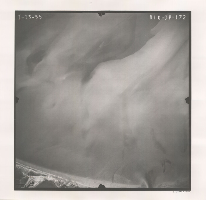
Flight Mission No. DIX-3P, Frame 172, Aransas County

Print $20.00
- Digital $50.00
Flight Mission No. DIX-3P, Frame 172, Aransas County
1956
Size 17.7 x 18.3 inches
Map/Doc 83778
Controlled Mosaic by Jack Amman Photogrammetric Engineers, Inc - Sheet 29
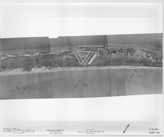

Print $20.00
- Digital $50.00
Controlled Mosaic by Jack Amman Photogrammetric Engineers, Inc - Sheet 29
1954
Size 20.0 x 24.0 inches
Map/Doc 83482
Wilbarger County Sketch File 11
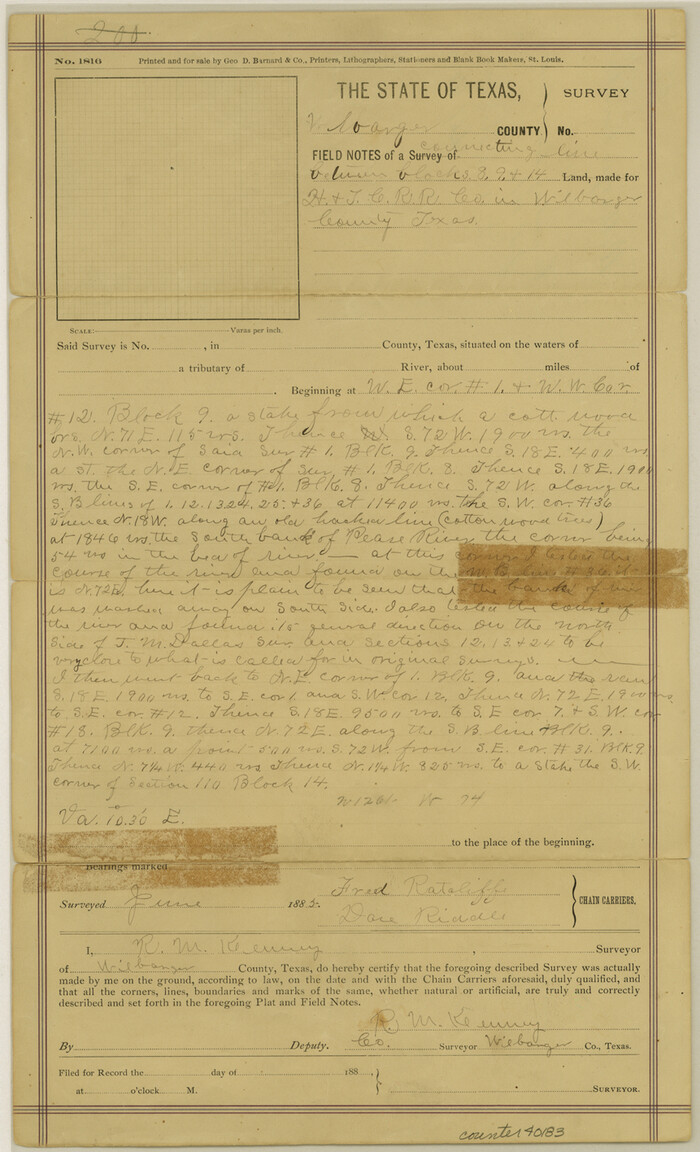

Print $4.00
- Digital $50.00
Wilbarger County Sketch File 11
1885
Size 14.2 x 8.6 inches
Map/Doc 40183
Hamilton County Working Sketch 14
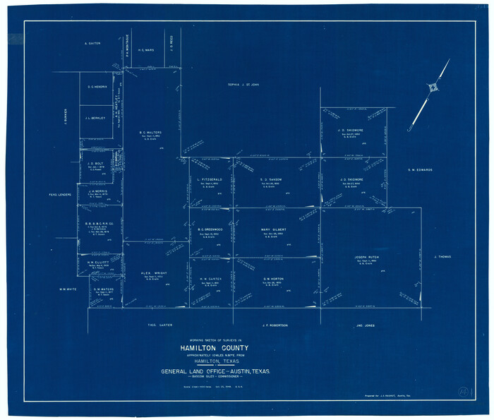

Print $20.00
- Digital $50.00
Hamilton County Working Sketch 14
1949
Size 30.1 x 35.4 inches
Map/Doc 63352
Upton County Rolled Sketch 23


Print $20.00
- Digital $50.00
Upton County Rolled Sketch 23
1940
Size 25.7 x 39.4 inches
Map/Doc 8074
[Sketch for Mineral Application 21493 - Clay County]
![65625, [Sketch for Mineral Application 21493 - Clay County], General Map Collection](https://historictexasmaps.com/wmedia_w700/maps/65625-1.tif.jpg)
![65625, [Sketch for Mineral Application 21493 - Clay County], General Map Collection](https://historictexasmaps.com/wmedia_w700/maps/65625-1.tif.jpg)
Print $40.00
- Digital $50.00
[Sketch for Mineral Application 21493 - Clay County]
Size 62.4 x 34.8 inches
Map/Doc 65625
Brooks County Boundary File 1


Print $54.00
- Digital $50.00
Brooks County Boundary File 1
Size 9.0 x 8.6 inches
Map/Doc 50809
Erath County Working Sketch 18


Print $20.00
- Digital $50.00
Erath County Working Sketch 18
1962
Size 30.5 x 34.8 inches
Map/Doc 69099
Brazoria County Working Sketch 34


Print $20.00
- Digital $50.00
Brazoria County Working Sketch 34
1981
Size 15.8 x 19.0 inches
Map/Doc 67519
Pecos County Working Sketch 33
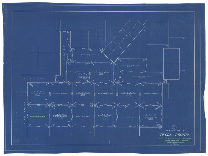

Print $20.00
- Digital $50.00
Pecos County Working Sketch 33
1937
Size 26.7 x 35.6 inches
Map/Doc 71505
Pecos County Boundary File 1


Print $2.00
- Digital $50.00
Pecos County Boundary File 1
Size 10.1 x 8.0 inches
Map/Doc 57854
![92450, [John H. Gibson Block D Showing Patented Sections], Twichell Survey Records](https://historictexasmaps.com/wmedia_w1800h1800/maps/92450-1.tif.jpg)
![92804, [Block O], Twichell Survey Records](https://historictexasmaps.com/wmedia_w700/maps/92804-1.tif.jpg)