![91965, [PSL Block B19], Twichell Survey Records](https://historictexasmaps.com/wmedia_w1800h1800/maps/91965-1.tif.jpg)
[PSL Block B19]
238-10
-
Map/Doc
91965
-
Collection
Twichell Survey Records
-
Counties
Ward
-
Height x Width
40.5 x 32.0 inches
102.9 x 81.3 cm
Part of: Twichell Survey Records
Whitehead Addition, City of Lubbock

Print $20.00
- Digital $50.00
Whitehead Addition, City of Lubbock
Size 17.9 x 24.6 inches
Map/Doc 92779
Sketch of Roll Number for Copy of Original Field Notes Texas & Pacific Railway Reservation

Print $3.00
- Digital $50.00
Sketch of Roll Number for Copy of Original Field Notes Texas & Pacific Railway Reservation
Size 17.4 x 10.0 inches
Map/Doc 92026
Brownfield Plant Arizona Chemical Co.

Print $20.00
- Digital $50.00
Brownfield Plant Arizona Chemical Co.
Size 27.0 x 44.4 inches
Map/Doc 92417
Section 16, Block "A", Sylvan Sanders Survey

Print $20.00
- Digital $50.00
Section 16, Block "A", Sylvan Sanders Survey
1953
Size 24.7 x 16.0 inches
Map/Doc 92715
Robertson & Scott V Ranch situated in Crosby County, Texas

Print $40.00
- Digital $50.00
Robertson & Scott V Ranch situated in Crosby County, Texas
Size 42.0 x 50.3 inches
Map/Doc 89753
Blocks 17, 18 & 19, Capitol Syndicate Subdivision of Capitol Land Reservation Leagues of Portions of Leagues Number 16, 6, 7, 8, 9, 11, 12, 13, 14, 17, 18. 19, 20, 21, 22, 38, 39, 40, 41, 42, 43, 44, 45 and 46

Print $40.00
- Digital $50.00
Blocks 17, 18 & 19, Capitol Syndicate Subdivision of Capitol Land Reservation Leagues of Portions of Leagues Number 16, 6, 7, 8, 9, 11, 12, 13, 14, 17, 18. 19, 20, 21, 22, 38, 39, 40, 41, 42, 43, 44, 45 and 46
Size 50.5 x 30.9 inches
Map/Doc 89686
[Sketch showing County School Land Leagues]
![90101, [Sketch showing County School Land Leagues], Twichell Survey Records](https://historictexasmaps.com/wmedia_w700/maps/90101-1.tif.jpg)
Print $3.00
- Digital $50.00
[Sketch showing County School Land Leagues]
1902
Size 11.0 x 11.1 inches
Map/Doc 90101
[Block 1 and vicinity]
![90703, [Block 1 and vicinity], Twichell Survey Records](https://historictexasmaps.com/wmedia_w700/maps/90703-1.tif.jpg)
Print $20.00
- Digital $50.00
[Block 1 and vicinity]
Size 25.3 x 24.1 inches
Map/Doc 90703
[Texas Boundary Line]
![92072, [Texas Boundary Line], Twichell Survey Records](https://historictexasmaps.com/wmedia_w700/maps/92072-1.tif.jpg)
Print $20.00
- Digital $50.00
[Texas Boundary Line]
Size 21.6 x 12.9 inches
Map/Doc 92072
[Sections 61-65, I. & G. N. Block 1 and part of Block 194]
![91678, [Sections 61-65, I. & G. N. Block 1 and part of Block 194], Twichell Survey Records](https://historictexasmaps.com/wmedia_w700/maps/91678-1.tif.jpg)
Print $20.00
- Digital $50.00
[Sections 61-65, I. & G. N. Block 1 and part of Block 194]
Size 24.9 x 17.3 inches
Map/Doc 91678
Amarillo City Stock Yards

Print $20.00
- Digital $50.00
Amarillo City Stock Yards
Size 21.6 x 12.2 inches
Map/Doc 91745
[Township 5-S, Blocks 37 & 38]
![92801, [Township 5-S, Blocks 37 & 38], Twichell Survey Records](https://historictexasmaps.com/wmedia_w700/maps/92801-1.tif.jpg)
Print $20.00
- Digital $50.00
[Township 5-S, Blocks 37 & 38]
Size 23.3 x 17.5 inches
Map/Doc 92801
You may also like
Paul Bennett Farm

Print $20.00
- Digital $50.00
Paul Bennett Farm
Size 18.7 x 21.5 inches
Map/Doc 92409
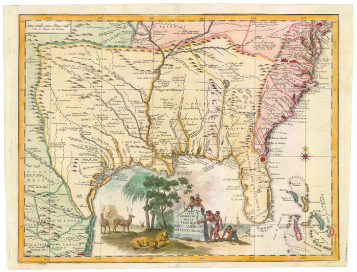
Carta Geografica Della Florida Nell America Settentrionale
Print $20.00
- Digital $50.00
Carta Geografica Della Florida Nell America Settentrionale
1740
Size 14.1 x 18.5 inches
Map/Doc 89222
Flight Mission No. DQN-1K, Frame 155, Calhoun County

Print $20.00
- Digital $50.00
Flight Mission No. DQN-1K, Frame 155, Calhoun County
1953
Size 18.5 x 22.2 inches
Map/Doc 84214
[Survey 321, Double Lakes Area Northwest of Tahoka]
![89962, [Survey 321, Double Lakes Area Northwest of Tahoka], Twichell Survey Records](https://historictexasmaps.com/wmedia_w700/maps/89962-1.tif.jpg)
Print $20.00
- Digital $50.00
[Survey 321, Double Lakes Area Northwest of Tahoka]
Size 41.3 x 43.0 inches
Map/Doc 89962
Wood County Sketch File 10

Print $12.00
- Digital $50.00
Wood County Sketch File 10
1850
Size 8.3 x 12.8 inches
Map/Doc 40658
Galveston County Rolled Sketch 15

Print $20.00
- Digital $50.00
Galveston County Rolled Sketch 15
Size 24.7 x 31.2 inches
Map/Doc 5954
Hidalgo County Sketch File 8

Print $4.00
- Digital $50.00
Hidalgo County Sketch File 8
1890
Size 14.1 x 8.6 inches
Map/Doc 26407
[Movements & Objectives of the 143rd & 144th Infantry and many other divisions and regiments, 1918]
![94138, [Movements & Objectives of the 143rd & 144th Infantry and many other divisions and regiments, 1918], Non-GLO Digital Images](https://historictexasmaps.com/wmedia_w700/maps/94138-1.tif.jpg)
Print $40.00
[Movements & Objectives of the 143rd & 144th Infantry and many other divisions and regiments, 1918]
1918
Size 64.2 x 37.5 inches
Map/Doc 94138
Presidio County Rolled Sketch T-2

Print $40.00
- Digital $50.00
Presidio County Rolled Sketch T-2
Size 29.9 x 65.1 inches
Map/Doc 9804
Randall County

Print $20.00
- Digital $50.00
Randall County
1958
Size 43.0 x 35.1 inches
Map/Doc 73269
Nolan County Working Sketch Graphic Index

Print $20.00
- Digital $50.00
Nolan County Working Sketch Graphic Index
1935
Size 41.6 x 36.9 inches
Map/Doc 76654
Atascosa County Working Sketch 1a

Print $20.00
- Digital $50.00
Atascosa County Working Sketch 1a
1908
Size 35.8 x 40.2 inches
Map/Doc 67194