[T. & P. Block 44, Township 1S]
68-12
-
Map/Doc
90814
-
Collection
Twichell Survey Records
-
Counties
Ector
-
Height x Width
10.4 x 23.2 inches
26.4 x 58.9 cm
Part of: Twichell Survey Records
[G. W. Carlisle Waco Manufacturing Co. Block 1]
![90669, [G. W. Carlisle Waco Manufacturing Co. Block 1], Twichell Survey Records](https://historictexasmaps.com/wmedia_w700/maps/90669-1.tif.jpg)
![90669, [G. W. Carlisle Waco Manufacturing Co. Block 1], Twichell Survey Records](https://historictexasmaps.com/wmedia_w700/maps/90669-1.tif.jpg)
Print $2.00
- Digital $50.00
[G. W. Carlisle Waco Manufacturing Co. Block 1]
Size 8.4 x 10.9 inches
Map/Doc 90669
[Block RG, Sections 1, 2, and 16, North Line of San Augustine County School Land]
![91392, [Block RG, Sections 1, 2, and 16, North Line of San Augustine County School Land], Twichell Survey Records](https://historictexasmaps.com/wmedia_w700/maps/91392-1.tif.jpg)
![91392, [Block RG, Sections 1, 2, and 16, North Line of San Augustine County School Land], Twichell Survey Records](https://historictexasmaps.com/wmedia_w700/maps/91392-1.tif.jpg)
Print $20.00
- Digital $50.00
[Block RG, Sections 1, 2, and 16, North Line of San Augustine County School Land]
Size 25.7 x 12.4 inches
Map/Doc 91392
[1680 Bed of Rock 20 Feet in Diameter on East Bank of Concho Drain]
![91361, [1680 Bed of Rock 20 Feet in Diameter on East Bank of Concho Drain], Twichell Survey Records](https://historictexasmaps.com/wmedia_w700/maps/91361-1.tif.jpg)
![91361, [1680 Bed of Rock 20 Feet in Diameter on East Bank of Concho Drain], Twichell Survey Records](https://historictexasmaps.com/wmedia_w700/maps/91361-1.tif.jpg)
Print $20.00
- Digital $50.00
[1680 Bed of Rock 20 Feet in Diameter on East Bank of Concho Drain]
Size 25.4 x 15.1 inches
Map/Doc 91361
[Sabine County School Land and vicinity]
![90981, [Sabine County School Land and vicinity], Twichell Survey Records](https://historictexasmaps.com/wmedia_w700/maps/90981-1.tif.jpg)
![90981, [Sabine County School Land and vicinity], Twichell Survey Records](https://historictexasmaps.com/wmedia_w700/maps/90981-1.tif.jpg)
Print $20.00
- Digital $50.00
[Sabine County School Land and vicinity]
Size 18.1 x 19.9 inches
Map/Doc 90981
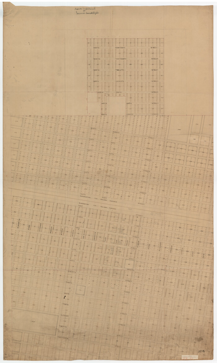
Amarillo Improvements for Sawville-Amarillo Heights

Print $40.00
- Digital $50.00
Amarillo Improvements for Sawville-Amarillo Heights
Size 37.2 x 62.1 inches
Map/Doc 89789
[G. B. & C. N. G. Blocks K3-K8]
![90537, [G. B. & C. N. G. Blocks K3-K8], Twichell Survey Records](https://historictexasmaps.com/wmedia_w700/maps/90537-1.tif.jpg)
![90537, [G. B. & C. N. G. Blocks K3-K8], Twichell Survey Records](https://historictexasmaps.com/wmedia_w700/maps/90537-1.tif.jpg)
Print $3.00
- Digital $50.00
[G. B. & C. N. G. Blocks K3-K8]
Size 11.4 x 13.7 inches
Map/Doc 90537
[Blocks Surrounding I. G. Yates Section 34 1/2]
![92442, [Blocks Surrounding I. G. Yates Section 34 1/2], Twichell Survey Records](https://historictexasmaps.com/wmedia_w700/maps/92442-1.tif.jpg)
![92442, [Blocks Surrounding I. G. Yates Section 34 1/2], Twichell Survey Records](https://historictexasmaps.com/wmedia_w700/maps/92442-1.tif.jpg)
Print $20.00
- Digital $50.00
[Blocks Surrounding I. G. Yates Section 34 1/2]
Size 41.9 x 11.3 inches
Map/Doc 92442
[Subdivision of Crockett County School Land Lgs. 214-217]
![90108, [Subdivision of Crockett County School Land Lgs. 214-217], Twichell Survey Records](https://historictexasmaps.com/wmedia_w700/maps/90108-1.tif.jpg)
![90108, [Subdivision of Crockett County School Land Lgs. 214-217], Twichell Survey Records](https://historictexasmaps.com/wmedia_w700/maps/90108-1.tif.jpg)
Print $2.00
- Digital $50.00
[Subdivision of Crockett County School Land Lgs. 214-217]
Size 12.1 x 8.3 inches
Map/Doc 90108
[Kent County Block 4, Sections 33 and 46, Block 97, Sections 771 and 772]
![92192, [Kent County Block 4, Sections 33 and 46, Block 97, Sections 771 and 772], Twichell Survey Records](https://historictexasmaps.com/wmedia_w700/maps/92192-1.tif.jpg)
![92192, [Kent County Block 4, Sections 33 and 46, Block 97, Sections 771 and 772], Twichell Survey Records](https://historictexasmaps.com/wmedia_w700/maps/92192-1.tif.jpg)
Print $2.00
- Digital $50.00
[Kent County Block 4, Sections 33 and 46, Block 97, Sections 771 and 772]
1951
Size 8.7 x 15.6 inches
Map/Doc 92192
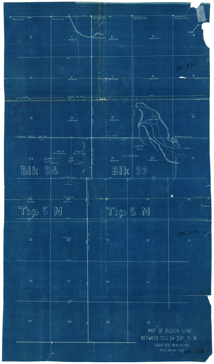
Map of Blockline between 33 and 34, Township 5 North

Print $20.00
- Digital $50.00
Map of Blockline between 33 and 34, Township 5 North
1919
Size 20.5 x 34.5 inches
Map/Doc 92565
[Blocks O18, G. & M. Block 3 and Blocks B10, B11 and 47]
![91813, [Blocks O18, G. & M. Block 3 and Blocks B10, B11 and 47], Twichell Survey Records](https://historictexasmaps.com/wmedia_w700/maps/91813-1.tif.jpg)
![91813, [Blocks O18, G. & M. Block 3 and Blocks B10, B11 and 47], Twichell Survey Records](https://historictexasmaps.com/wmedia_w700/maps/91813-1.tif.jpg)
Print $20.00
- Digital $50.00
[Blocks O18, G. & M. Block 3 and Blocks B10, B11 and 47]
Size 19.7 x 30.0 inches
Map/Doc 91813
[Blocks M-25 and H]
![92978, [Blocks M-25 and H], Twichell Survey Records](https://historictexasmaps.com/wmedia_w700/maps/92978-1.tif.jpg)
![92978, [Blocks M-25 and H], Twichell Survey Records](https://historictexasmaps.com/wmedia_w700/maps/92978-1.tif.jpg)
Print $20.00
- Digital $50.00
[Blocks M-25 and H]
1922
Size 17.5 x 13.9 inches
Map/Doc 92978
You may also like
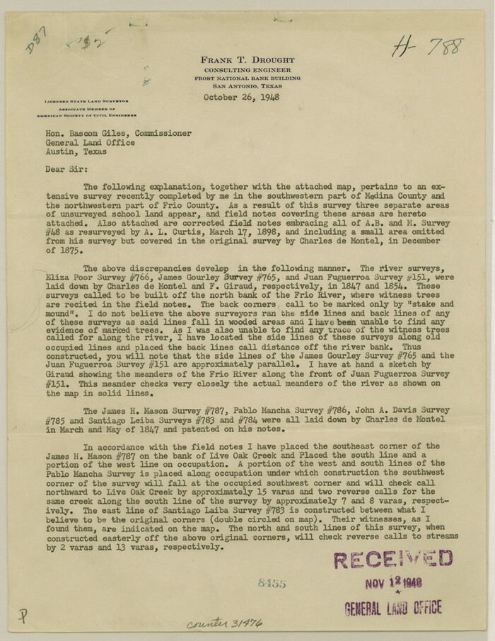
Medina County Sketch File 16

Print $8.00
- Digital $50.00
Medina County Sketch File 16
1948
Size 11.4 x 8.8 inches
Map/Doc 31476
Map of the Houston and G. N. R.R. and lands adjacent, from Troupe to the Texas Pacific R.R.


Print $40.00
- Digital $50.00
Map of the Houston and G. N. R.R. and lands adjacent, from Troupe to the Texas Pacific R.R.
Size 21.2 x 92.0 inches
Map/Doc 64627
Maverick County Rolled Sketch 23

Print $91.00
- Digital $50.00
Maverick County Rolled Sketch 23
1965
Size 9.5 x 14.8 inches
Map/Doc 46786
Colorado County Working Sketch 6


Print $20.00
- Digital $50.00
Colorado County Working Sketch 6
1921
Size 15.4 x 14.3 inches
Map/Doc 68106
Smith County Boundary File 1


Print $52.00
- Digital $50.00
Smith County Boundary File 1
1922
Size 14.3 x 8.8 inches
Map/Doc 58791
Williamson County Boundary File 1

Print $66.00
- Digital $50.00
Williamson County Boundary File 1
Size 8.4 x 6.0 inches
Map/Doc 59974
Flight Mission No. BRA-7M, Frame117, Jefferson County


Print $20.00
- Digital $50.00
Flight Mission No. BRA-7M, Frame117, Jefferson County
1953
Size 18.7 x 22.4 inches
Map/Doc 85511
[South line of Blocks B24, B25, and B26]
![90463, [South line of Blocks B24, B25, and B26], Twichell Survey Records](https://historictexasmaps.com/wmedia_w700/maps/90463-1.tif.jpg)
![90463, [South line of Blocks B24, B25, and B26], Twichell Survey Records](https://historictexasmaps.com/wmedia_w700/maps/90463-1.tif.jpg)
Print $2.00
- Digital $50.00
[South line of Blocks B24, B25, and B26]
1936
Size 14.6 x 9.0 inches
Map/Doc 90463
Duval County Rolled Sketch 34


Print $20.00
- Digital $50.00
Duval County Rolled Sketch 34
1951
Size 24.3 x 37.6 inches
Map/Doc 5749
[St. L. S-W. Ry. Of Texas Map of Lufkin Branch in Cherokee County Texas]
![64021, [St. L. S-W. Ry. Of Texas Map of Lufkin Branch in Cherokee County Texas], General Map Collection](https://historictexasmaps.com/wmedia_w700/maps/64021.tif.jpg)
![64021, [St. L. S-W. Ry. Of Texas Map of Lufkin Branch in Cherokee County Texas], General Map Collection](https://historictexasmaps.com/wmedia_w700/maps/64021.tif.jpg)
Print $40.00
- Digital $50.00
[St. L. S-W. Ry. Of Texas Map of Lufkin Branch in Cherokee County Texas]
1912
Size 23.4 x 124.3 inches
Map/Doc 64021
Chambers County Sketch File 35a

Print $31.00
- Digital $50.00
Chambers County Sketch File 35a
1935
Size 15.4 x 9.1 inches
Map/Doc 17632
![90814, [T. & P. Block 44, Township 1S], Twichell Survey Records](https://historictexasmaps.com/wmedia_w1800h1800/maps/90814-2.tif.jpg)
